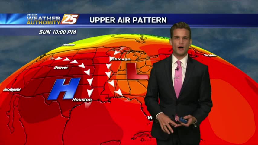
8/26 - Payton's Sunday Night Forecast
Back to the typical summertime forecast.
Back to the typical summertime forecast.
A wet start to the week then a cold front??
Hot and humid today, and much of the same tomorrow.
Wetter week, which means some cooler temperatures.
After a hot hot weekend...a little relief is on the way.
Hot & humid, but rain chance are increasing this week.
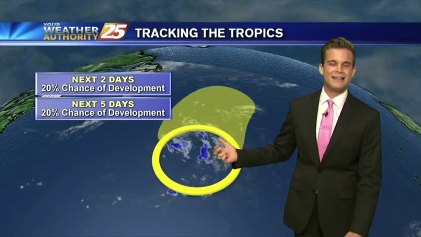
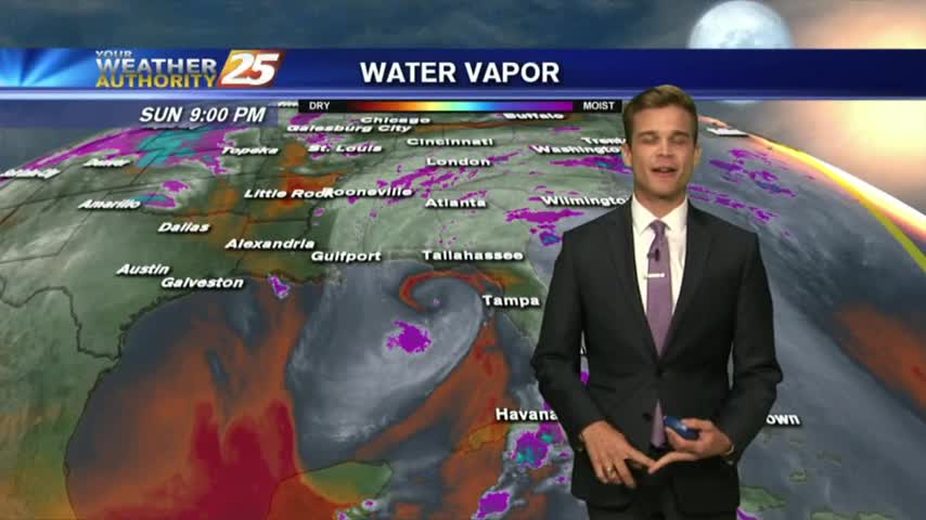
Rain chances go down to start the week, and the tropics continue to heat up.

Rain, rain go away...unfortunately it doesn't look like that will be happening anytime soon.
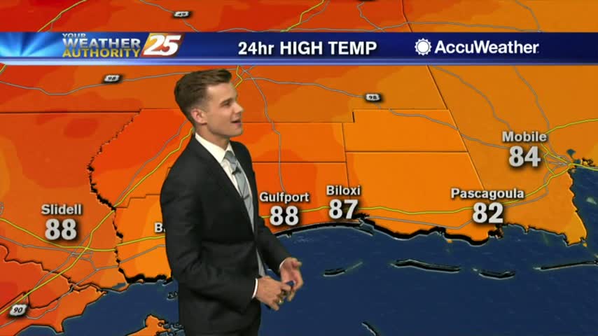
Hot, Hot...and Hot. Your workweek forecast is looking similar to last week's.
A summer like week with showers thunderstorms in the forecast and the latest on the tropics.

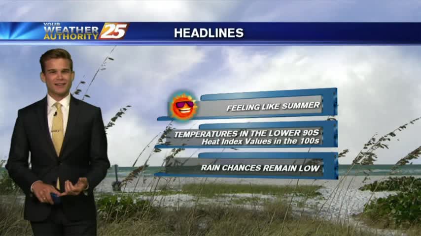
It felt like it was around 110 degrees this afternoon...but relief is on the way.
Alberto continues to strengthen, but the worst will stay off to the east.
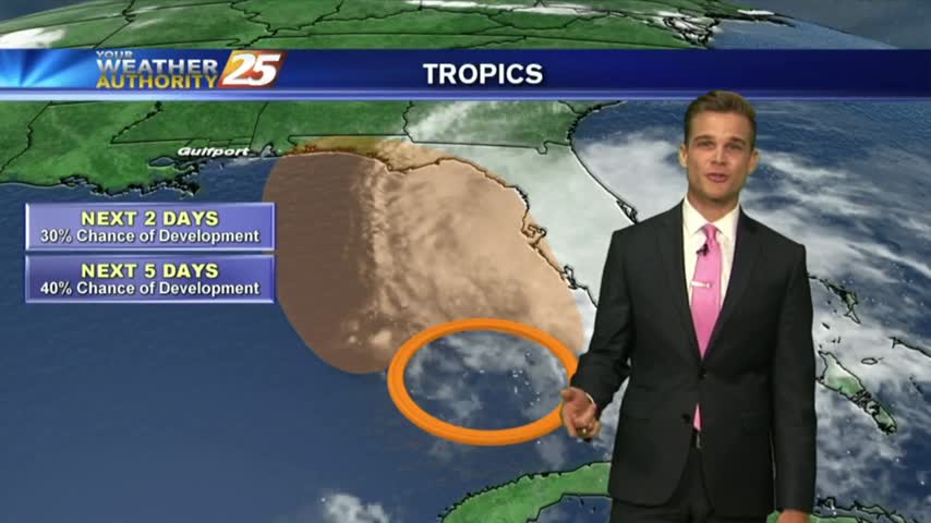
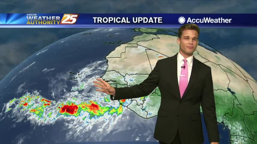
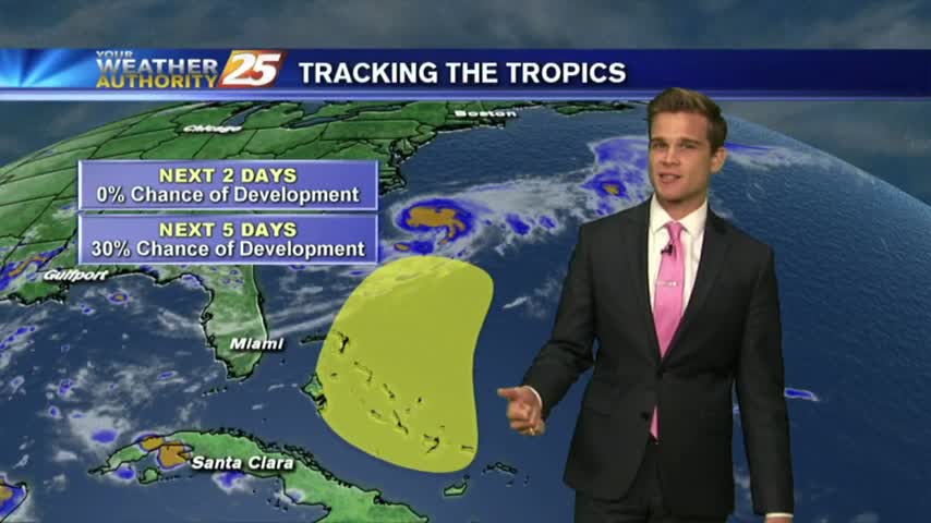
Another hot one, but now our attention turns to the tropics.

An interesting day with an earthquake in the Gulf of Mexico, and very warm temperatures.
Beautiful weather to start your week!
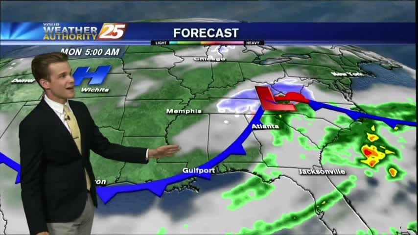
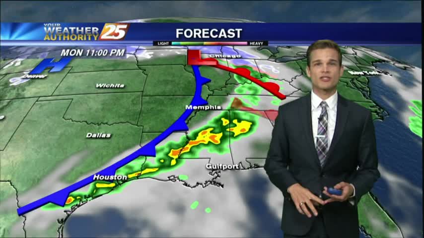
All the storms are off to the east as a cold front continues to move out of the area. This means nice weather to start the week, but rain chances are back in the forecast.
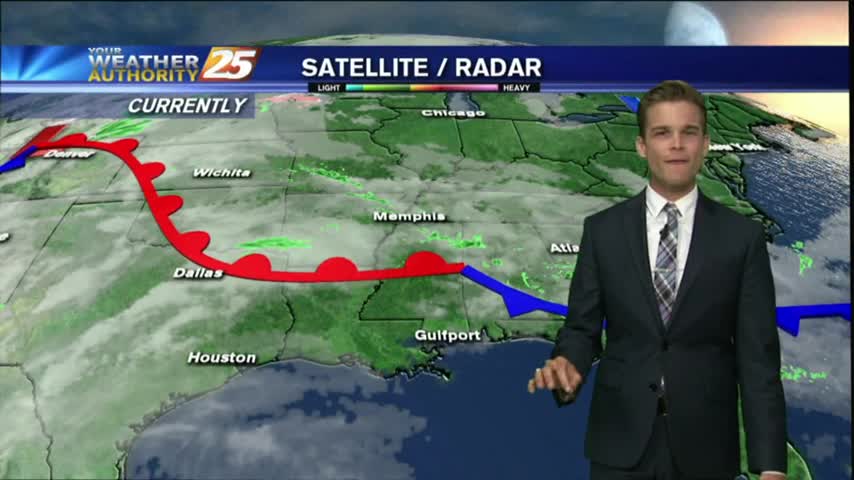
Cooler today, but a warming trend starts this week.
Happy Easter! Another beautiful weekend, but the post frontal weather is slowly coming to an end..moisture is returning and rain chances are in the forecast.
What a beautiful day on the coast! Unfortunately it all comes to an end to start your workweek.

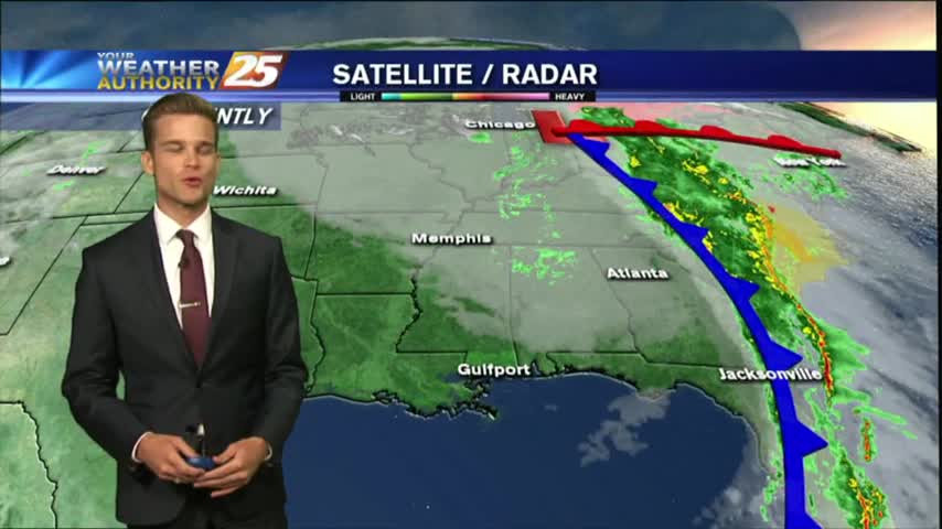
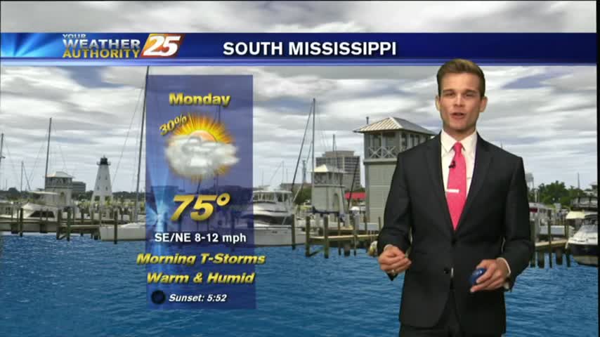
South Mississippi is now under a SLIGHT RISK for severe weather through the overnight hours.
Heavy showers and thunderstorms from this morning have moved out of the area, and a front will bring breezy conditions to start the workweek.
The beautiful weather this weekend is coming to an end as we start the workweek.
Heavy showers and few thunderstorms tonight, but drying is in the forecast.
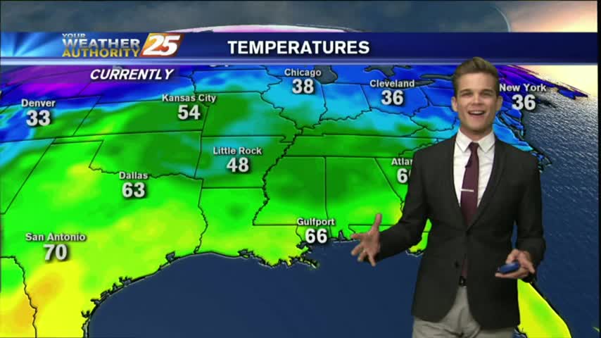
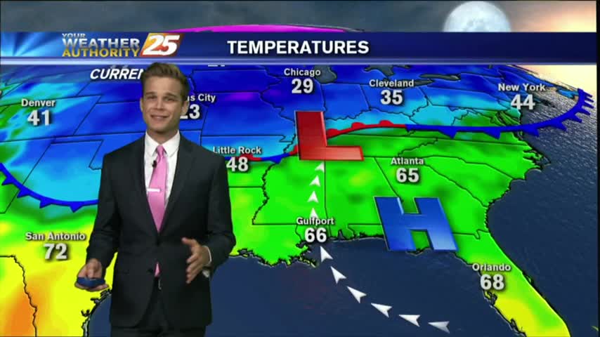
Record warmth continues as we start the work week.