4/29 - The Chief's "Severe Weather Threat" Monday Afternoon Forecast
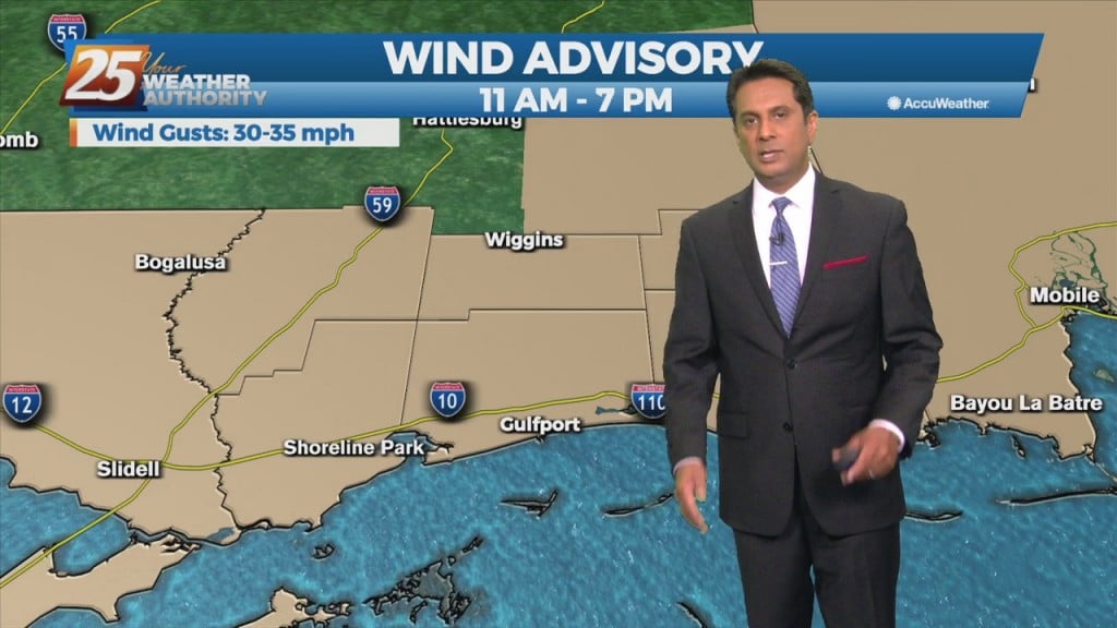
Winds will begin to weaken dropping below advisory thresholds this afternoon. But there will still be gusts to 25mph at times and even higher winds up…
Winds will begin to weaken dropping below advisory thresholds this afternoon. But there will still be gusts to 25mph at times and even higher winds up…
A vigorous storm system continues to move east though the region. Activity from this morning will begin to taper-off…with another batch of energy moving tough the…

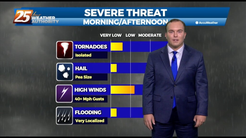
SEVERE THREAT this afternoon/tonight, with multiple potential hazards in the first 24 hours of the forecast before the weather quiets down for a while. A…

A surface warm front is at the coast moving northward continuing to destabilize the atmosphere. All variables that would support severe storms will also exist today…

With an approaching system to the west, showers and t-storms are expected through midday. It seems that the best instability and forcing will remain north.…

Hot and humid conditions continue into the first part of the weekend. Heat alerts will be in effect for some of tomorrow due to sunshine and the hot…
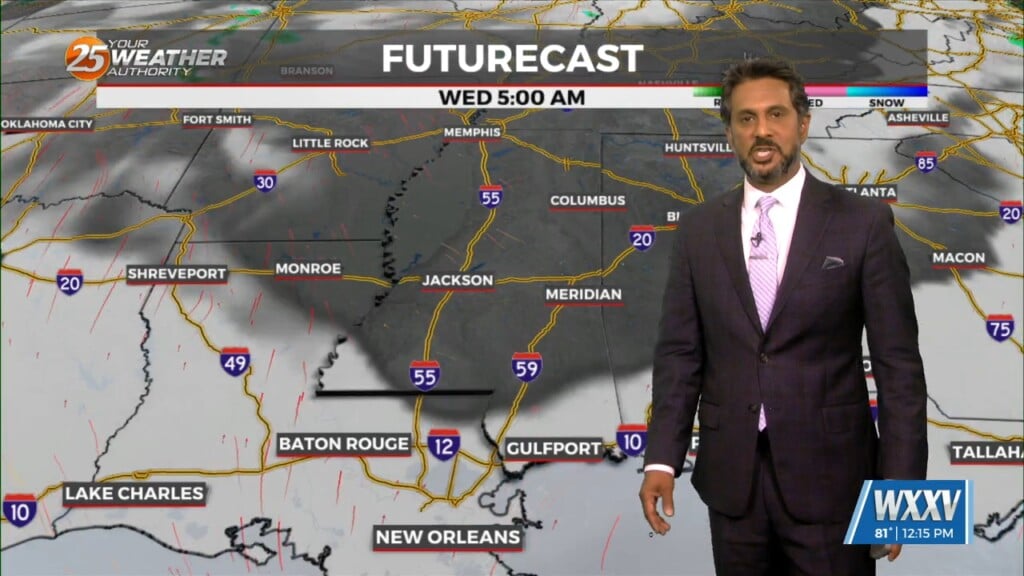
A weakening upper low currently moving through the Central Plains will continue east across the lower/mid-Mississippi Valley this afternoon and evening. With increasing low level moisture, cooling…
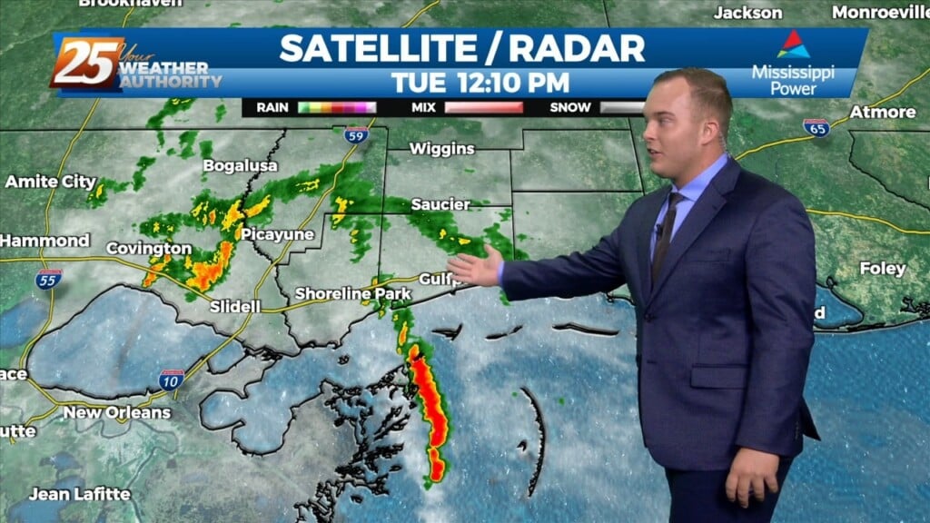
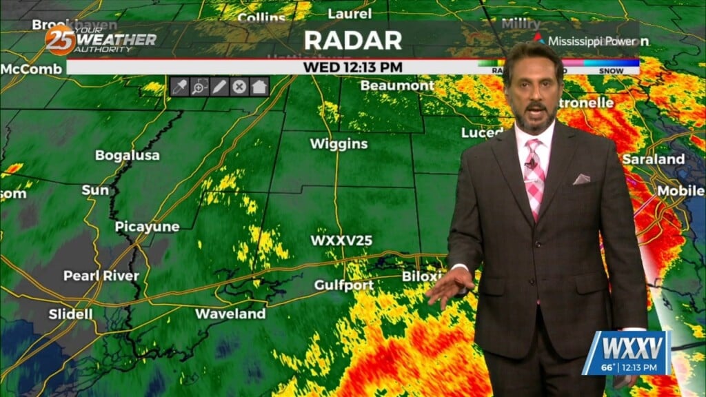
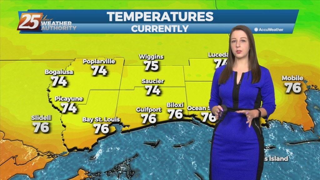
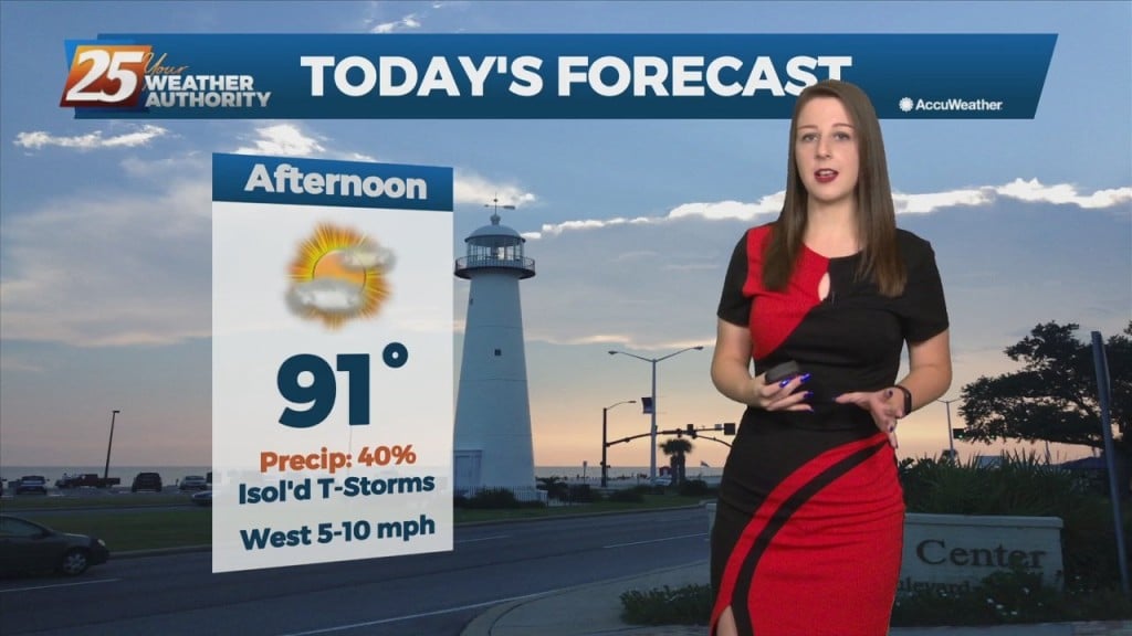
Some shower activity is passing through our area. There will be 40% coverage of showers for the remainder of this afternoon. Skies will be mostly cloudy and…
A warm front will lift out of the gulf and move over the area around noon today. This front will allow some showers/t-storms to develop by…
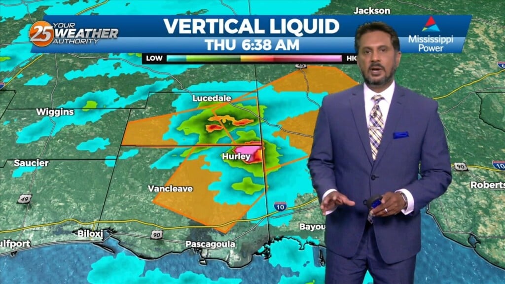
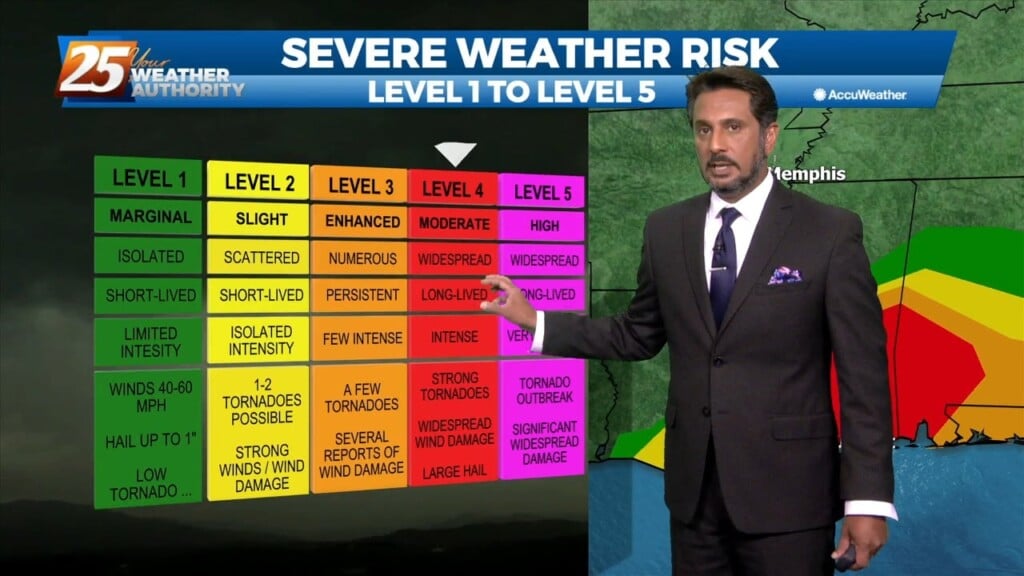
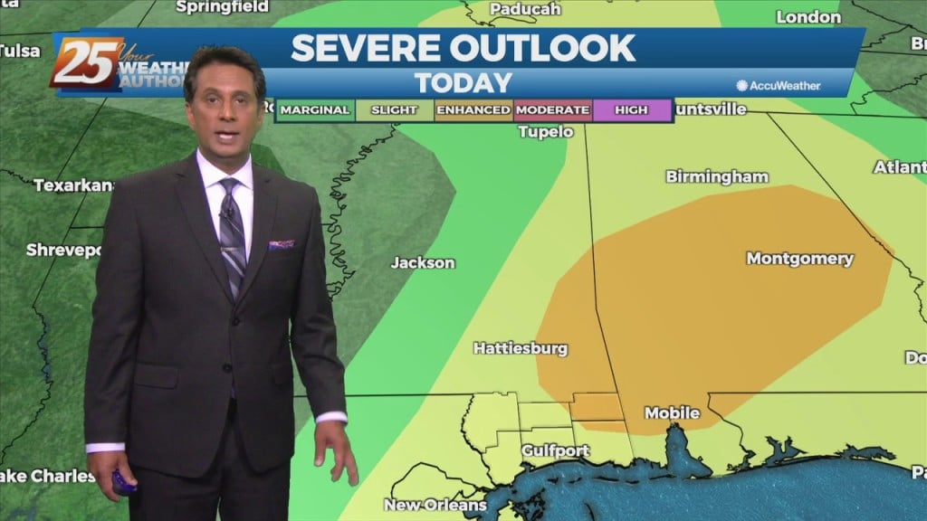
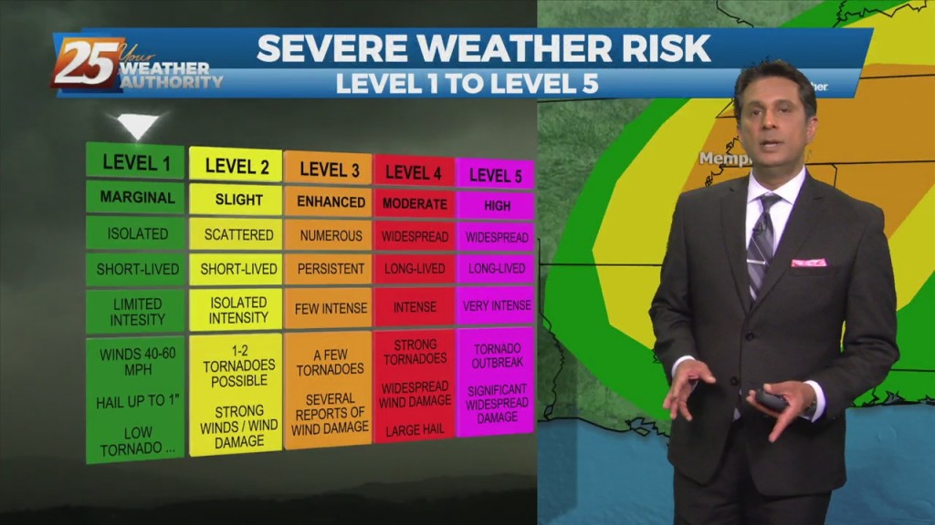
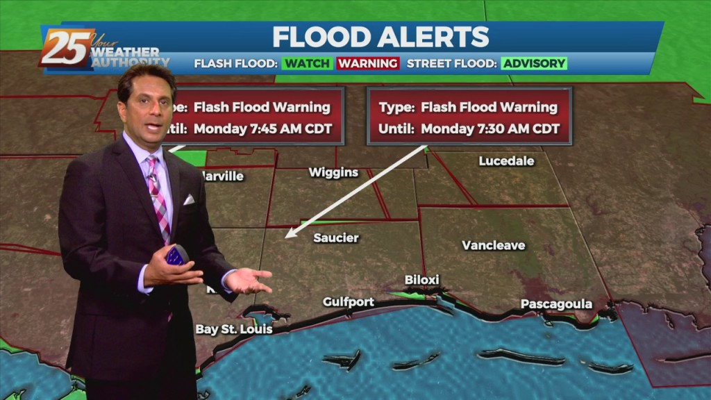
There is a Marginal (Level 1 of 5) Severity risk for the majority of our area, with portions of George and Stone County under a Slight…
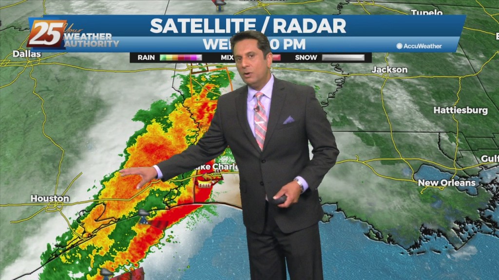
Significant severe weather and excessive rainfall threats can be expected this afternoon into mid-evening...especially from the Interstate 10 corridor northward. A vigorous system just to the…
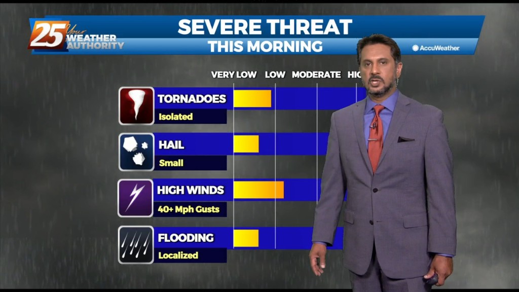
The main forecast issues for the entire forecast package occur in the first 18 hours of the forecast...today and this evening. Significant severe weather and excessive…
While isolated showers are streaming north across the local area, the activity will ramp up through midday. The upper disturbance is becoming somewhat negatively tilted early this morning,…
The risk for severe weather today will be greater than what we saw yesterday, with the main risks being damaging straight line winds around or > than 60mph, large…
A weak boundary still forecast to sink southward and stall near the coast for today and tomorrow. While widespread showers and storms are not expected, the boundary should provide…
THE AREA/STATE IS UNDER A MODERATE (LEVEL 4 OF 5) SEVERE POTENTIAL THROUGH TONIGHT... A WIND ADVISORY and a HIGH WIND WARNING is in effect with wind…
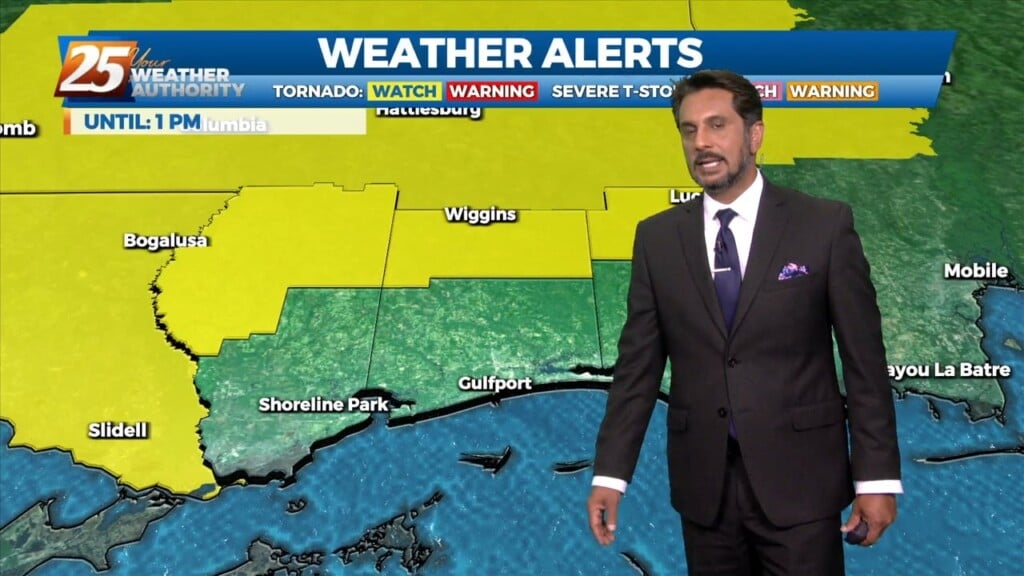
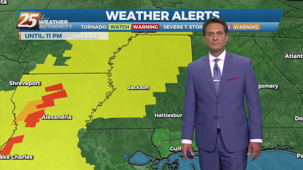
A vigorous system is in the area moving to the east. The area is under a TORNADO WATCH until 10 AM. All form of SEVERITY will…
A brief dry period today will change overnight as the stationary front drifts north, along with a vigorous cold front approaching from the NW. Rain will move back…
The main concern for today will be the front moving into the area this afternoon. The front is expected to enter the western portion of the region about…
High pressure still shaping the forecast today, however cloud coverage will start making its way into the area beginning tonight. Wednesday and Thursday mornings will have…
With the severe weather behind us the rest of the forecast will be focused on temperatures and winds. Windy conditions will remain in place today with winds…
A cold front will continue east with a line of convection ahead of it by early to mid-afternoon. While the very warm and moist airmass is expected to…
With IDA to the NNW moving towards north central Mississippi, expect gradual improvement through today. Widespread rain across the area will continue and gradually decrease to scattered showers later today as Ida tracks slowly to the north. After the center…
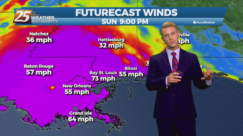
The NWS Doppler radar imagery and data from an Air Force Reserve Hurricane Hunter aircraft showed that Ida made landfall around 1655 UTC along the southeastern coast of Louisiana near Port Fourchon with estimated maximum winds of 130 kt and…