3/14 - Sam Parker's "Final preparations" Friday Evening Forecast
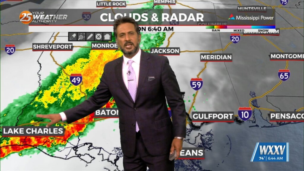
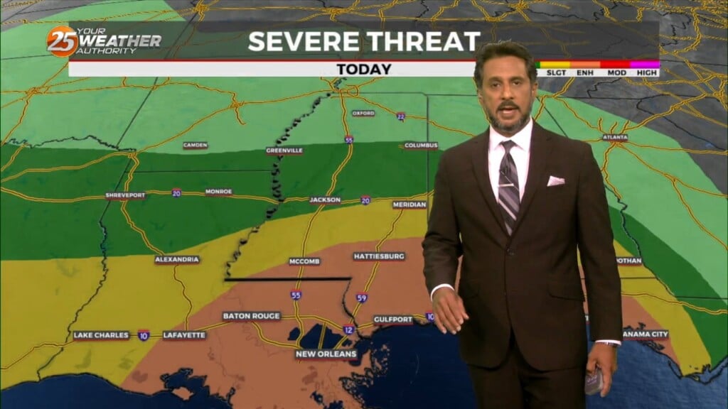
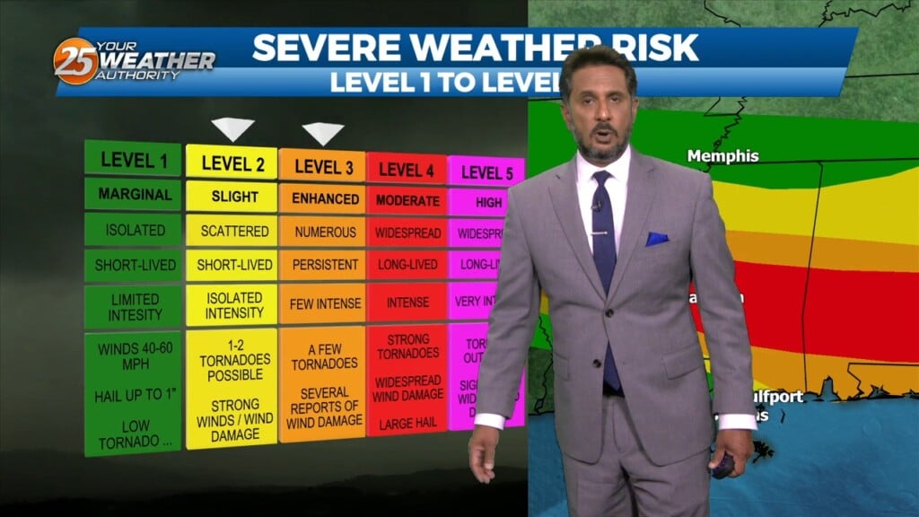
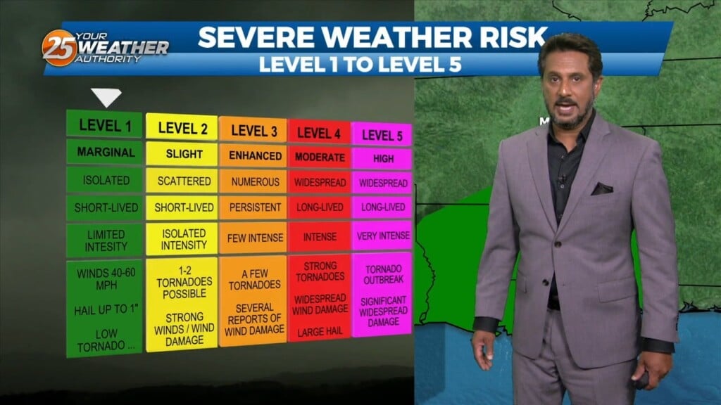
A rare High risk threat for severe weather issued for portions of Mississippi while we prepare for our moderate threat in our area. Today there is…
A rare High risk threat for severe weather issued for portions of Mississippi while we prepare for our moderate threat in our area. Today there is…
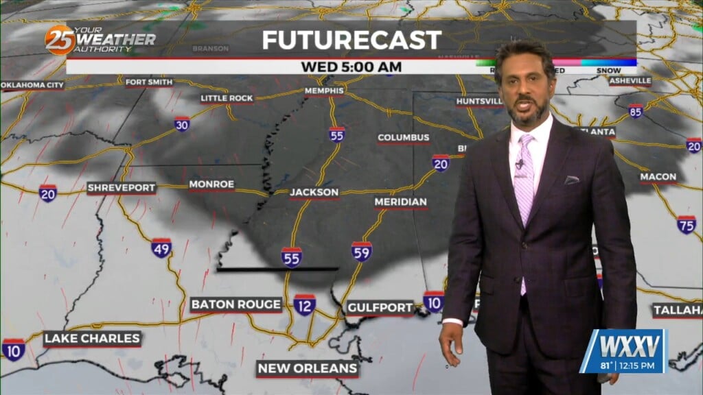
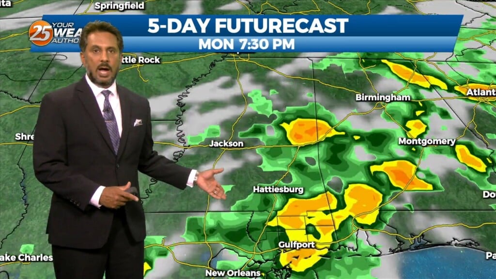
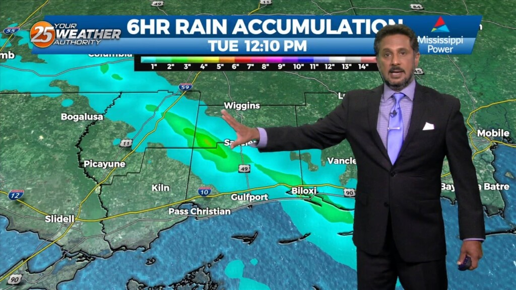
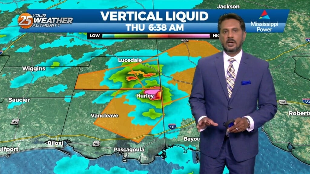
The upper flow is now supportive and subsequent lower level flows are also lining up to support the training of HEAVY RAINFALL. The first of 2 rounds…
First things first this morning it appears there could be a few isolated low topped showers develop with the initial impulse moving into NW Louisiana.…
Winds will begin to weaken dropping below advisory thresholds this afternoon. But there will still be gusts to 25mph at times and even higher winds up…
Finally…winds will begin to weaken today dropping below advisory thresholds. But there will still be gusts to 25mph at times and even higher winds up…
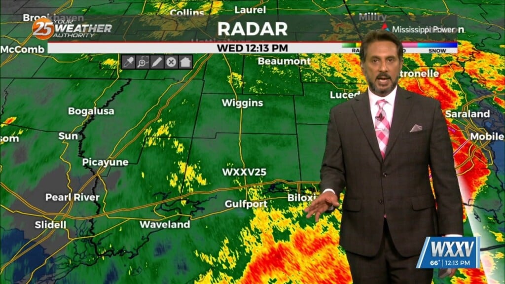
A vigorous storm system continues to move east though the region. Activity from this morning will begin to taper-off…with another batch of energy moving tough the…
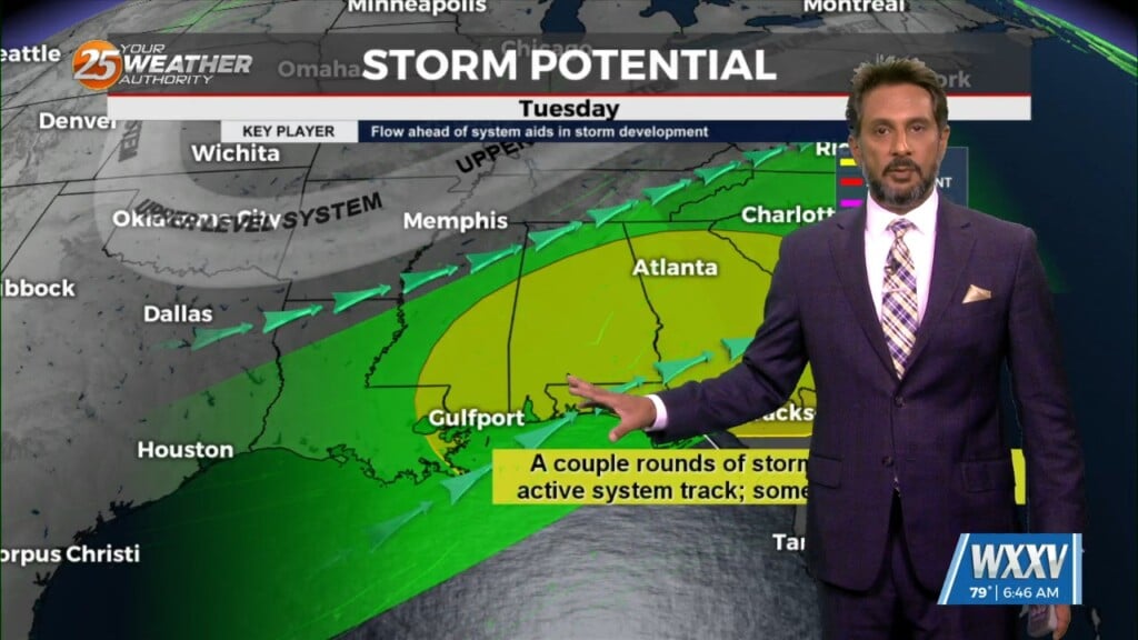
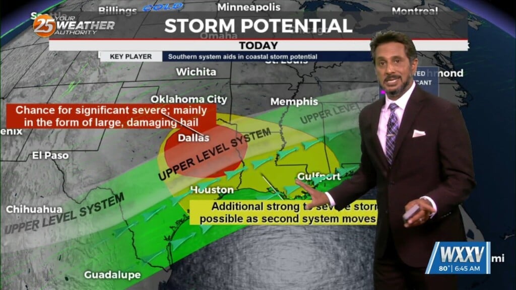
Anticipate multiple potential hazards in the first 24 hours of the forecast before the weather quiets down for a while. Low pressure over western Kansas this…

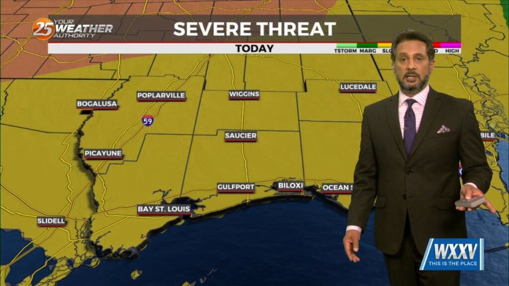
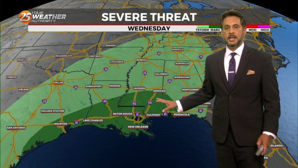
A surface warm front is at the coast moving northward continuing to destabilize the atmosphere. All variables that would support severe storms will also exist today…
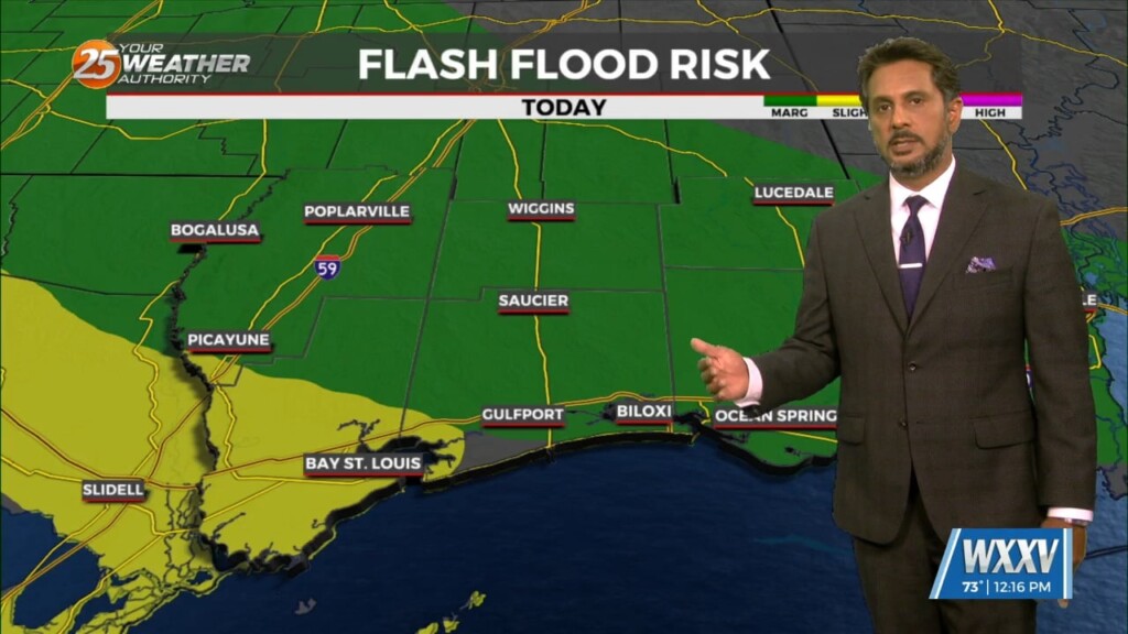
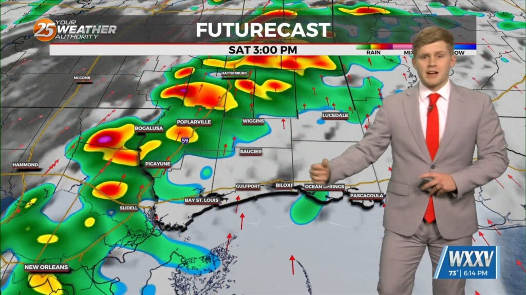
SEVERE & HEAVY RAIN THREAT THIS AFTERNOON/OVERNIGHT... Showers/t-storms will begin around midday with activity increasing this evening and overnight. The next thing would be…
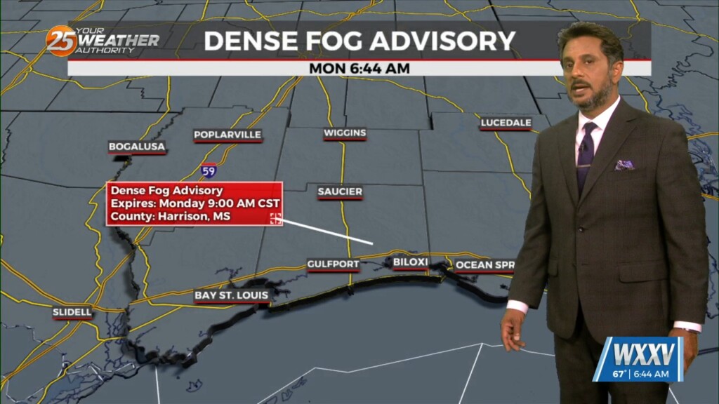
Fog will be in and out at most locations this morning. This fog should get lifted rather quickly by mid-morning as the entire boundary layer should…
The overall pattern begins to shift with high pressure centered over eastern North Carolina, with a weakness/cold front along the lee side of the Rockies.…
With an approaching system to the west, showers and t-storms are expected through midday. It seems that the best instability and forcing will remain north.…
Heading into this afternoon, a severe storm may not even be a probability but a certainty for some areas. There will be a lot going…
Multiple weaknesses in the overall pattern including an area of low pressure to the west has brought rain chances back to the region. Strong cored…
With a weak cold front overhead and drier airmass, showers and thunderstorms will pop a little later this afternoon. The activity will get started farther NW and…
There is plenty to talk about in the first 24-48 hours with a challenging forecast ahead. An impulse riding SE along a stationary front to the…
An upper level weakness continues to reside over Texas this afternoon keeping our region under an active southwesterly flow aloft with impulses circulating around this upper level…
Overall, a complicated forecast through the short term, mainly due to the upper level pattern over the region. An upper level weakness continues to reside…
This pattern will be in place today through Sunday. This onshore flow regime will advect in a substantially more humid airmass into the area today and…
A weakening upper low currently moving through the Central Plains will continue east across the lower/mid-Mississippi Valley this afternoon and evening. With increasing low level moisture, cooling…
Early this morning, a strong upper disturbance extended from the Upper Mississippi River Valley southward into Texas. At the surface, a cold front extended from…
We continue to see scattered t-storms develop along a boundary well to the southwest, with strong to severe storms noted over the Gulf of Mexico to…
Warm and breezy conditions ahead this afternoon with a storm system developing to the west. A strong upper level disturbance begins to move from…
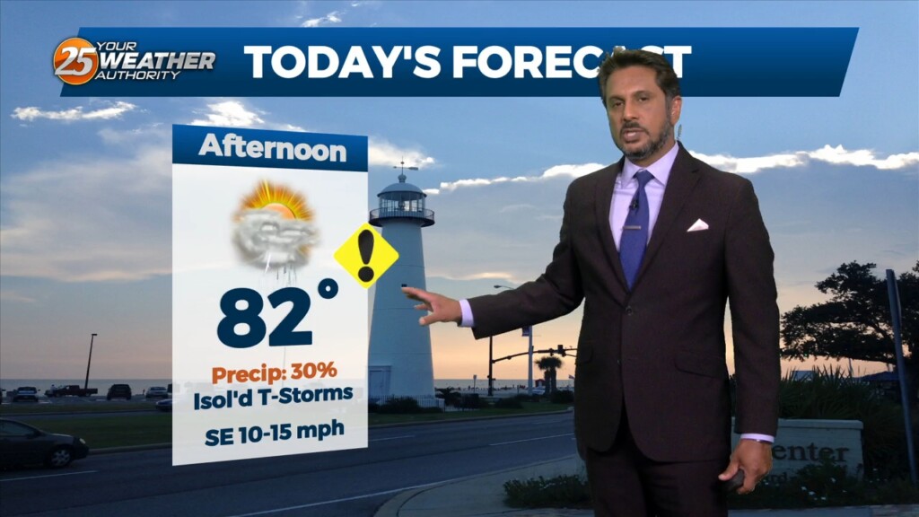
Another well above average day is expected in terms of temperatures across the region. At the surface a weak stationary front north of Hattiesburg will…