6/6 - The Chief's "Scattered T-Storms" Friday-Eve Morning Forecast
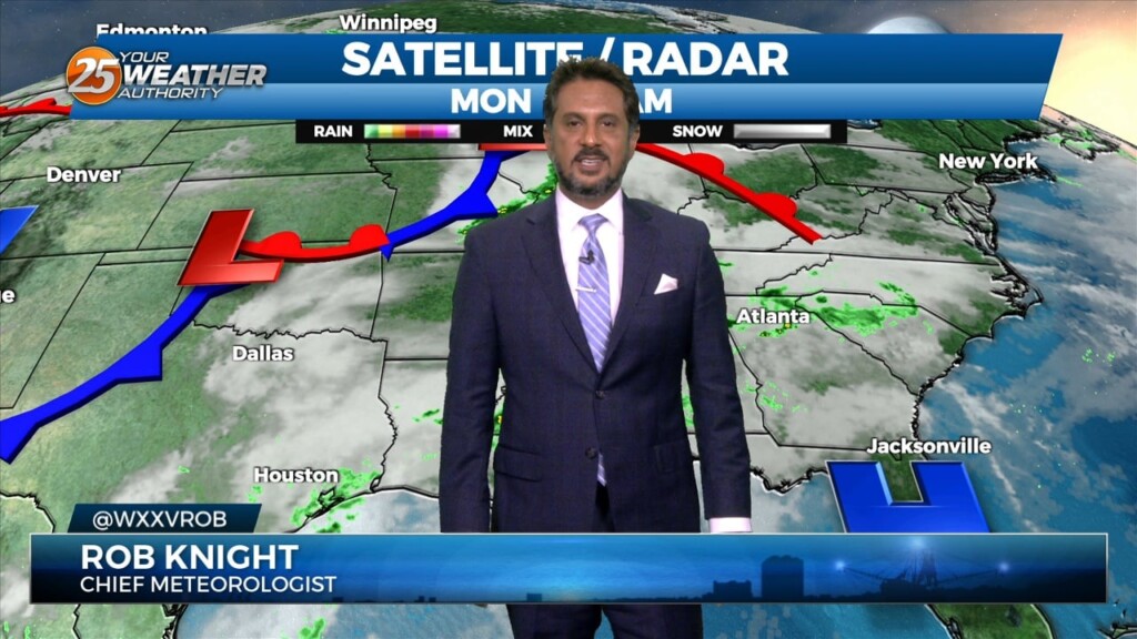
The front that has been talked about is arriving this morning. This is more of a weakness at the surface than a front, but there is some…
The front that has been talked about is arriving this morning. This is more of a weakness at the surface than a front, but there is some…

The old front has backed off into central Mississippi which is where showers/t-storms are developing this morning. A few storms are moving NE as they follow this…
I will try to keep things as simple and non-confusing as possible by keeping headlines to what is necessary and only ramping up to the highest…
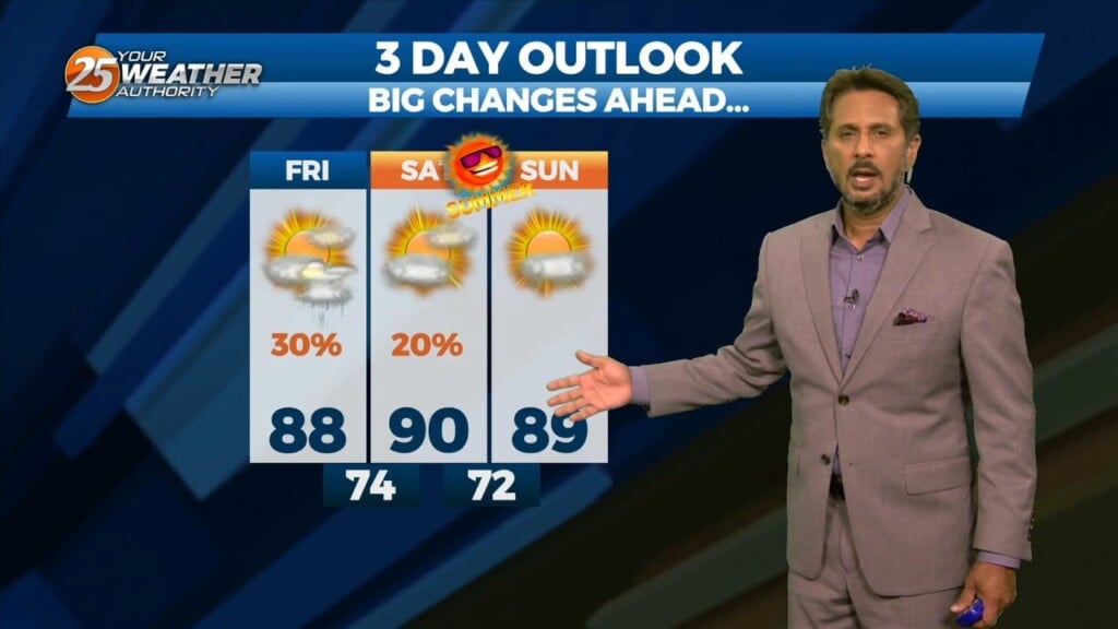
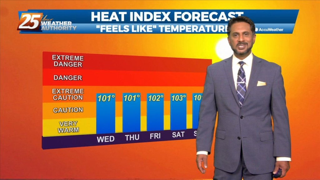
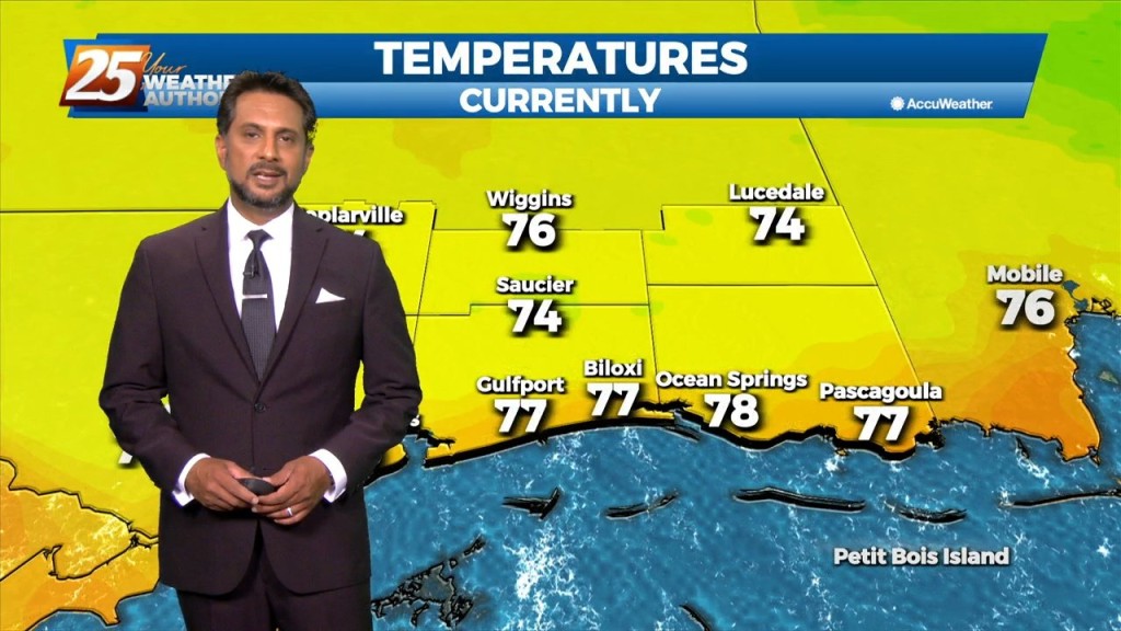
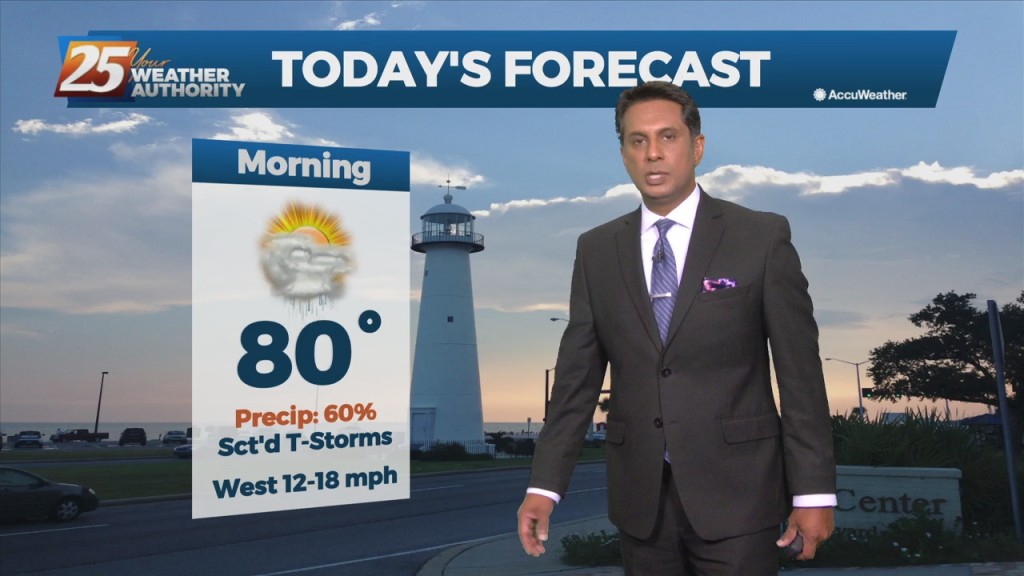
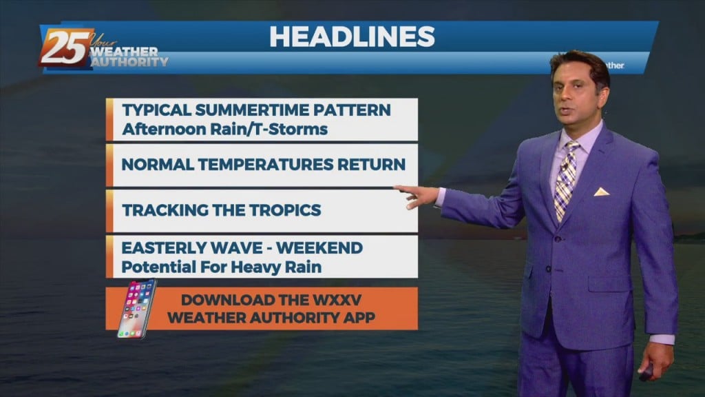
Scattered showers and thunderstorms will be possible this afternoon as temps warm into the upper 80s/low 90s within a fairly moisture regime. Although the latest…
Confidence in the forecast/conditions continues to take hits as convection is just not developing like initially anticipated. Even with the arrival of rich low-level moisture and…
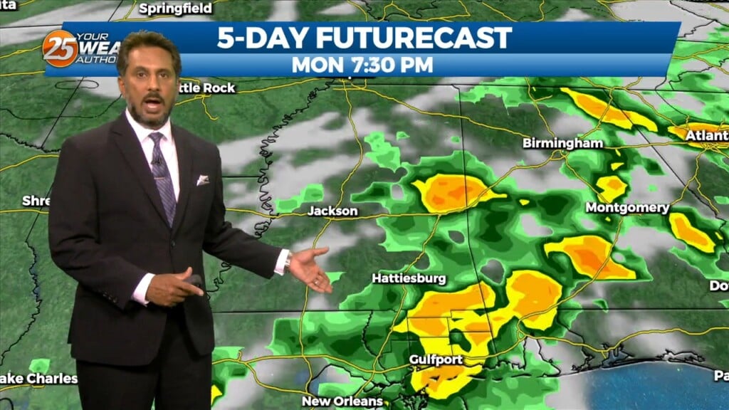
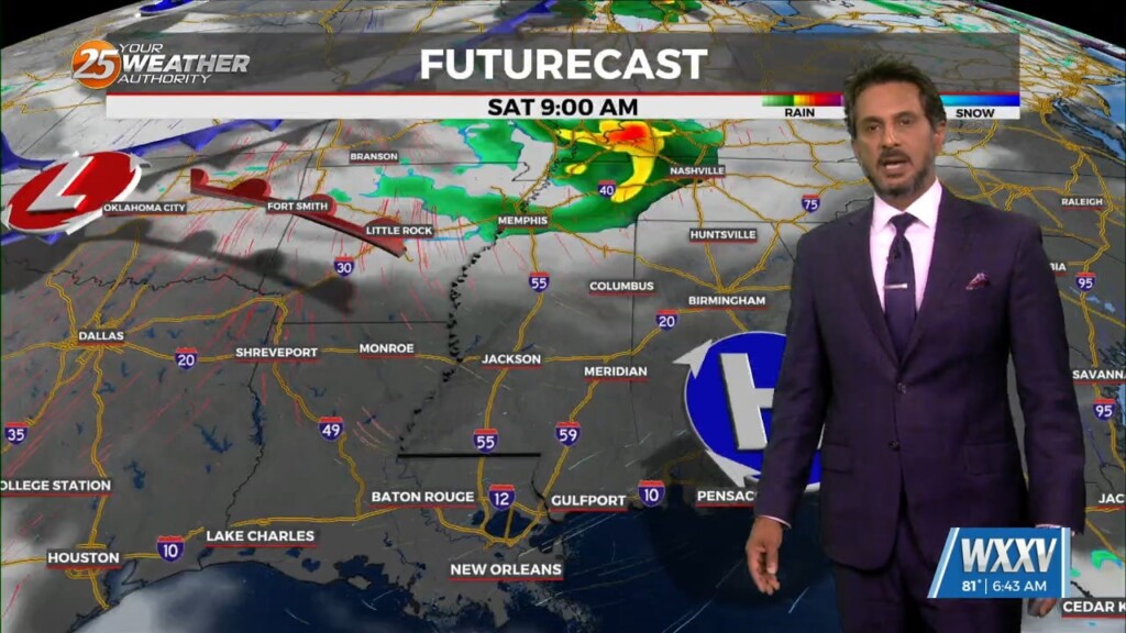
Multiple weaknesses in the overall pattern including an area of low pressure to the west has brought rain chances back to the region. Strong cored…
Showers/t-storms will once again ramp up this afternoon with daytime heating. High pressure is still in place but there has been just enough of a weakness…
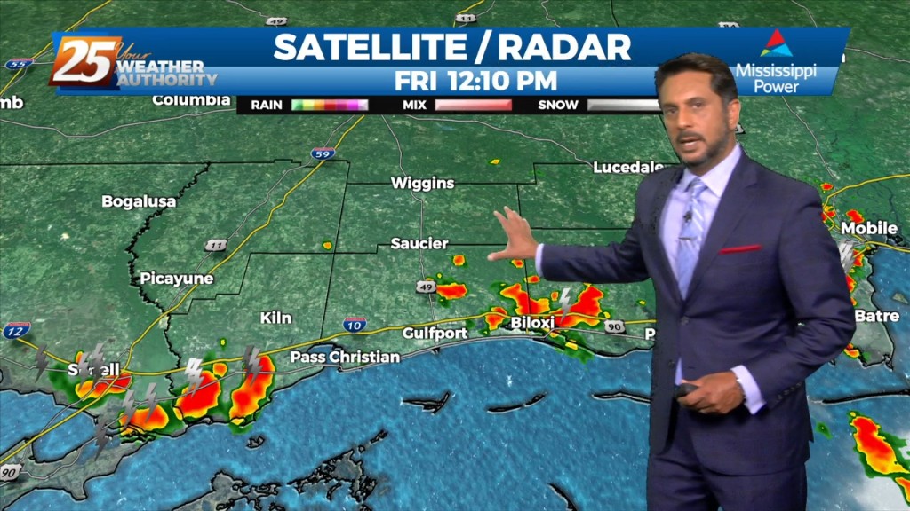
A few scattered showers have developed across the region early this morning, which will continue to develop into t-storms as we progresses towards midday. Today looks…
The high pressure that has been over the region has been providing for little to no resistance to convection working into the area from the…
A line of showers & t-storms moving across SW Mississippi should continue to slowly spread/work east-southeast through the pre-sunrise hours and slide east through 9 a.m. before…
Warm and moist air advection continues as we stay ahead of the trough over southern Colorado. The advection as well as isentropic lift has created some showers…
A weakness/subtle mid-level inverted trough over the northern Gulf continues a slow retrograding motion towards the WSW along the outer periphery of a mid-level high pressure…
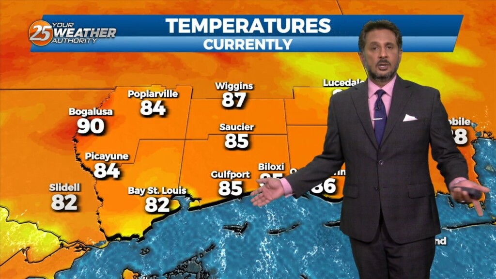
Many parts of the area have seen considerable rainfall over the past several days with a few locations having had measurable rainfall for quite an extended period. While…
Very moist air along with erratic thunderstorm development thanks to sea-breezes and the like could run into a similar issue as yesterday where intense rates…
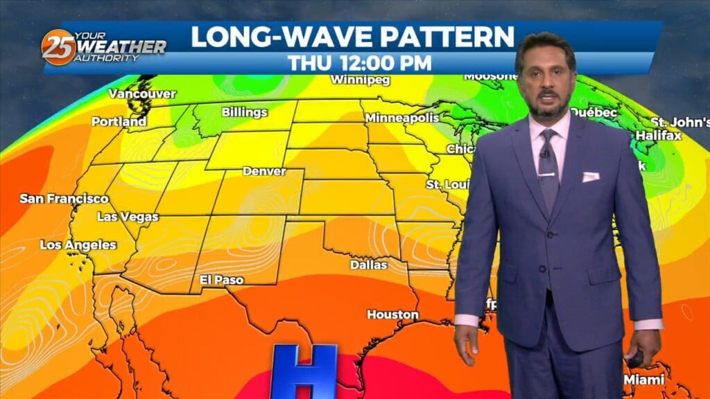
High pressure will continue to move into the area and shape the forecast though the weekend. The Bermuda ridge extends westward from the Atlantic Ocean to…
A broad upper level high pressure system is centered near the 4-Corners region extends from Mexico to Canada and CA to around MS. This eastern portion of…
Locally, there’s still some form of residual frontal boundary that moved through to the area Sunday, with an area of low-pressure which developed east of…
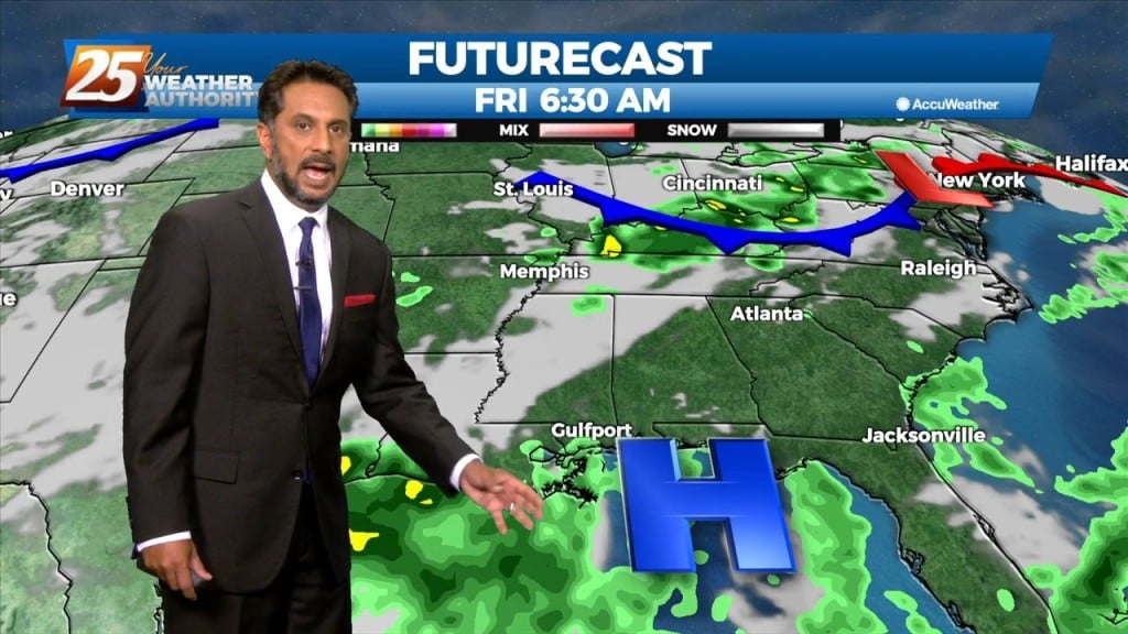
There is an area of high-pressure over the Rockies and along the Atlantic Coast with disturbances over the Great Lakes and approaching the Pacific Coast. Pressure fields…
An upper low-pressure system this morning is moving into Missouri, with the associated cold front appears to extend from Jackson to Lafayette, probably just moving into the Baton…
A cold front still tracking toward the area early this morning will move into the northwest portion of the area around noon, reaching the Mississippi Coast…
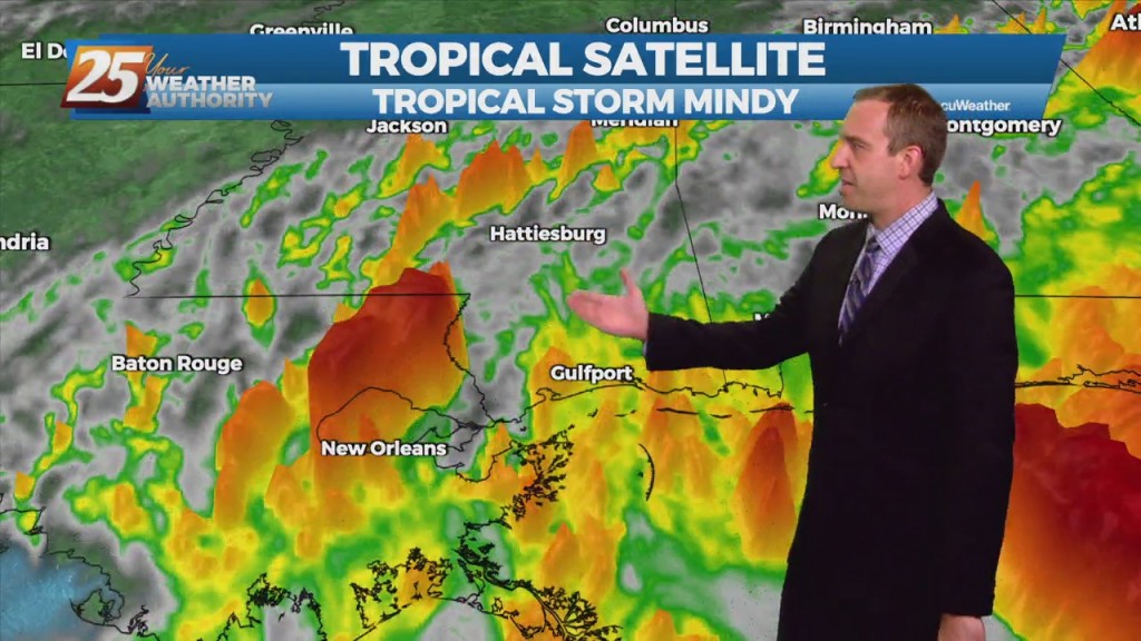
As unexpected as it was from last night's forecast, Tropical Storm Mindy formed today in the Northern Gulf. It's disorganized, and moving rapidly, but will still bring heavy…
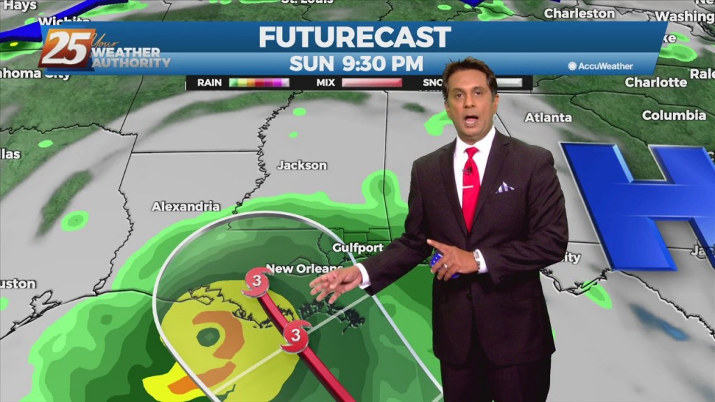
HURRICANE WATCHES have been issued for coastal Mississippi, with a TROPICAL STORM WATCH inland and to the east. Guidance is relatively tight in terms of Louisiana as the most likely to be impacted. The timing and the intensity of Ida…
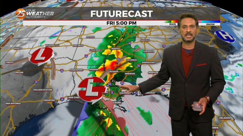
Showers/t-storms will develop late morning and early afternoon, a few thunderstorms could produce rain rates of 2-4" per hour and this could cause some very localized flooding of poor drainage areas. Thursday will be different as a wetter scenario develops…
There will be a lot more activity today than the previous several days as high-pressure weakens. Showers/t-storms will develop late morning and early afternoon, a few thunderstorms could produce rain rates of 2-4" per hour and this could cause some…