05/09 Ryan's "Mild & Calm" Tuesday Forecast
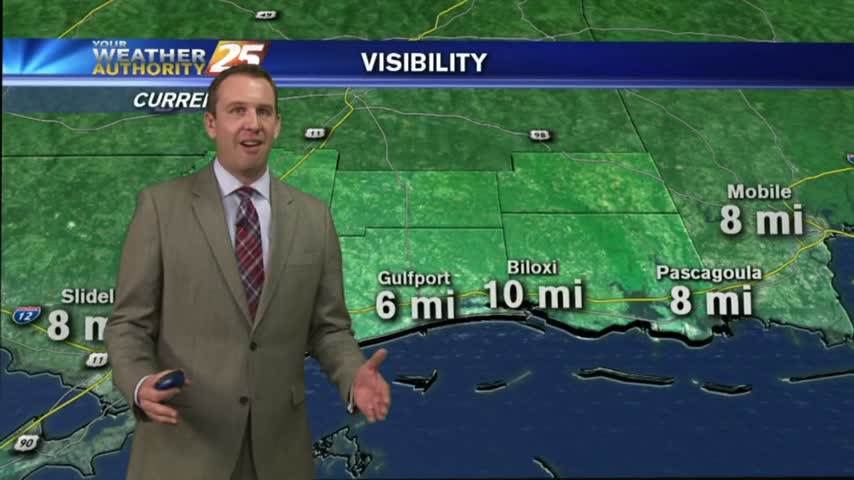
Expect another calm night tonight, which I expect to lead to areas of patchy fog in the early morning hours. Watch the full forecast for all the details.
Expect another calm night tonight, which I expect to lead to areas of patchy fog in the early morning hours. Watch the full forecast for all the details.
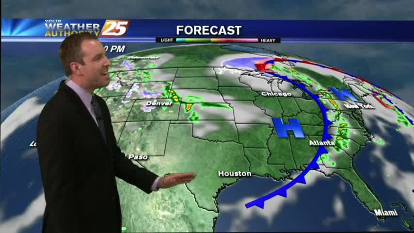
Skies remained mostly clear today and that's still expected to continue until around Thursday, when we'll begin feeling the effects of an approaching cold front. Details within.
Skies remain clear though our days and nights will continue to warm through the week. Watch the full forecast for details.
Hope everyone enjoyed their Cinco de Mayo festivities responsible today, and be assured your headache will go away soon as long as you drink plenty of water. The weather certainly won't be giving anyone headaches for several days after strong…
The cold front associated with last night's strong storms finally moved East of the area today, and we're already seeing significant clearing & cooling. Watch the full forecast for all the details.

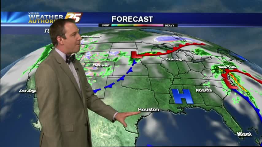
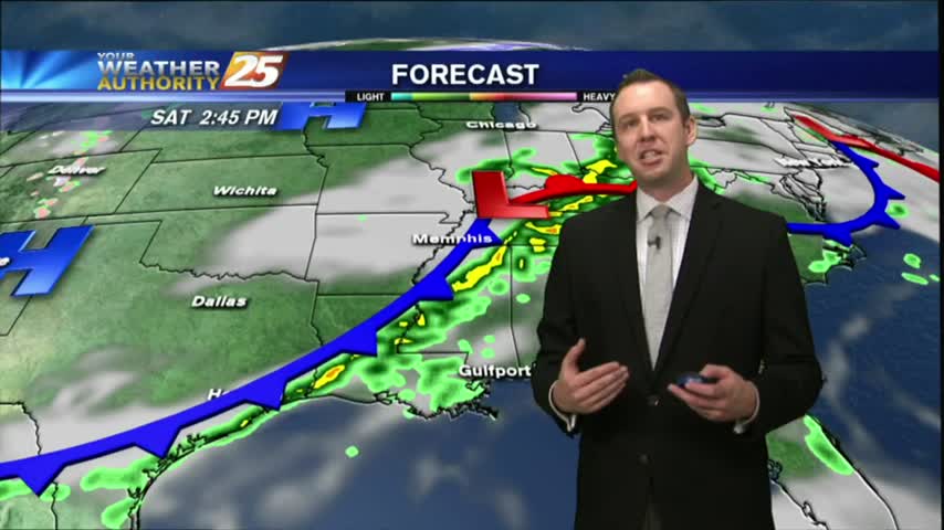
Storms are pushing into the area now and will continue over the next few hours. Our severe threat was lowered from "enhanced," "to slight," and now to "marginal," so little damaging weather is expected though we will see some strong storms. Watch the forecast for details.
Today was another beautiful South Mississippi afternoon, and most of tomorrow will be as well. Once we start heading into the evening though, showers and storms will begin moving in from the West. Be sure to watch the full forecast for details.
Beautiful cool & dry weather moved in after yesterday's front, and will linger in South Mississippi for another day or so. Expect another round of rain before the weekend though, watch the full forecast for details.
Strong storms moved through earlier today, but have now moved off towards the East. A cold front will pass through overnight leading to some cooler & drier air, so be sure to watch the full forecast for details.
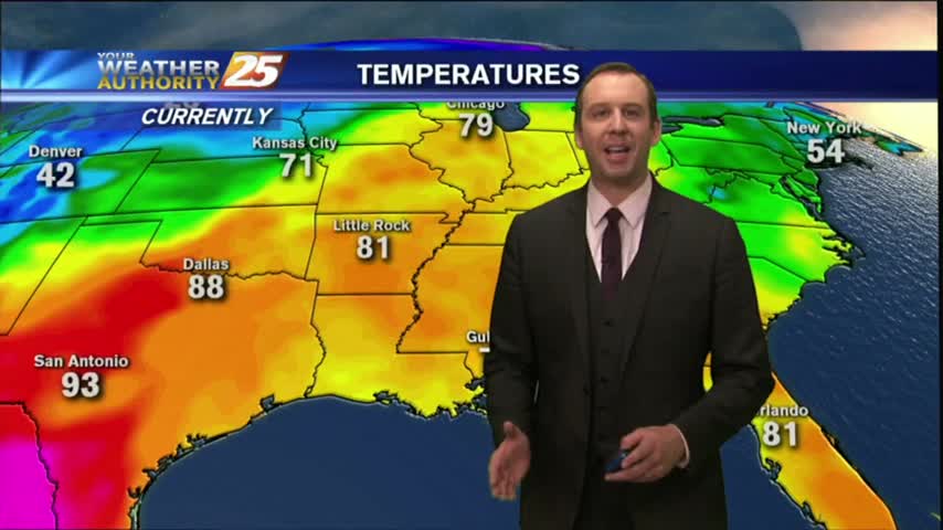
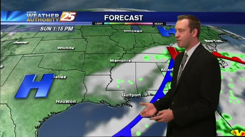
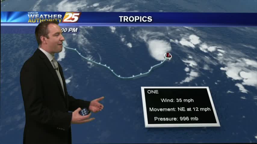
It may feel like a tropical rain-forest now, but it'll keep getting worse until a strong cold front moves through Sunday night. Watch the full forecast for details.
A cold front may have passed through overnight, but temperatures warmed today. Expect a few days of calm weather before another potential severe threat. Watch the full forecast for details.
Storms are beginning to creep in from the NW, and despite our "marginal" threat for severe weather, conditions are trending for weaker storms in South MS. Watch the full forecast for more details.
I hope you enjoyed our two mild days and cooler evenings, because a warming trend begins tonight and doesn't stop until the beginning of next week. Watch the full forecast for details.
This afternoon's cooler and drier weather carries over into tonight, but we'll see higher temps and humidity as we head through the week. Watch the forecast for details.
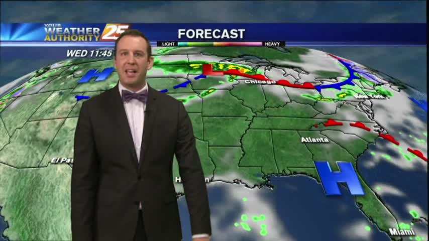
High pressure settled in over the area leading to clear skies, drier, air, and slight cooling. We'll begin seeing changes as a front approaches the area tomorrow night, so watch the forecast for details.
Saturday's cold front brought some stronger storms to the area than anticipated, but severe weather stayed away. The cooler and drier condition didn't stay away, and they'll continue into tomorrow. Watch the forecast for details.
We're finally going to see our "boring" weather streak coming to an end, but not until after one more sunny and humid afternoon. Showers and thunderstorms begin moving in by sundown, so be sure to check out the forecast for details.
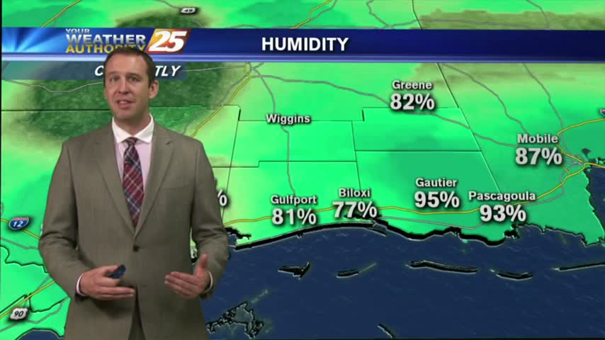
Last night's clouds have moved on, so things should cool by a degree or so, but will remain warm and humid with overnight fog. Click the forecast link for more details on this weekend's weather.
After another beautiful Spring day, you've got to be expecting the "other shoe to drop" soon right? Well, it does, but not until after a few more great days. Click the forecast link and find out when the rain arrives.
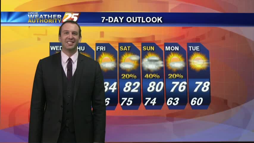
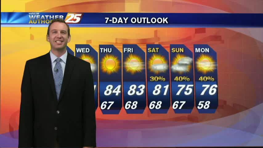
The rest of the week will be dry, sunny, and beautiful, but "active" weather moves in for the weekend. Watch the forecast for details.
So far the forecast from last weekend has held up well. We continue to see gradually warmer and more humid conditions, but now the clouds will begin clearing, leading to a few sunny and dry days. Forecast details inside.
The clouds are beginning to clear from the area, but we'll retain the small chance of an isolated t-storms in the afternoon. Watch the full forecast for details.
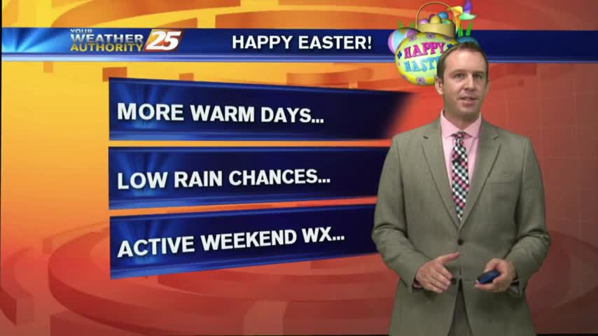
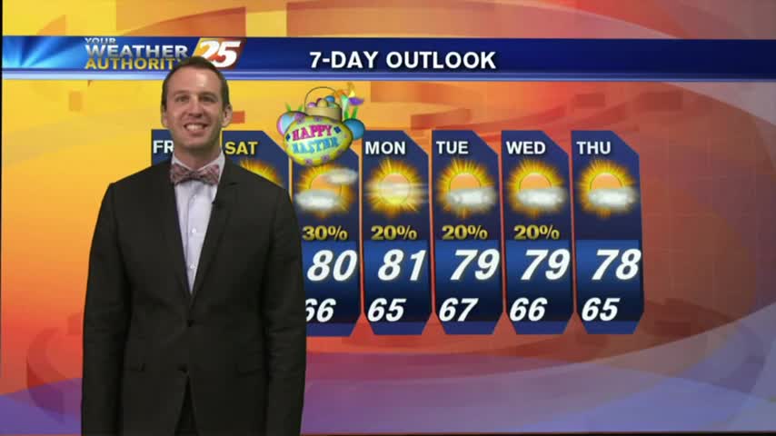
I hope everyone enjoyed their cloudy, but otherwise pleasant, Easter weather! We've more beautiful days ahead, though it looks like stormy weather will move in late Saturday. Watch the forecast for details.
Expect a few clouds and humid conditions tonight, though the stronger winds will limit any fog production. Afternoon showers could begin popping up over the next few days though, so watch the forecast for details.