07/02 Ryan's "Wet Weekend" Thursday Evening Forecast
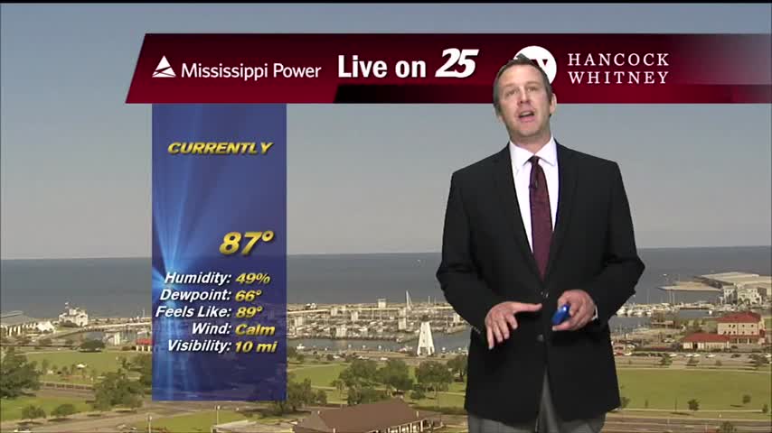
Things cooled down after an early afternoon round of showers and thunderstorms, but even more rain lies ahead.
Things cooled down after an early afternoon round of showers and thunderstorms, but even more rain lies ahead.
We're seeing more rain each afternoon now, a trend that will continue into the weekend.
Afternoon thunderstorms returned today, and we'll see even more of them in the days ahead.

More similar days ahead, but rain will be arriving just in time to keep things from getting out of hand.
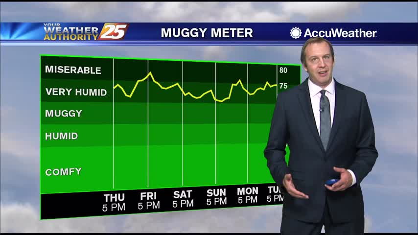
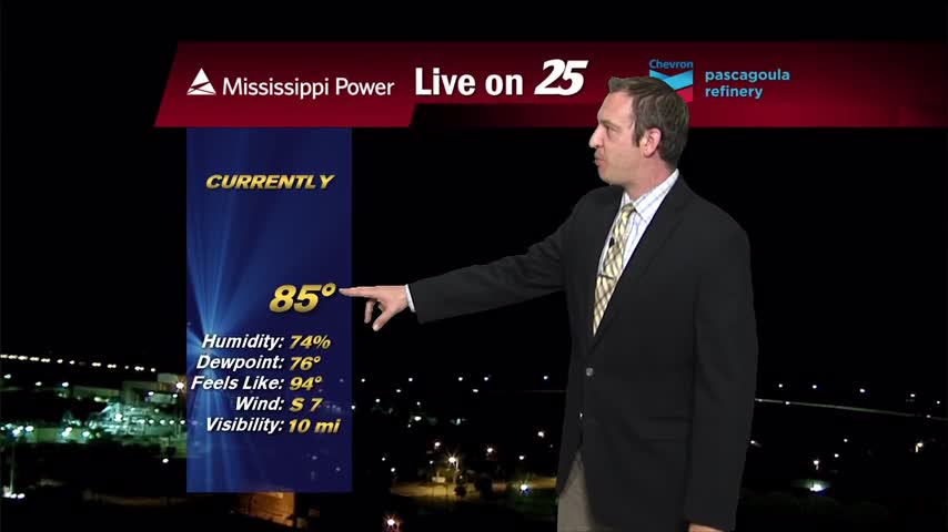
Hot and exceptionally humid weather remains, with little else changing for the rest of the week.
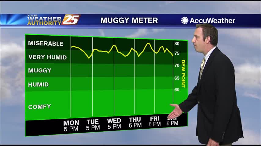
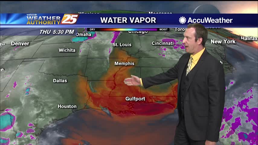
More miserably humid afternoons lie ahead, but more rain is on the way to bring some light cooling.
More miserably hot and humid weather ahead, but thankfully more rain moves in later.
Fewer showers this afternoon and evening, a trend that'll continue into the weekend along with higher humidity....
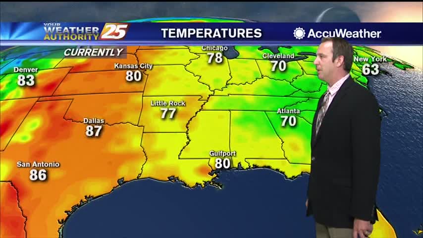
Less rain today, but still very hot and humid and the rain doesn't stay away long.
Been quite a miserably humid, hot, and rainy week so far, but positive changes are moving in.
Less rain today, with even fewer showers heading into the next few days! Still going to be exceptionally humid and hot though.
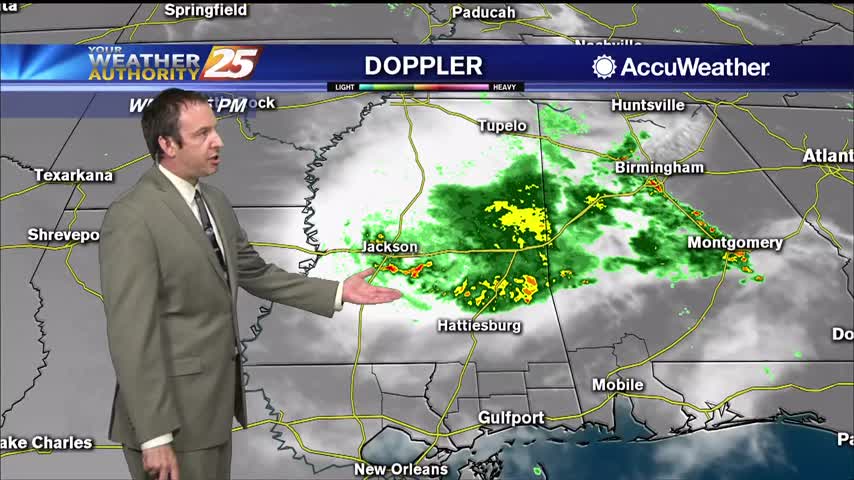
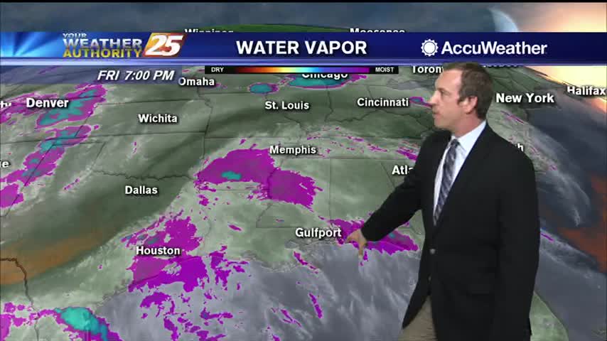
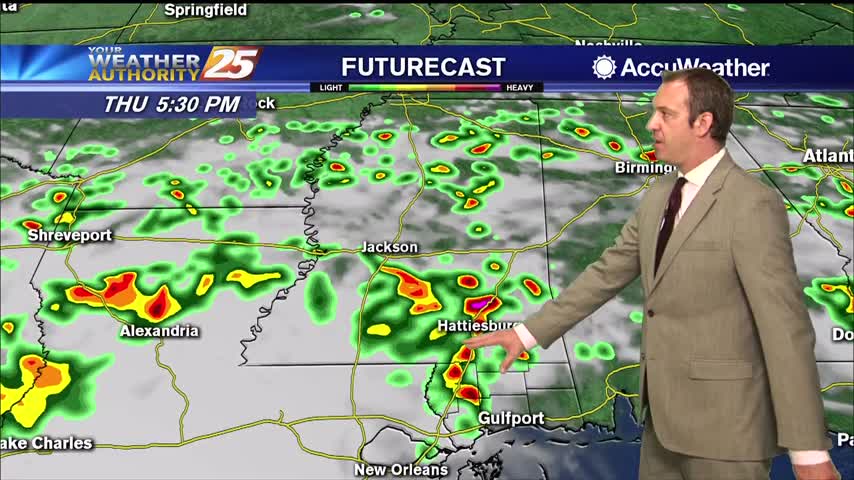
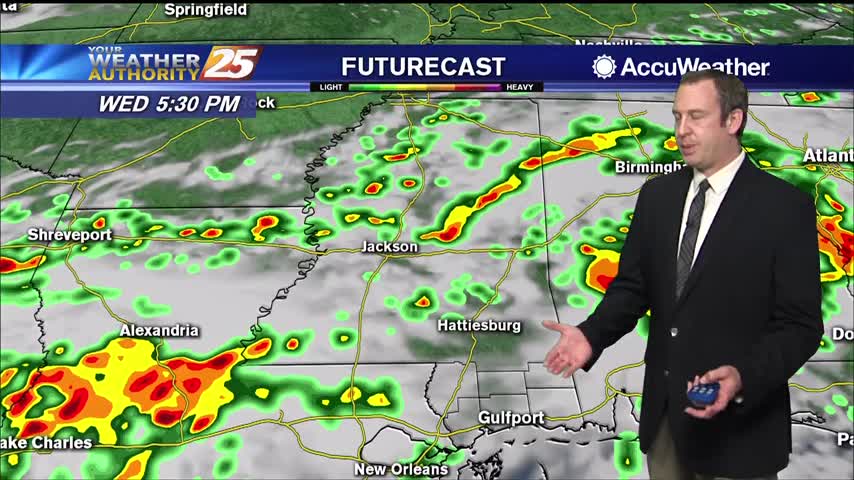
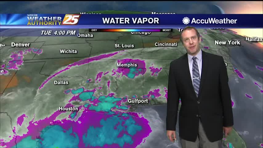
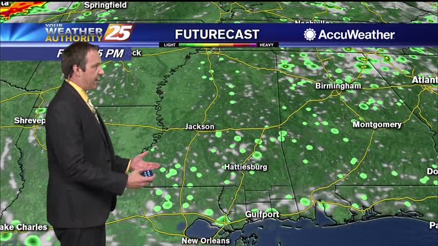
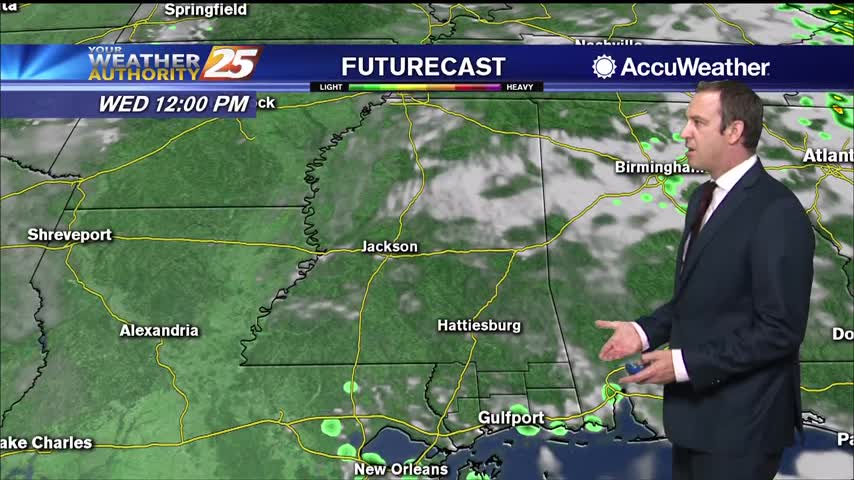
Active, strong weather moved in early this afternoon, and while it did weaken a bit through the evening the rain didn't leave completely.
Today started off with a line of strong thunderstorms bringing severe weather to South MS, but that trend isn't going to continue beyond today.
Last week was dry, this one will be wet as afternoon/morning showers pop up every day.
Today saw increased rain activity, something we'll see even more of tomorrow as hot and humid weather lingers in South MS.
Last week was hot and dry, but this week will be hot and wet. Starting off summer on the damp and humid side.

Last week was hot and dry, while this one will be hot and damp as showers are expected nearly everyday.
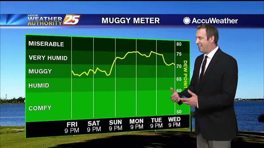
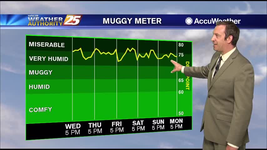
Things have been manageable over the last few days, but the humidity will jump sharply over the weekend while it stays just as hot.
Still hot and humid but rain hasn't been much of an issue, that changes though as we head into next week.
Our manageable heat and humidity is going to increase significantly soon.
The weather has been consistently nice and sunny, but the temperature and humidity will steadily rise into next week.
It's feeling pretty good right now, but even higher humidity is on the way as summer begins this weekend.
Not much has changed since last weekend, and won't be changing for the rest of the week.
It's felt like summer for a while now, but it doesn't officially begin until this weekend...