1/26 - Rob Knight's Weekend "Midday News" Forecast
After a MUCH WARMER start to the day earlier this morning, mild and humid conditions can be expected this afternoon with windy conditions...

After a MUCH WARMER start to the day earlier this morning, mild and humid conditions can be expected this afternoon with windy conditions...
Yesterday morning brought a FRIGID start to the day...this morning the mercury in the mid/upper 40s...
A CHILLY start to the day with mid/upper level clouds moving across the N'tern Gulf of Mexico...

In the wake of yesterdays cold front now beginning to move off the east coast, colder air is moving into our region...
After temps in the upper 60s to 71 degrees yesterday afternoon, warm conditions continue this morning as low temps are in the mid-60s...
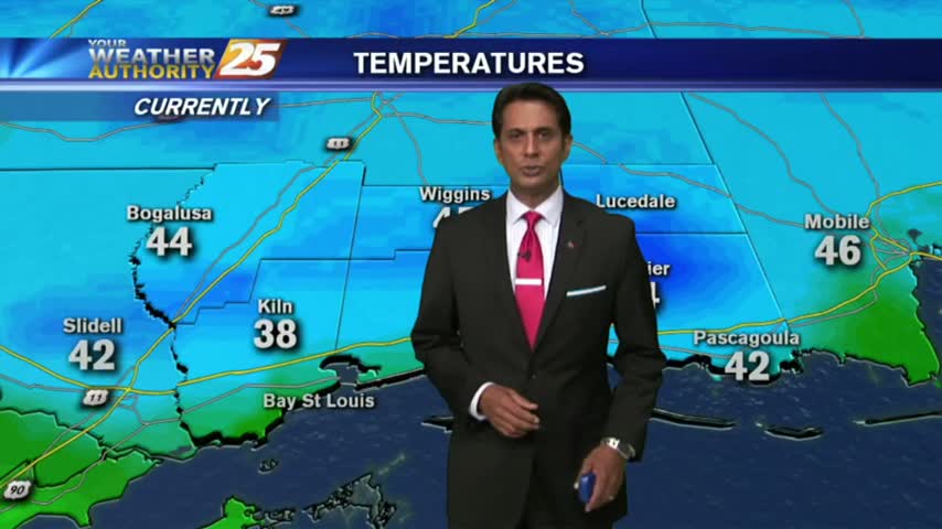
Another FRIGID start to the day as clear skies are in the area, Bundle up the kiddos as they head back to the bus stop...
After a cold and cloudy start to the day, clouds have cleared with SUNNY skies this afternoon then FRIGID conditions overnight...
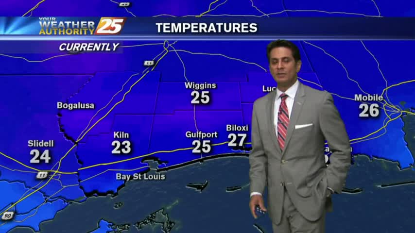
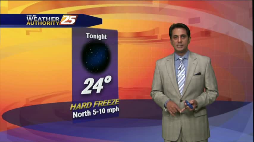
After another FRIGID start to the day with temps in the upper teens...they are slowly warming into the upper 30s...
An ABSOLUTE FRIGID start to the day/new year as temps are in the 20s...but wind chill makes it even COLDER...

Another COLD start to the day for the final Friday of the year...BUT, it is rain-free under mostly clear skies.
The HEAVIER activity has moved east with light rain linger through the viewing area...along with COLD TEMPS and WINDY CONDITIONS...
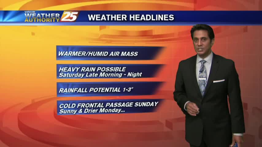
It feels like SPRING again as the warmer, more humid air air mass continues to move in from the Gulf of Mexico...
After a COLD start to the day, temps continue to be CHILLY as a good bit of upper-level clouds are keeping the sunshine away...

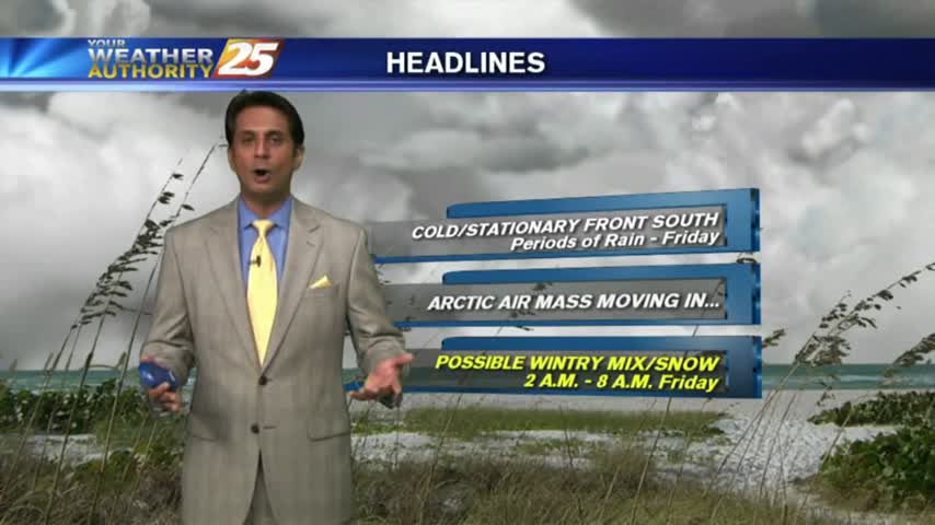
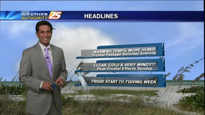
Changes through the weekend with frontal passage now has FRIGID temperatures along the Mississippi Gulf Coast...
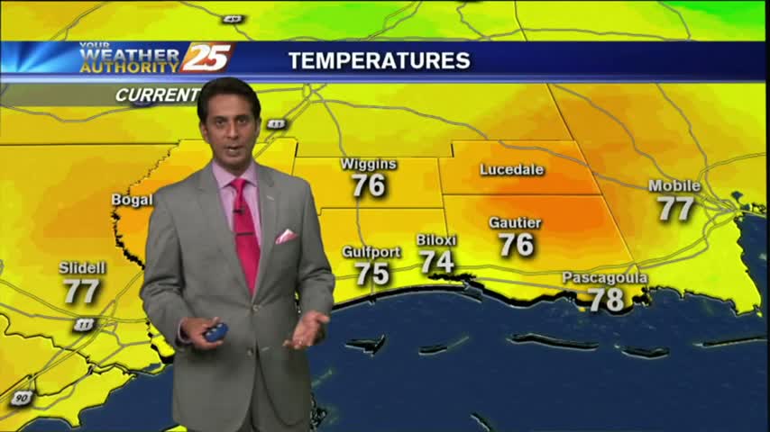
Patchy morning fog is out of the area as temps continue to warm into the upper 70s under a few clouds along the immediate coast...

Areas of patchy morning fog has burned off leaving beautiful blues, with just a touch of low-level clouds...
After a VERY COLD start to the day, temperatures have warmed but still on the chilly side under sunny skies...
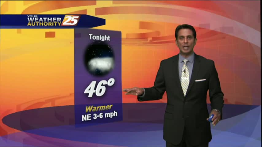
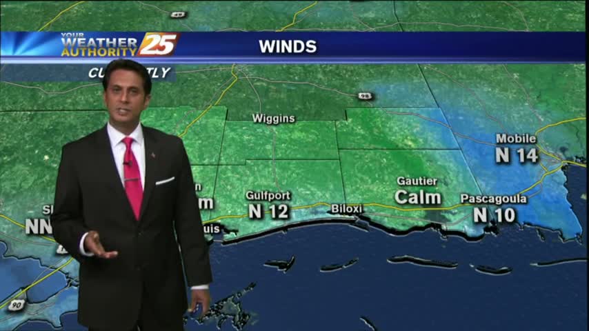
Clear skies last night with a north wind has brought COLD number to the area this morning...in the upper 30s to low 40s...
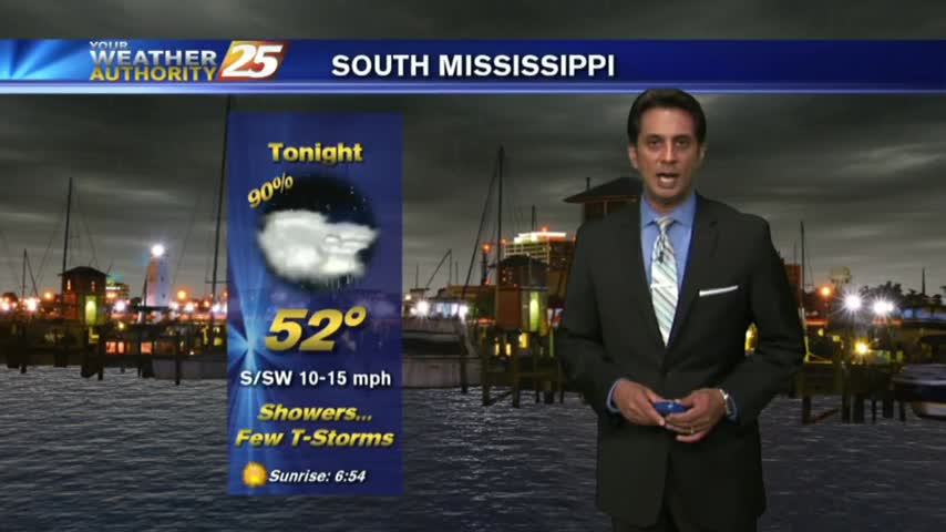
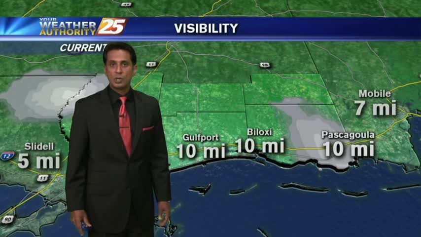
After a FOGGY start to the day, visibility has improved considerably with cloudy skies and light rain in the area/region...
A cool but warmer start to the day as the pattern has begun to shift...bringing warmer more humid conditions to the region...
As the south wind from yesterday afternoon continues in advance of the approaching cold front, it's a WARMER more humid start to the day...
After another CHILLY morning...changes in the patter is bringing a more humid and unstable air mass in advance of an approaching cold front...
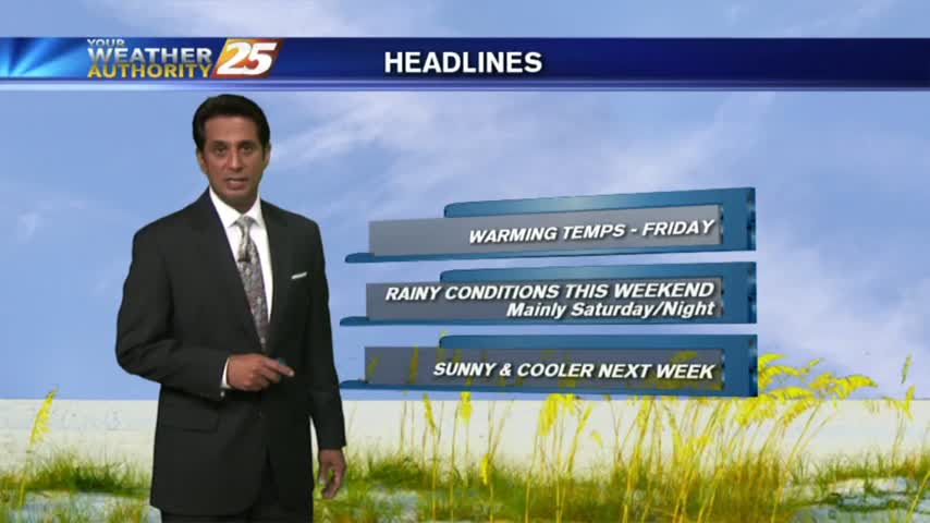
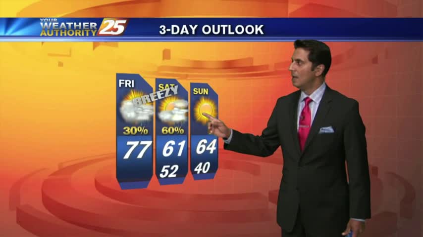
A warm and humid Friday afternoon heading into the weekend which could bring a SLIGHT THREAT for SEVERE Weather...
As high-pressure dominates east of the continental divide, its'a warm/humid start with isolated showers/t-storms to start off the day...