8/31 - Rob Knight's "Wet" Labor Day Weekend Forecast
Rainfall has been moving in from the Gulf of Mexico, and it will continue...
Rainfall has been moving in from the Gulf of Mexico, and it will continue...
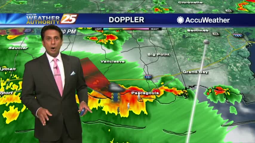
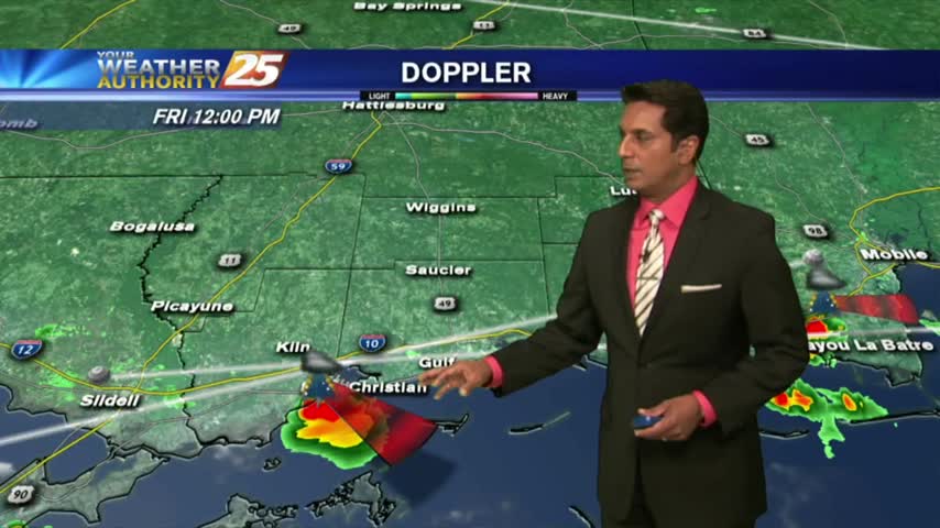
HEAVY RAINFALL has already moved across the viewing area this morning, with more to come...

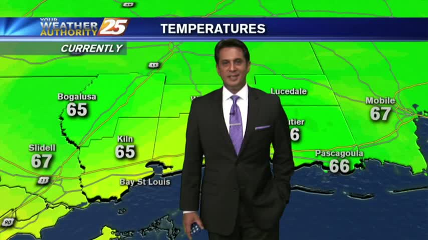
Another LOVELY start to the day with lower humidity and several locations with temps in the 60s...

After a clear start to the day, daytime heating has flared up low-level clouds along the coastal counties...

Minimal activity over the sound this morning will continue to push towards the west...

After a clear start to the day, clouds continue to develop with daytime heating as the mercury climbs into the upper 80s...
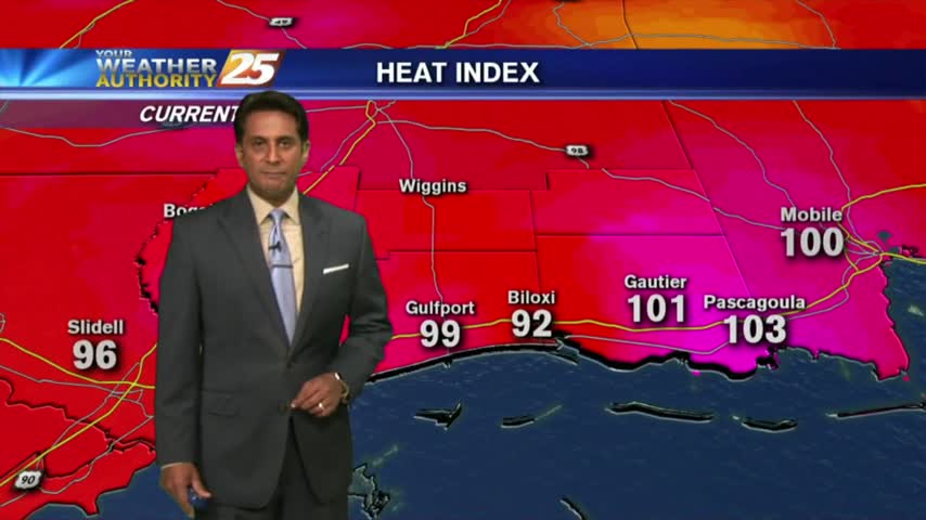
Hot & humid with the HEAT INDICES pushing 100 degrees. Minimal activity is in the area...

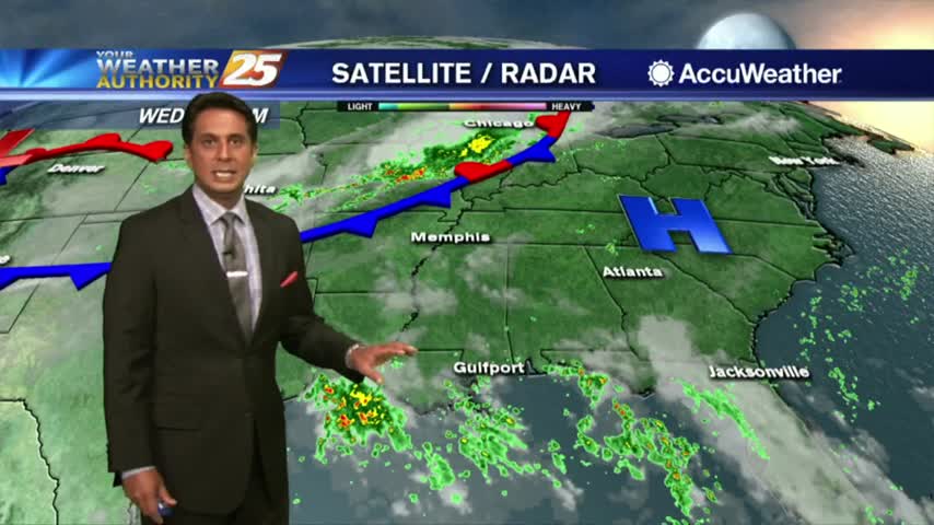
This morning we have isolated activity south, moving into the viewing area...
Another morning with a few light showers moving into the area from the northern Gulf of Mexico...
After a few showers shortly after sunrise this morning, t-storms are now beginning to develop...

Summer is definitely in the air as morning low temps are in the upper 70s to low 80s...

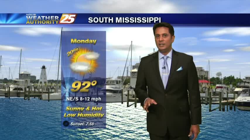
The final day of Spring is shaping up nicely with much more sunshine and HOT conditions...
A tropical wave has moved ashore E'tern Texas with warm & humid conditions along S. Mississippi...
Isolated showers and cloud coverage prior to sunrise cleared to the SE, with hot temperatures on-tap this afternoon...
A cold front to our south will bring hot temperatures and a drier air mass to the area...

A HOT day with the sea-breeze developing isolated activity along the southern coastal counties...
Isolated activity beginning to pop as temps warm into the upper 80s...

A MUCH WARMER start to the day with a south wind elevating humidity and temperatures...

After a FRIGID start at a few locations, temps are warming nicely with upper-level clouds moving cross the area...

With a cold front moving across the area, showers/t-storms are in south Mississippi...
Another morning with DISRUPTIVE weather in the form of PATCHY FOG, along with slightly cooler temps...

After a FOGGY morning, the fog has lifted into a low-level cloud deck as temps continue to warm into the mid-upper 70s...

A warm/humid start to the day with WIDESPREAD FOG, a DENSE FOG ADVISORY is in effect through late morning...
In the wake of a cold front, cloudy skies coupled with a strong wind from the North has the mercury struggling to warm...