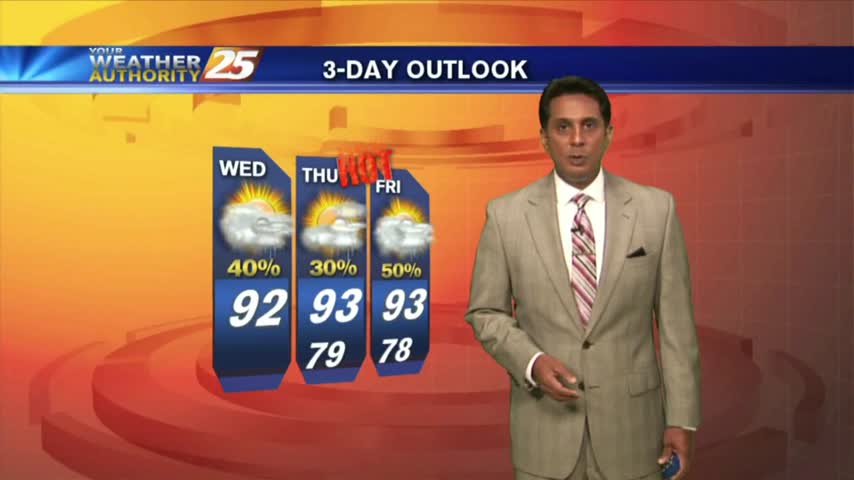
8/20 - Rob Knight's Workweek Forecast
Another humid start to the day with very light rain moving in from the Gulf of Mexico...
Another humid start to the day with very light rain moving in from the Gulf of Mexico...
Overnight clouds have cleared to the SE, with warm & humid conditions to start off the day...
Early morning clouds have thinned considerable with HOT & HUMID conditions expected this afternoon...
Similar to yesterday morning, thin mid/upper level clouds moving in from the NW are thinning...

It's a warm start to the day with mid/upper level clouds moving in from the NW and thinning...
A similar start to yesterday morning with isolated shower/t-storms over the sound, which will move ashore later this morning...
Similar to yesterday morning, isolated showers from the northern GOM, moving NE are dissipating along the beach...
The clouds have developed along the coastal counties, with showers/t-storms to follow shortly...
Cloud coverage has been on the increase the past few hours with light showers in the vicinity...
Isolated showers/t-storms south of the area overnight has been slowly moving north into the coastal counties...

The stationary front is overhead and beginning to dissipate as minimal activity is to our south...
Clear skies from last night continues as we're watching a few showers/t-storms to our south over the outer-coastal waters...
This morning we have another cold front approaching the region which will move the drier air out of the area...
A good bit of clouds moving south into the area earlier this morning has thinned considerable...as the temps skyrocket!

After a clear start to the day, daytime heating and moisture has flared-up cloud coverage along the coastal counties...
A tad bit warmer this morning with isolated activity south, moving into S. Mississippi...

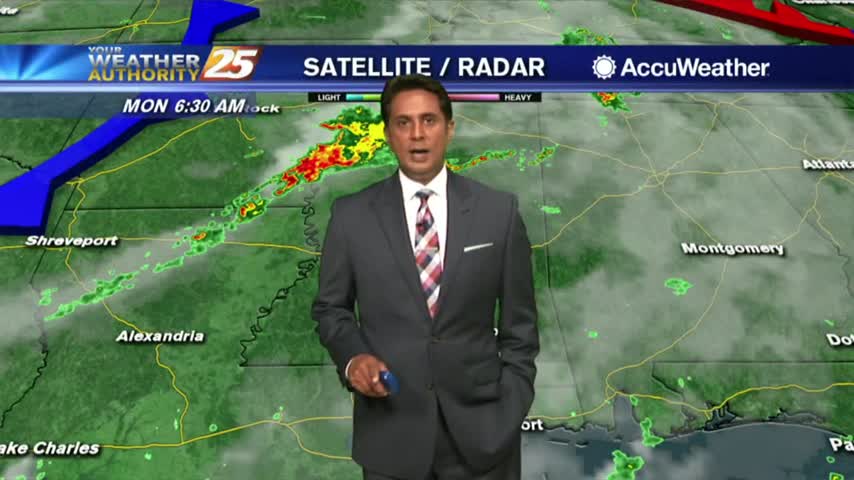
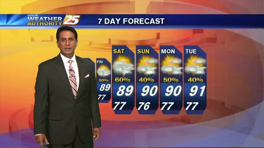
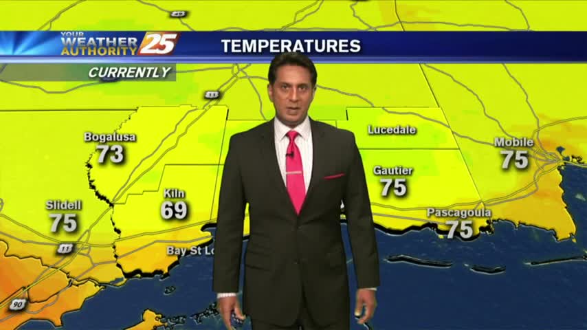
After a rain-free and HOT weekend, it's a warm and humid start to the workweek...
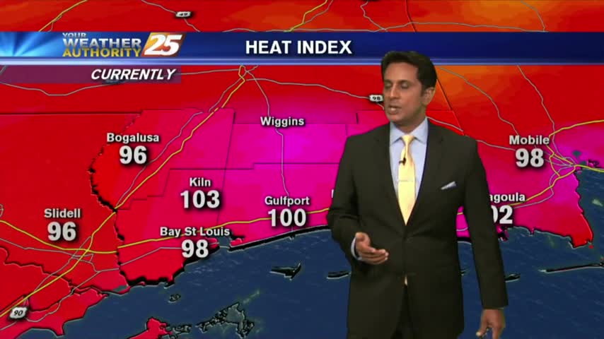
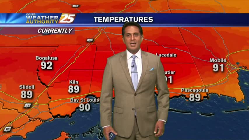
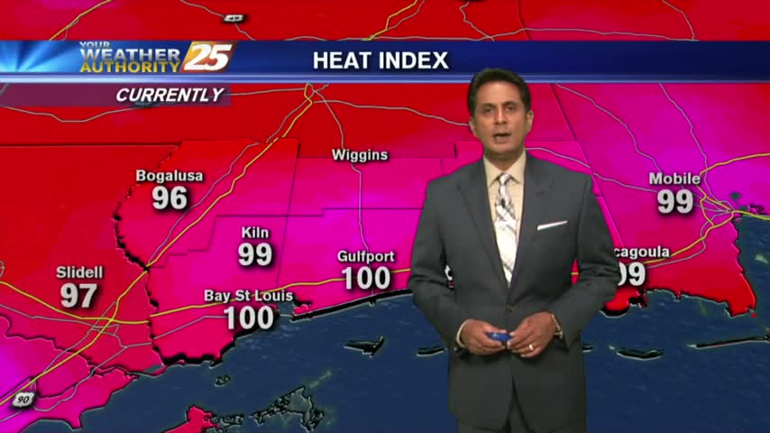
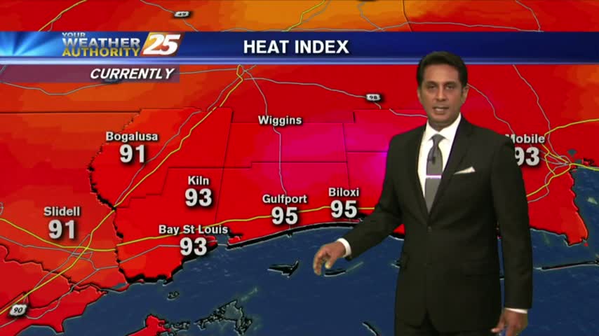
Things are getting HOT out there as the HEAT INDEX is now pushing 100 degrees...
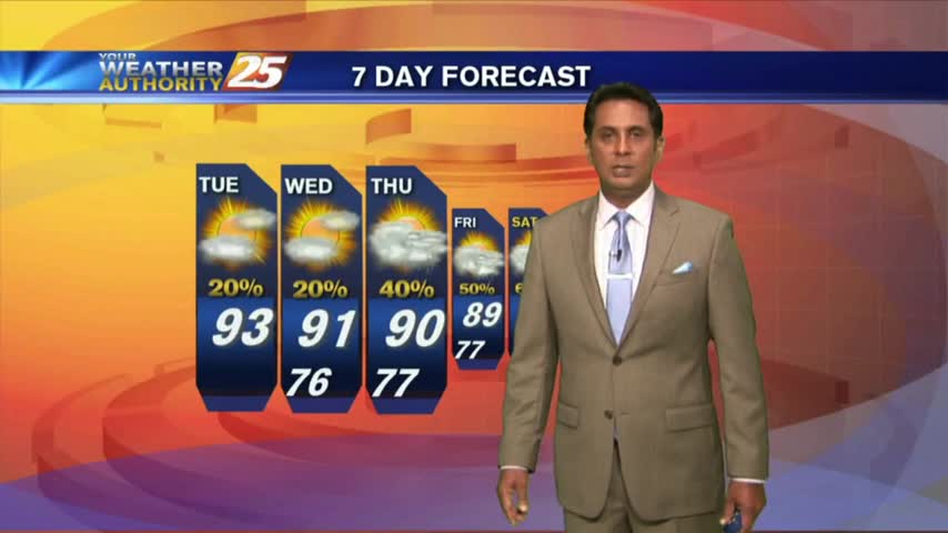
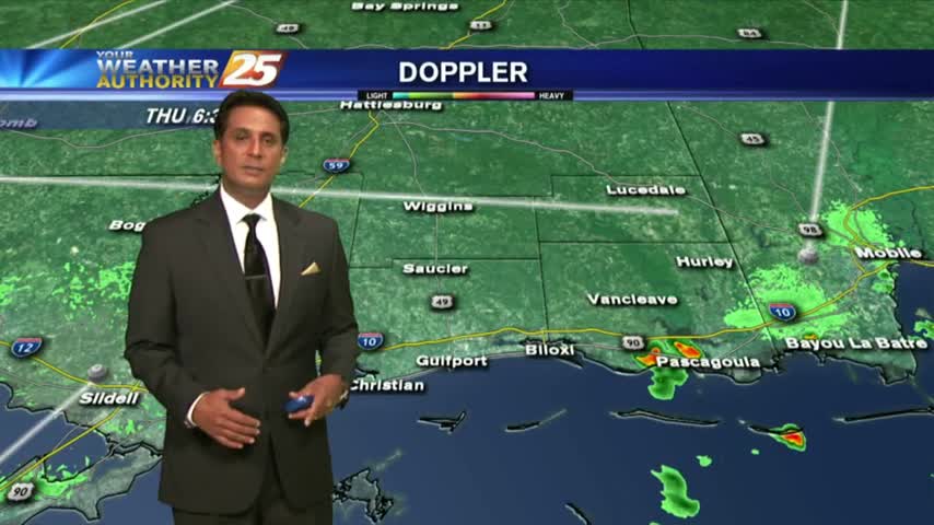
HOT & HUMID with showers and t-storms beginning to pop along the Southern 6 and the region...
The activity is taking a bit longer to fire off but will begin heading into early afternoon...
Isolated showers/t-storms are beginning to pop with more activity this afternoon...
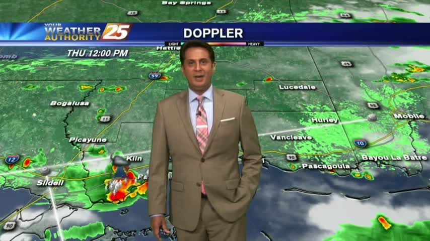
T-storms are developing along the coastal counties, moving very slowly to the NNW...
Overnight t-storms over the sound continue to move south, away from he area as drier air moves in...
Showers and t-storms beginning to pop in the local area due to intense daytime heating...