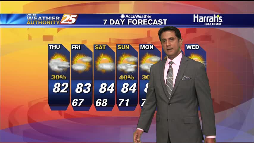
9/24 - Rob's "Wet Thursday Morning" Forecast
Areas of patchy fog and spotty rain is affect the area this morning...
Areas of patchy fog and spotty rain is affect the area this morning...
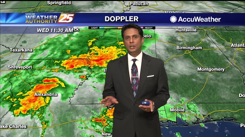
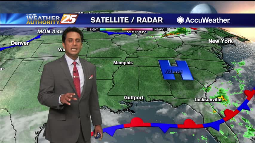
Showers and t-storms from the SW will continue to move NE into south Mississippi...

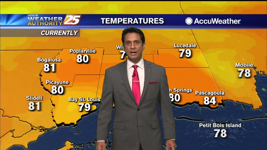
Slightly warmer temperatures as you're heading out the door this morning...
Extensive cloud coverage with light/moderate rain continues to move into the area from the SE...
A cloudy and wet start to the day with areas of patchy fog affecting your morning commute...
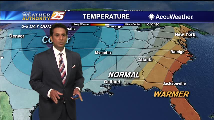
Extensive upper-level clouds and a north wind will keep high temperatures in the manageable zone this weekend...

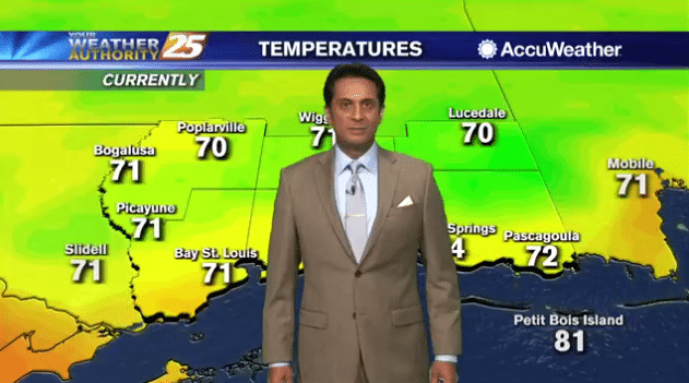
A mild start as a north wind continues to bring in a less humid air mass...
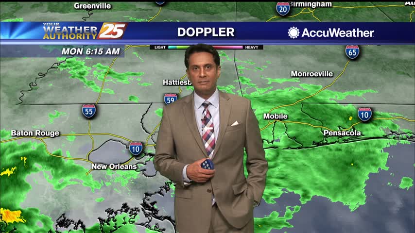
A much better start this morning as SALLY continues to move NE out of the region....
AS HURRICANE SALLY continues to move ashore east of our area, south Mississippi will find improving conditions...
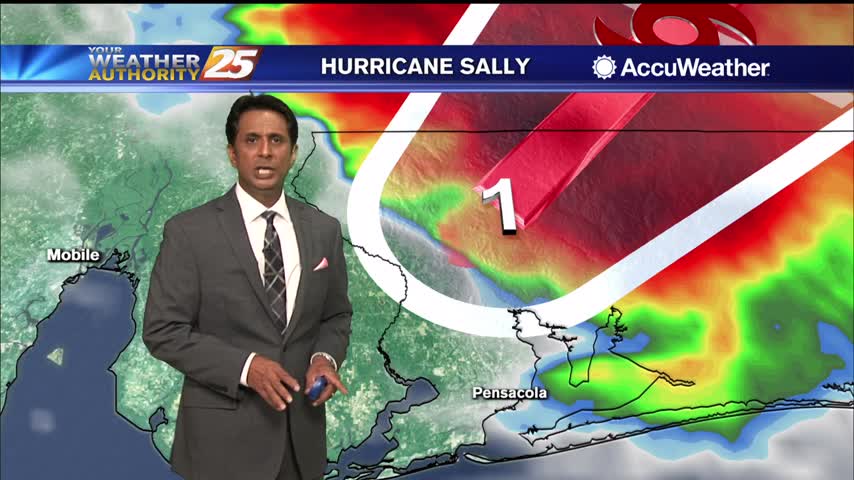
Strong winds and rainfall continue to affect the local area as HURRICANE SALLY is making landfall along the Pensacola area...

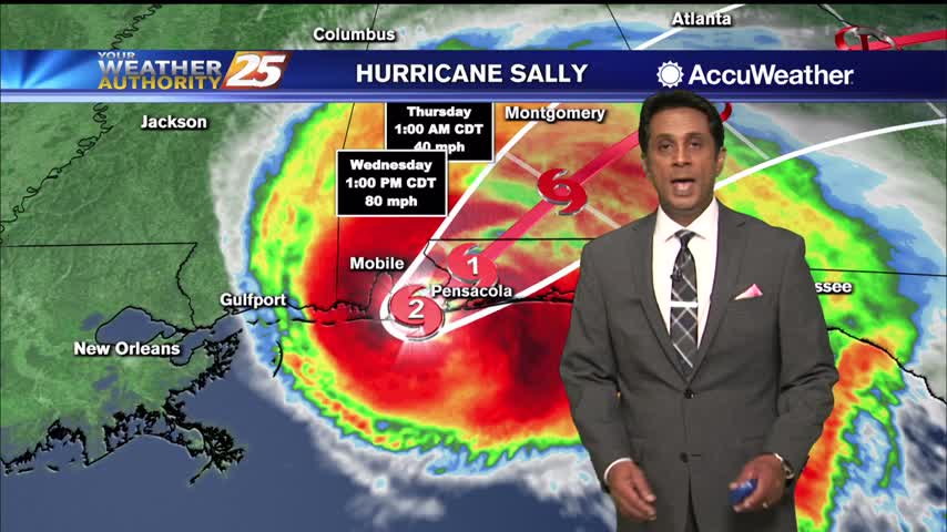
SALLY continues to slowly move towards the Mississippi/Alabama coastline...
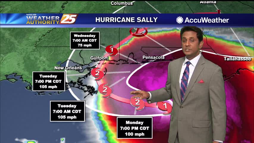
Clouds continue to move into the area as we are focused on HURRICANE SALLY in the Ne'tern GOM...
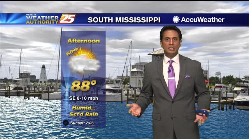
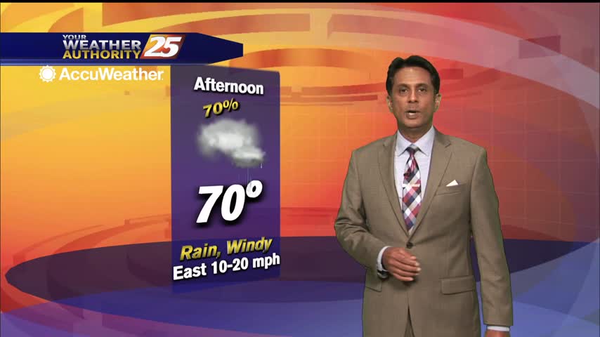
Rain will continue to move in this afternoon with embedded t-storms as well...
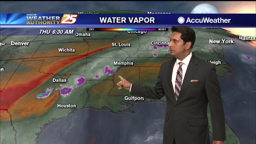
Rain that occurred yesterday quickly dissipated or moved west out of the area before the evening hours last night. With that it has been very quiet and should remain so for at least the next 24 hrs. There has been…
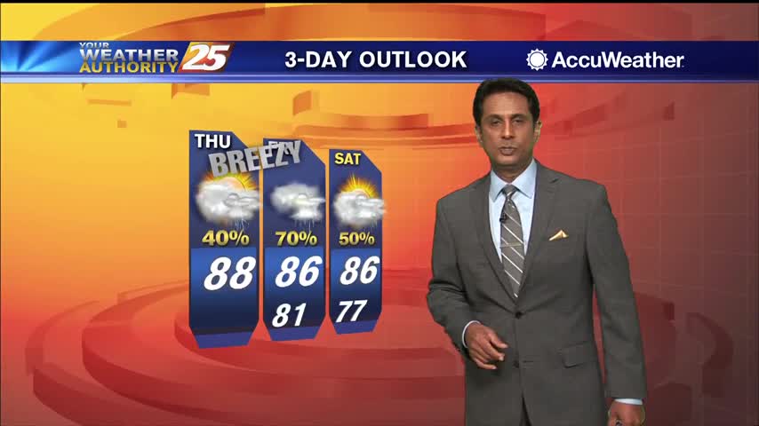
Over the next few days rain may be a little difficult to come by, especially Thursday which should have high-pressure sitting right overhead. There will be a chance of rain mainly along and south of the I-10 corridor, and maybe…

Hot temperatures heading into the afternoon won't feel to terribly bad as lower humidity continues...
A rather pleasant start to the day as lower humidity from this past weekend continues...
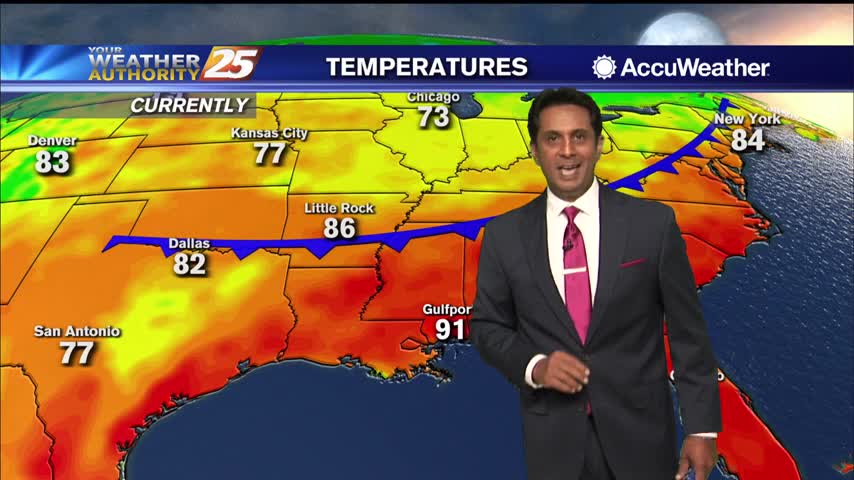
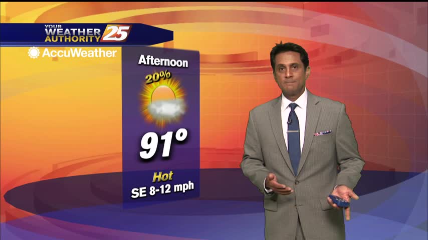
Hot conditions heading into the holiday weekend as the HEAT INDEX will top the 100 degree mark...
The area is under the firm grasp of Bermuda High ridge extension across the Gulf States through at least Saturday. This will allow relatively stagnant air to warm into the mid-90s for areas away from maritime influences. Overnight lows will…

Models continue to show a weak upper level high-pressure over the northern Gulf coast with weak disturbances to the northwest and an easterly flow over the central Gulf. Certainly, through Friday, moisture will be insufficient for any more than very…
A warm and humid start with areas of light patchy fog inland...
A warm and humid start with just a few clouds overhead...

Grab the rain gear heading out the door, bands of rain continue to move in from the south...
A feeder band linger along SE Louisiana, will slowly move east this afternoon into the area...