rob knight

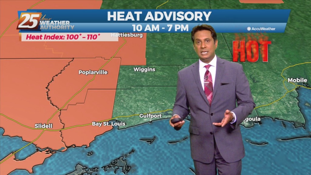
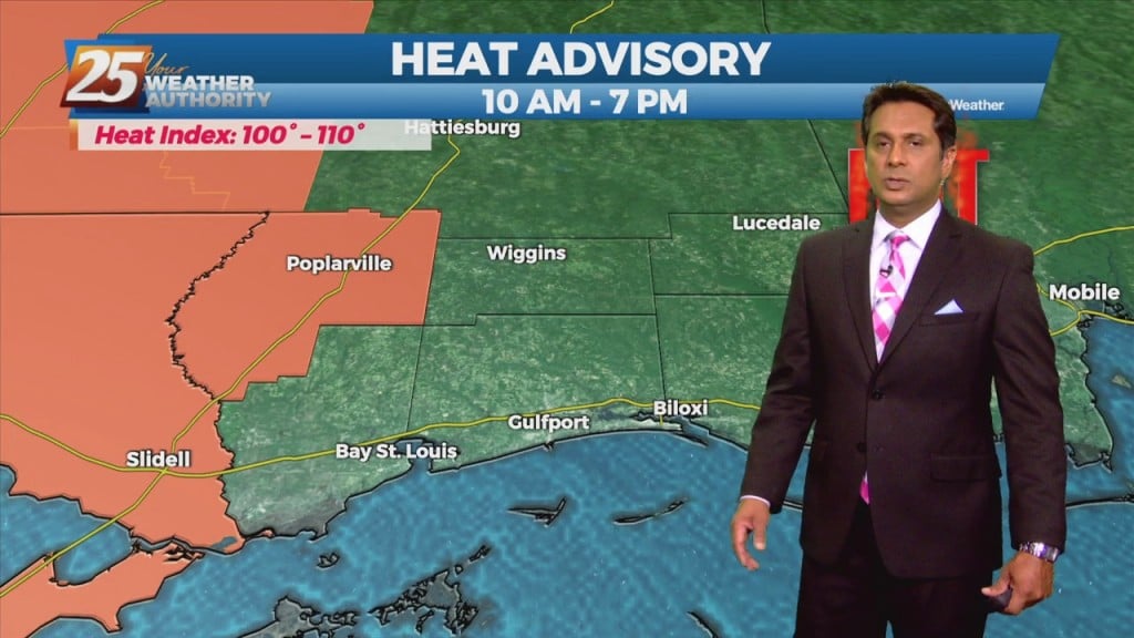
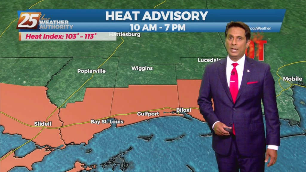
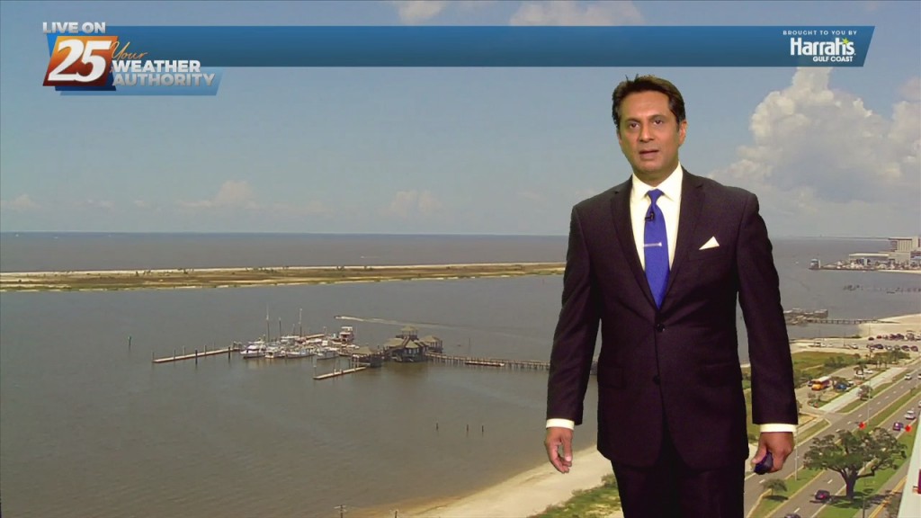
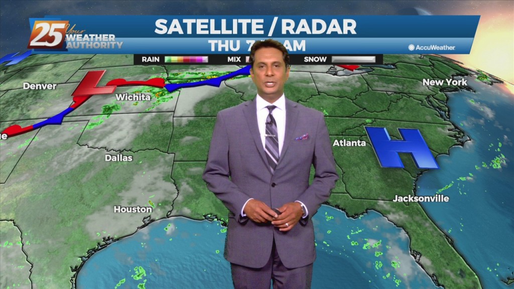
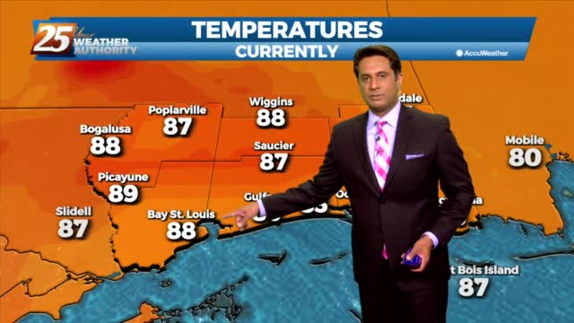
7/29 - Rob's "Heat Advisory" Thursday Morning Forecast

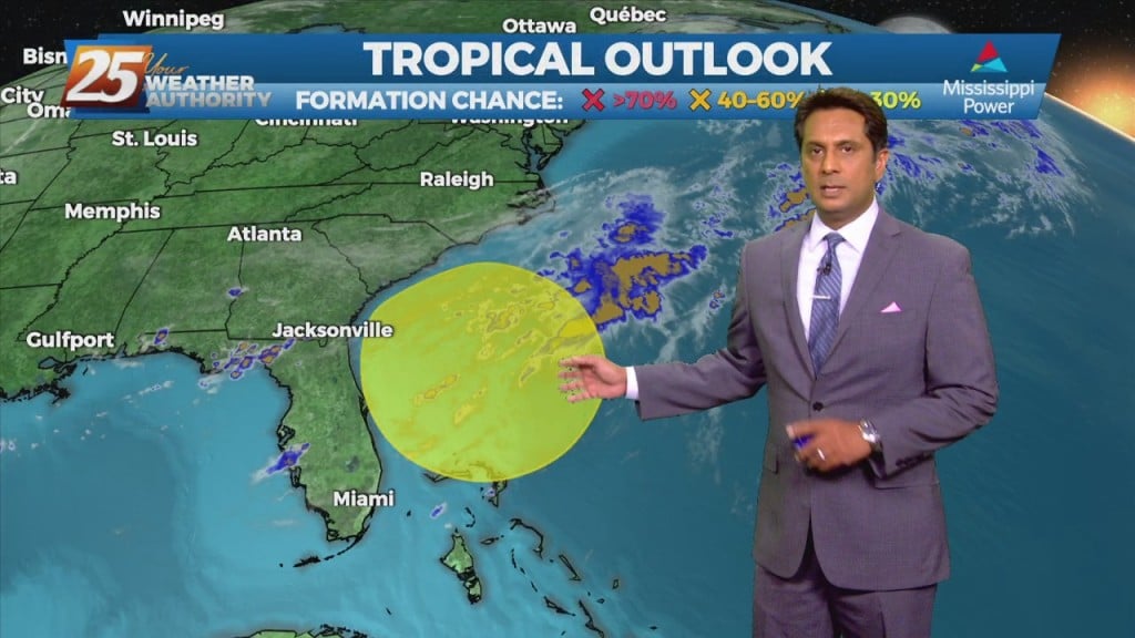
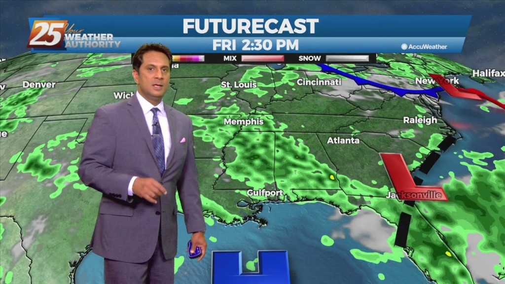
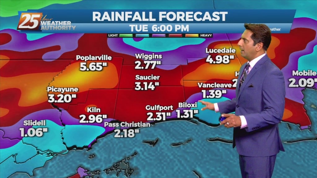
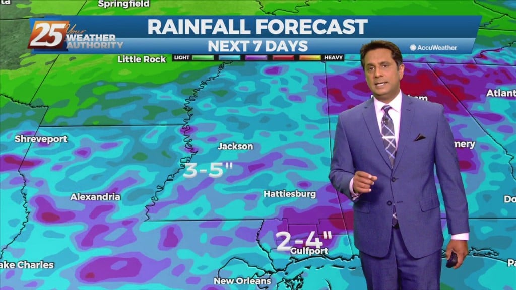
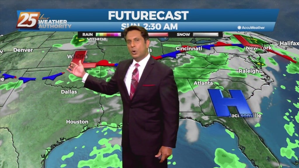
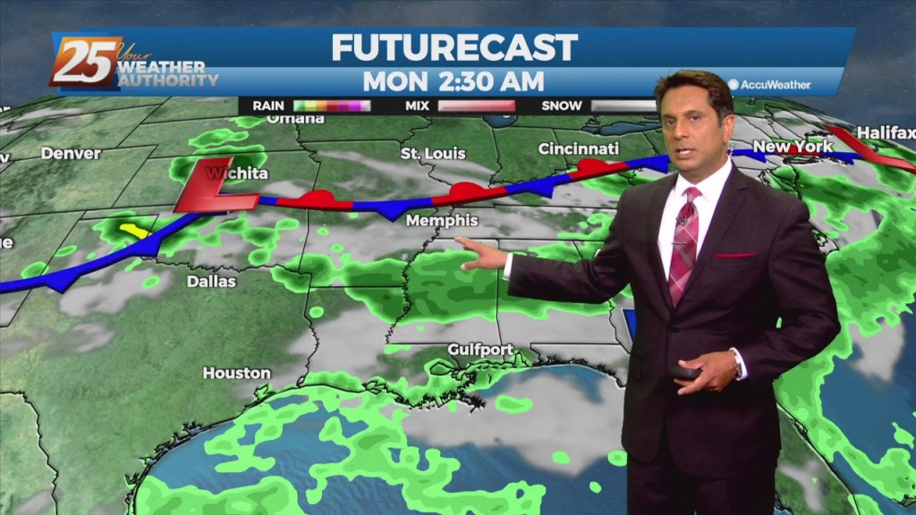
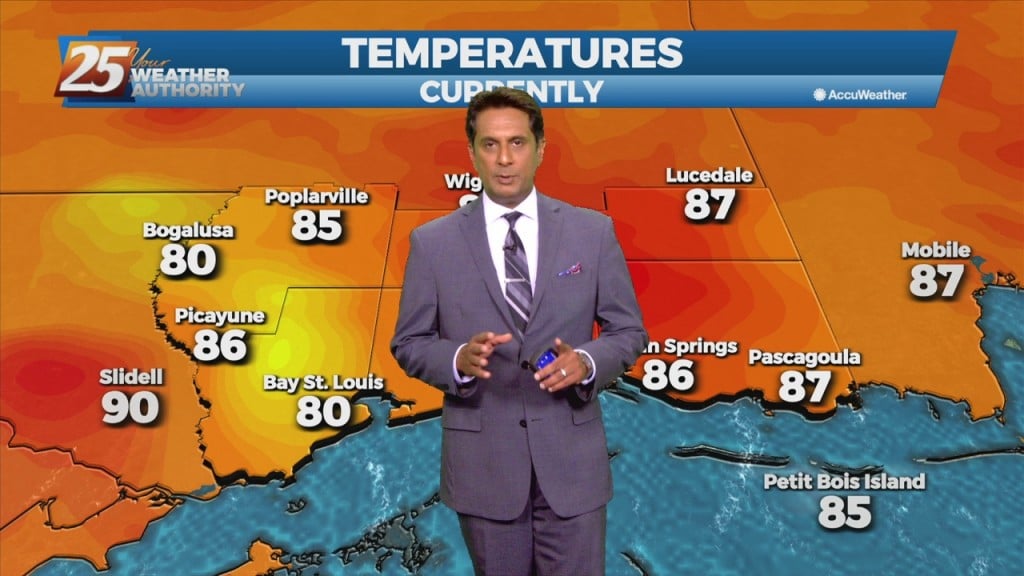
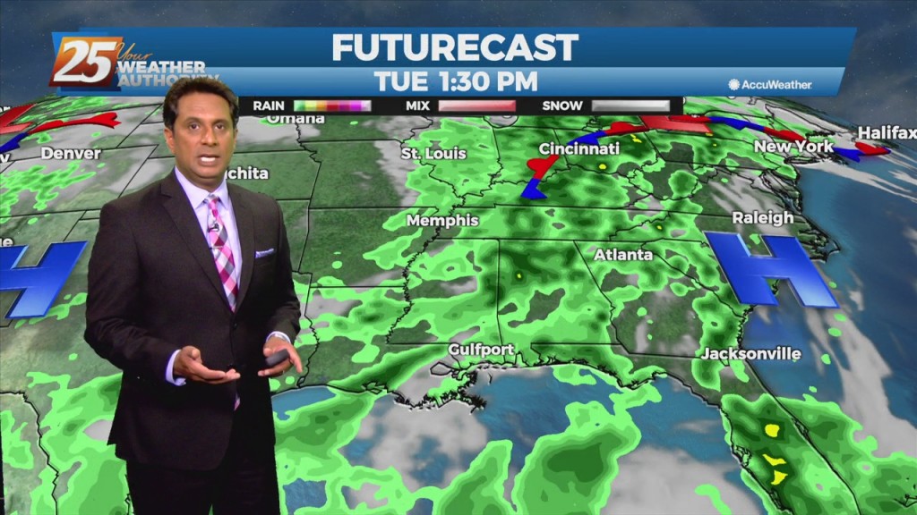
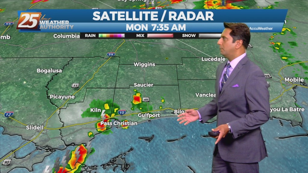
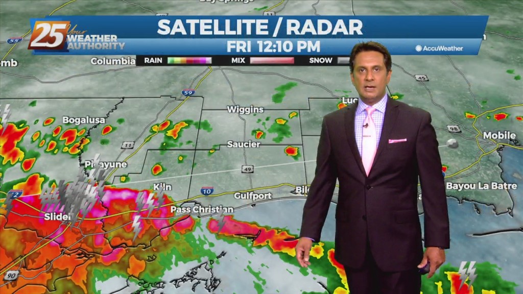
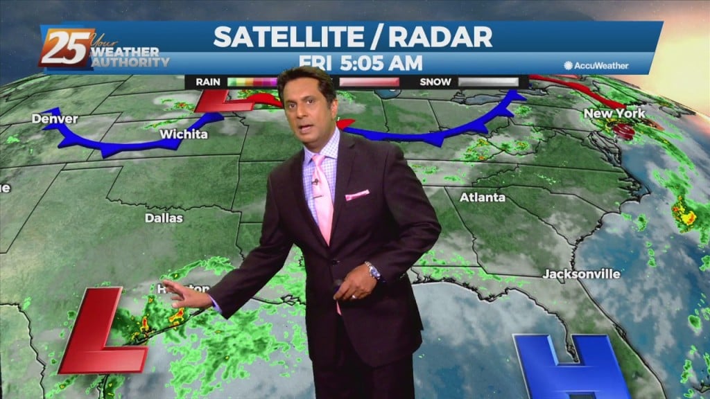
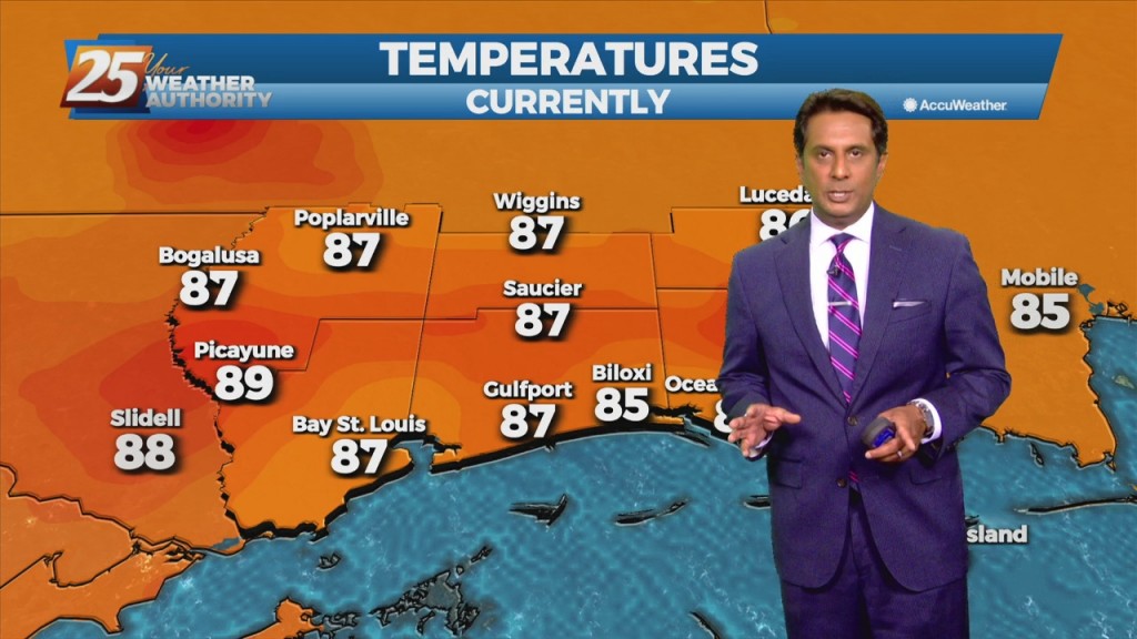
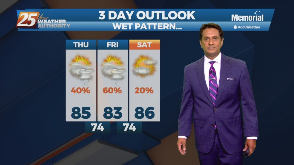
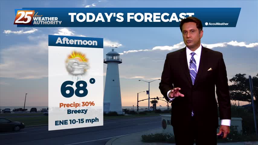
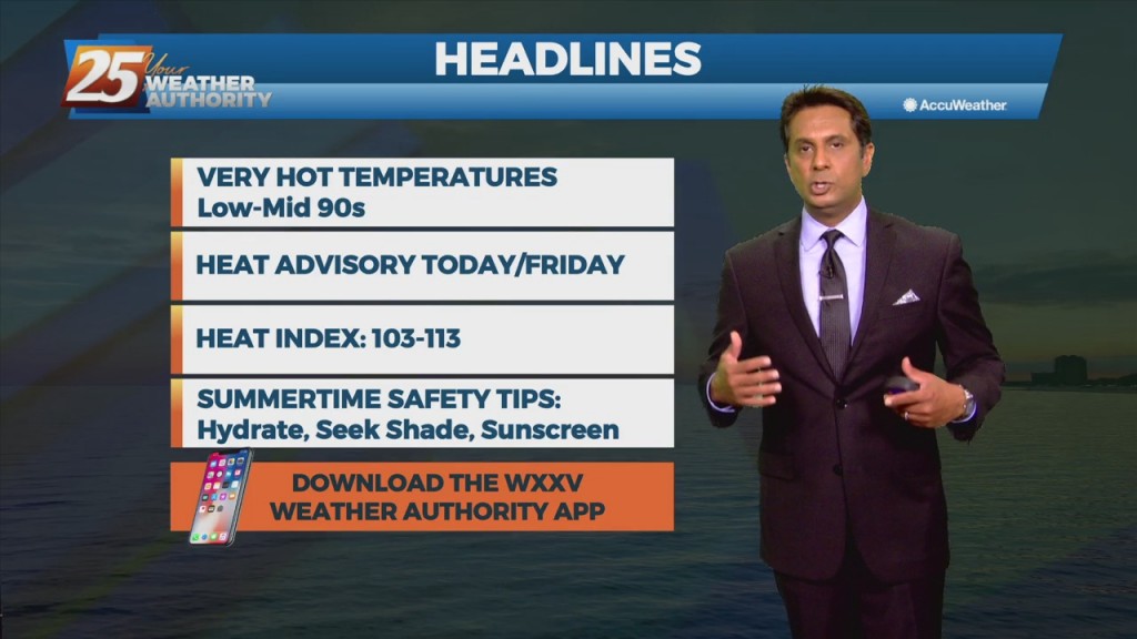
More of the same hot, muggy weather is expected to continue for the next couple of days. Afternoon and early evening showers will be possible over the next few days, with a slight elevation in precip chances into the weekend.…

7/27 - Rob's "Heat Continues" Tuesday Morning Forecast

Humid air, warm temperatures, and light winds will keep the current heat advisory posted through today. The main hope for cooling will be any thunderstorm development which will be embedded in a deep easterly flow. Afternoon seabreeze should provide a…

7/22 - Rob Knight's "HOT" Afternoon Forecast

A Weak frontal boundary draped along the lower Tennessee valley will continue to slide east and out of the region, high-pressure will slowly build eastward through Friday as this weakness moves off the east coast over the next 48 hours.…

7/21 - Rob Knight's "Hot & Muggy" Afternoon Forecast

A stalled frontal boundary from the Carolinas to southeast Texas will slowly shift north and wash out by Thursday afternoon. High-pressure over the mid-section of the country will build slowly eastward by Thursday bringing lower rain chances and a return…

7/21 - Rob's "Changing Pattern" Wednesday Morning Forecast

A frontal boundary remains stalled from the Carolinas to southeast Texas, with a weak impulse of low-pressure currently over south central Louisiana. The boundary will remain stalled over the area today thus widespread showers and thunderstorms will develop along it…

7/20 - Rob's "Gray & Gloomy" Tuesday Afternoon Forecast

An area of upper level weakness over New England will be in place through the early part of the week with a massive high-pressure system sitting over the western third of the country. A frontal boundary will continue to slowly…

7/19 - Rob's "Threat For Heavy Rain" Afternoon Forecast

A stationary front will continue to slowly move south and southeastward through the plains to mid/lower Mississippi Valley area, just north of the forecast area during the period. This should lead to widespread coverage of showers and thunderstorms each day.…

7/16 - Rob's Midday News "Afternoon/Weekend" Forecast

This afternoon-Sunday, convection will initiate along the seabreeze/landbreeze boundary each day with thunderstorms initially forming along the weak landbreeze boundary in the offshore waters and then gradually moving inland through the day as a seabreeze boundary forms and intensifies. The…

7/15 - The Chief's "Weekend Look Ahead" Afternoon Forecasts

This afternoon though the weekend, south Mississippi will be in the middle of lower moisture to the east, higher moisture to the west. Convection in the onshore flow should remain isolated to scattered, with the best coverage over the western…

7/15 - Rob's "Continued HOT" Thursday Morning Forecast

The Bermuda high-pressure is at the surface and aloft, extending westward across the Gulf Coast into east Texas early this morning. The eastern portions of the area may squeeze out one more relatively dry day today, as moisture flow will…

7/13 - Rob's "Hot & Humid" Afternoon Forecast

This afternoon will bring a few showers/air mass t-storms to south Mississippi. The good news is we are not anticipating AS widespread coverage as the previous few days, but an enhancement of typical summertime coverage will persist. Also any airmass…

7/13 - Rob's "Hot & Hazy" Tuesday Morning Forecast

Today will bring much less in the way of rainfall than we have seen over the past several weeks. We will need to watch just how much coverage of convection develops across the coastal areas. The good news is we…

7/12 - Rob's "Hot & Humid" Afternoon Forecast...

With daytime heating, afternoon showers/t-storms will affect the area with the activity diminishing around sunset. By Tuesday, the upper-level dynamics supporting showers/t-storms upstream of the zonal deep-layer flow exits towards our north, as we settle into overall weaker moisture flow.…

7/12 - Rob's "Warm & Humid" Monday Morning Forecast

Another day, another wet forecast as focus will be out towards our west at a disorganized cluster of showers and storms ongoing across central LA and eastern TX. This activity remains supported by noticeable instability denoted by a broad unstable warm…

7/9 - Rob Knight's "Lower Rain Chances" Weekend Forecast

This afternoon will bring scattered showers and t-storms. A southerly surface winds will help to enhance the warm air and moisture advection into the area, which will enhance the lifting in the environment. Models indicate the possibility for locally heavy…

7/9 - Rob Knight's Friday Morning "Hot/Humid" Forecast

Today through Sunday, scattered showers and t-storms and enhanced rain chances will be possible, especially each afternoon. Southerly surface winds will help to enhance the warm air and moisture advection into the area, which will enhance the lifting in the…

7/8 - Rob's Friday-Eve Afternoon Forecast

The interaction of outflow boundaries and sea/land breeze boundaries have been the focus of some recent instances of high rainfall amounts and that will likely be the case as well this afternoon. So while the overall threat for flash…