rob knight

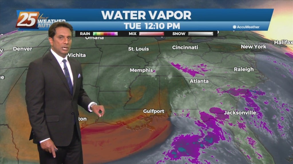
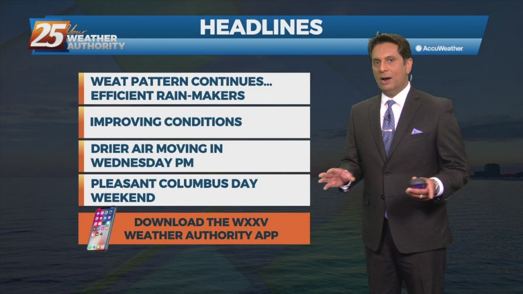
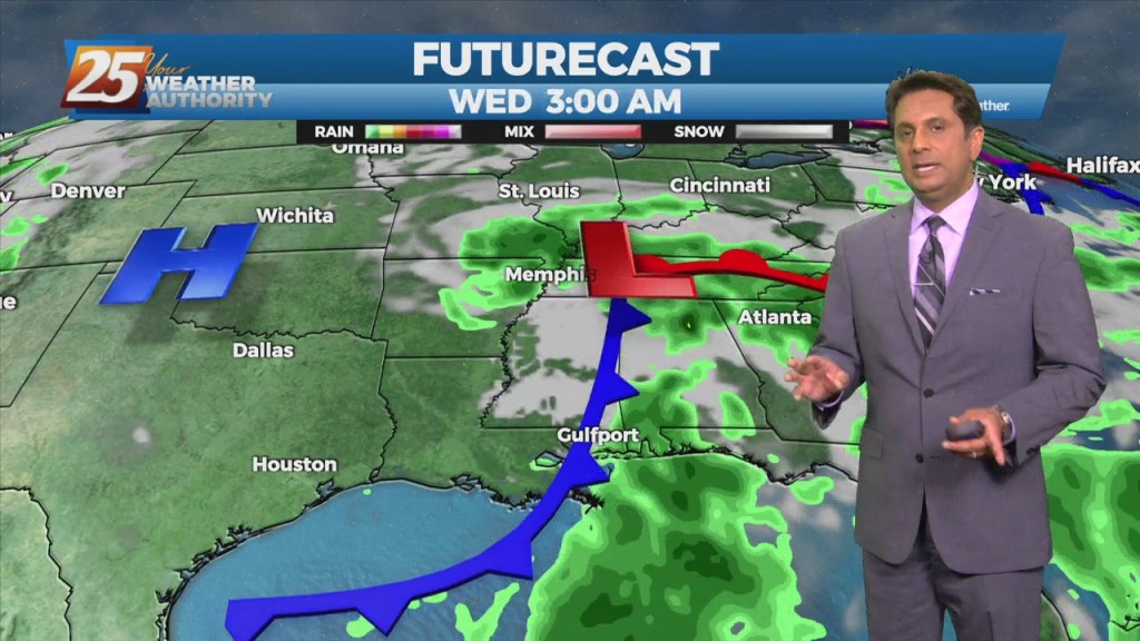
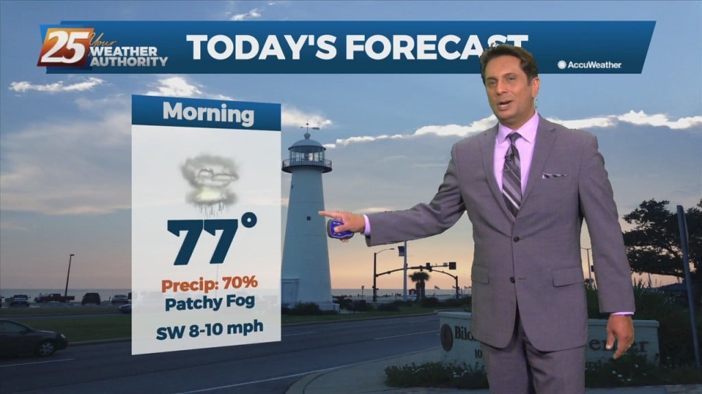
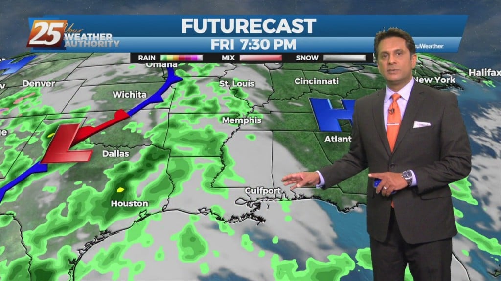
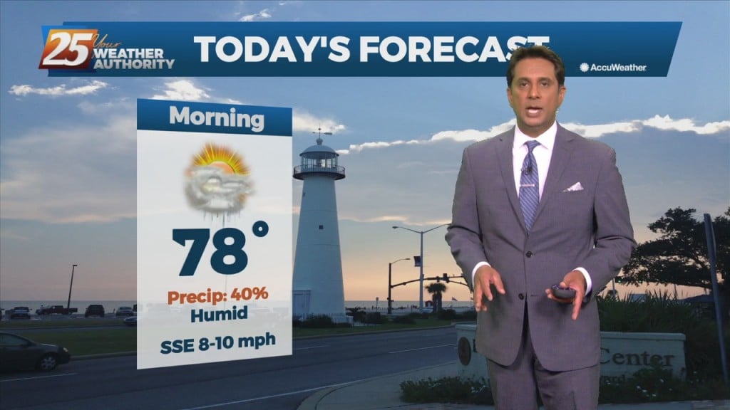
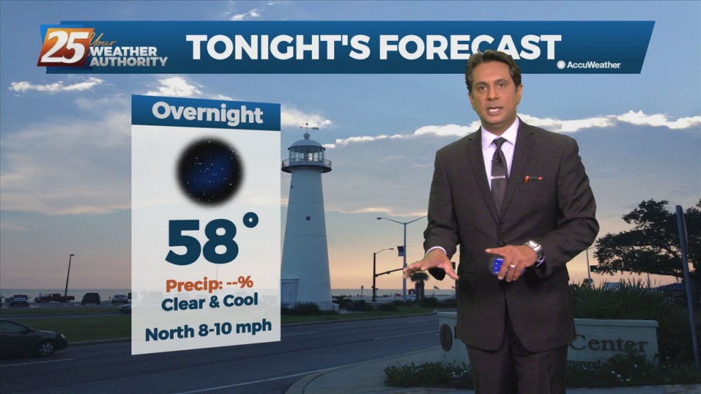
10/8 - Rob's "Cruisin' The Coast" Weekend Forecast

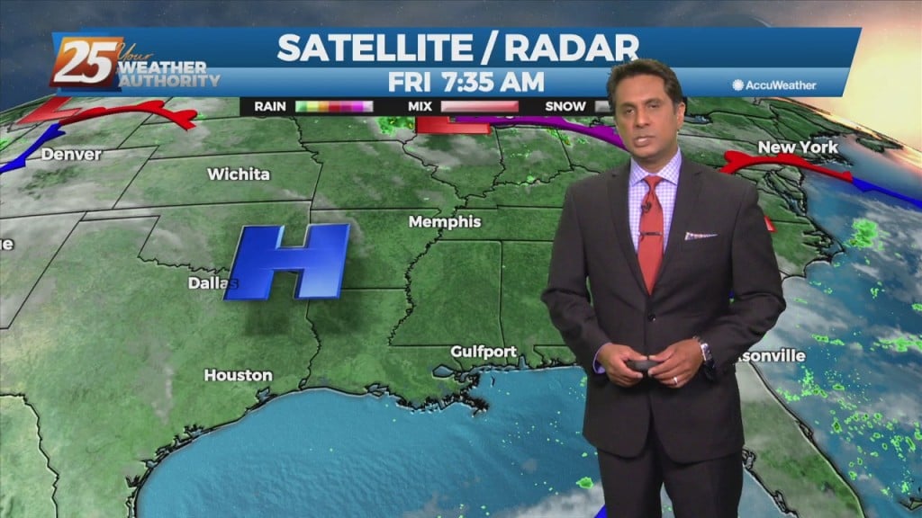
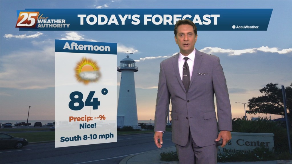
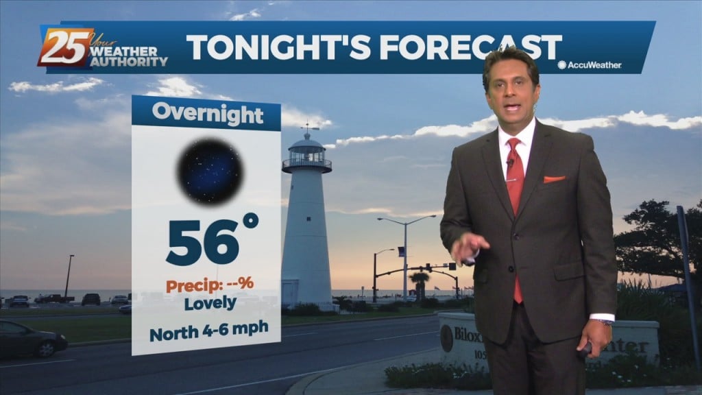
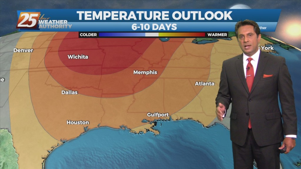
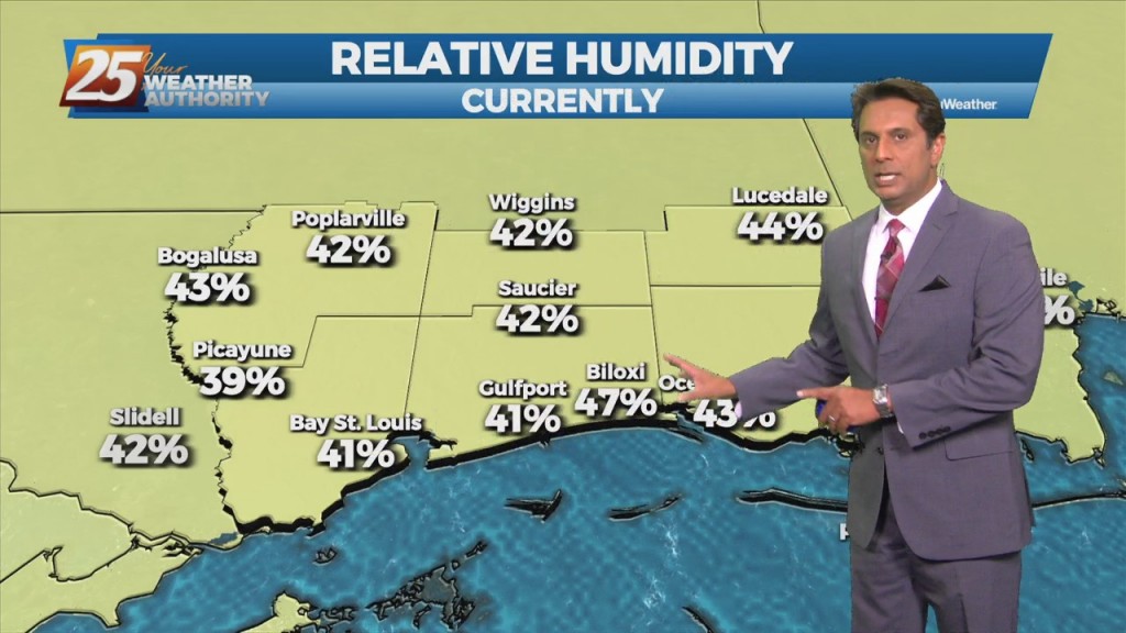
High-pressure NW will slowly move SE into the region this weekend. This will keep dry weather and lower humidity over the forecast area, although humidity levels/dew-points will be coming up slightly on Sunday to more muggy readings. Diurnal temperatures…

10/8 - Rob Knight's "Pleasant" Friday Morning Forecast

The persistent mid/upper low-pressure over the mid-Mississippi Valley will finally lift northeast to the Great Lakes region through tonight. This will be replaced by an upper level high-pressure building in from the southern plains into the Gulf Coast region. Surface…

10/7 - Rob's "Beautiful" Friday-Eve Morning forecast

High-pressure moving into the region along with a much drier air mass will dominate the forecast through the weekend. This will bring skies clear, and winds on the light side. A change from yesterday with model guidance now showing the disturbance…

10/6 - Rob's "Beautiful Extended" Afternoon Forecast

As we fall back into a drier regime, a more October like pattern should show itself. But with no good cold fronts moving through at least through Friday, conditions won't change much but also shouldn't be too uncomfortable. As the…

10/6 - Rob's "Dense Fog" Morning Forecast

Moisture flow will continue to fall off over the next few days. As we fall back into a drier regime, a more October like pattern should show itself. But with no good cold fronts moving through at least through Friday,…

10/5 - Rob's "Afternoon T-Storms" Midday News Forecast

There is a marginal risk for excessive rainfall for the best chances of getting rainfall this afternoon over coastal Mississippi. This is all being brought about from an upper disturbance that extends from northern LA up into the northeast. The…

10/4 - Rob's "Muggy & Damp" Afternoon Forecast

Moisture flow in advance of a cold front to the west will continue. The one positive that could keep us from seeing very heavy rain will be the instability, which is quite low. Rather thick cloud cover today should help…

10/1 - Rob Knight's 1st Weekend of October Forecast

Pulses of weak Energy from the west are expected to continue to aid a wet environment favorable for more isolated showers and thunderstorms. Isolated showers and thunderstorms may still form later than previous days and affect west of the local…

10/1 - Rob's 1st Day of October Forecast

Closing out the workweek into the weekend will bring lower rain chances. Pulses of weak Energy from the west are expected to continue to aid a wet environment favorable for more isolated showers and thunderstorms. Isolated showers and thunderstorms may…

9/30 - Rob's "Improving Conditions" Afternoon Forecast

A disturbance coming out of the base of the western US will use the moist airmass to develop scattered convection during the daytime hours each day. Friday's convection may be a little later developing than today's or Saturday's, as it…

9/30 - Rob's "Changing Pattern" Friday-Eve Morning Forecast

The airmass remains very moist, with climatologically above the 90th percentile for this time of year. No real indications of any significant drying through Saturday, as even then, moisture levels remain elevated. A disturbance coming out of the base of…

9/29 - Rob Knight's "Wet" Hump-Day Forecast

Weak upper-level high pressure currently extends along the Mississippi Valley from Canada to the Gulf of Mexico. The ridge isn't particularly strong enough to keep the low-level moisture flow out of the area however. The main concern for today will…

9/28 - Rob's "Warm & Humid" Afternoon Forecast

An upper level high-pressure is developing along the Mississippi Valley from Canada to the Gulf of Mexico. The moisture recovery has occurred since yesterday evening. A disturbance in the NW'tern GOM will continue to slowly move to the NW towards…

9/28 - Rob Knight's "Moisture Returns" Morning Forecast

An upper level high-pressure is developing along the Mississippi Valley from Canada to the Gulf of Mexico. The moisture recovery has occurred since yesterday evening. A disturbance in the NW'tern GOM will continue to slowly move to the NW towards…

9/27 - Rob Knight's 1st Full Week of Autumn Forecast

The first half of this week will be the end of clear skies and no rain as high-pressure develops and extends along the Mississippi River Valley from the Gulf of Mexico to Canada. Moisture recovery will take some time but…

9/24 - The Chief's "Gorgeous Autumn Weekend" Afternoon Forecast

Very pleasant and comfortable conditions will continue through the weekend. With the less humid flow, morning low temperatures will continue to be a good 10 to 15 degrees below climatological lows. Afternoon high temperatures will max out in the upper…

9/24 - Rob Knight's "Cooler/Less Humid" Morning Forecast

Very pleasant and comfortable conditions will continue through the weekend. With the less humid flow, morning low temperatures will continue to be a good 10 to 15 degrees below climatological lows. Afternoon high temperatures will max out in the upper 70s…

9/23 - Rob Knight's "Beautiful" Afternoon Forecast

The strong cold front from yesterday has already exited the area and is moving further southward into the Gulf. Temperatures as well as dew points have dropped and while there are still some gusty winds currently, that should begin to…

9/23 - Rob Knight's "Beautiful" Friday-Eve Morning Forecast

The strong cold front from yesterday has already exited the area and is moving further southward into the Gulf. Temperatures as well as dew points have dropped and while there are still some gusty winds currently, that should begin to…

9/21 - Rob's "MUGGY/FOGGY" Tuesday Morning Forecast

There is one last day of uncomfortable weather before a welcome changes. The disturbance moving through the Great Plains this morning will be over the Ohio River Valley by midday tomorrow. The cold front associated with this disturbance is expected…