03/25 Ryan's "Slightly Cooler" Wednesday Night Forecast
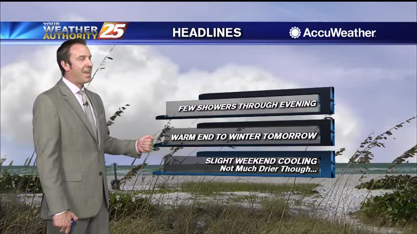
Expect some subtle changes in the short term, but much drier, cooler weather moves in after for the weekend along with some rain.
Expect some subtle changes in the short term, but much drier, cooler weather moves in after for the weekend along with some rain.
We'll see some hot afternoons ahead as warm, moist air piles up ahead of a front, but we'll see some slightly cooler and drier days ahead...slightly.
Still a bit on the muggy side, but drier days are ahead...won't be much cooler though.
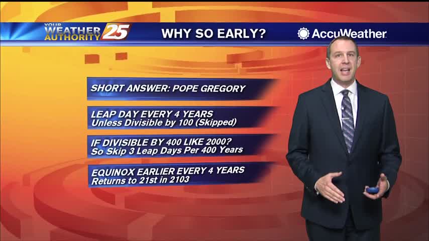
Spring has arrived earlier than usual, and I explain why in the forecast, but cooler weather is on the way as a front moves in.
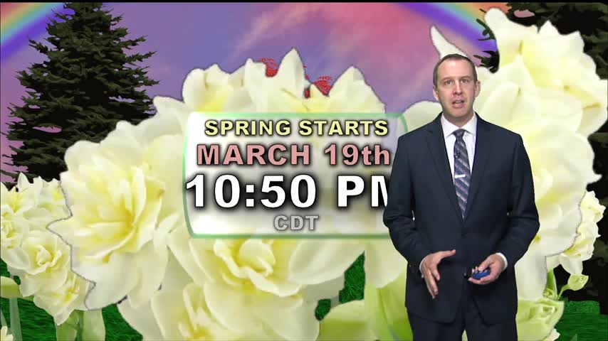
Spring begins tonight just before 11 PM, earlier than it has in nearly 125 years!

Tonight is the last full night of winter, as spring begins tomorrow...the earliest it's been in over a century!

Not much has changed in the last few weeks, but it is now getting much warmer and more humid as we begin spring tomorrow.

Tomorrow is the last day of winter, and it'll continue to warm as we approach the weekend and a cold front moves in.
Few more clouds today and even a few showers, but expect fewer of them going forward. It will continue warming though.
It's been warm and humid for quite some time, and it's only going up as we head toward the weekend.
More of the same as we head into a new week! Expect clouds, high humidity, and at least a few showers.
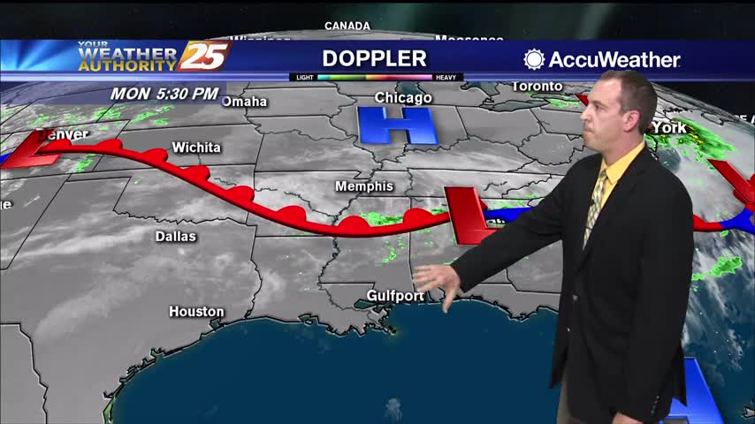
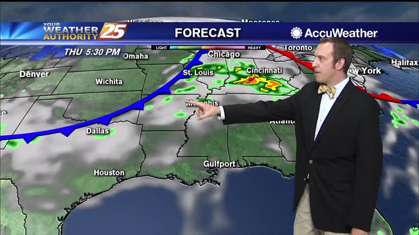
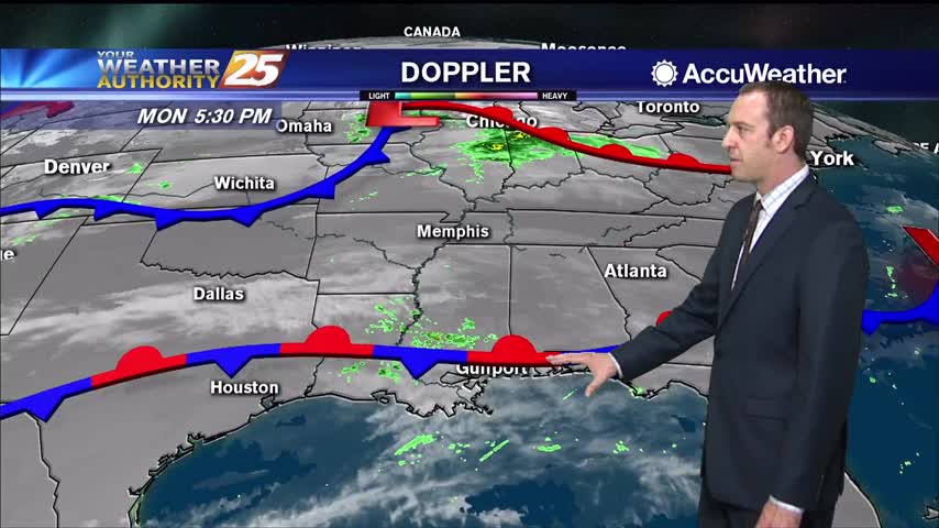
Near the surface, a ridge of high pressure will develop along the eastern seaboard on Monday. This will result in a light northerly wind flow developing overnight, followed by a light southerly wind flow redeveloping on Monday. A dry weather…
Today was a bit more sunny in the afternoon, but light cloud cover still lingered and will build back in tonight along with more dense fog.

Been a bit on the rainy side today, but we won't see much of that tomorrow....just more clouds.
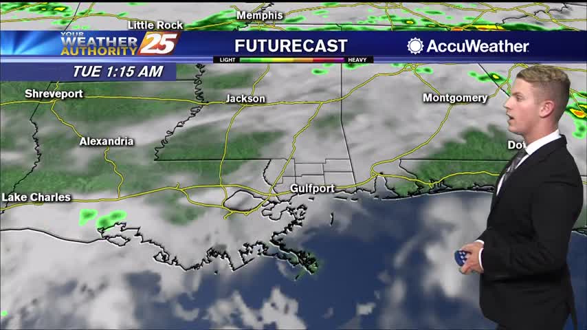
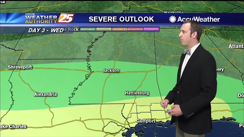
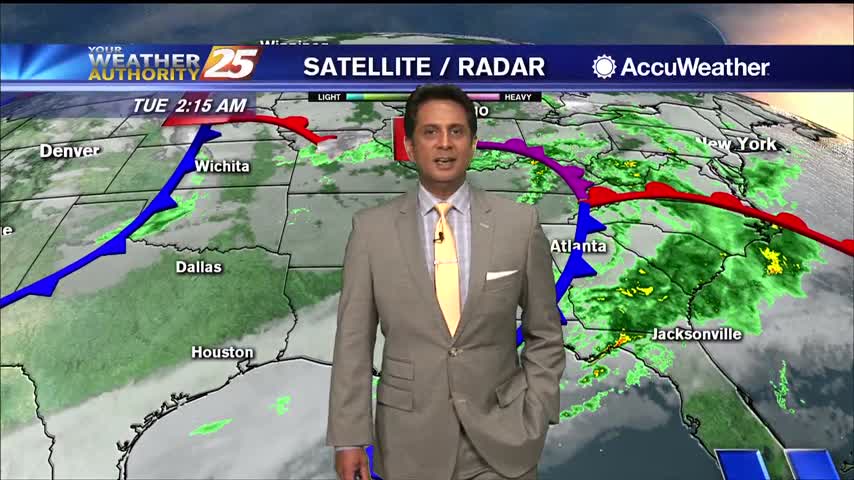
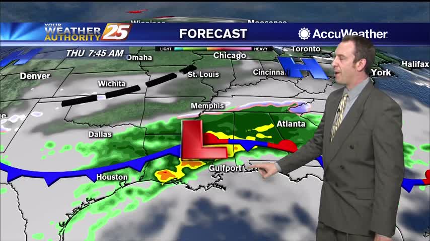
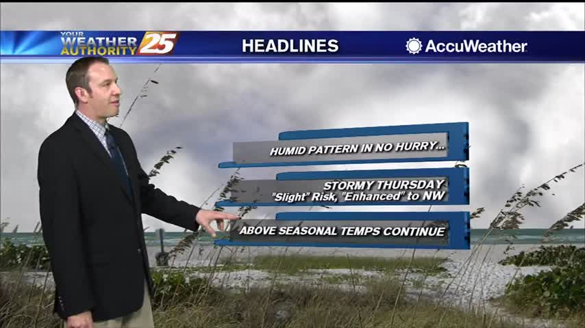
Active, potentially severe weather is moving in for all of Wednesday, but will clear quickly before the weekend.
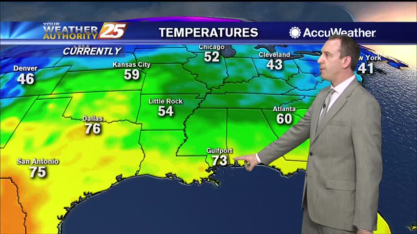
This time last week we were getting ready for freezing temperatures, but tonight's low will be double that as warm, moist air lingers.
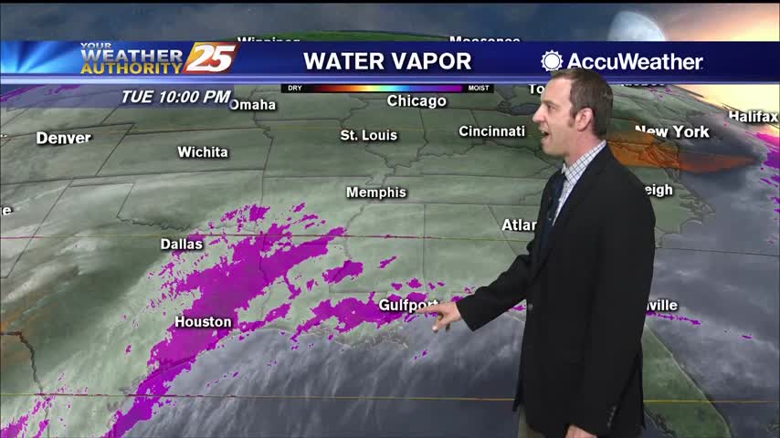
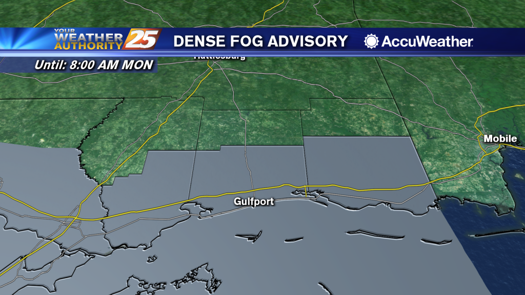
A low pressure system is now to the east with areas of patchy dense fog. A Dense Fog Advisory is in effect through mid-morning. Cloud coverage will continue through Wednesday when a secondary frontal system is expected to move through…
It's been grey and muggy all week long, but rain has been harder to come by. That changes overnight and tomorrow, but things clear up quickly after.
The weekend was nice, but clouds began to move in pretty early Sunday and grey, wet weather is expect for most of the week.
The clouds are moving in again after our sunny and drier weekend, so get ready for another grey, dreary week ahead.
Expect more dense fog tonight, and tomorrow isn't looking much better. Changes move in quickly by the weekend though.
Calm and humid weather will keep foggy conditions in place for a few days before thunderstorms move in.
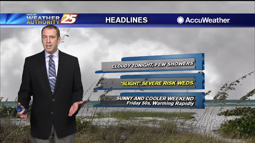
Skies were grey all day but the rain didn't arrive until later in the evening. Potentially severe storms move in tomorrow though, so stay tuned.
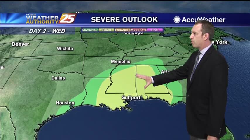
Only grey skies and humid air for most of the day, but rain is starting ahead of tomorrows potentially severe storms.