3/30 - Rob's "Good Friday" Morning Forecast
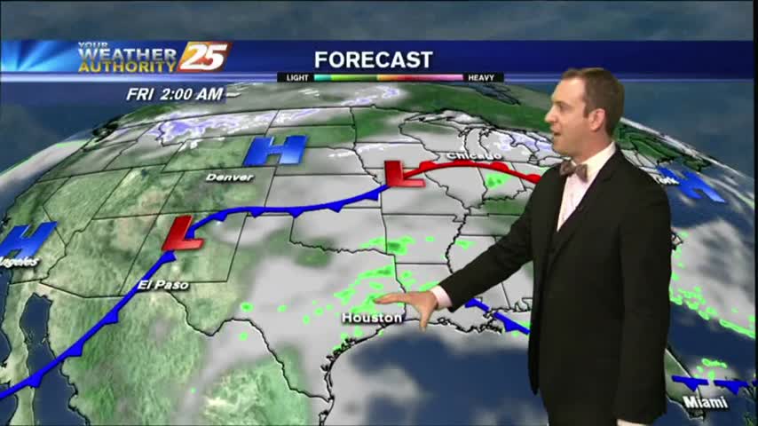
The cold front is now east with a weak boundary moving through the area, along with areas of patchy fog...

The cold front is now east with a weak boundary moving through the area, along with areas of patchy fog...
Another warm and humid day down with a few more to go before a sunny and drier Easter weekend....
The humidity and clouds just keep coming for the next few days, but the holiday weekend is looking much clearer....
It was beautiful last week, started getting warm and humid over the weekend, and is now cloudy and humid where we'll stay until rain later in the week....
It was a cloudy and warm afternoon after a foggy start to the day, but rain isn't expected until much later this week....

After a warm weekend, elevated humidity has areas of patchy DENSE FOG in the area...
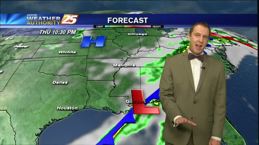
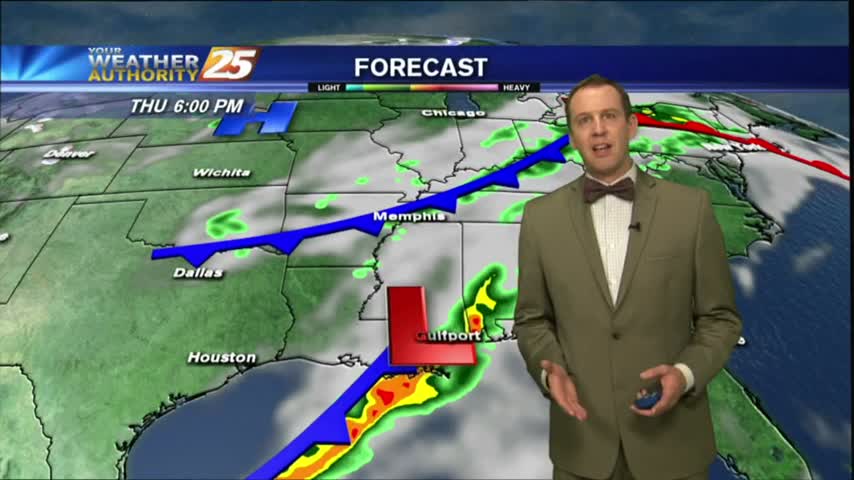
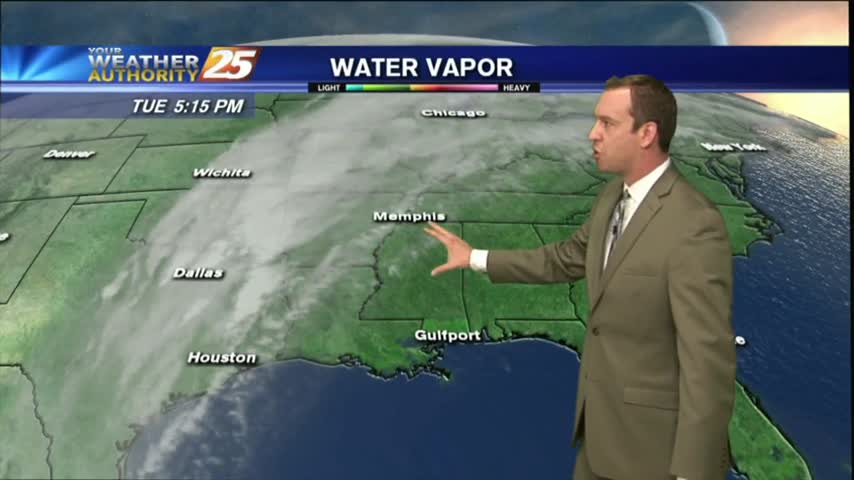
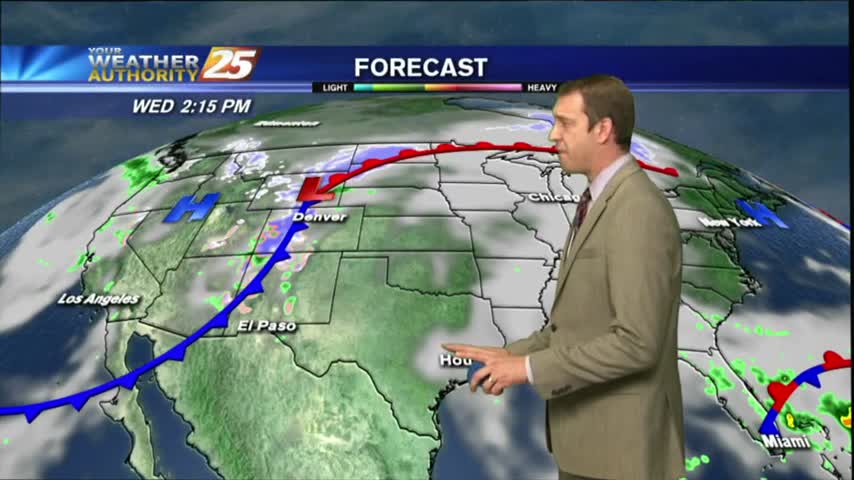
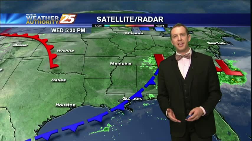
A RAINY start to the workweek as showers/t-storms continue through the local area with a passing cold front...

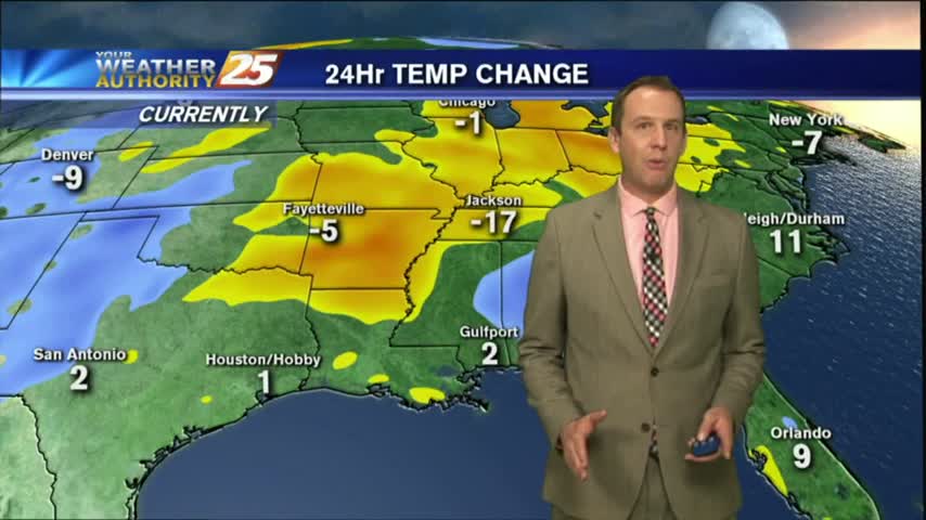
We've tied or broken temperature records every day, with the exception of last Sunday, since last Friday; a trend I expect to continue through the rest of this week and the weekend. Watch the full forecast for details.
Another day down, and another high temperature record tied or exceeded. Expecting more of the same ahead with a little rain mixed in, so watch the full forecast for the details.

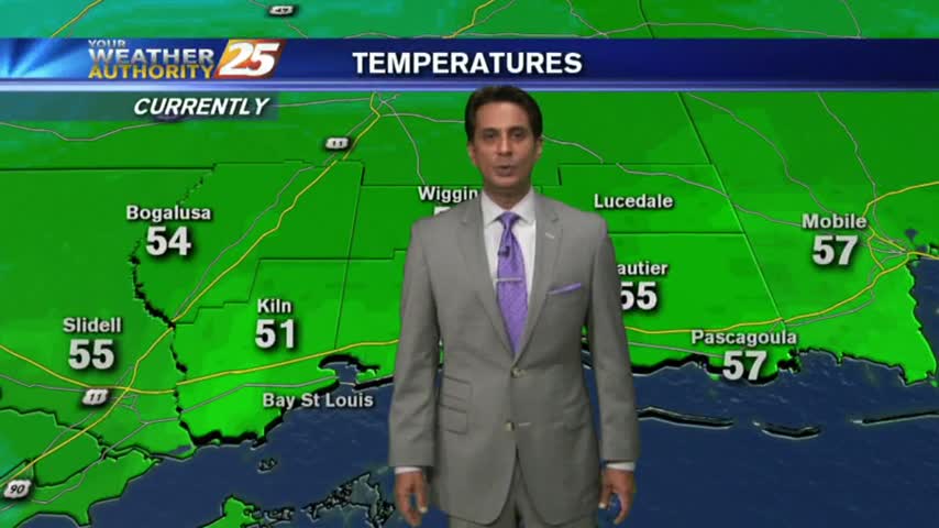
A mild and humid start to Valentine's day with areas of PATCHY FOG through the Southern 6...
After last night's chilly conditions we're in for a few days of warm and humid weather and mild, foggy nights. Watch the full forecast for details.
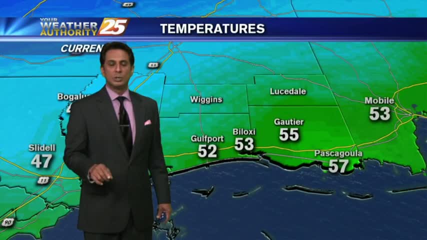
A cooler and cloudy start to the workweek, with areas of patchy fog along the coastal counties...
After a FREEZING start yesterday morning, temps are a good 20 degrees warmer under cloudy skies...
Not much change in weather from the afternoon until now (11 PM), but a cold front is moving through overnight and we have long week of frigid nights ahead. Click here for the full forecast.

Another warm and humid afternoon today, but tonight's cold front will reverse both of those conditions as we head into the next several days. Click on this forecast link for the details.
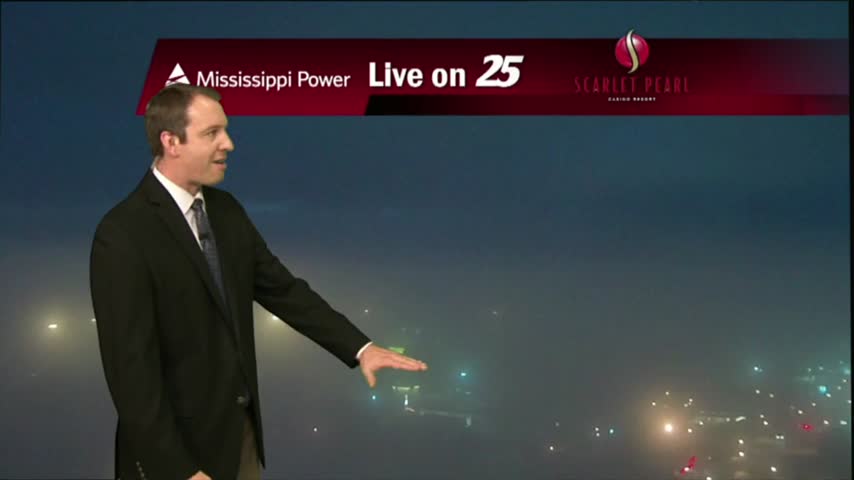
The fog cleared this afternoon and the skies even opened up for a while, but dense fog is already forming in the Southern coastal counties and Dense Fog Advisories have been issued. Click here for details.
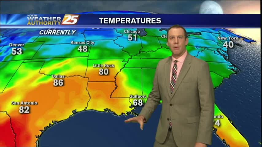
We warmed into the early 70s a day earlier than expected, and increasing southerly winds will bring even more moisture and warmth into the area. Click here for the full forecast.
It was a gloomy day in South MS as our high humidity lead to a misty light fog and low pressure lead to cloudy skies. Expect little change in the short term, but you'll have to click the forecast link fore the details.
Patchy fog and low clouds are out in full force this morning through the region with light activity through our viewing area...
Patchy fog has been developing over the last few hours, and will continue to do so throughout the night and into Tuesday morning. Click this link to watch the full forecast for the details.
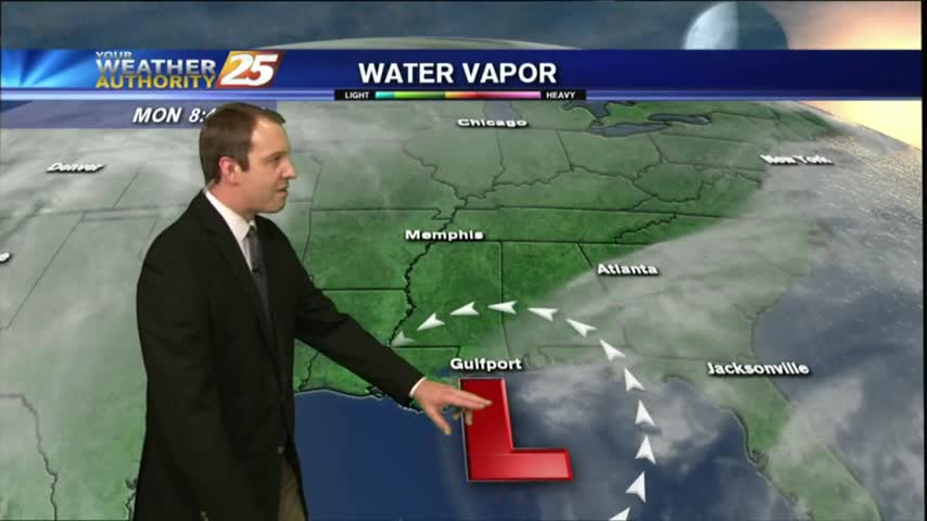
The showers and storms moved in as expected last night, and while the rain may have moved on, the moisture will remain for most of the week. Click this forecast link for more details.
Clear skies overnight led to what is known as "Radiational Cooling", where temps dropped all the way to the dew-point. This has developed areas of PATCHY FOG...
The fog cleared this afternoon and ushered in a sunny & warm afternoon, but as we cool tonight more fog will develop...just not as bad as the last few nights have been. Watch the forecast for details.
The fog finally lifted in all South MS areas for the afternoon, and the sun came out for the first time in days! We'll see more rain before Christmas though, so watch the full forecast for the details.