6/4 - The Chief's "Hotter Temperatures Ahead" Tuesday Afternoon Forecast
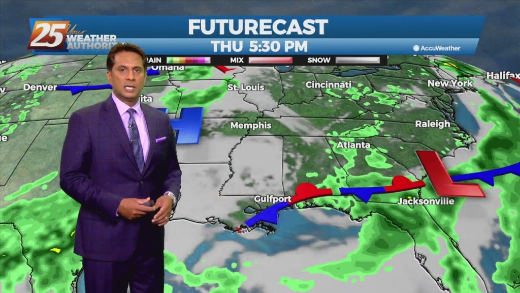
A complex of t-storms well to the NW will continue SE and dissipate late this evening. The activity will move in to the region and traverse…
A complex of t-storms well to the NW will continue SE and dissipate late this evening. The activity will move in to the region and traverse…
As a stalled boundaries form last week move northward and leave the gulf coast, rain chances will drop off through the weekend. A…
A rather cool day is in store, however, with high pressure building in over the lower MS River Valley, expect plenty of sunshine today, so overall…
The stubborn high pressure continues to remain centered over the I-35 corridor from Kansas through much of north and central Texas this morning.…
An easterly wave in the SE GOM is expected to continue to move west-northwest toward the Rio Grande Valley of south Texas by late tonight or…

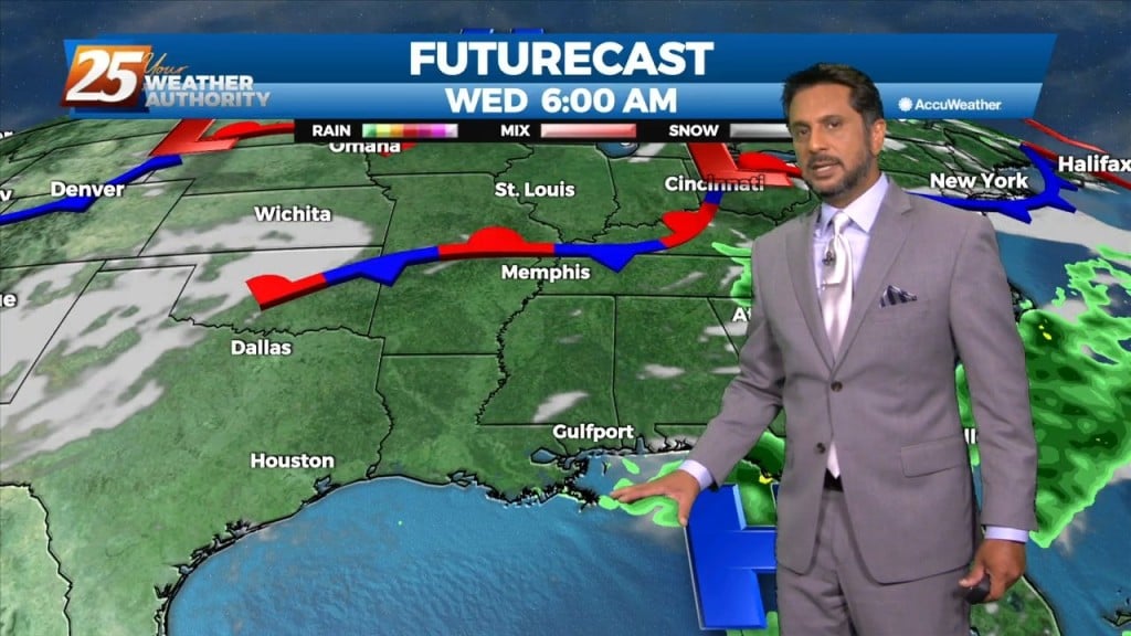
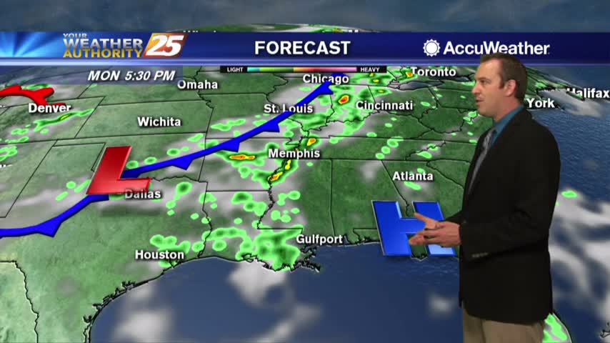
A deepening upper level disturbance is situated over the Southeast U.S. An approaching weak backdoor cold frontal boundary is expected in the region later this…
Despite the frontal passage overnight, temperatures will actually be slightly warmer today given the drier mid-levels holding down afternoon convective development. Rain chances will be lower…
Mid-level dry air is moving into the area from the west this morning on the backside of the exiting upper level disturbance retrograding back to the…

Overall, a fairly quiet day is expected across the area. It should be another lackluster convective day with plenty of dry air aloft. The best potential…
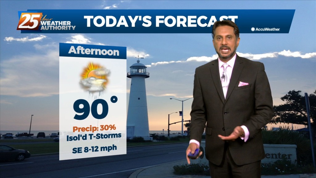
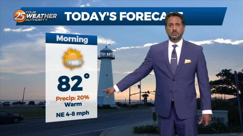
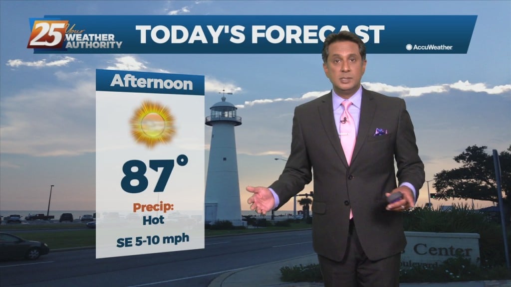
Today will bring hot and humid conditions with t-storm coverage slightly more reduced for generally areas along/near of I-55 and east to the MS coast given…
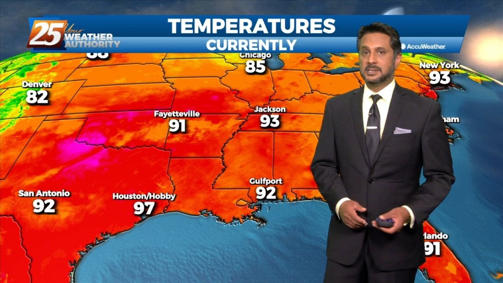
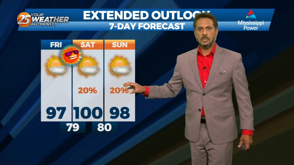
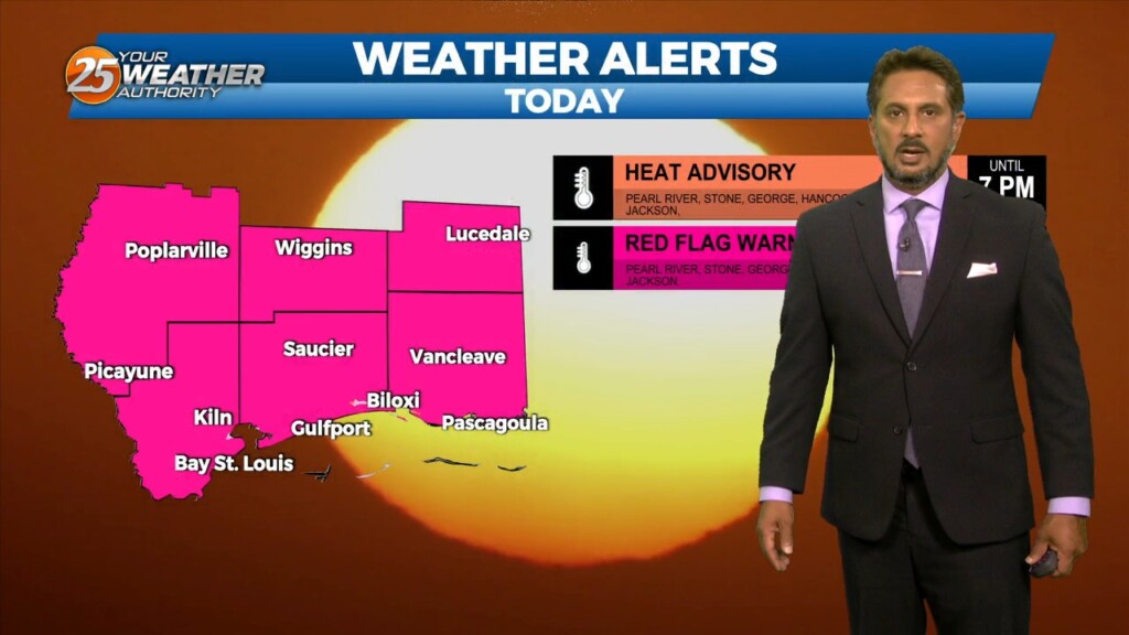
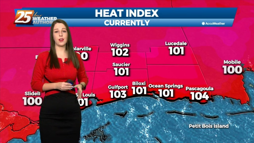
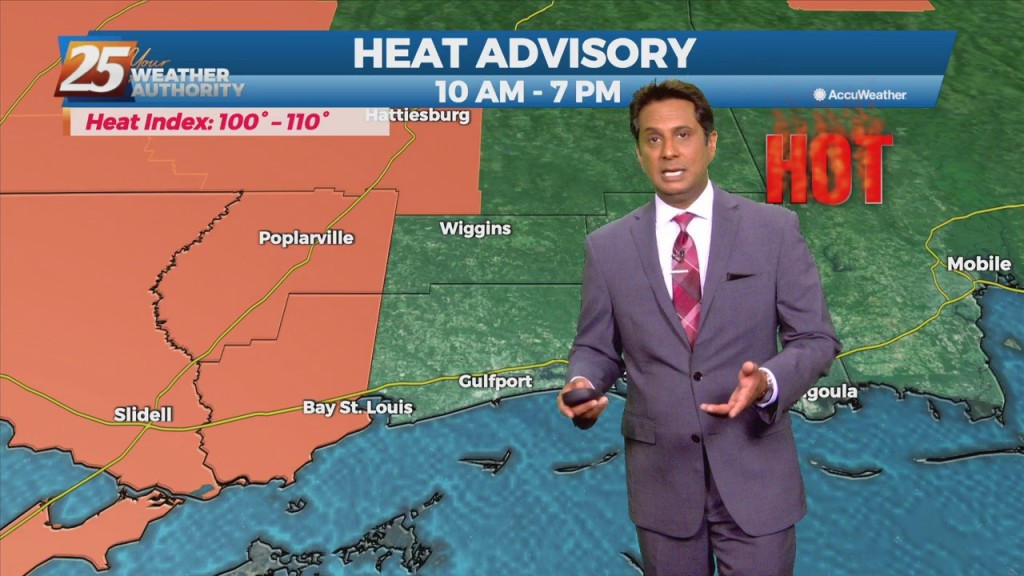
A Heat Advisory is in effect... The upper level high pressure will gradually continue to get stronger from west to east across the region. That and a continued…
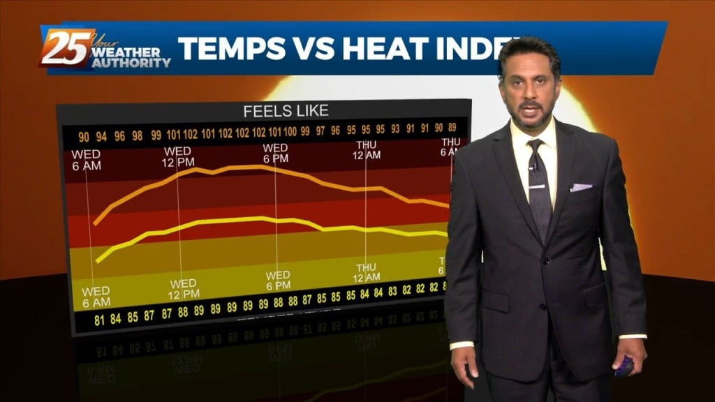
The focus early in the forecast will be the topic of heat. Heat Advisories were needed yesterday as compressional heating gradually increased, especially over the western tier.…
Strong high pressure will continue to shape the forecast with hot temperatures and low rain potential due to the compression of the atmosphere. The best potential for…
Today will bring a continuation of the past few days and a gradual warming trend as high pressure moves closer to the area. This will also…
The general upper level setup aloft hasn’t changed in the last week or so for all intents and purposes with the exception of small variations. A broad…
The main concern in the short term will continue to be the potential for thunderstorms and possible severe weather. We’ll remain in northwesterly upper flow…
Hot and dry pattern continues as high-pressure extends SW to NE from the western Gulf of Mexico to the Great Lakes. This will easily support…
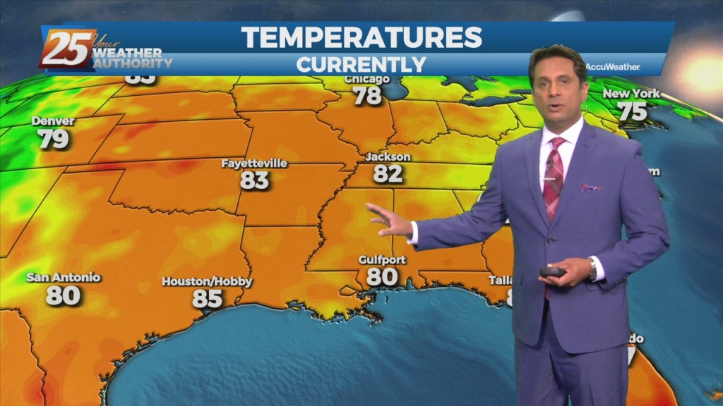
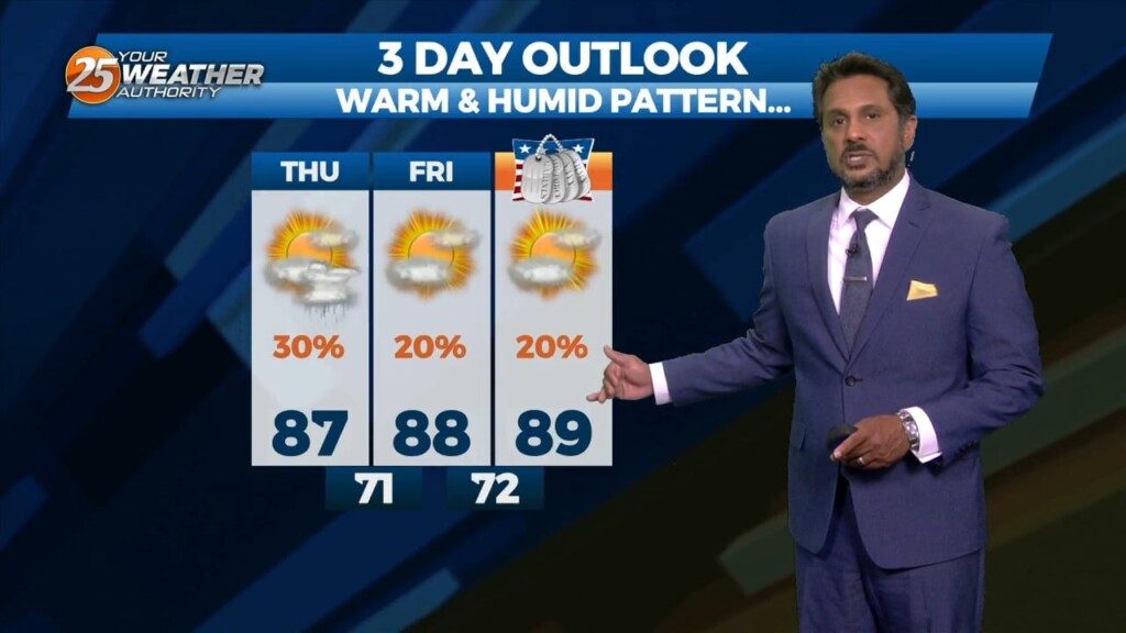
The first half of this week will be the end of clear skies and no rain as high-pressure develops and extends along the Mississippi River Valley from the Gulf of Mexico to Canada. Moisture recovery will take some time but…
Winds from the southwest will spread over the entire area throughout the day today which will help to bring back a steady increase in moisture. The typical summertime pattern will dominate with mostly clear skies in the morning with clouds…
Fred has been downgraded to a tropical depression drifting north-northeast through western Georgia. Meanwhile along the northern Gulf coast, we remain parked underneath light westerly flow aloft upstream from the western section of departing TS Fred. Winds from the southwest…
Early this morning, what is left of a weak stationary front remains draped across our area. The front is now south of the area making a transition to a stationary front. This will bring a drier air mass into the…
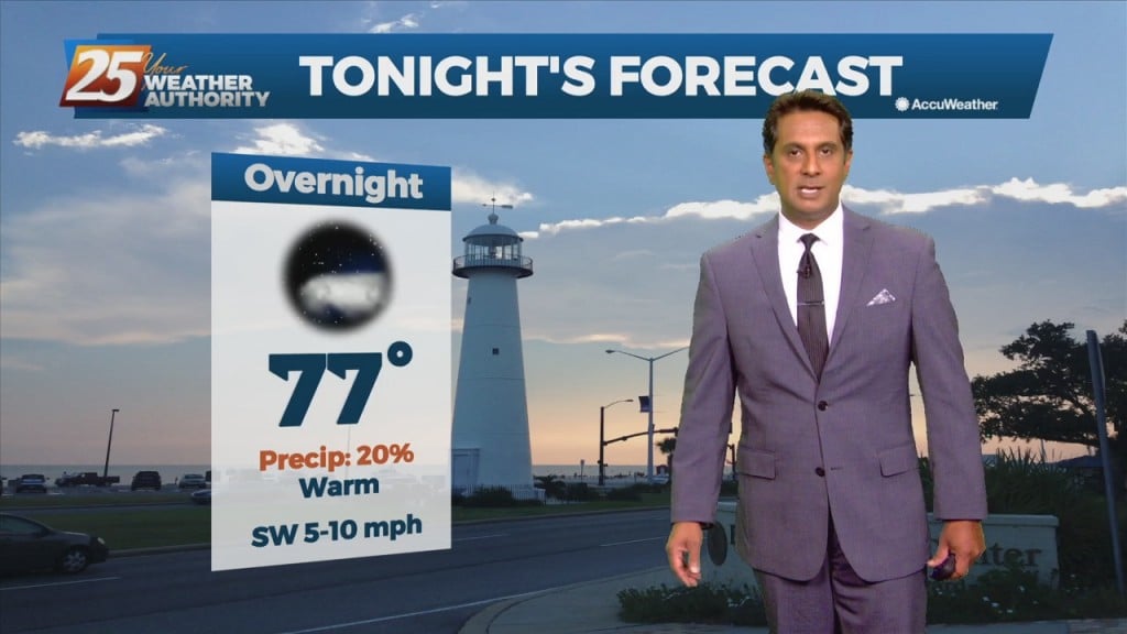
Humid air, warm temperatures, and light winds will keep the current heat advisory posted through today. The main hope for cooling will be any thunderstorm development which will be embedded in a deep easterly flow. Afternoon seabreeze should provide a…
A Weak frontal boundary draped along the lower Tennessee valley will continue to slide east and out of the region, high-pressure will slowly build eastward through Friday as this weakness moves off the east coast over the next 48 hours.…
The week began beautifully after a sunny weekend, and more of the same is expected in the days ahead....