9/8 - Brittany's "Not Quite as Cool" Thursday Evening Forecast
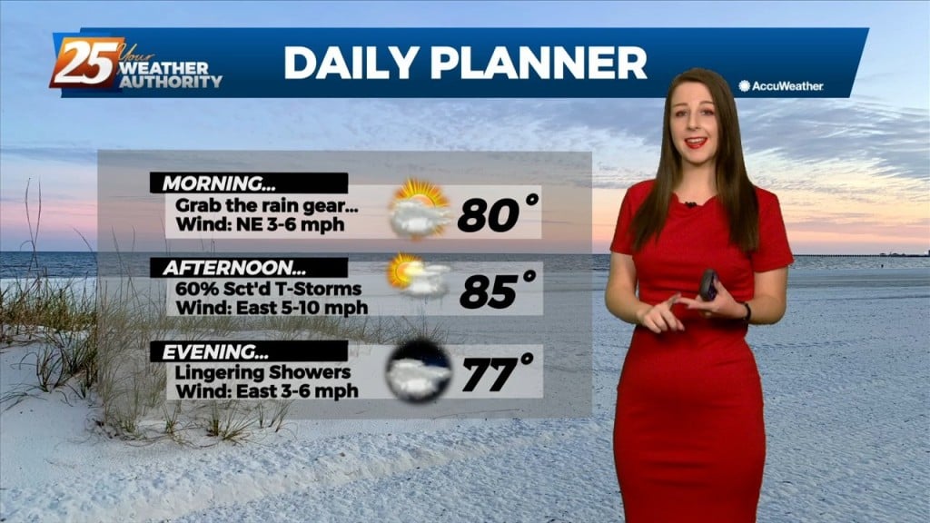
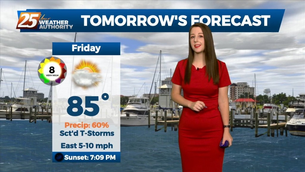
We could see some lingering showers and thunderstorms this evening. Heading into tomorrow, an upper low will be completely closed off at this point and meandering around…
We could see some lingering showers and thunderstorms this evening. Heading into tomorrow, an upper low will be completely closed off at this point and meandering around…
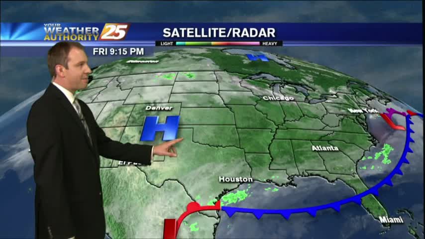
Starting out in the upper levels, a broad ridge centered near the 4- Corners region extends from California to beyond the Great Lakes. A trough sagging southeast…

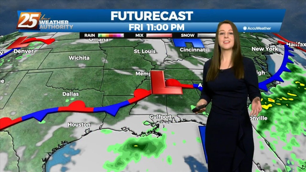
Tonight, we're seeing some lingering showers, mainly west of highway 49. Through the end of the week, an upper level low is expected to influence the area, enhancing rain…
Tonight, some scattered showers and storms will be possible,especially in the northernmost areas. Through the end of the week, an upper level low is expected to influence…
Mississippi is still under the influence of upper level troughing which is slowly moving east while further west has a large ridge with a cutoff low. This trough has…
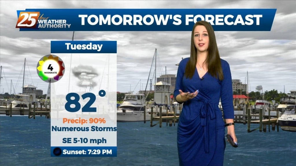
A strong and persistent meso-low currently over the Arklatex region and broader and weaker shortwave trough in the upper levels will continue to work in conjunction to produce…
A strong and persistent meso-low currently over the Arklatex region and broader and weaker shortwave trough in the upper levels will continue to work in conjunction to produce…
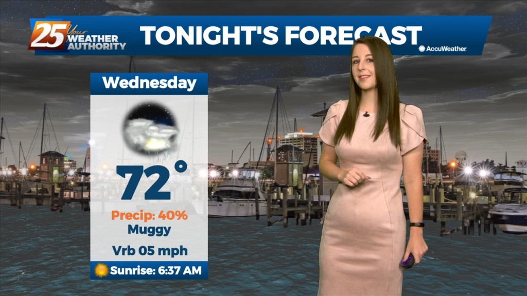
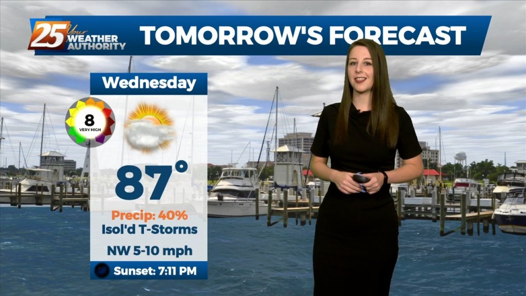
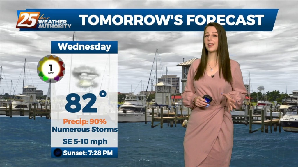
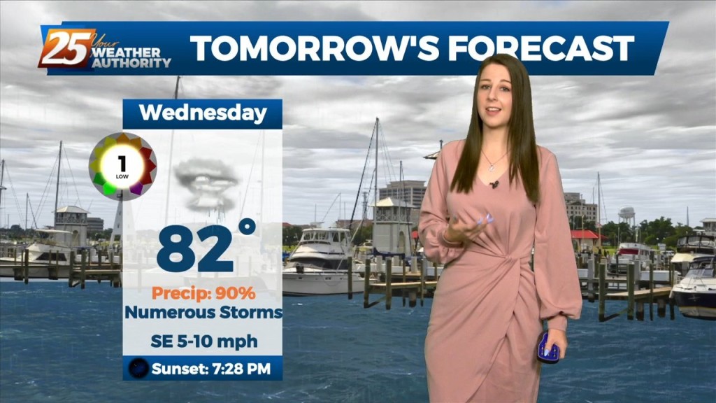
Tonight through Wednesday Night, little change in the ongoing pattern is expected through Wednesday night as a broadly diffluent westerly upper level pattern, a weak shortwave trough,…
The upper level pattern across the country, and somewhat locally, is starting the transition process that will begin to finally lower rain chances for the northern Gulf…
The upper level pattern across the country, and somewhat locally, is starting the transition process that will begin to finally lower rain chances for the northern Gulf Coast.…
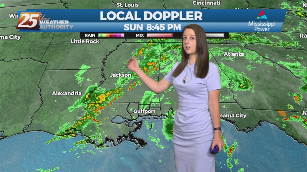
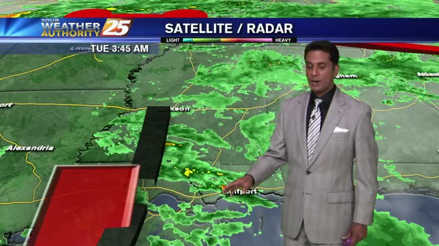
An area of low pressure located of across the Northern Gulf of Mexico is producing showers and thunderstorms that are expected to move to the north and…

An upper level low-pressure system currently centered in the western Atlantic will move west into FL/GA today. At the same time, an upper level disturbance to the NW will…
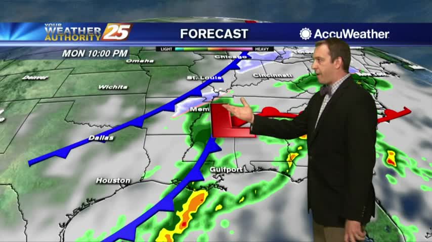
Low pressure is currently over southern Indiana with a cold front southwestward to near Memphis and Shreveport. As the surface low continue to lift northeastward, the cold front will…
A warmer start with areas of light rain moving across south Mississippi...

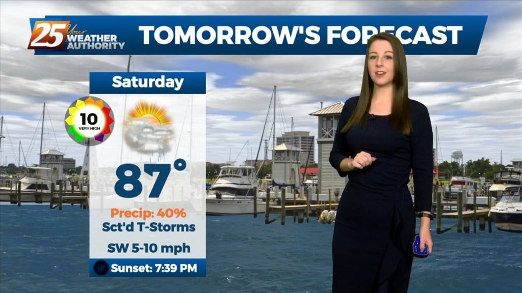
A warm/humid air mass is affecting the viewing area in advance of a low-pressure which will move in Saturday...
The light rain will continue through the night and into the next few days before much drier weather moves in....
We're in for a wet week ahead as we'll see several days like today with late morning/afternoon showers and partly sunny skies. Weekend outlook not looking good....
Expect this week to be significantly different from the last with cooler temperatures, more clouds, and much more rain....
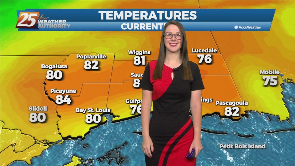
Today was the warmest and most humid day we've seen all week, but after a rainy weekend we'll get back to those cooler and dry days. Click here for the full forecast with Meteorologist Ryan Mahan.
The humidity has been rising throughout the day and rain is expected overnight. Expect a few thunderstorms tomorrow, but you'll have to click this link for the full forecast.
It'll be colder tonight than it's been the last few, but not the coldest weather we've seen recently. Inland areas will flirt with freezing tonight, but we'll be back in the 70s by Sunday. Details within.
It's rained every day for well over the last week, but should be finished after tonight's showers. Watch the full forecast for details.
After a good bit of rainfall yesterday, isolated moderate/heavy rainfall is already in the area...
A gloomy and rainy morning as an area of low-pressure moves across the northern Gulf...