
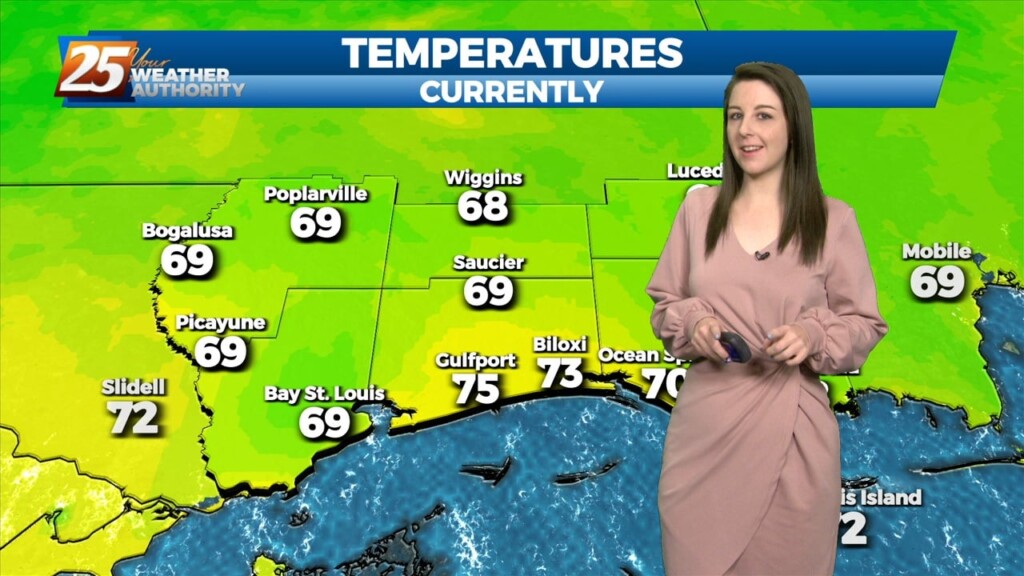
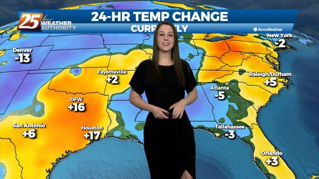
4/24 - Sam Parker's "Mostly Dry and Hot" Thursday Night Forecast
Warming up over the next couple of days with small rain chances. We saw very little rain showers today across south MS mainly stayed…
Warming up over the next couple of days with small rain chances. We saw very little rain showers today across south MS mainly stayed…
The upper level ridge axis that has been dominating the region over the past several days will weaken tomorrow as a progressive upper level trough passes through.…
The primary forecast concerns through Thursday night will be the prospect of locally dense fog forming each night, the threat of isolated to widely scattered convection forming…
The primary forecast concerns through Thursday night will be the prospect of locally dense fog forming each night, the threat of isolated to widely scattered convection…
No significant changes in the overall synoptic pattern that has been influencing the region for the past several day is anticipated through Thursday night. A weak backdoor frontal boundary…
No significant changes in the overall synoptic pattern that has been influencing the region for the past several day is anticipated through Thursday night. A weak backdoor frontal boundary…
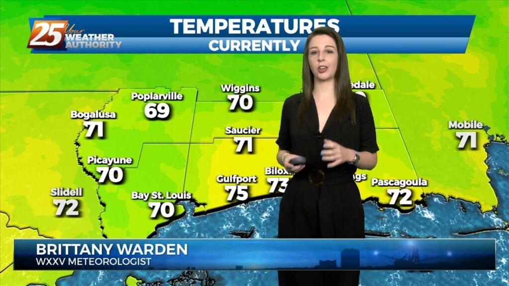
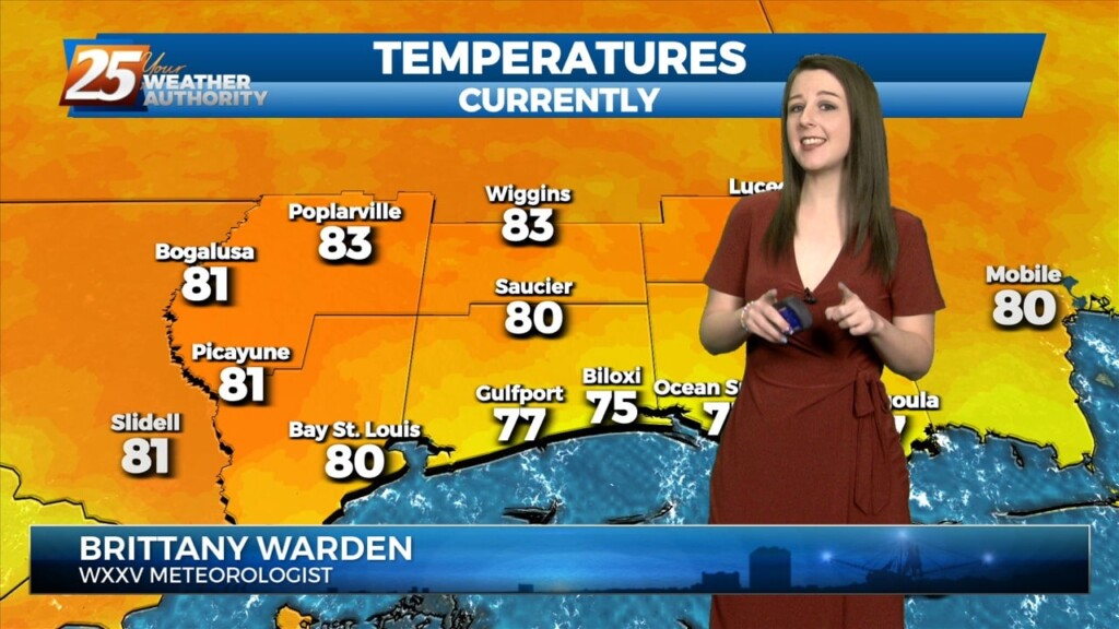
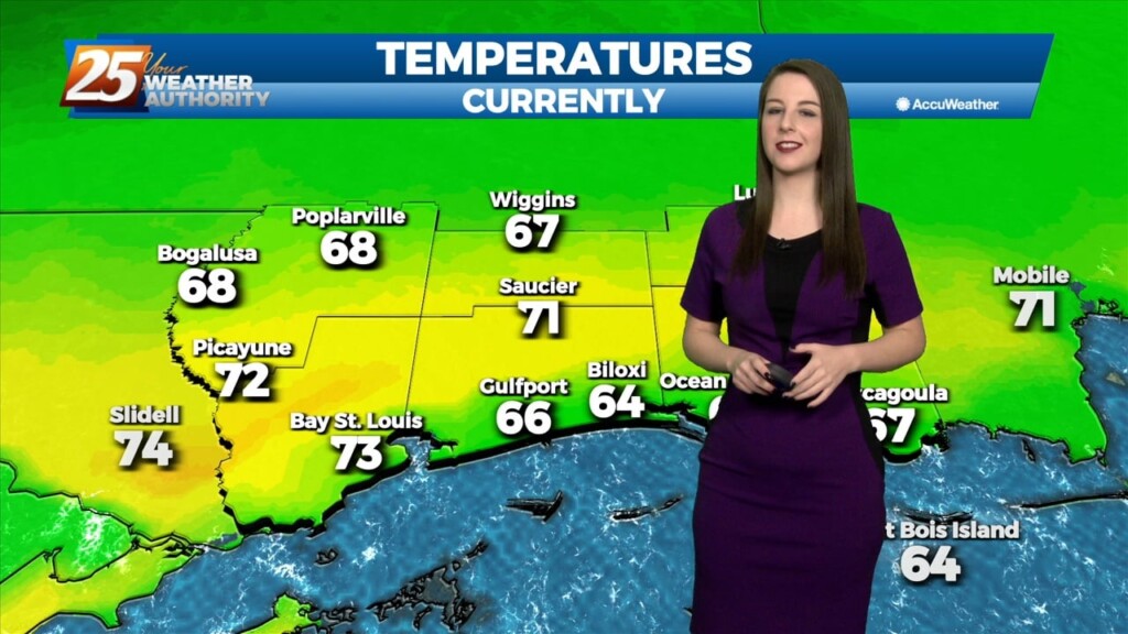
Another warm day across the region and no sign of a change at least in the short term. Fog was an issue this morning and could be…
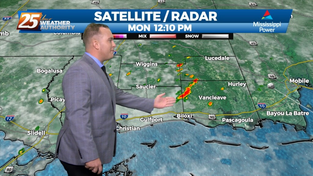
A stationary front near our area is providing just enough lift for 30% coverage of isolated showers this afternoon. Warm and humid conditions are returning to our area…
The old frontal boundary from the prior system that mostly bypassed our area currently resides across portions of MS and LA this afternoon. On the backside…
Upper low and trough continue to lift northeastward today. With deep layer flow mostly parallel to the surface frontal boundary, expect it to remain stalled near the mouth of…
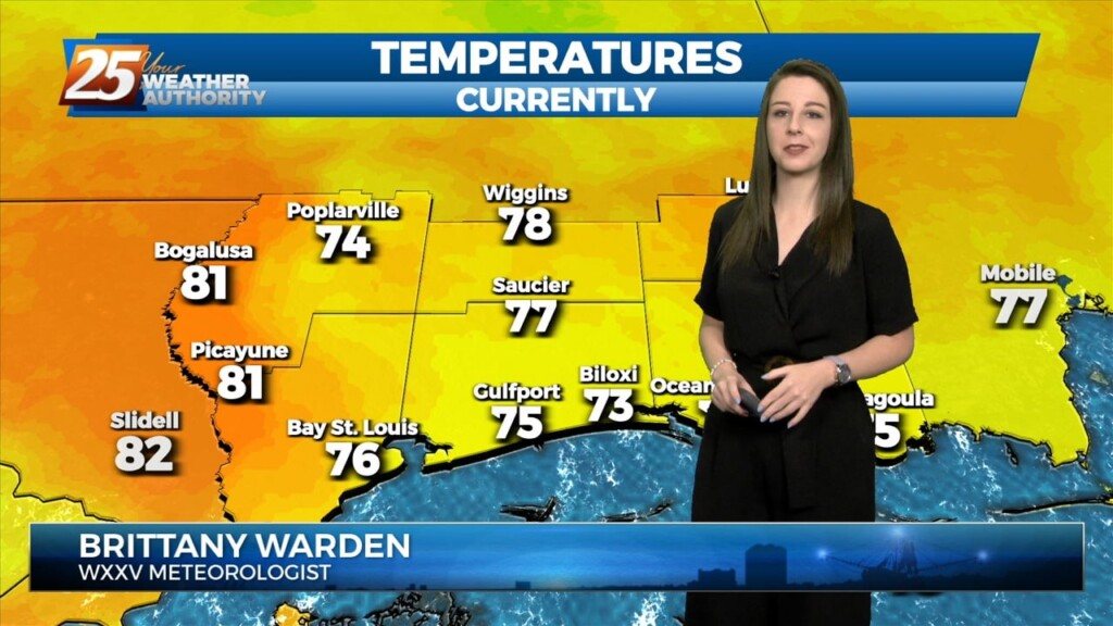
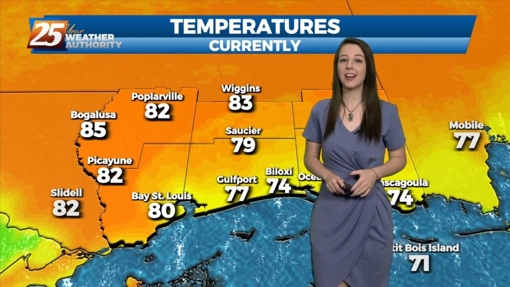
Quite the dreary start to the day but once fog burned off temps torched out with mid to upper 70s. Along and north of the stalled stalled…
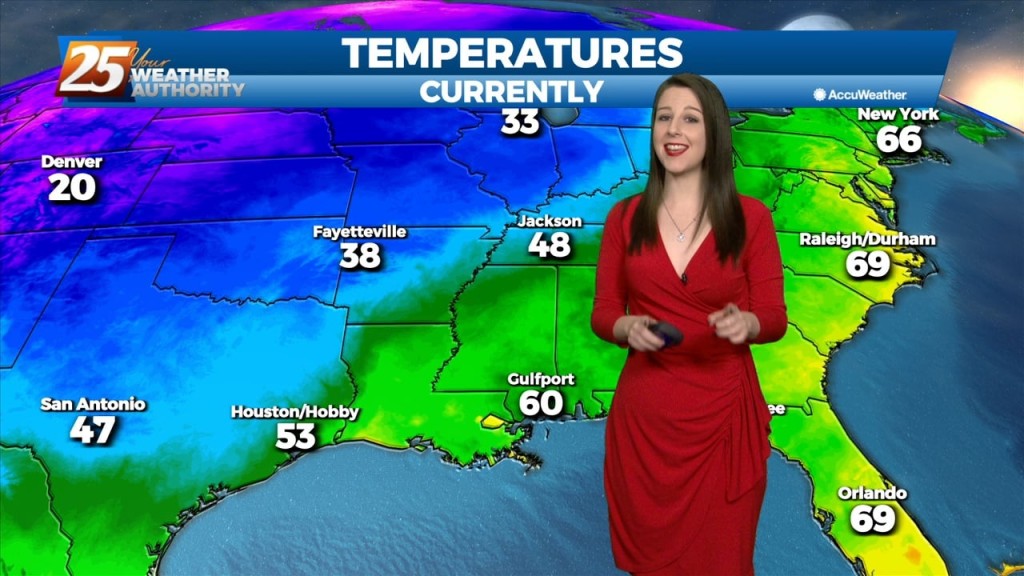
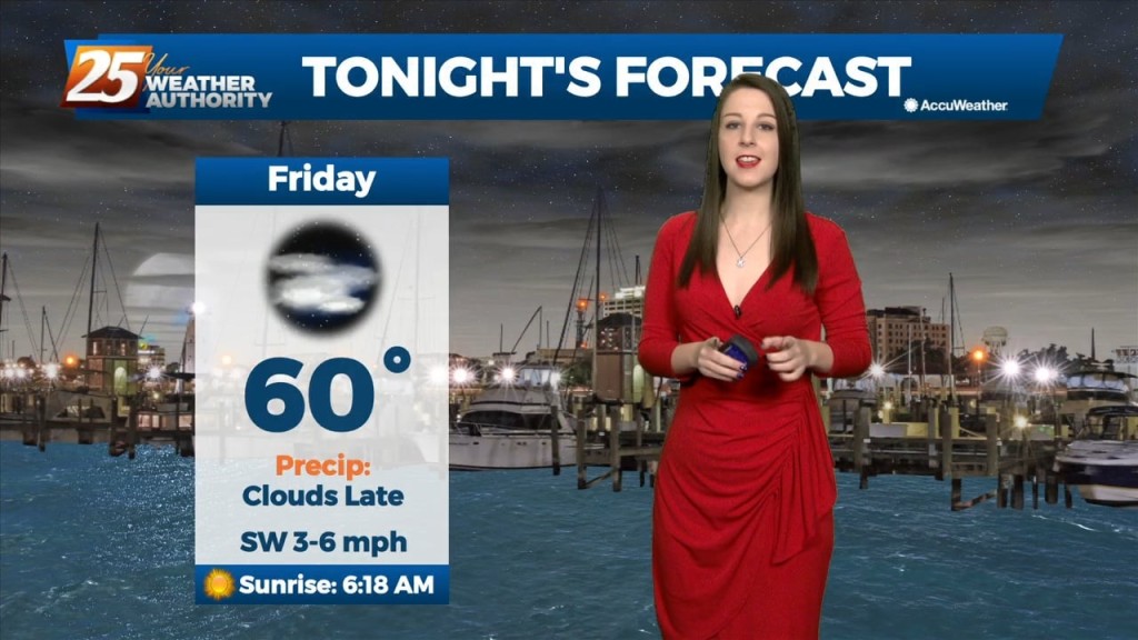
We'll have a strong cold front make its way through our area late tonight into early tomorrow morning. The cold front will bring along with it increasing…
Main forecast concern in the short term will be temperatures and winds with the greatest forecast question being morning lows Sunday and Monday morning. Remnants of Nicole…
Cold frontal passage will occur this morning with a 30% chance of showers and thunderstorms associated with it. Mostly cloudy skies will clear this afternoon…
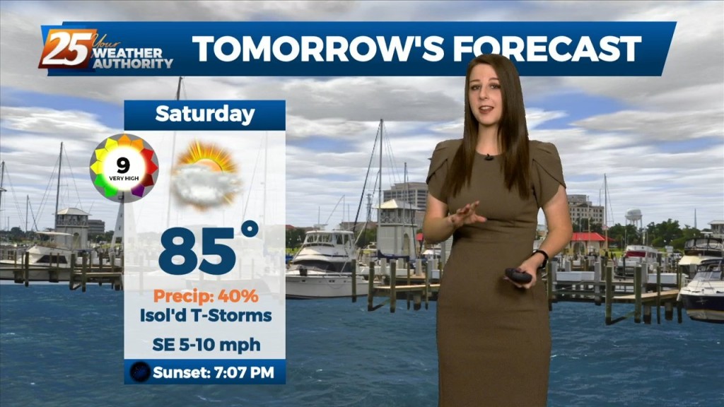
Saturday is looking nice to start yet again with some low-level clouds around. Main focus will be the continued return of low-level moisture drifting north adding to that old…
Tomorrow, we'll only see slight changes as the overall pattern shows little change. The upper low will still be in place overhead, but likely weakening at this…
Mississippi is still under the influence of upper level troughing which is slowly moving east while further west has a large ridge with a cutoff low. This trough…
The dry conditions have been nice for a short time, but the rain will return over the weekend as the pattern changes. Southerly surface winds will act to…
The upper high pressure over Colorado this morning will gradually build southeastward over the next few days, even as the trough to our northeast continues to dig…
The area is currently still between high pressure to our west and and the Bermuda high pressure to our east and a weak mid level inverted trough…
Above seasonal average temperatures will continue until a cold front makes its way through our area early tomorrow morning. The warmer temperatures coupled with high relative humidity…
A few showers will affect the area this afternoon and Friday with the approaching cold front. The main effects from the front will come overnight Friday into Saturday morning prior to sunrise. As the upper-level support begins to outrun the…
No surprises in tonight's forecast, just more hot, humid, and occasionally active weather. This afternoon was more rainy than yesterday was, slightly above average, but we'll trend in a drier direction for…
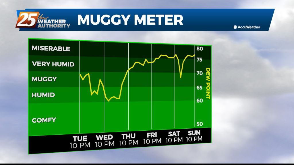
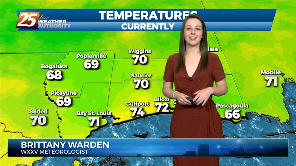
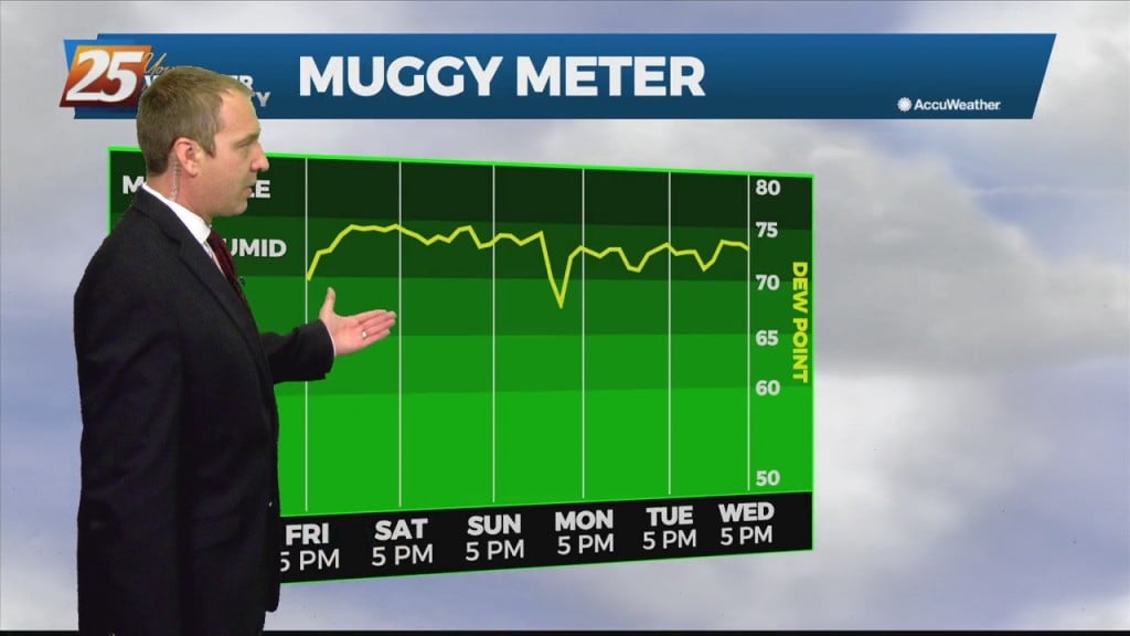
Finally drying out a bit after a long, abnormally humid couple of weeks. It won't be all that significant as it looks like dewpoints will only fall from the mid 70s into the low 60s, but it will be noticeable. …