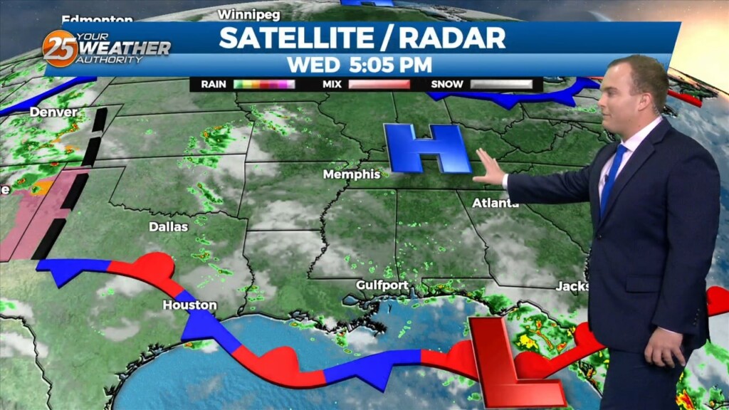
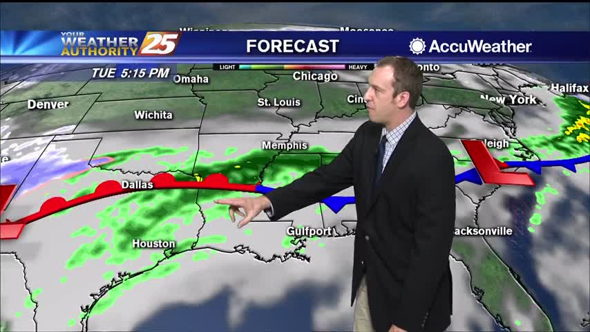
2/28 - The Chief's "Cold Frontal Passage" Wednesday Morning Forecast
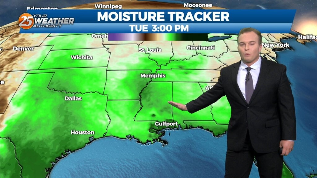
With low level moisture continuing to advect into the region from the south a solid low stratus deck of low level clouds has developed across most…
With low level moisture continuing to advect into the region from the south a solid low stratus deck of low level clouds has developed across most…
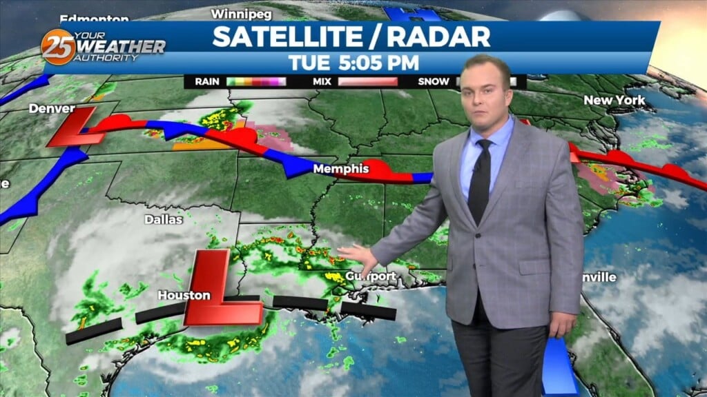
The system to the SE that brought thunder/hail to parts of the area yesterday evening will continue to meander south and east today. On the backside…
It will remain warm and very humid overnight as the predominantly southerly winds build back in. The pattern of dangerous heat will linger through the rest of the…
Rain chances will be eliminated this evening and skies will clear out. It will remain hot and humid for a good portion of this evening but cloud cover and…
Winds remaining out of the south overnight will keep it very warm and extremely humid overnight. Some clouds will be present at times but expect the…
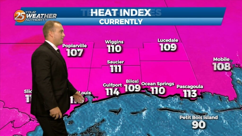
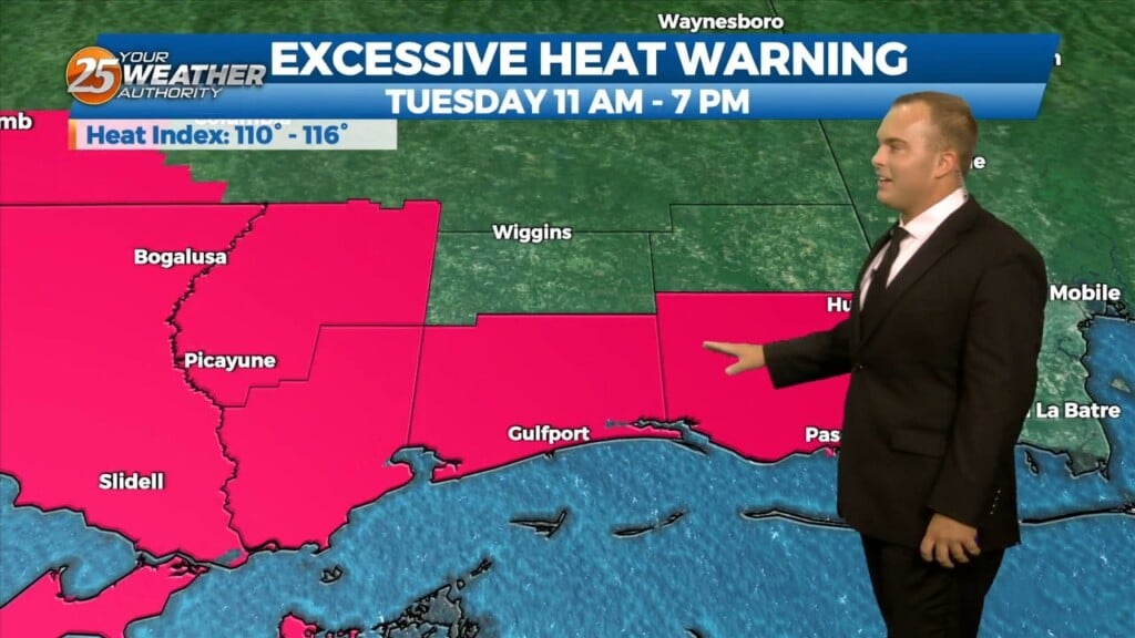
The heat wave we have been dealt continues through the much of this week. An Excessive Heat Warning is in effect until 7 PM for heat indices…
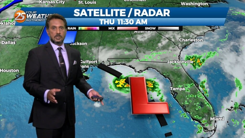
Heading in to this afternoon rain will continue to move in from the southeast. That being said, an area of low-pressure off the Florida west coast…
Today is June 1st and the official start of the 2023 Hurricane Season. That being said, an area of low-pressure off the Florida west coast will…
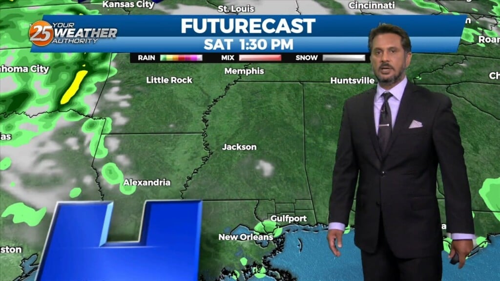
Rain chances will be put to bed for at least the next 2 days following some showers ending this evening. Expect some clearing of skies towards…
Clouds have broken up somewhat which provided for some warmth for the latter portions of today. Very isolated shower and thunderstorm chances will come to an end…
Winds have shifted behind a cold front that moved through the area this weekend. With that, there is some relief from the heat due to increased cloud coverage.…
Isolated shower and thunderstorm activity will diminish through the evening as the best coverage remains west of here. Expect warm and muggy conditions to continue overnight. Very…
Currently there is a narrow line of showers across western Louisiana. Expect that to continue to move off to the east through the late morning hours.…
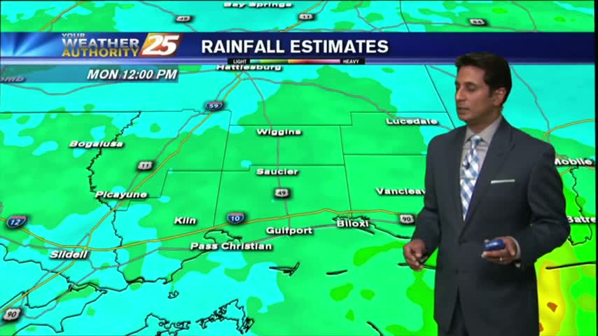
A stationary front draped along the coast east through the central Florida panhandle will continue to bring showers/t-storms. A few showers could bring heavy rain as rain rate will…
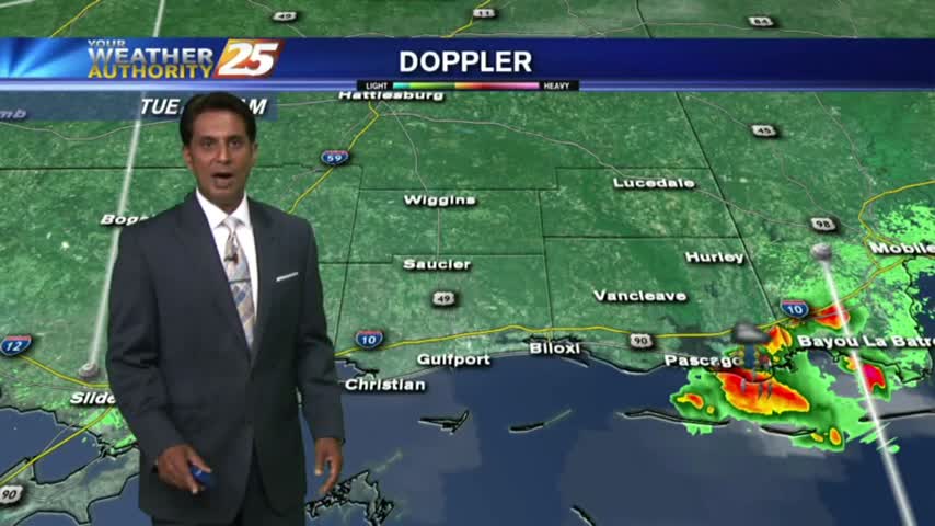
The threat for severe weather and flash flooding has diminish by isolated showers and even a few late afternoon t-storms. Tonight will bring a lull in activity until…
A warm and muggy start with a few overnight showers/t-storms moving SE across the area...
Calm and humid weather will keep foggy conditions in place for a few days before thunderstorms move in.
With a nice weekend behind us, we enter a warm, humid, and eventually rainy start to the week.
A warm and muggy start to the day with isolated rain moving in from the south...
With a warmer/humid air mass moving in ahead of a weak cold front, spotty light rainfall is moving across the area...
The cold front has moved in, and the clouds and rain are here to stay for the rest of the week....
After moderate/heavy rainfall last night through this morning, the majority of the rain shield has shifted to the east with just a few showers this afternoon...
Another WARM/HUMID start to the day with areas of patchy fog and isolated rain moving in from the Gulf/Sound...
Isolated morning rain is moving in from the Gulf/Sound, with the activity expected to increase...