2/6 - Rob Knight's "Spring-Like Pattern" Afternoon Forecast
Dense fog has dissipated but with the warm and humid air mass, areas of patchy fog will continue...

Dense fog has dissipated but with the warm and humid air mass, areas of patchy fog will continue...
After a chilly start to the day, temperatures continue to warm under beautiful blue skies...
In the wake of last night's cold front, it's a chilly start to the day with the winds beginning to increase...
With a warm and humid air mass affecting the area/region, areas of dense fog from this morning continues...

Another cloudy and gloomy start to the day with areas of patchy fog and light drizzle/mist...
A much better start to the day with just a few clouds moving in from the south and mild temperatures...
A slightly cooler morning along the gulf coast with a few showers approaching from the south...
A rain-free start to this final day of Spring with areas of light patchy fog...
After HEAVY RAINFALL yesterday afternoon, only a few light sprinkles exist this morning...
A CHILLY...but slight warmer start to the day. Temperatures will continue to warm heading towards the weekend...
As high-pressure dominates east of the continental divide, its'a warm/humid start with isolated showers/t-storms to start off the day...
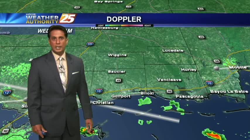
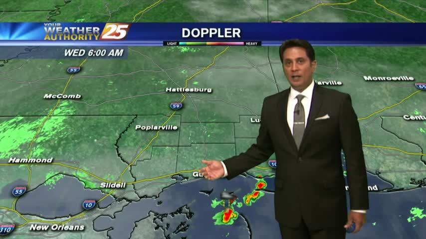
Isolated showers/t-storms have been moving in since midnight and will continue through much of today...
As temps have been slowly warming over the past few days...areas of light fog have developed this morning.
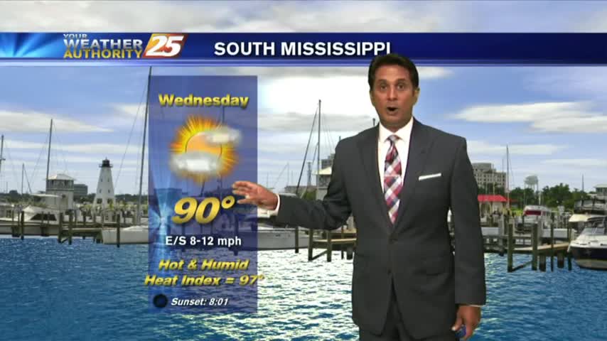
It was quite a beautiful, but humid "hump" day today with temperatures reaching 90 in the afternoon and not many showers. A few showers tried to pop up on the Eastern edge of the viewing area but they didn't last…
A beautiful sunrise under mostly clear skies and warm temperatures...