6/13 - The Chief's "Getting HOTTER" Thursday Morning Forecast
Today will bring increasing subsidence through the area.as high pressure begins to expand eastward from the southern Plains and Texas. At most, some fair weather cumulus cloud…
Today will bring increasing subsidence through the area.as high pressure begins to expand eastward from the southern Plains and Texas. At most, some fair weather cumulus cloud…
Dense fog should quickly burn off in the following hours after sunrise and temperatures will rapidly warm into the upper 80s to low 90s area…
High pressure will continue to move into the area and shape the forecast though the weekend. The Bermuda ridge extends westward from the Atlantic Ocean to…
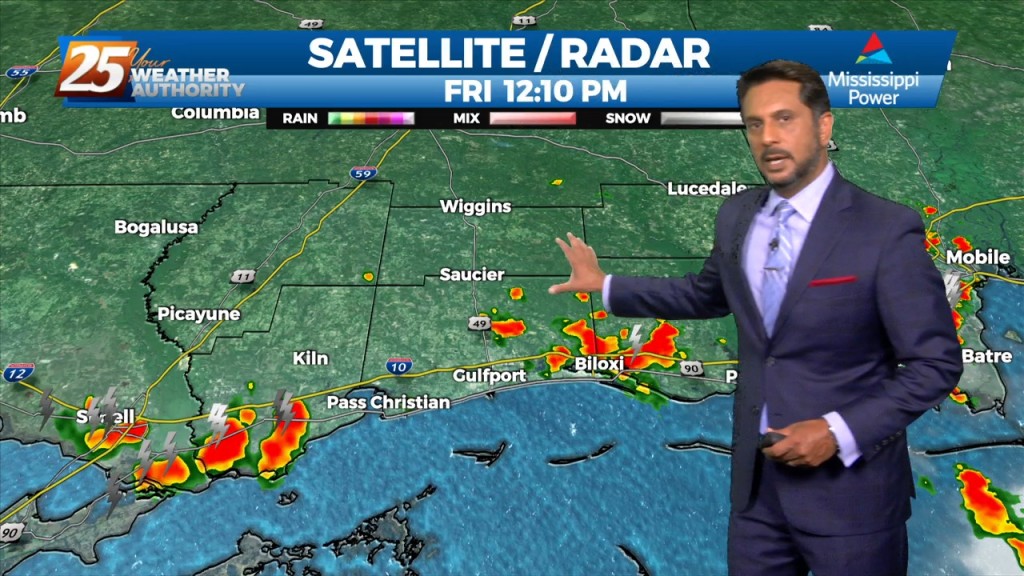
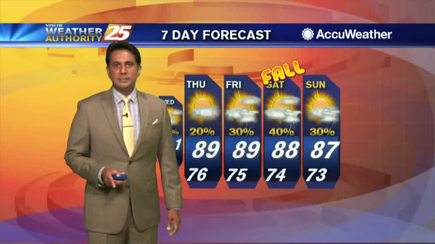
Persistence is the call with the forecast through Thursday. T-storm activity was limited today, and it’ll be more of the same tomorrow, although some…
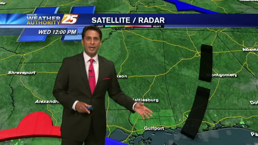
High pressure is centered pretty much over our area as the disturbance that brought the heavy rainfall to portions of the area yesterday, is well…

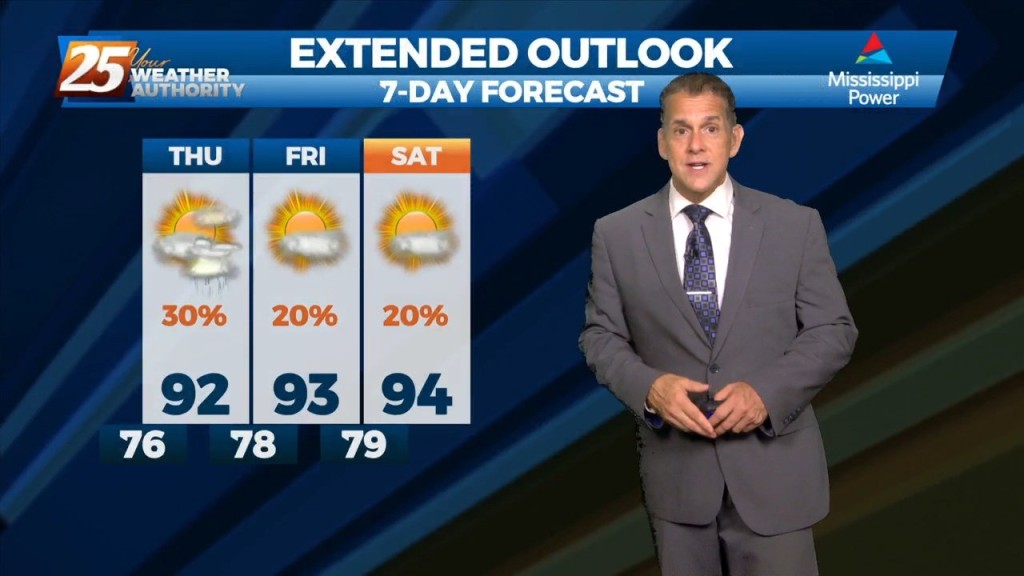
High pressure continues to dominate the upper level pattern. Heat will be the biggest concern tonight through Saturday. The high pressure is still building/staying over our…
A stalled frontal boundary from the Carolinas to southeast Texas will slowly shift north and wash out by Thursday afternoon. High-pressure over the mid-section of the country will build slowly eastward by Thursday bringing lower rain chances and a return…

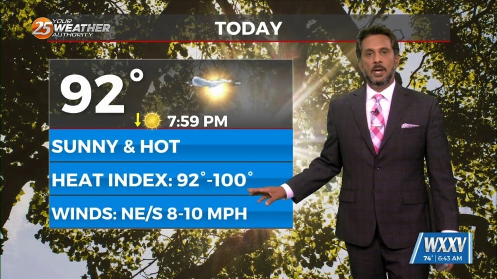
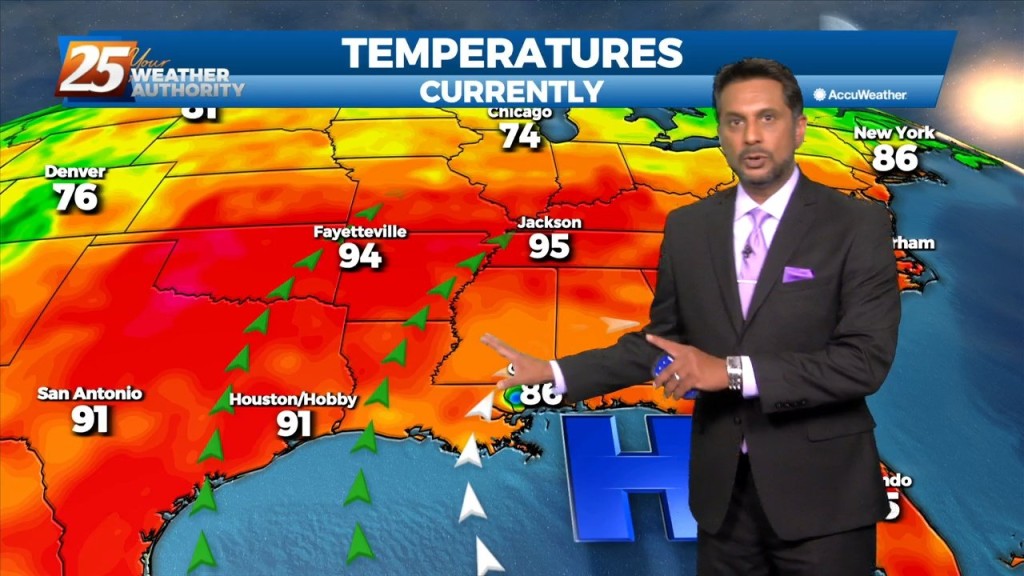
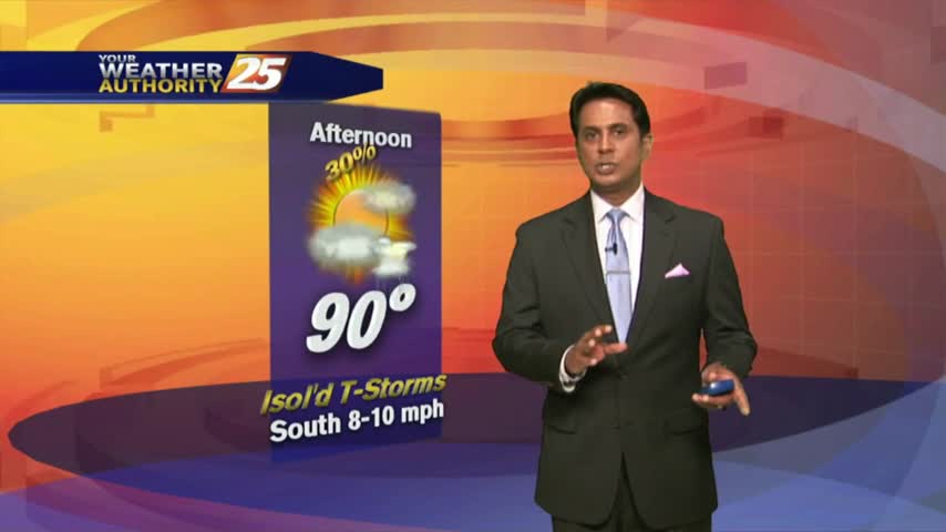
After a warmer start to the day, hot temperatures feel even hotter when we factor in the heat indices...
Above seasonal temperatures continue with the mercury climbing into the 90s this afternoon...
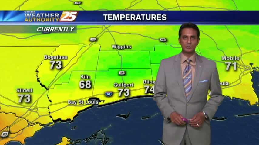
A lovely start to the workweek under clear skies and mild temperatures in the 70s...

After another beautiful start, rain-free conditions continue with only a few mid-afternoon t-storms ahead....
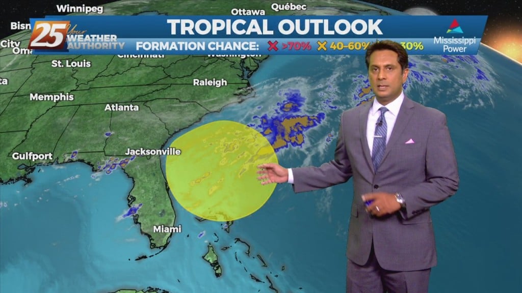
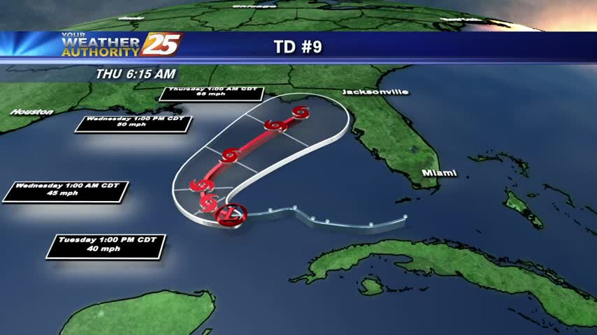
A mild start to the day as we continue to keep an eye on the tropics and Hurricane Florence making landfall in North Carolina...
After a clear start to the day and mild temps, it's going to feel hotter this afternoon with more of a humid wind flow...
A good bit of clouds moving south into the area earlier this morning has thinned considerable...as the temps skyrocket!
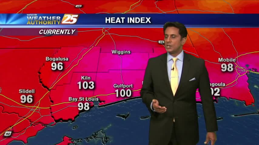
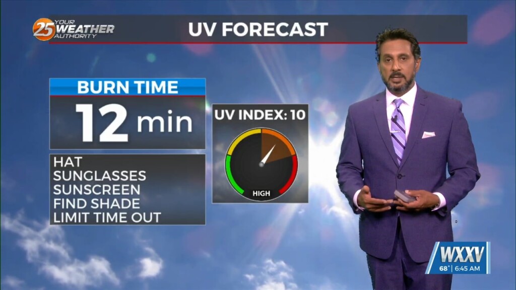
Things are getting HOT out there as the HEAT INDEX is now pushing 100 degrees...
Isolated showers and cloud coverage prior to sunrise cleared to the SE, with hot temperatures on-tap this afternoon...
A MUCH different start than 24 hours ago as cooler/drier air is moving into south Mississippi...
A BEAUTIFUL start to the day with mild temps and clear skies providing for a very nice sunrise...