7/6 – Rob Martin’s “Over The Hump With Rain?” Wednesday Night Forecast
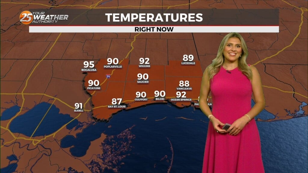
Persistence is the call with the forecast through Thursday. T-storm activity was limited today, and it’ll be more of the same tomorrow, although some downpours cannot be ruled out. Look for the morning to be fine, with any showers initiating from afternoon to early evening before fizzling out at night. Temps will nudge a bit higher, generally in the lower 90s.
High pressure is centered pretty much over our area as the disturbance that brought the heavy rainfall to portions of the area yesterday, is well to the west. High pressure at the surface and aloft will basically sit in place over the next several days. However, the high isn’t particularly strong, and the very humid air isn’t going anywhere. While we don’t have the early-week disturbances to enhance lift across the area, daytime heating should be more than enough to trigger a few storms by mid-day.
Activity will be spottier and occur a bit later Thursday and Friday afternoons. With slight drying over the next couple of days, temperatures will continue an upward trend.
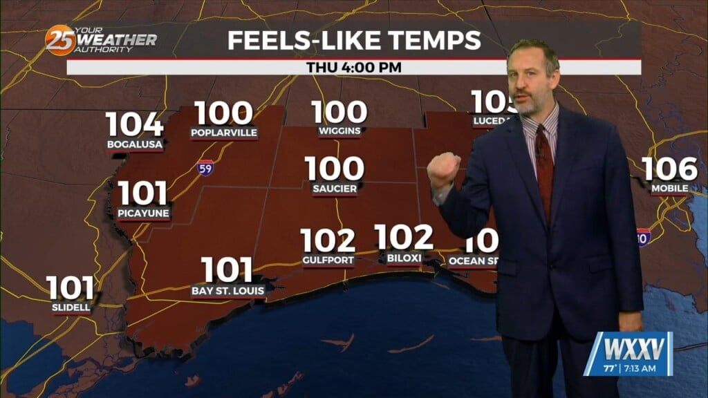
High pressure will continue to shape the forecast this weekend as temps will continue to max out the low 90s, with some mid 90s possible Friday and Saturday. With low level moisture still in place, HEAT INDEX values (real-feel temperatures) will be in 105-degree range Friday and Saturday. While enjoying the weekend outdoors, remember summertime safety tips as hydration, taking periodic breaks and keeping an eye on each other. Heat advisories will likely continue to our north.
An upper disturbance will try to move a cold front into the area Sunday or Monday. That’s somewhat unusual for July around here. It now appears that most of the area won’t really get the treat of lower humidity, so there will be a continuing threat of daily, daytime heat enhanced t-storms.