7/26 - The Chief's "Dome of High Pressure" Wednesday Morning Forecast
The pattern has change slightly as the cold front overhead dissipated overnight. The lower dew-points will remain with us as drier air will once again…
The pattern has change slightly as the cold front overhead dissipated overnight. The lower dew-points will remain with us as drier air will once again…
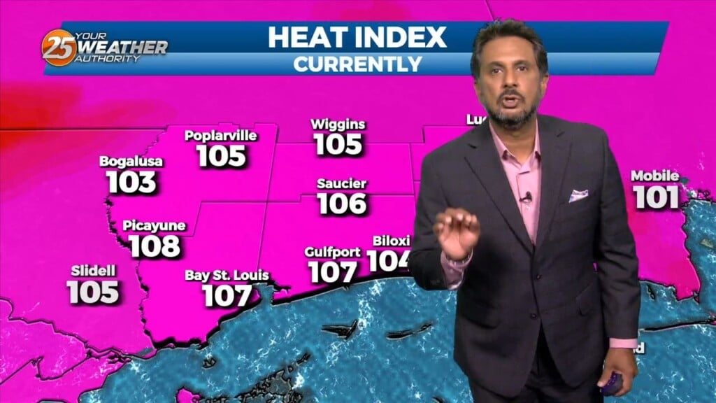
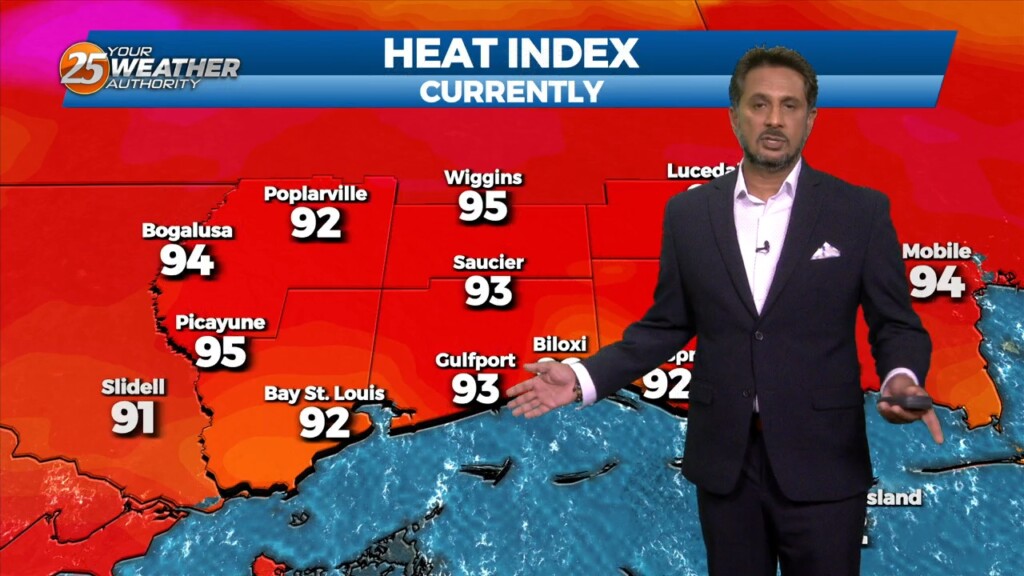
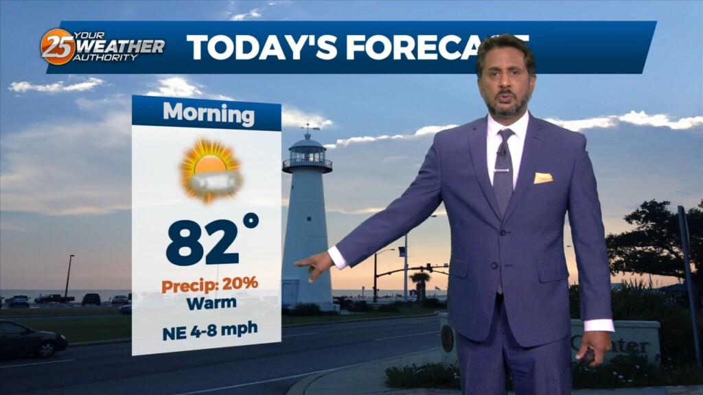
A HEAT ADVISORY is in effect once again this afternoon with heat indices between 106-112 degrees expected. Synoptically, the region remains under the influence of a large…
The short term is practically a rinse and repeat of the last day or two, with continued hot conditions expected. A HEAT ADVISORY is in effect…
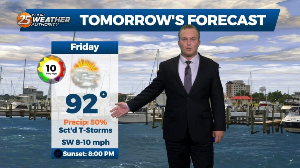
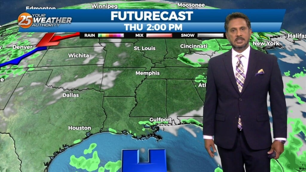
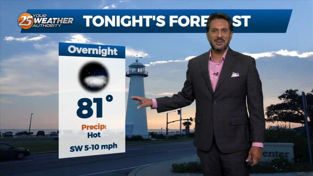
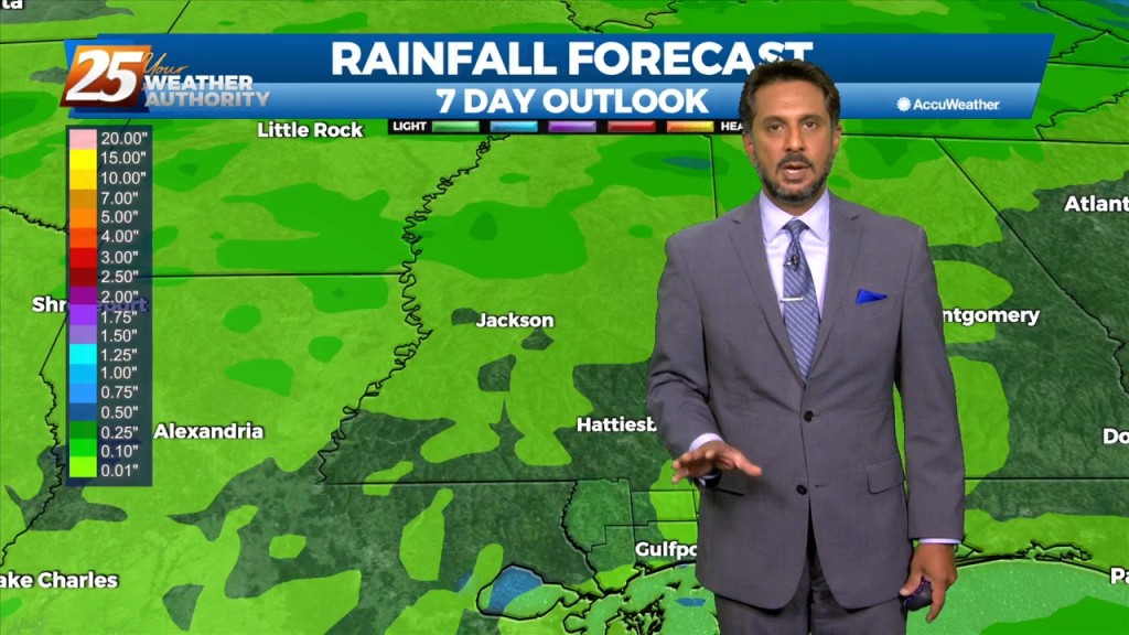
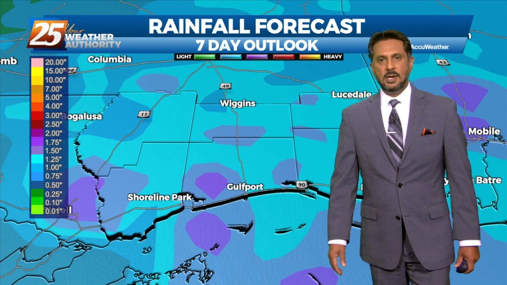
Humidity and cloud cover will remain dominant overnight. Rain chances should remain fairly isolated until the start of the day tomorrow. Friday will bring the potential for scattered…
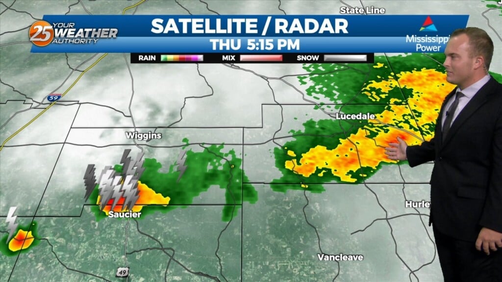
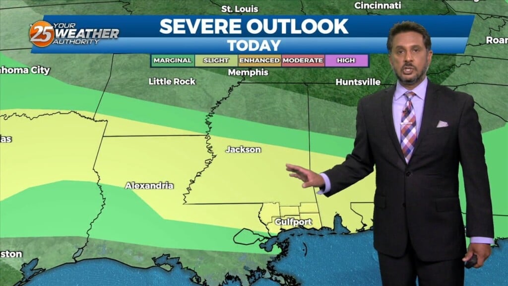
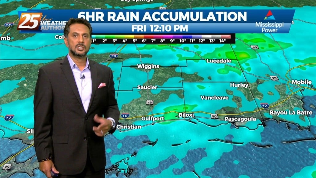
Scattered thunderstorms will be in our area for the early portion of this evening. Some thunderstorms could bring very heavy rainfall, and pack frequent lightning. A…
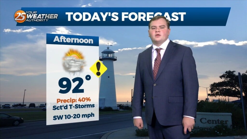
Another day of mid/late afternoon showers/t-storms, as high pressure to the south will continue to pump in the moisture. Temperatures may be a little higher than forecast...but…
Outflow boundary is firing new cells this morning where it meets the surface front just to the N/NW of our area. Stability should begin to increase over…
A Heat Advisory is in effect untill 7pm, showers and thunderstorms will bring relief to a lucky few. How long can our NW to westerly upper…
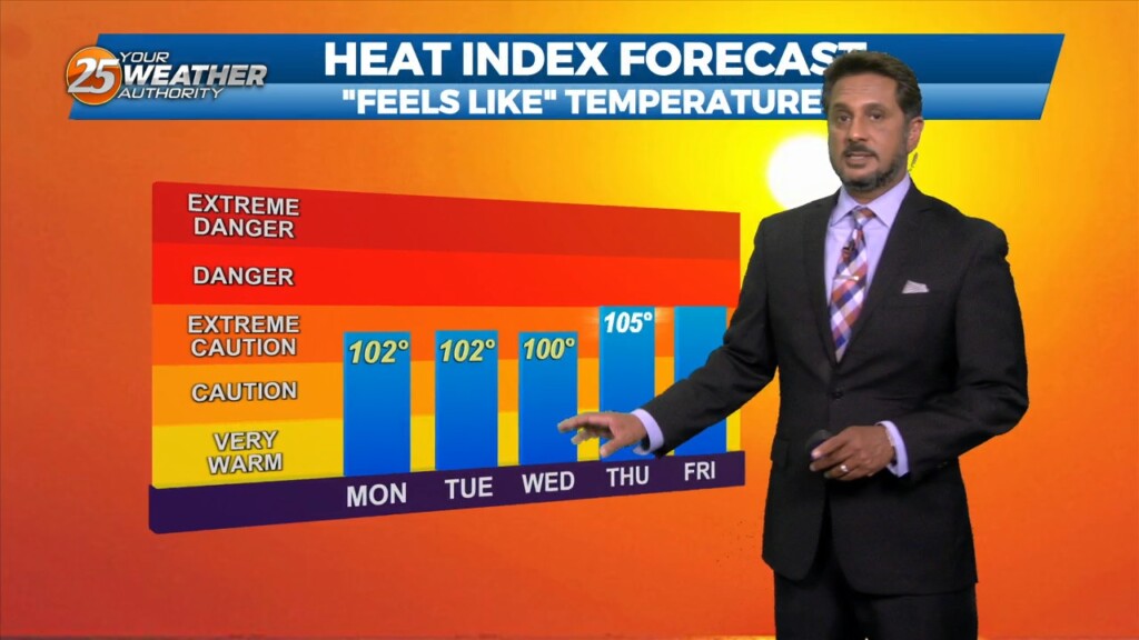
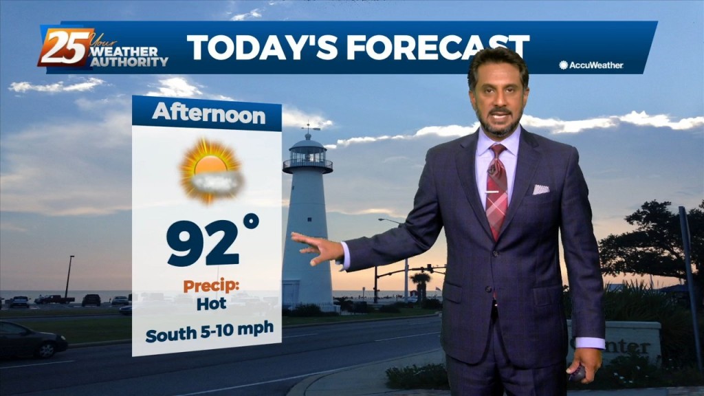
Very HOT temperatures ahead this afternoon as the HEAT INDEX will top the 100 degree mark. A stationary front coupled with daytime heating will pop afternoon showers/t-storm.…
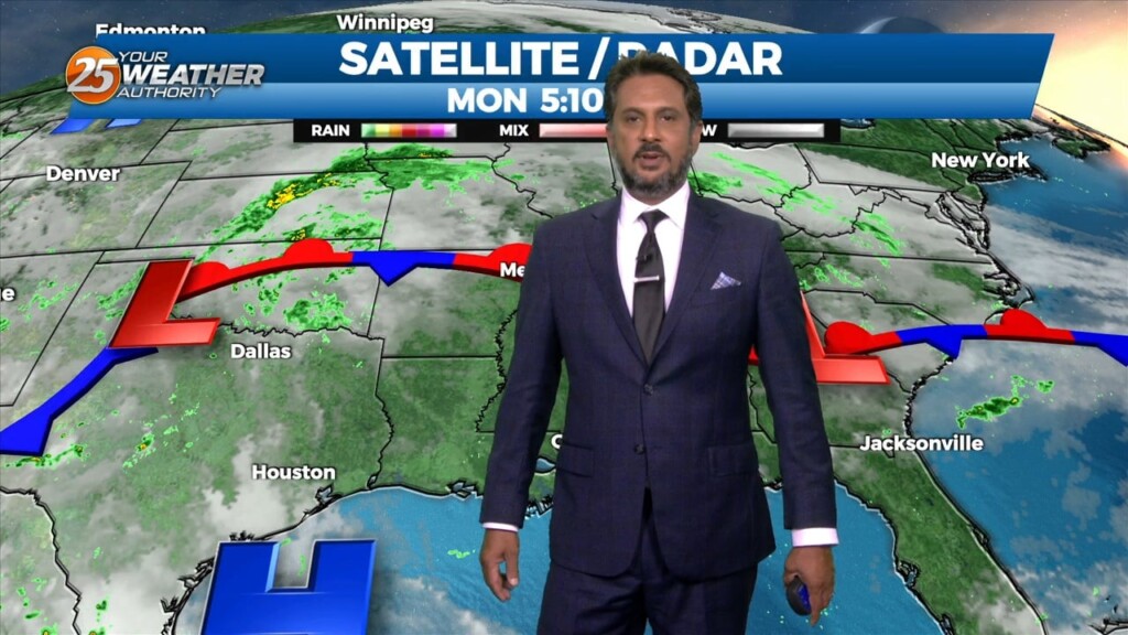
There is a low pressure system is in the Great Lakes region with a cold front draped just north of the area that has become stationary. This…
Hot temperatures heading into this afternoon with even higher heat indices values expected to max out closer to 100 degrees. High pressure across the…
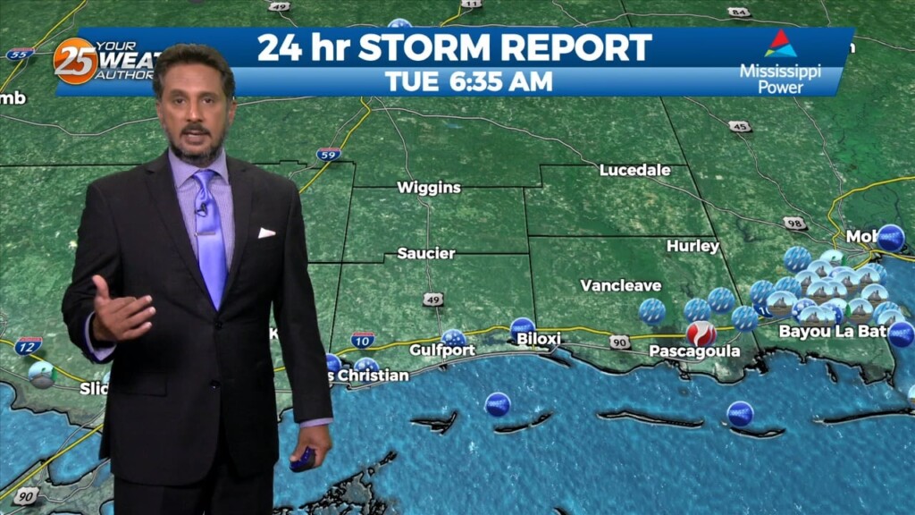
Some weak marine convection has developed near and east of the mouth of the MS River this morning. A few lightning strikes have occurred, but…
Mid-level dry air is moving into the area from the west this morning on the backside of the exiting upper level disturbance retrograding back to the…
An upper-level high pressure that has been parked over the area should break down throughout the course of today. Although the ridge should be breaking…

Dry conditions will continue trough the rest of the workweek thanks to the high pressure to the NE. Consequently, temperatures will be fairly warm for…
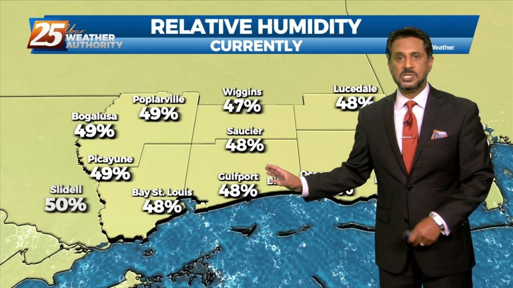
Northerly surface winds will help advect drier and more stable air into the area. Looking at the models, conditions will be dry over the next few days…
The forecast continues to be dictated by a strong mid-level high pressure situated over the south-central CONUS that is providing drier and warmer mid-level air to…
High pressure will expand across the southern US early in the week and should be centered across TX. An upper level weakness looks to clip…
The area is still under the influence of upper level weakness which is slowly moving east while further west has a large area of high pressure with…
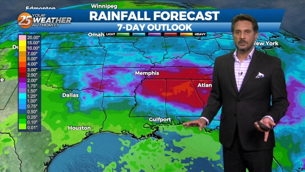
The best potential for rainfall, similar to Wednesday looks to be again along and west of the I-55 corridor later this afternoon. With the…
Heavy rainfall wording will remain with us as rates up to 4"/hr will be possible but most of this activity will be moving, so without lingering over an area or training, flooding will be less of an issue. But what could…
Water vapor imagery continues to show a plume of moisture extending from south Texas to the Carolinas, covering much of our area. The current disturbance that is…

The focus late this afternoon and evening will be on convective development to our north and east, moving into south Mississippi. A zone of low-level convergence oriented…

Hot and dry again on today for most of the day. No real distinct changes in the overall profile of the atmosphere. This subsiding dry layer has…