7/26 - Rob Knight's Wednesday "Midday News" Forecast
After a rain-free start to the day, HOT and HUMID conditions are along the Mississippi Gulf Coast...
After a rain-free start to the day, HOT and HUMID conditions are along the Mississippi Gulf Coast...
This morning brought partly cloudy skies to the area with isolated t-storms to the south. With daytime heating, the activity will develop on shore this afternoon...
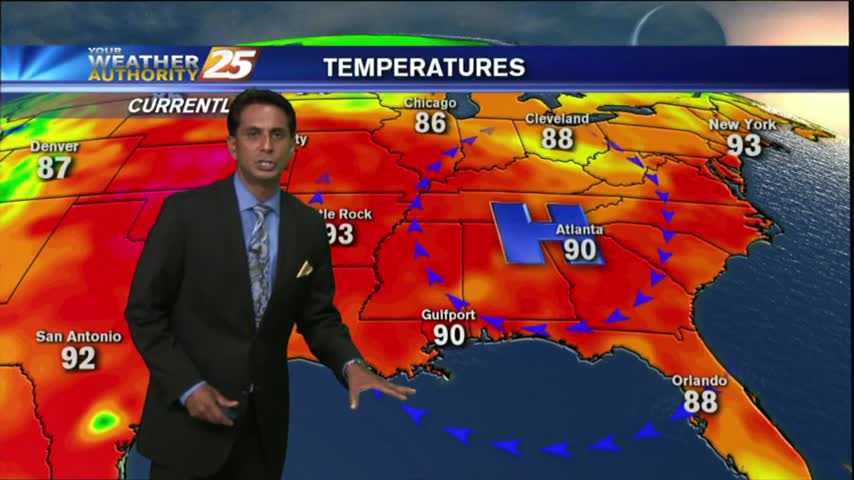
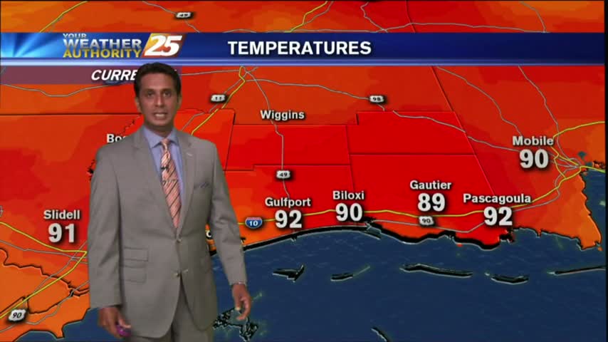
HOT conditions continues along the Mississippi Gulf Coast with the HEAT INDICES pushing the 100 degree mark once again this afternoon...
As the cold front begins to slow down and stall in central Mississippi, areas of PATCHY FOG has developed along the southern 6...
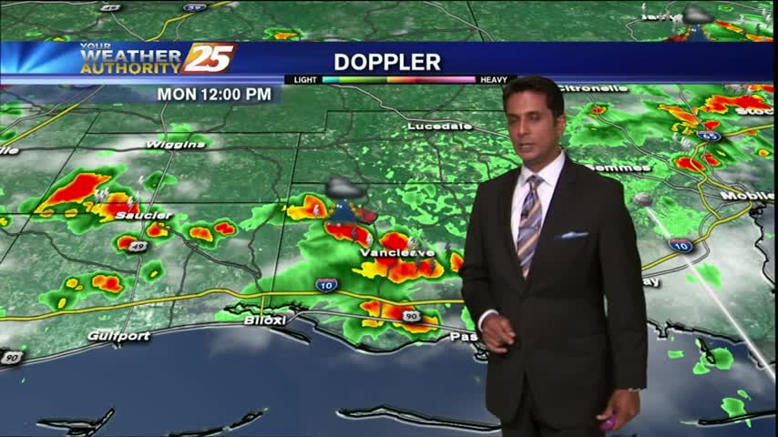
Humidity has been on the increase over the past couple day...this afternoon HOT conditions will trigger a few t-storms...
As low-level humidity continue to increase, it's a warm & humid start with areas of PATCHY FOG...

After a southerly wind much of yesterday, increasingly humid conditions have developed with warm temps...
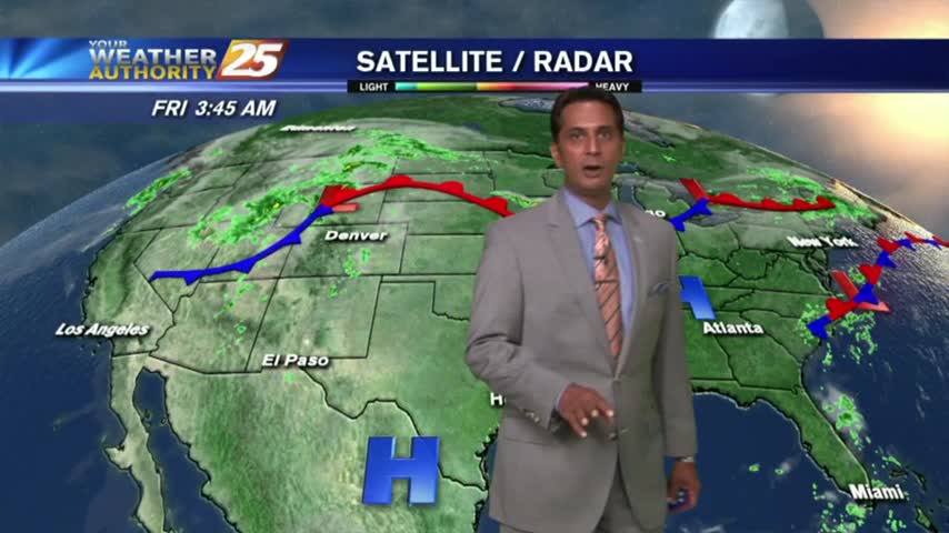
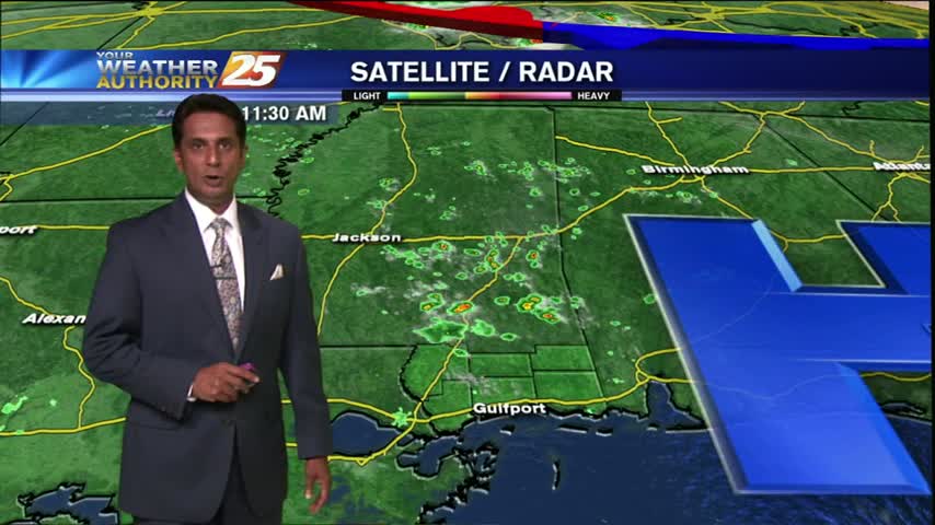
Early morning showers and t-storms continue over the northern Gulf and sound...moving to the NW.
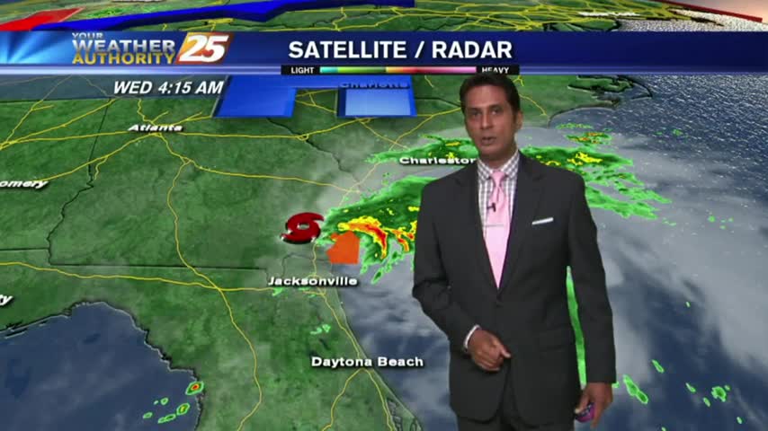
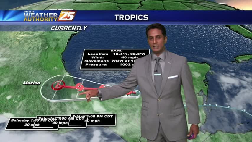
As TS HERMINE moves NE into Georgia, a drier wind and hotter temps will affect south Mississippi...
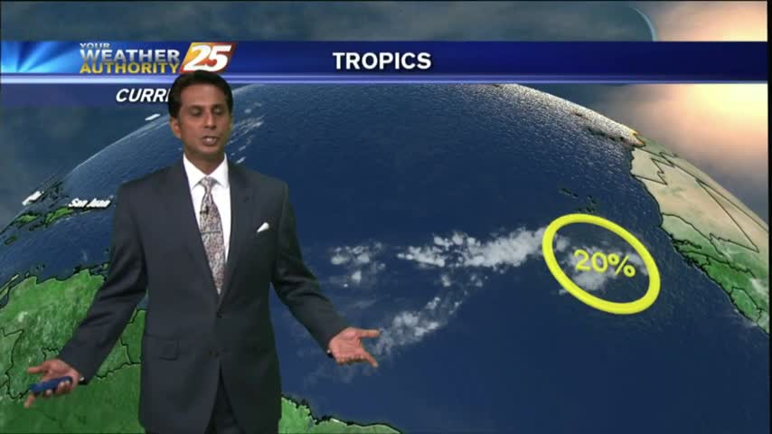
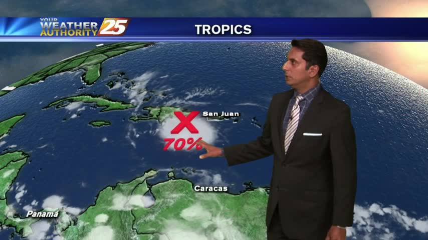
After a cloudy and rainy Sunday, it's a mostly clear start as TD #9 is now in the SE/tern Gulf...
Warming temps with low-level moisture heating into a cloud deck...
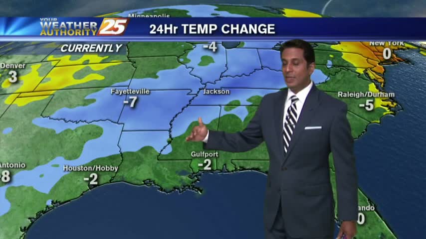
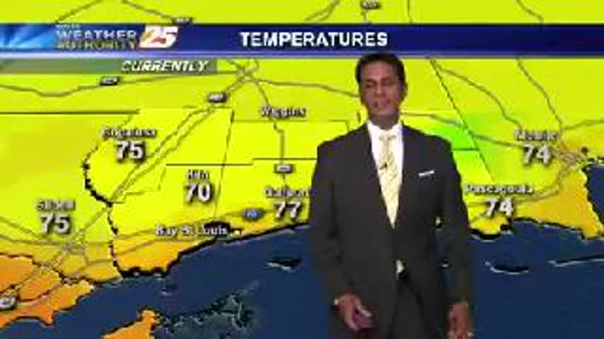
Slightly cooler start this morning as temps are in the low 70s with a pleasant NW wind, BUT hot & humid will continue...
A HUMID start with a few t-storms over the sound, and areas of light fog on-shore...
Early morning activity began to dissipate...but flaring back up with daytime heating.

A HOT & STEAMY day as we head into the weekend, with showers and t-storms continuing...
High-pressure continue to suppress the atmosphere, providing partly cloudy skies and HOT conditions...
A drier start this morning with showers over the NW'tern Gulf of Mexico...
After a warm and humid start, showers developed earlier...now becoming t-storms with daytime heating...
A humid start with isolated showers moving in from the sound has brought areas of fog...

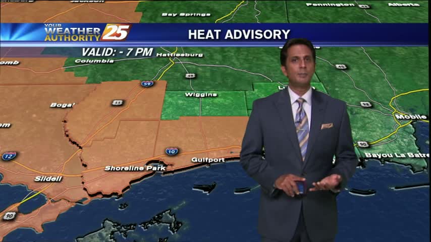
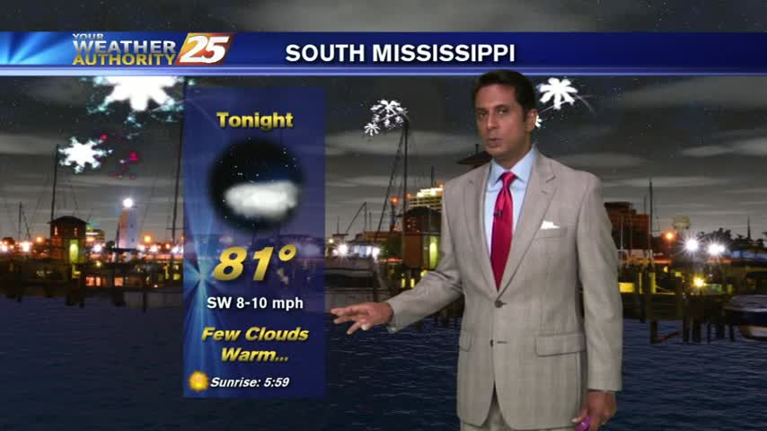
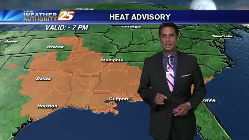
At this point we are still under a heat advisory until 7 PM, though sadly the forecast calls for even more hot & humid days. Tonight will be slightly cooler than it was last night, low near 80, with cloud…
Temps continue to rise as showers and t-storms pop in the local area and over the sound...
A warm and humid start with a few light coastal showers to kick-off the 4th of July...
Another fairly pleasant start as a NW wind brings drier and slightly cooler conditions to the area...
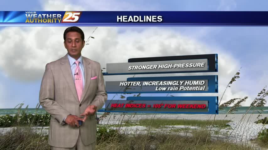
The HEAT WAVE continues as HEAT INDICES are well over the 100 degree mark, a HEAT ADVISORY is in effect...