11/19 Ryan's "Heavy Rain" Tuesday Morning Forecast
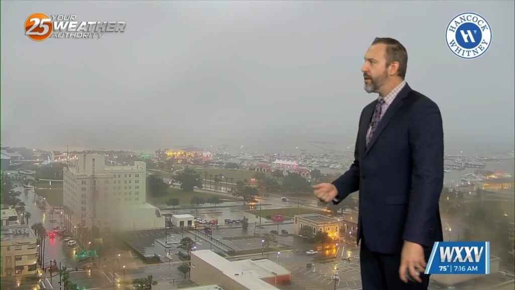
The rain started last night, but we're just now getting our heavy rain as showers and thunderstorms pop up along this morning's cold front. We're still under a level…
The rain started last night, but we're just now getting our heavy rain as showers and thunderstorms pop up along this morning's cold front. We're still under a level…
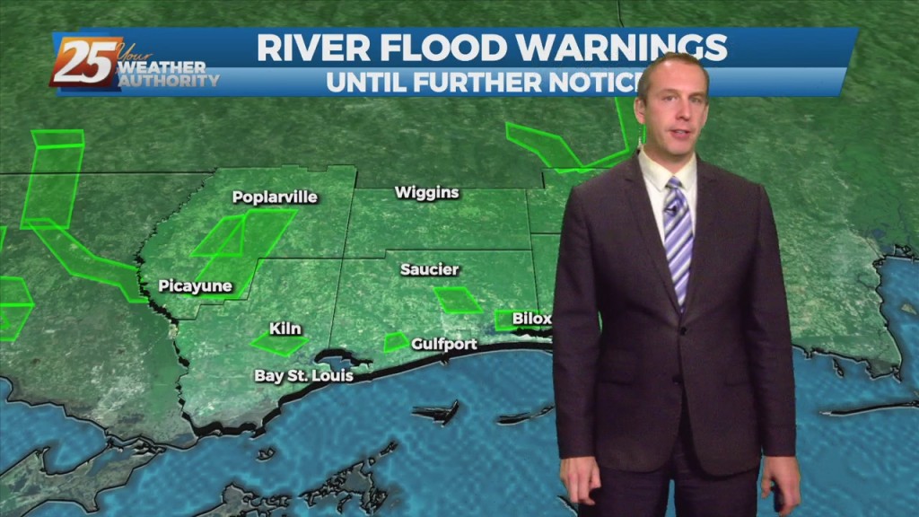
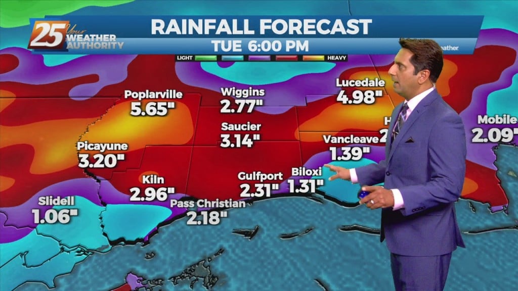
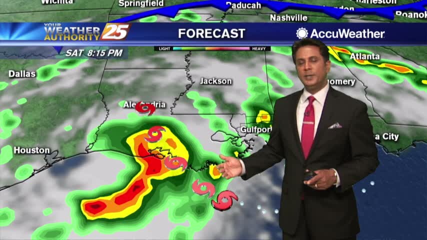
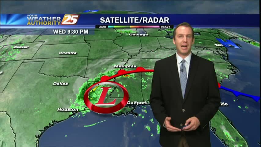
Flood watches remain in effect across South MS as more and more rain moves through. Several inches have already fallen since early this morning, mostly in East Harrison…
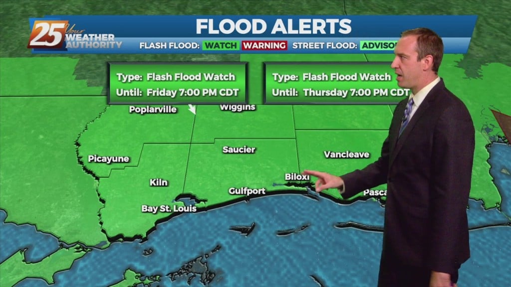
Flooding woes have popped up and will continue across South MS as more and more rain moves through. Several inches have already fallen since early this morning, mostly…
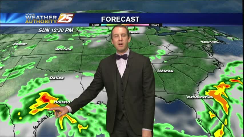
A stationary front will continue to slowly move south and southeastward through the plains to mid/lower Mississippi Valley area, just north of the forecast area during the period. This should lead to widespread coverage of showers and thunderstorms each day.…
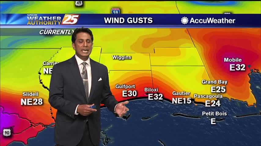
Numerous areas in South Mississippi dealing with flash flooding and flooding along Hwy 90...
A warm, humid and cloudy start with isolated showers moving in from the SW...
It's a cloudy start this morning as a cold front will move through south Mississippi later today...

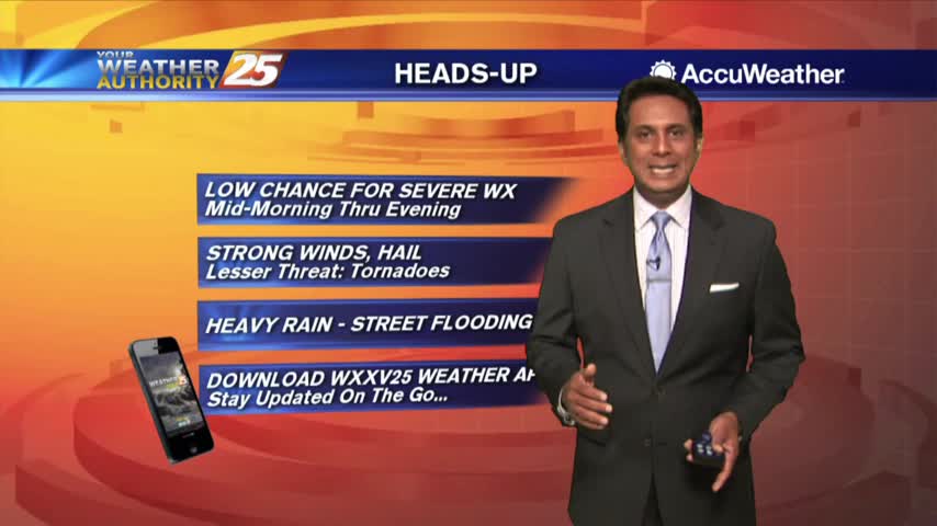
Today started rather nice but those potentially severe storms we've been expecting will begin to move in tonight....
We have only seen minimal activity thus far, but it will continue to develop this afternoon...
Severe weather began popping up in the early afternoon, but didn't see much more through the evening and only a few showers & storms are likely overnight. Full forecast inside.
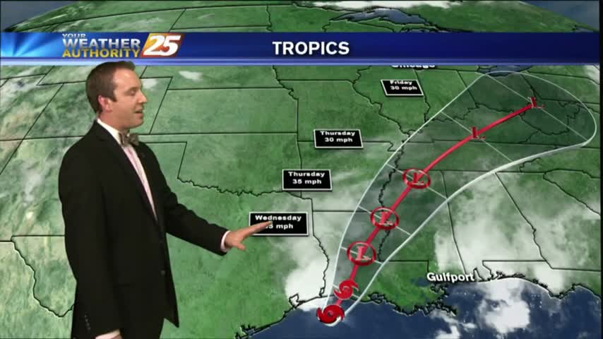
Tropical Storm Harvey continues to push East, and comes close to home on the anniversary of Katrina before moving inland. Rains expected locally, but you'll have to watch the full forecast for details.
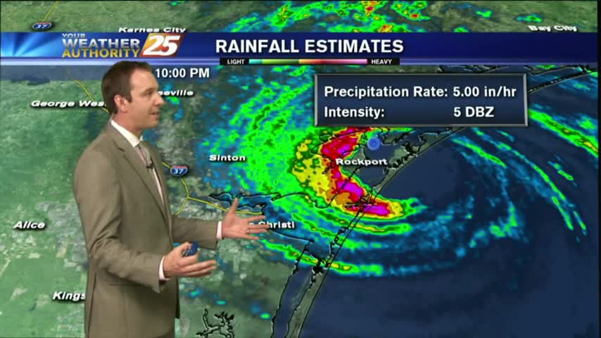
Category 4 Hurricane Harvey officially made landfall tonight, and is slowly roaring through the town of Rockport, TX. Click the forecast link for a full report, as well as local effects.
Harvey continues its rapid intensification, and will strike Southeastern TX overnight tomorrow. We'll see some enhanced rain locally, but you'll have to click the link for details.
HEAVY RAIN has tapered-off quite a bit but the activity is still in the area with several watches/warnings still in effect...
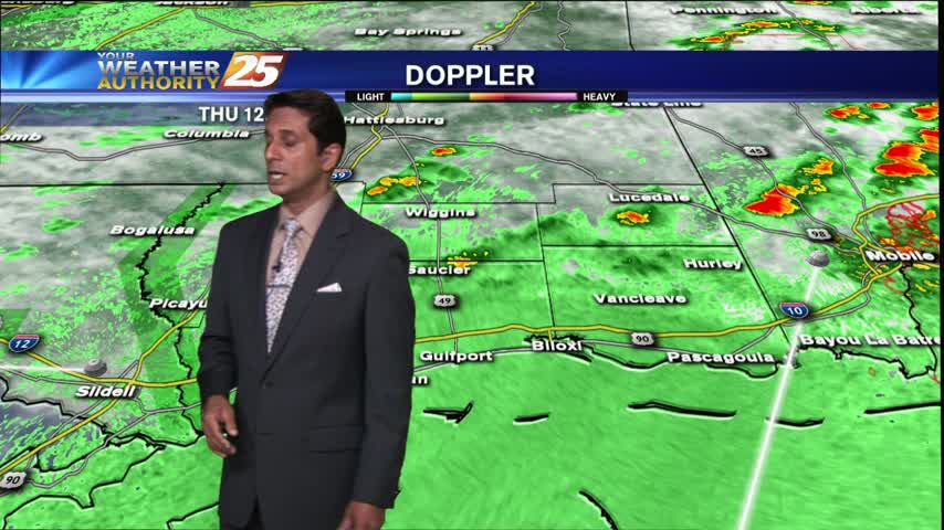
Isolated activity continues but with daytime heating...the activity will flare-up and become more widespread...
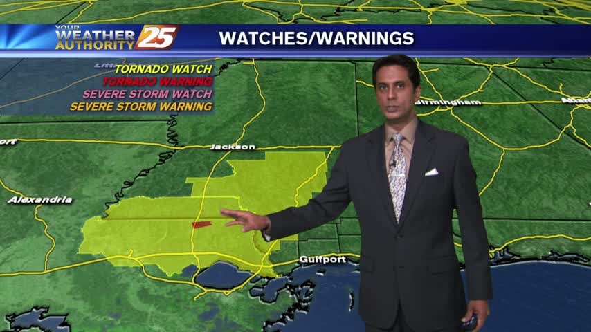
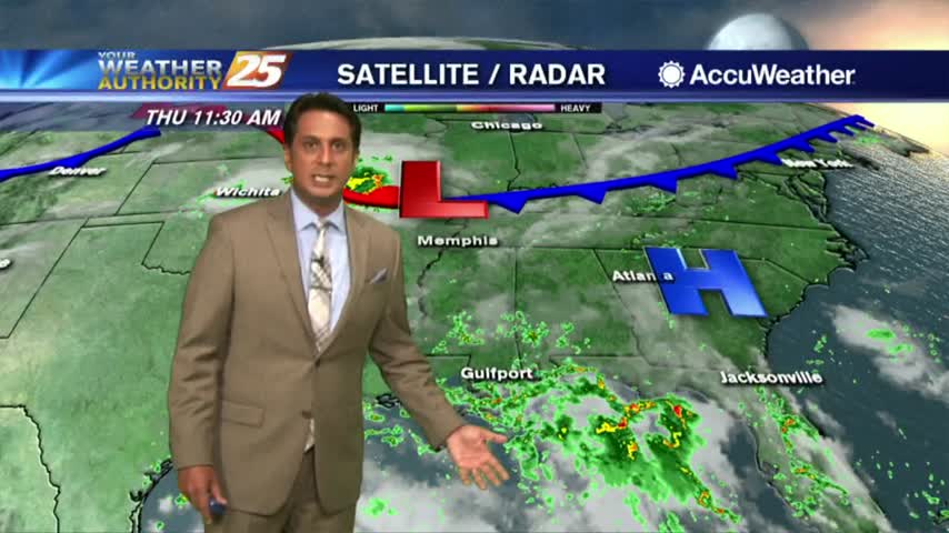
T-Storms with heavy rain north of the viewing is moving south with a TORNADO WATCH in effect...