7/6 - The Chief's "Hot & Wet" Thursday Afternoon Forecast
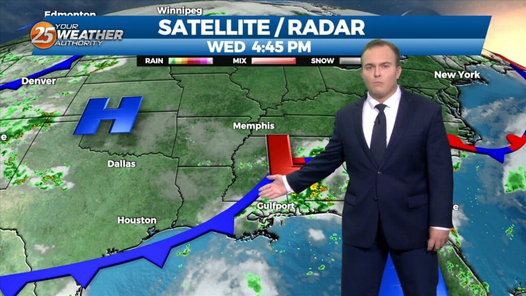
Showers/t-storms will once again ramp up this afternoon with daytime heating. High pressure is still in place but there has been just enough of a weakness…
Showers/t-storms will once again ramp up this afternoon with daytime heating. High pressure is still in place but there has been just enough of a weakness…
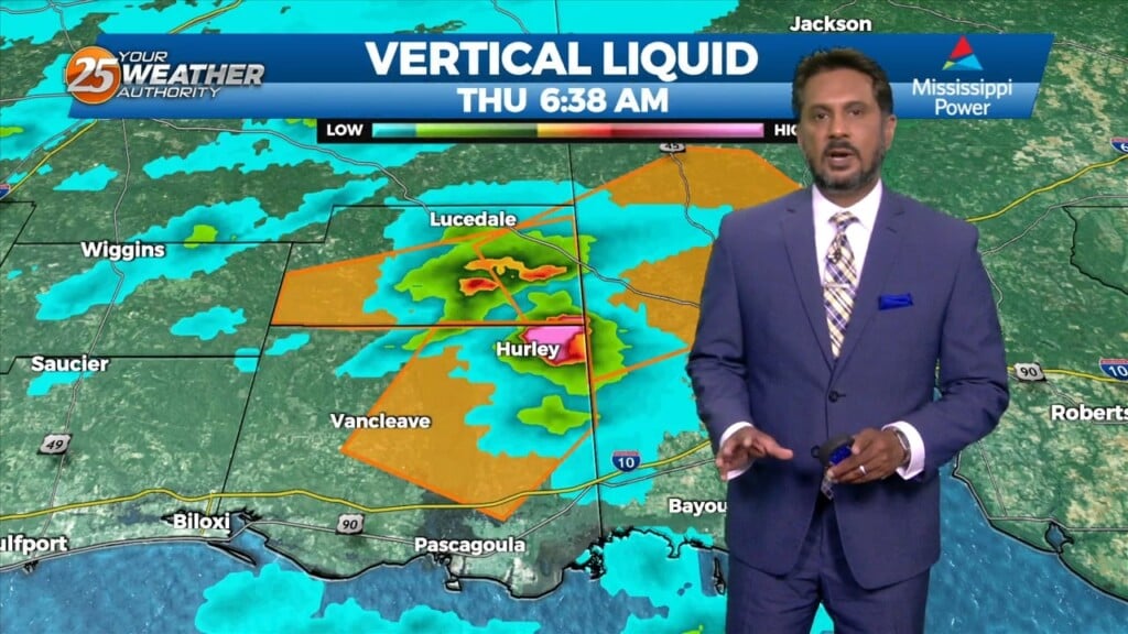
Spotty Showers continue through the area this morning, as radar is indicating activity in the vicinity. This activity will continue through this morning with the activity…
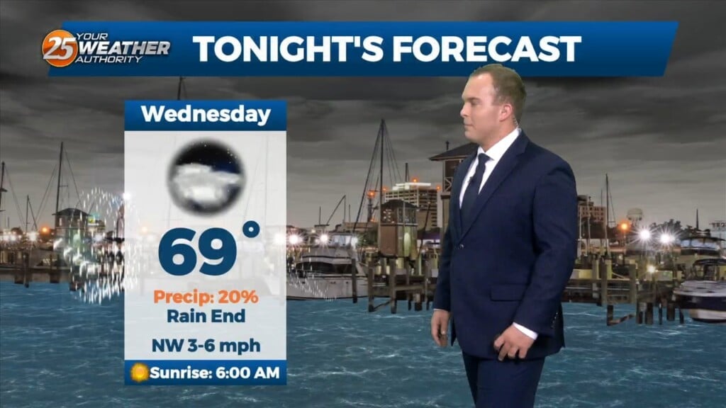
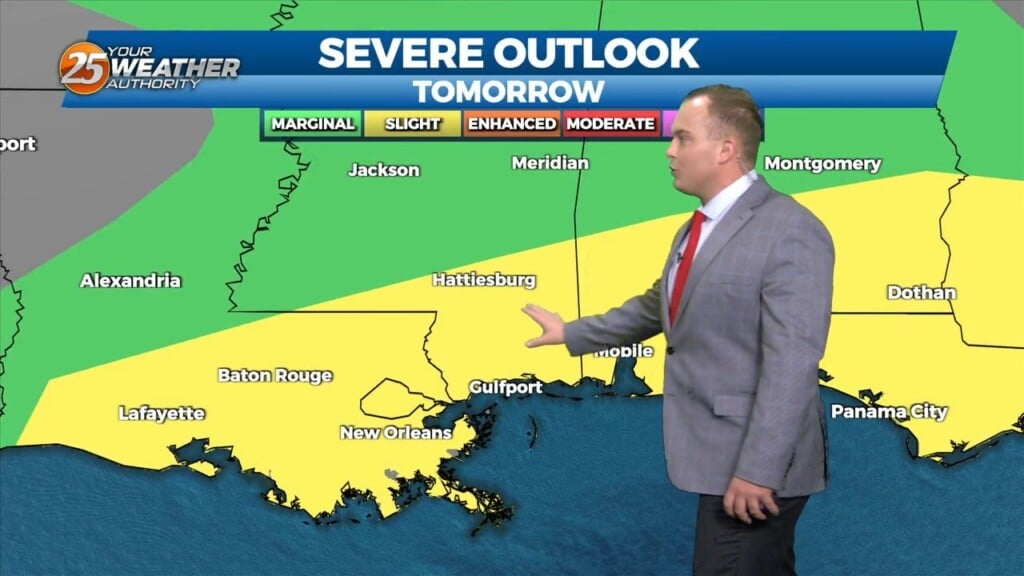
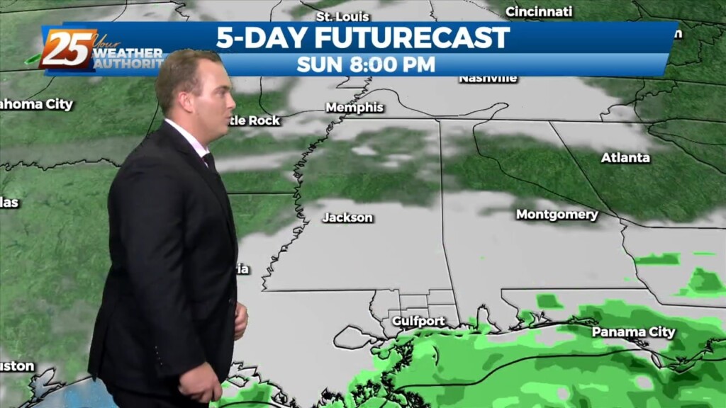
Mostly cloudy skies will be around overnight. Rain chances will gradually come to an end. Rain chances can be expected to begin again around noon tomorrow. Your…
Thunderstorms will wind down this evening as the peak heating of the day goes away. Cloud coverage will remain dominant overnight. Winds will shift to out of…
Other than isolated showers and thunderstorms at times, it will be fairly quiet overnight until rain chances elevate around daybreak. Scattered to numerous showers and thunderstorms will…

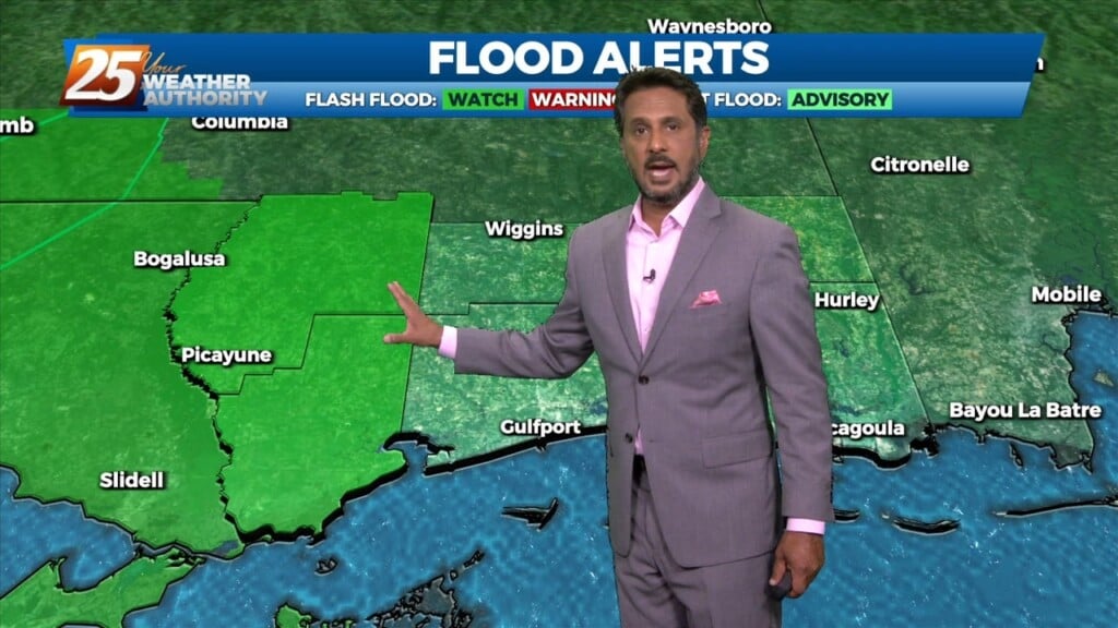
Shower and thunderstorm chances will continue to drift inland between now and the evening hours as the sea breeze clears Coastal Mississippi. You can still expect…
There is a disturbance in the pattern located in our area this morning. This disturbance will move SW just a bit and should be located…
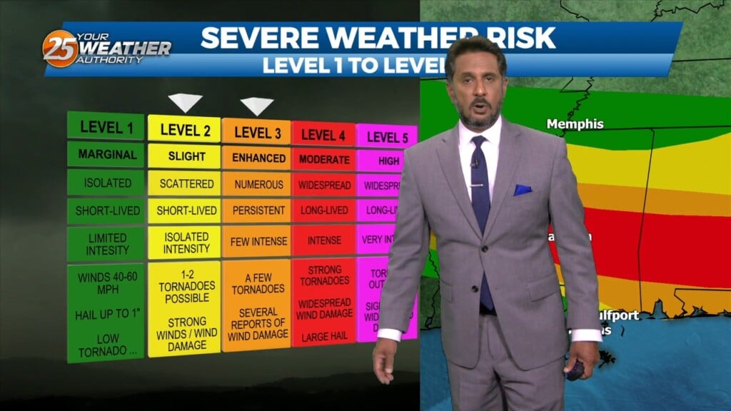
There is plenty to talk about in the first 24-48 hours with a challenging forecast ahead. An impulse riding SE along a stationary front to the…
Widely scattered shower and thunderstorm activity will come to an end overnight as a weak cold front will make it through South Mississippi. Other than a wind…
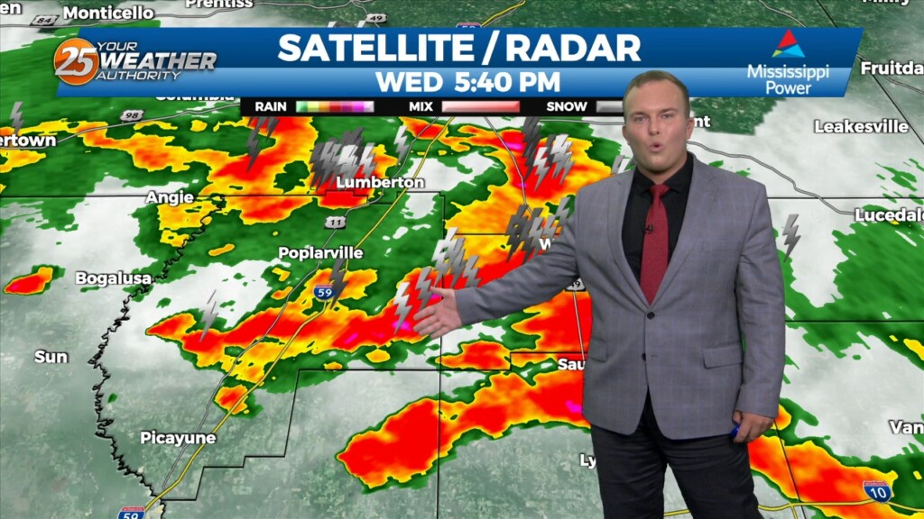
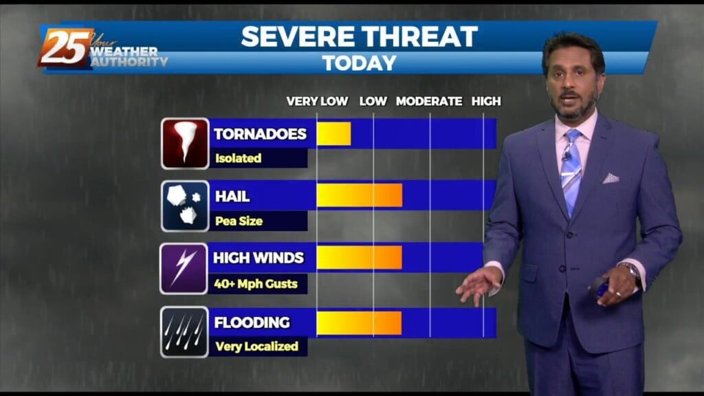
Showers and thunderstorms have been around since just before noon. Frequent lightning, torrential rain, and occasional gusty winds and hail have accompanied the activity. As we head through…
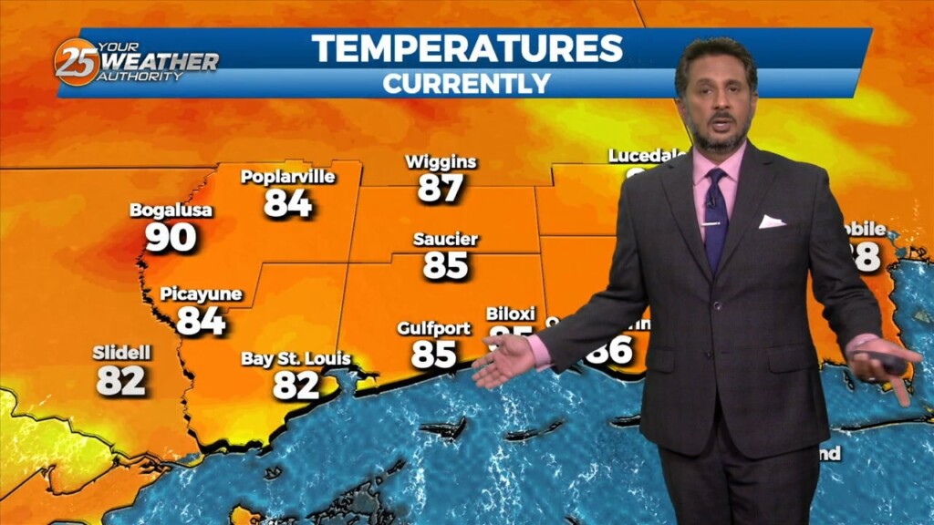
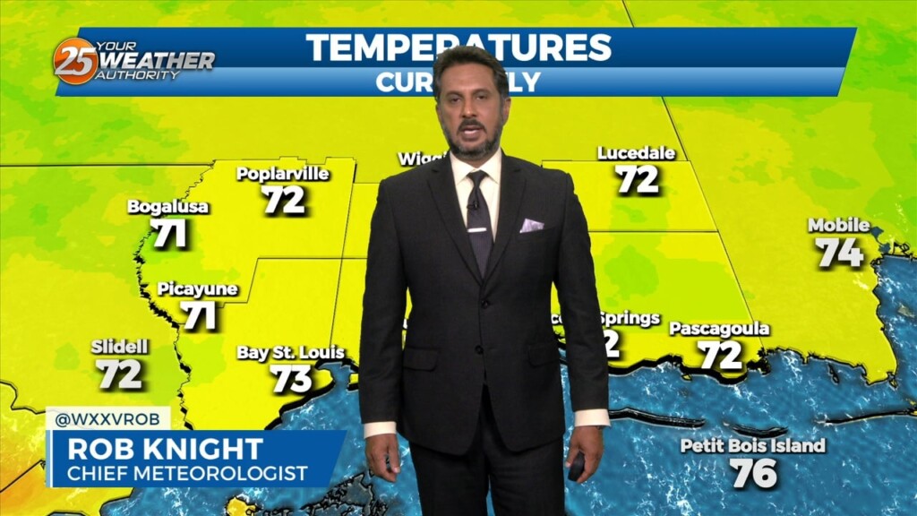
Surface warming will once again commence bringing us to convective temperatures in the upper 80s by noon, however, more abundant high clouds may just keep us…
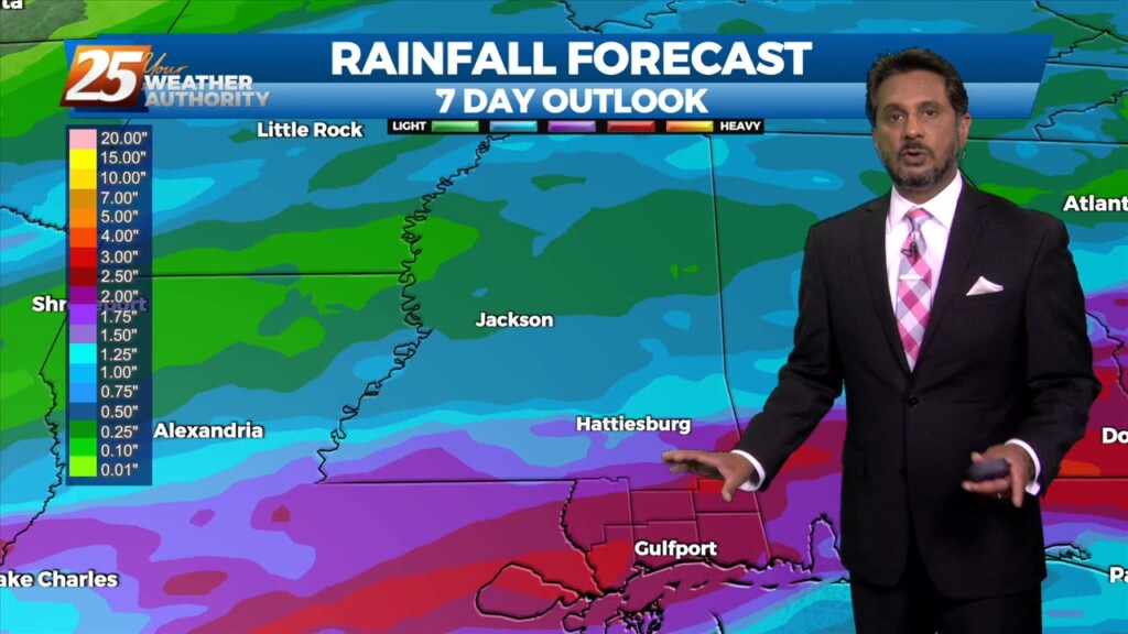
This pattern will be in place today through Sunday. This onshore flow regime will advect in a substantially more humid airmass into the area today and…
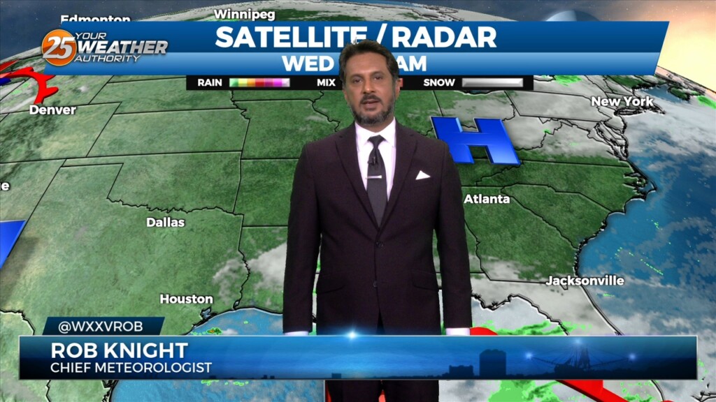
A very persistent pattern of weak upper level high pressure with passing disturbances will continue through the Lower Mississippi Valley. This pattern will be…
A weakening upper low currently moving through the Central Plains will continue east across the lower/mid-Mississippi Valley this afternoon and evening. With increasing low level moisture, cooling…
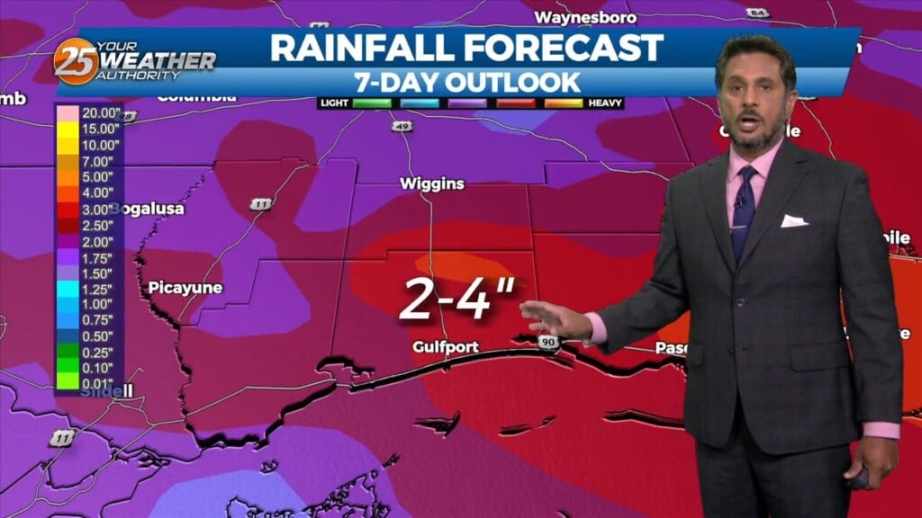
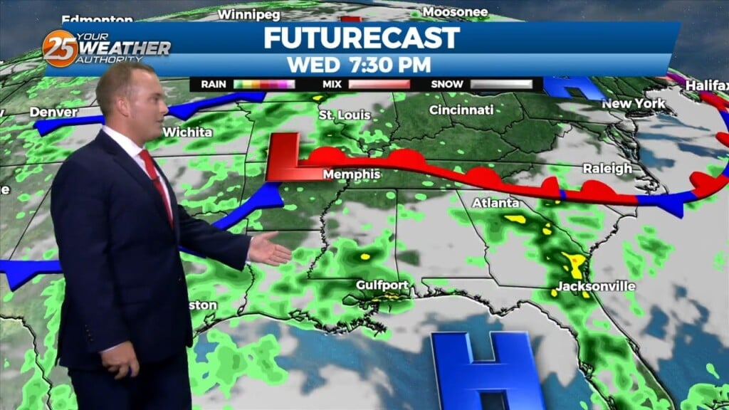
Cloud coverage will increase tonight ahead of a complex of thunderstorms that will move in. Expect rain to move in around daybreak tomorrow and persist through much…
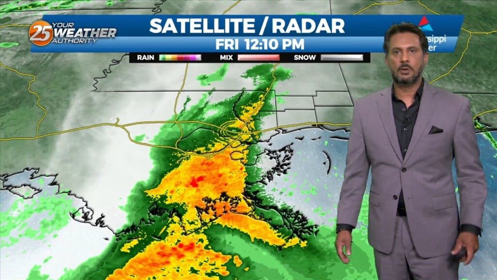
A surface, a cold front will slowly move across the area with a nearly solid line of showers and thunderstorms this afternoon. The main…

A surface low pressure is developing over the central gulf at the moment but this will move north today with an explosion of storms offshore of the…
The upper low is now beginning to cut off from the base of the upper disturbance and should wobble but remain over or near the TX/LA…
Today, eyes will be focused upstream as a mid-level impulse begins to move near and over the region. This feature along with the surface convergence along…
Elevated winds have backed off somewhat this evening. Cloud coverage will continue to build, and lower again overnight. Warm and muggy conditions will be around in the…
We continue to see scattered t-storms develop along a boundary well to the southwest, with strong to severe storms noted over the Gulf of Mexico to…
A meandering frontal boundary currently located just north of the area in south-central Mississippi and central Louisiana will drift southward this morning in response to a…
Clouds and patches of fog are back this morning. Winds will elevate to gusts of 25 MPH this afternoon. Some peeks of sunshine can be expected later…
A line of showers/t-storms to the west associated with an approaching cold front will move into through area this morning into early afternoon. A…