1/17 - The Chief's "It's Way TOO COLD" Wednesday Morning Forecast
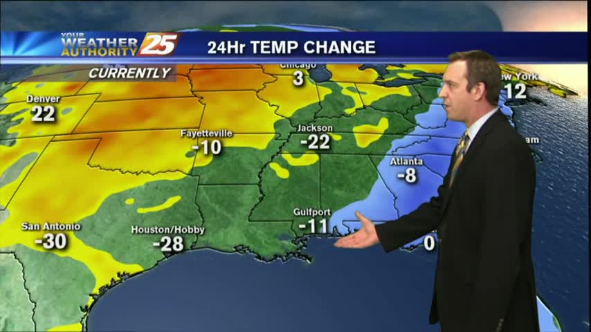
A very deep longwave pattern still encompasses almost ¾ of the country with the apex now east of the Mississippi River Valley. This feature has…
A very deep longwave pattern still encompasses almost ¾ of the country with the apex now east of the Mississippi River Valley. This feature has…
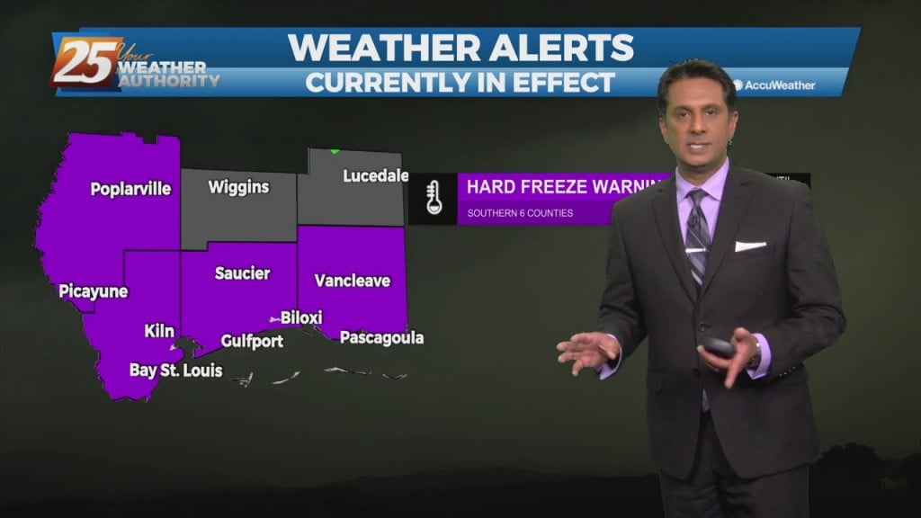
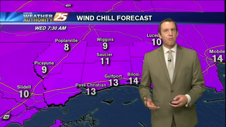
Bitterly cold temperatures continue overnight along with a Hard Freeze Warning and Wind Chill Advisory. Temperatures in the teens will feel like the single digits tomorrow. Bring…
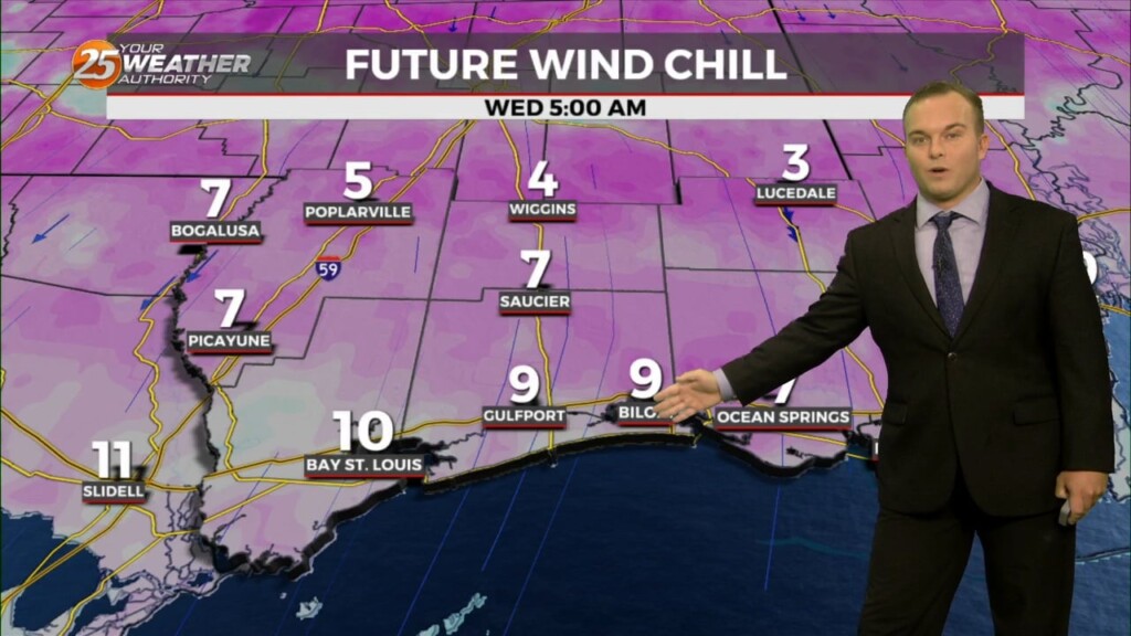
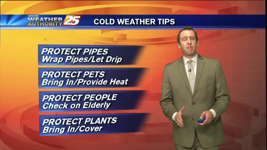
A Hard Freeze Warning goes into effect at 6 PM and carries through 10 AM tomorrow. Be sure to bring in pets, plants, protect pipes with a…
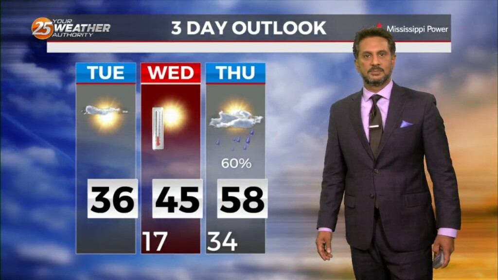
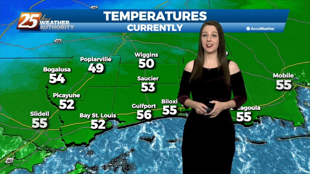
WIND CHILL & HARD FREEZE WARNINGS in effect tonight... Temperatures will struggle to warm into the 40s this afternoon especially with a strong north wind…
A Winter Weather Advisory is in effect for our area until 9 AM. There will be the possibility of light freezing rain leading to some icing concerns,…
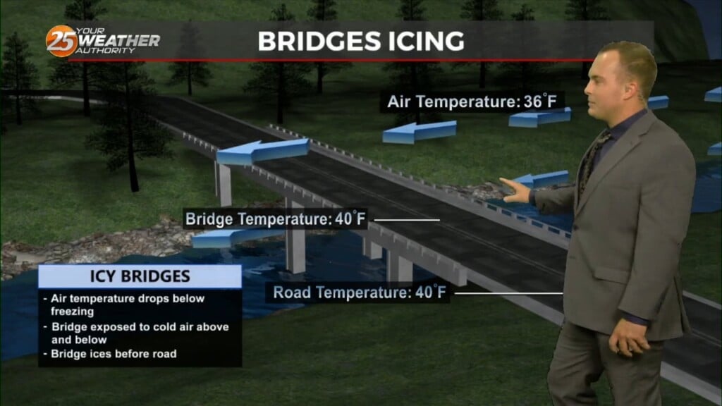
A Winter Weather Advisory is in effect for our area tonight until 9 AM Tuesday. There will be the possibility of light freezing rain leading…
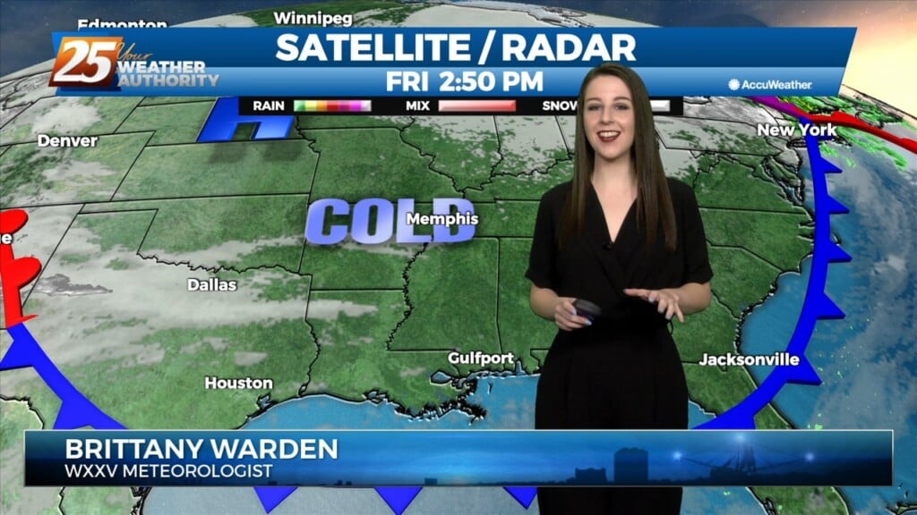
A large upper level disturbance encompasses about the northern half of the country, with relatively zonal flow across the southern half of the country. The next…
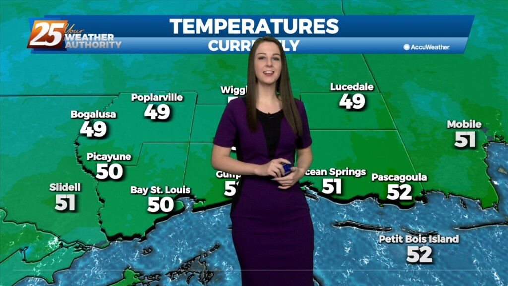
A hard freeze is in store for many of us yet again. Plants, pets, people, and pipes need to be protected with inland temperatures in the 20s.…
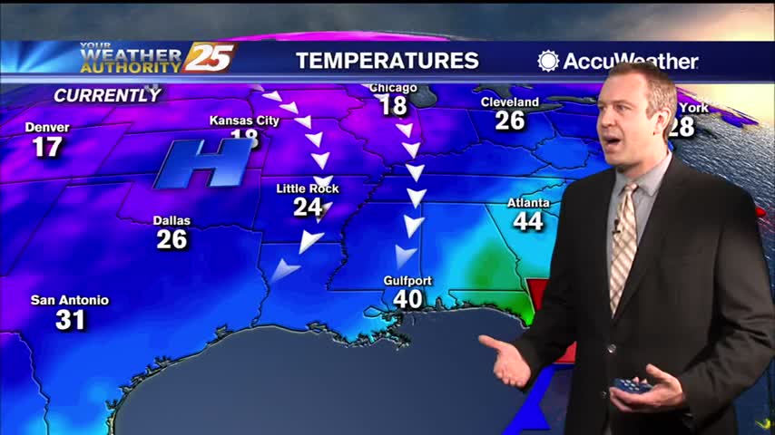
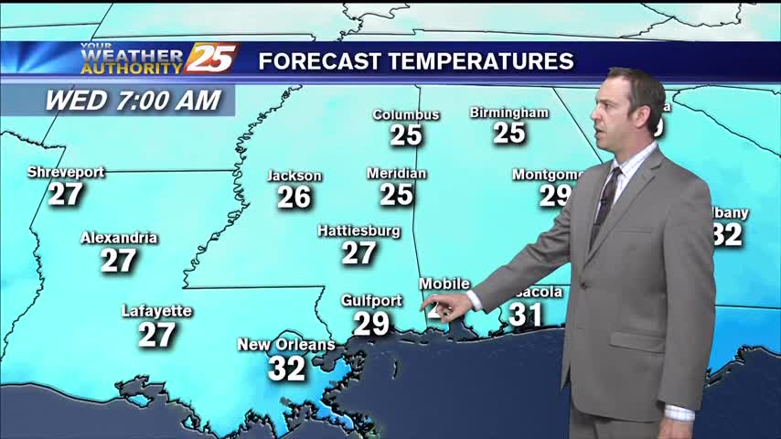
The very VERY COLD Arctic air mass brought bitter cold conditions to the region last night, with high temperatures earlier today only maxing out in…
The very VERY COLD Arctic air mass brought bitter cold conditions to the region last night, with high temperatures earlier today only maxing out in the low to…
Temperatures are still moderate by the 10 o clock hour but an approaching cold front will push through our area by midnight and it'll usher in…
The quiet portion of the forecast is now. The sfc low plaguing the area yesterday has moved into the northeastern Gulf and weak high pressure is back…
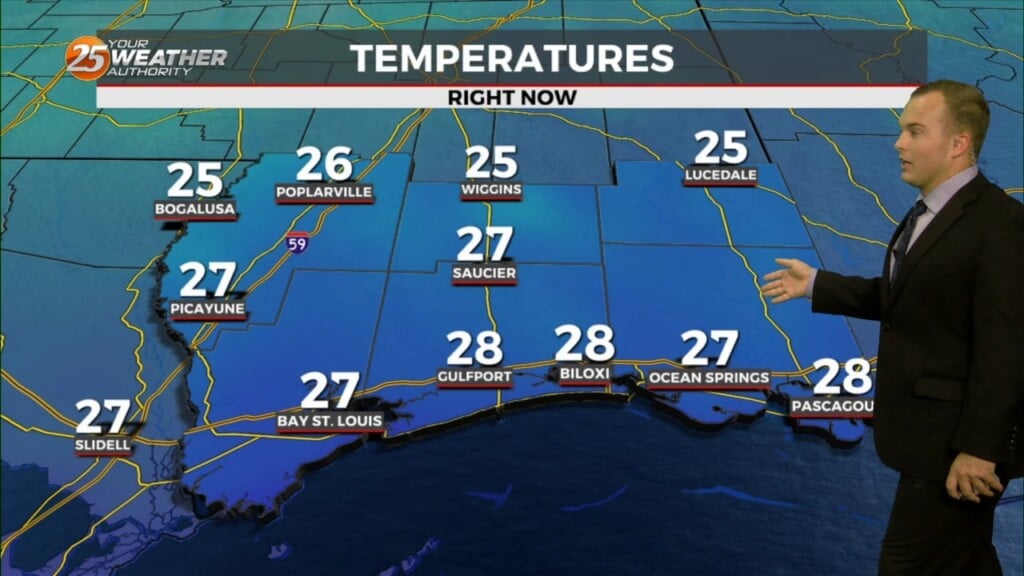
TONIGHT: Harrison & Jackson counties will be under a FREEZE WARNING beginning at 10pm, lasting through 8am. Temperatures could drop as low as 28 degrees. Pearl River &…
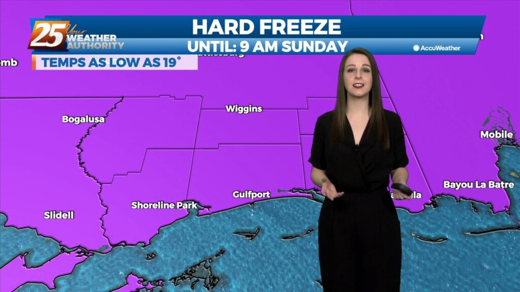
A HARD FREEZE WARNING in effect TONIGHT and SATURDAY NIGHT A deep layer northwest flow pattern will persist through Sunday, this will allow for continued cold…
Temperatures warmed for the last couple of days and nights, but now we start going the other direction, but this trend won't last long either....
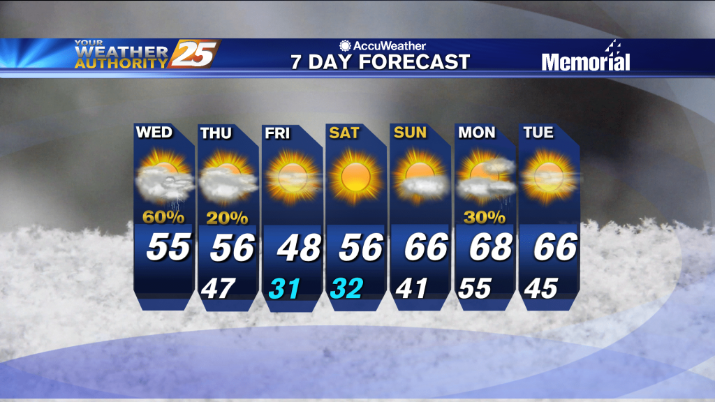
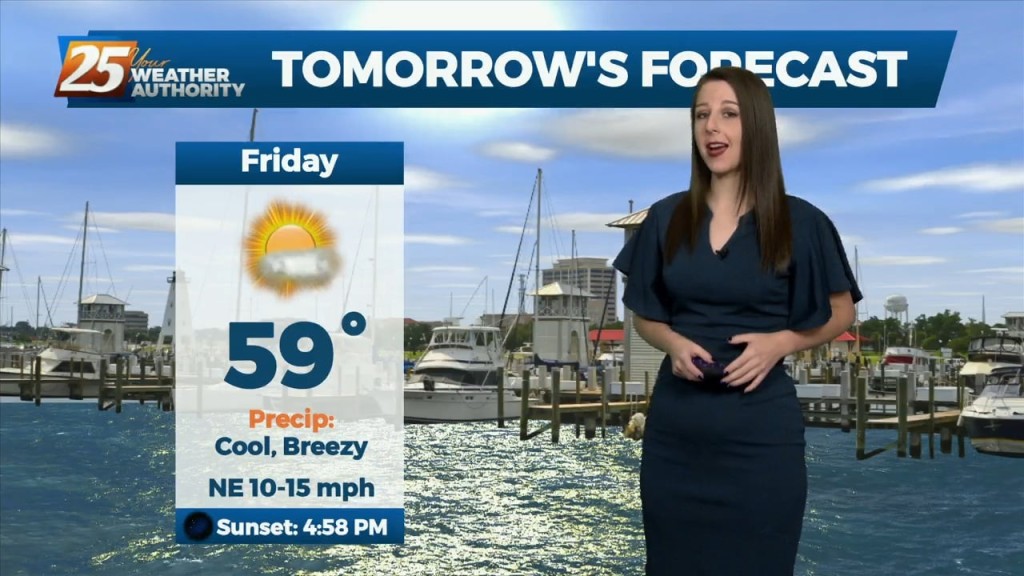
Going to be another exceptionally cold night by South MS standards, but it is warming.
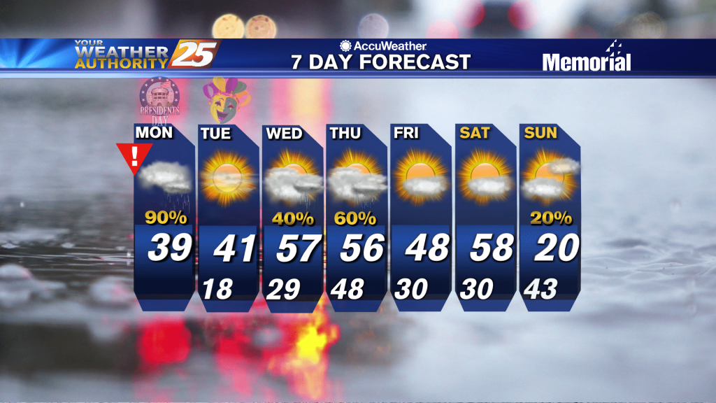
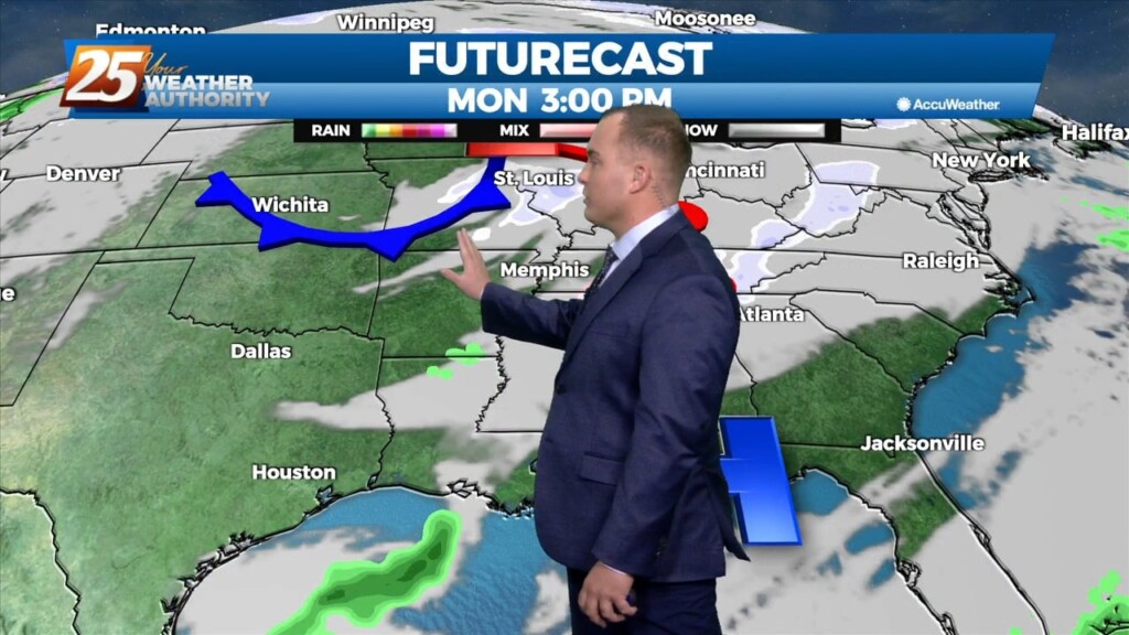
With rain on Monday, high temperatures north of I-10 will struggle to climb out of the 30s with highs a little warmer along the coast. Once the low passes, temperatures will quickly begin to drop off heading into Monday evening.…
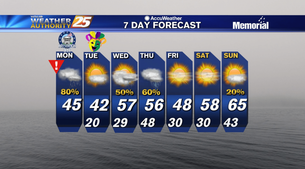
Temperatures tonight will remain cold with cold air moving in quickly at the surface and a shallow arctic air mass in place. Lows will be in the low 30s. With rain on Monday, high temperatures north of I-10 will struggle…
Freezing, potentially record breaking conditions are moving in tonight....
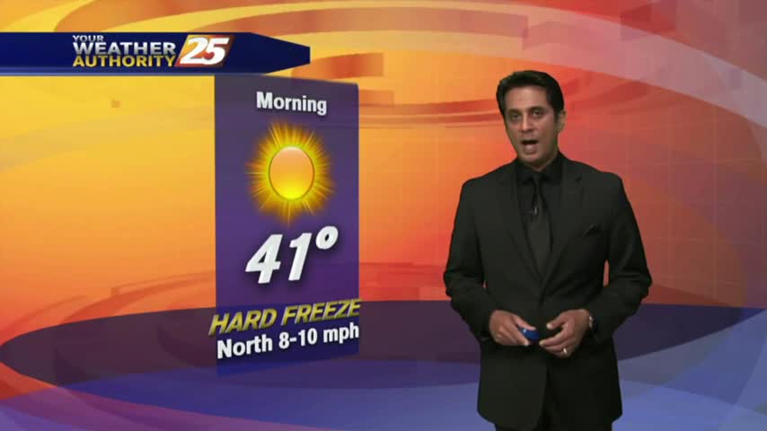
Another FRIGID start to the day with a HARD FREEZE WARNING through 11 a.m...with the warm-up beginning tomorrow...
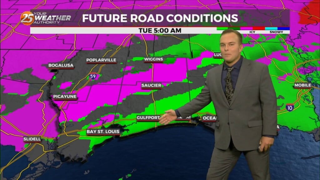
There won't be any winter weather tonight, but icy conditions will remain on some South MS roads. Watch the full forecast for the latest.
We're in for another brutal and dangerously cold evening, but without the added drama of the winter weather which has moved East. Click this link for the full forecast.
Another round of rare winter weather has moved into South MS bringing inches of snow to the Jackson and Hattiesburg areas, but so far not much more than sleet for us. Watch the full forecast for details.
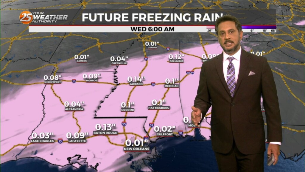
Most of South MS will see some form of winter weather tonight, but even colder and more brutal temperatures are moving in over the next day and a half. Watch the full forecast for details.