1/31 - Rob Knight's "Much Warmer" Forecast
A FRIGID start but with an area of high-pressure now to our SE, MAJOR changes will occur heading into the weekend..
A FRIGID start but with an area of high-pressure now to our SE, MAJOR changes will occur heading into the weekend..
Cloud coverage lingered into this morning but have cleared since with BEAUTIFUL blues skies now in the area...
As the cold front continues to move further east, COLD and clear conditions have moved into the area...

A line of light rain has moved east with only a few spotty showers this afternoon...

With a warmer/humid air mass moving in ahead of a weak cold front, spotty light rainfall is moving across the area...

Light rainfall continues to move in from the SW...
A cloudy start to the day with areas of light fog and drizzle as a warm front is over the area...
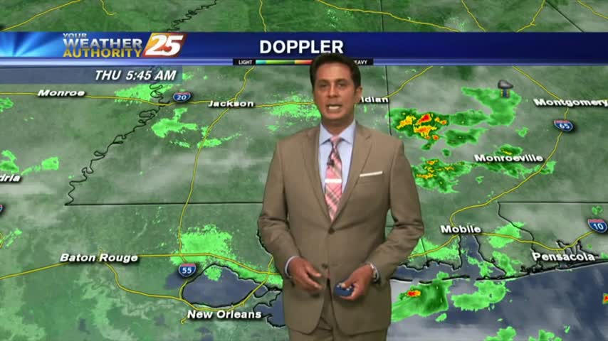
Light rain is now east of the area with DENSE FOG along the southern 6 counties...
Another FRIGID start to the day but the warmer air mass will begin to move in later today...
Cloudy skies continue as spotty rain developed in SE'tern Louisiana, now moving into and through our coastal counties...
Violent weather from the squall line earlier this morning is now out of the area with clearing skies expected overnight into Friday...
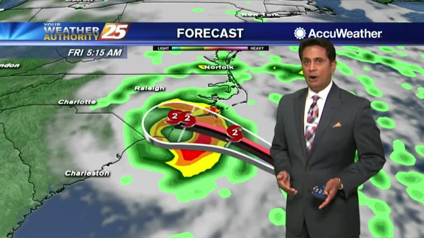
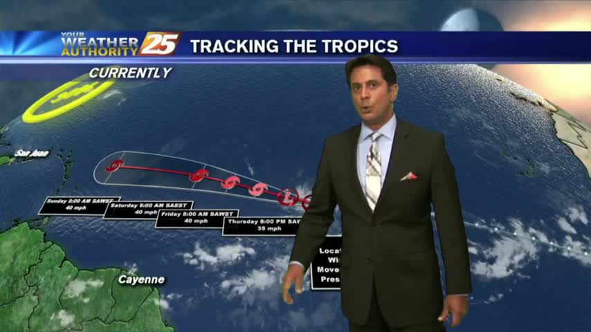
Another rain-free start to the day as we continue to watch HURRICANE FLORENCE getting closer to the Carolinas...
TD Gordon is well in our rear-view mirror with a few showers coming in from the Gulf of Mexico...
We have only seen minimal activity thus far, but it will continue to develop this afternoon...
A LOVELY start to the day as drier air has allowed for overnight temps to drop into the 60s...
Isolated showers south are moving north and into the coastal counties...
Similar to yesterday morning, isolated showers from the northern GOM, moving NE are dissipating along the beach...
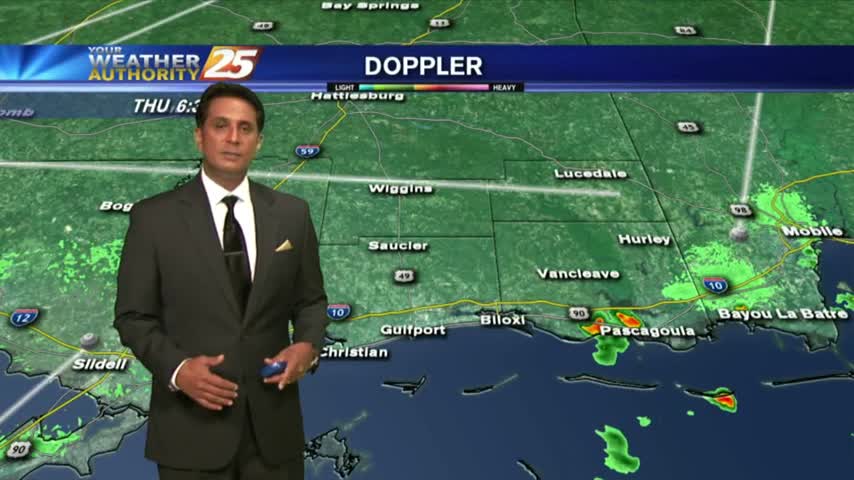
The extensive cloud cover age continues as temps are slow to warm. Showers & t-storms will develop later this afternoon...
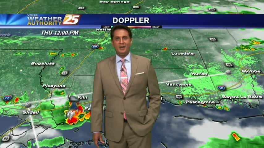
One final round of heavy rain/flash flooding before the pattern begins to change...
After a clear start to the day, clouds continue to develop with daytime heating as the mercury climbs into the upper 80s...

We are still under rain-free conditions for now...as the heat indices are again in the triple digits...
Another morning with a few light showers moving into the area from the northern Gulf of Mexico...
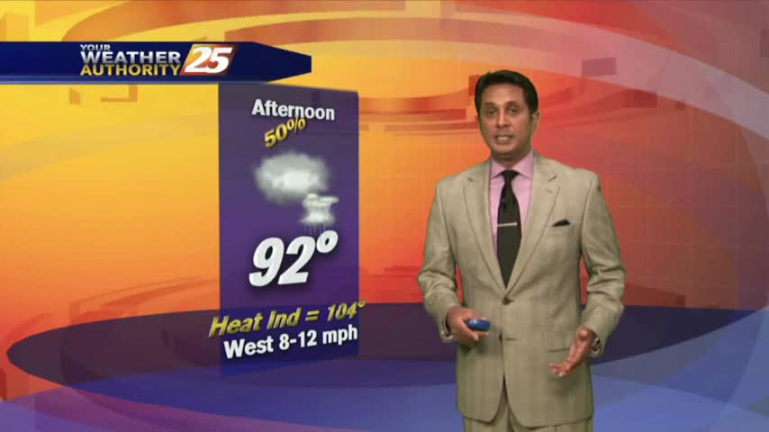
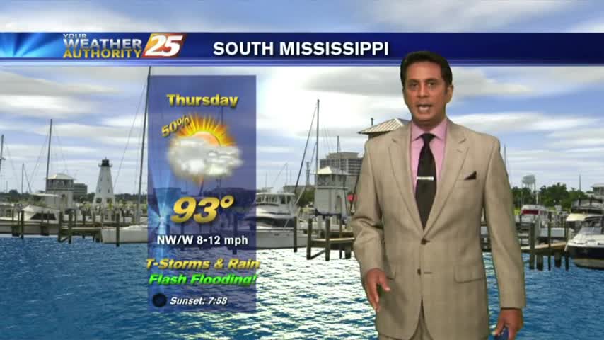
HOT & HUMID with showers and t-storms beginning to pop along the Southern 6 and the region...
Another HUMID start to the day with isolated activity in the vicinity...