06/05 Ryan's "Rain Returns" Friday Forecast
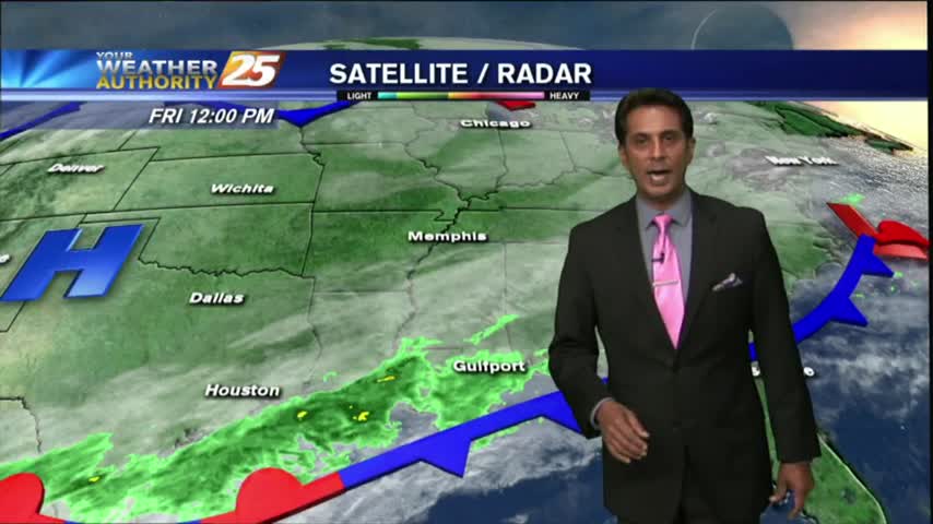
We saw some drier days on Wednesday and Thursday, but now the rain returns as moisture begins to deepen again across the area. That'll lead to a few showers…
We saw some drier days on Wednesday and Thursday, but now the rain returns as moisture begins to deepen again across the area. That'll lead to a few showers…
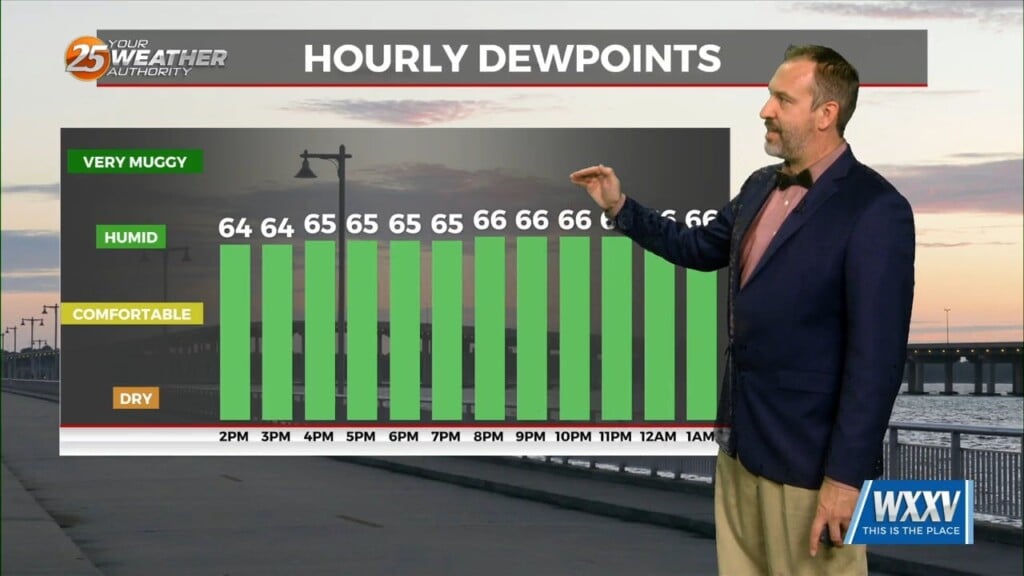
Today was the coolest and driest we'll get with the few fronts we've seen over the last several days, as dewpoints fell into the "comfortable" range in the…
Clouds dominate again this afternoon with a mild day overall. A cold front to our northwest will move in overnight which will provide for more…
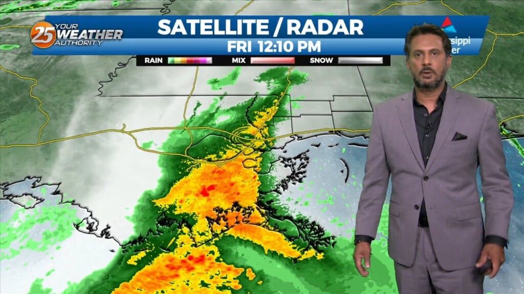
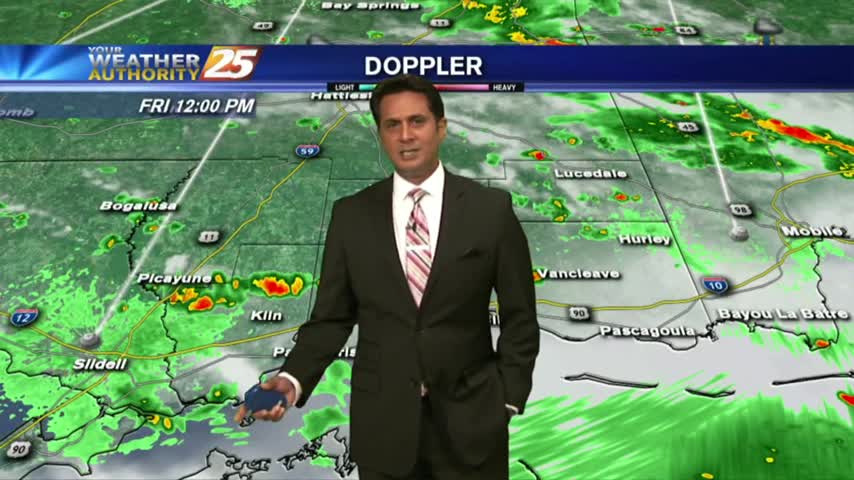
A surface, a cold front will slowly move across the area with a nearly solid line of showers and thunderstorms this afternoon. The main…
At the surface, high pressure was centered near the Sabine River. High pressure will slide eastward to the Carolina coast by Saturday evening. This will allow…
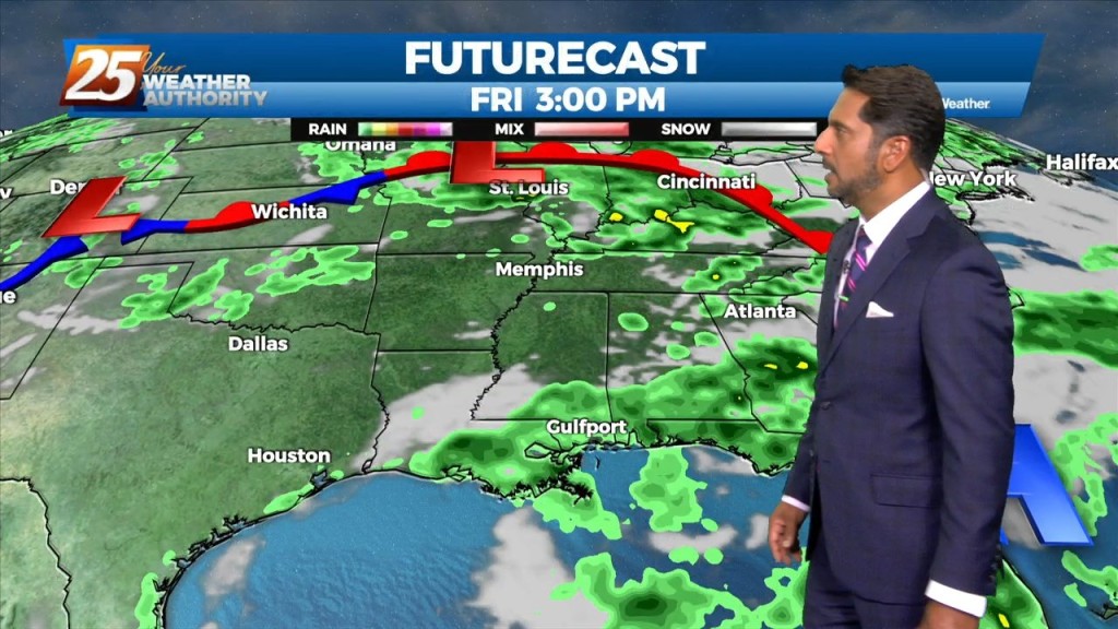
Southerly surface winds will help to advect moisture and warm air into the environment. There will still be plenty of moisture in the atmosphere and moisture…
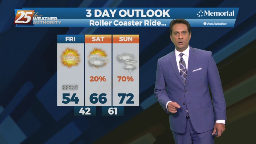
The hot and dry pattern will come to and end this weekend... The upper pattern will start the transition into a wetter one late in the…
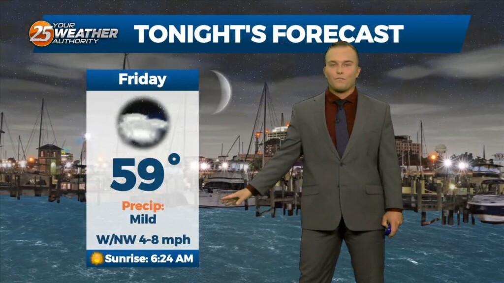
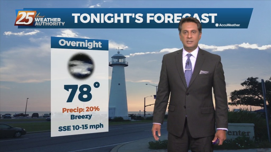
Tonight temperatures will be chilly once again with lows in the upper 30s to low 40s. Winds look to really lighten up tonight so wouldn't be surprised…
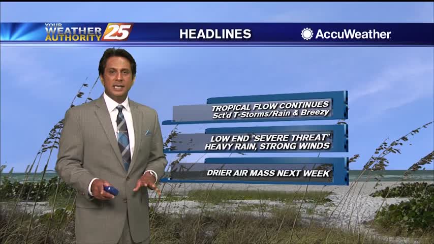
As the tropical air mass continues to move in from the south, showers/t-storms are developing...
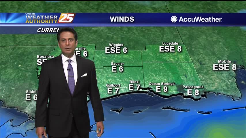
After a chilly start, cooler temperatures and breezy conditions are affecting the viewing area...

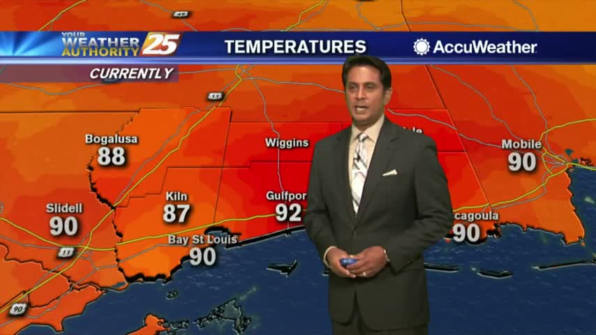
Temps continue to soar into the low/mid 90s as high-pressure to our north provides clear skies...

We are still dealing with areas of DENSE FOG as isolated rain is moving in from the south...
Another HOT afternoon ahead as the heat indices are already in the triple digits...
Temperatures continue to warm as the HEAT INDICES are in the mid-90s, with t-storms developing...
Light rain continues to move across the area towards the NE, most of it not making it to the surface...
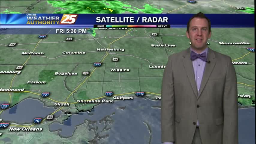
Another gloomy day in the books in a week that's been full of them, but that will be coming to an end soon. The Friday afternoon forecast calls for the skies to remain mostly cloudy through the night and into…