Below Freezing Temperatures Expected Tuesday Morning
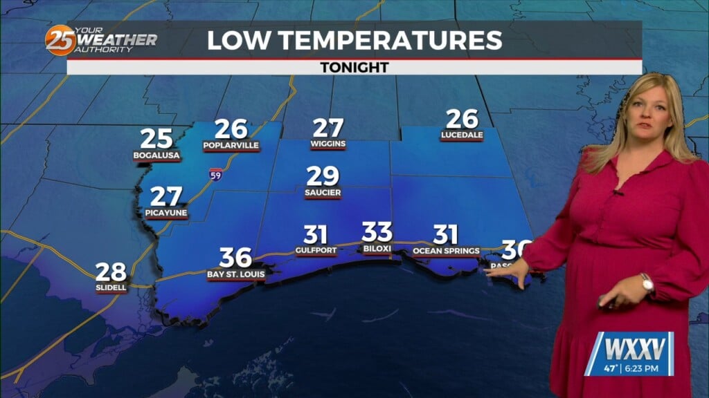
We are expecting a cold night ahead with temperatures dipping to the mid and upper 20s inland, and near 30 at the coast under clear skies. A Freeze Warning…
We are expecting a cold night ahead with temperatures dipping to the mid and upper 20s inland, and near 30 at the coast under clear skies. A Freeze Warning…
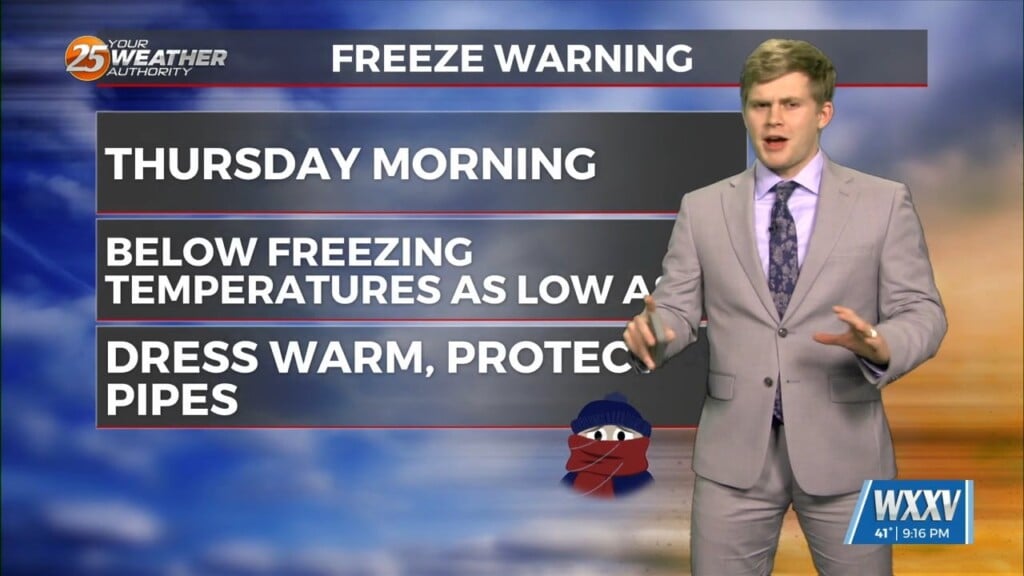
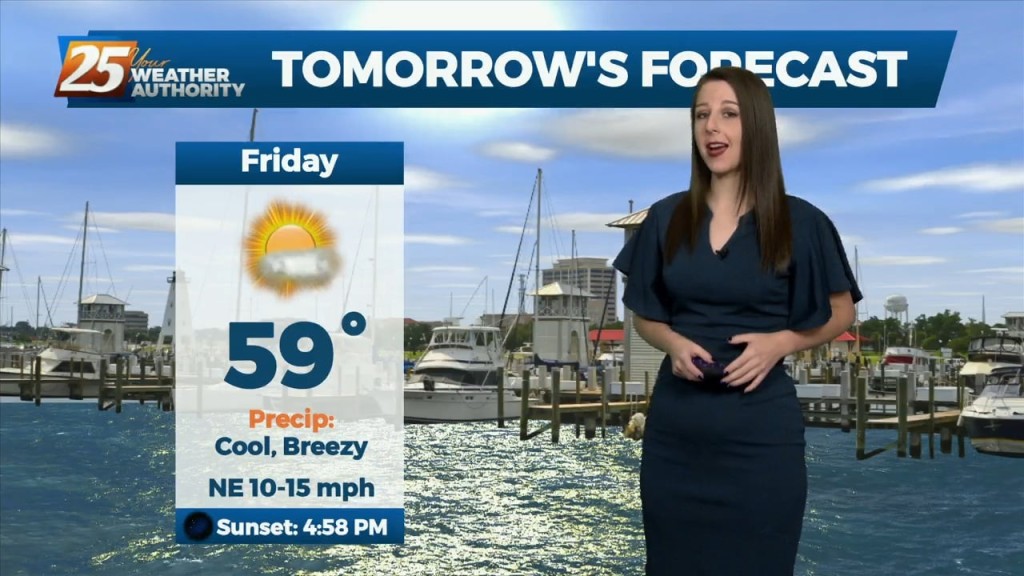
Freeze warnings Thursday morning then to rain showers Thursday into Friday. Thursday morning lows will be the coldest morning of the cold arctic…
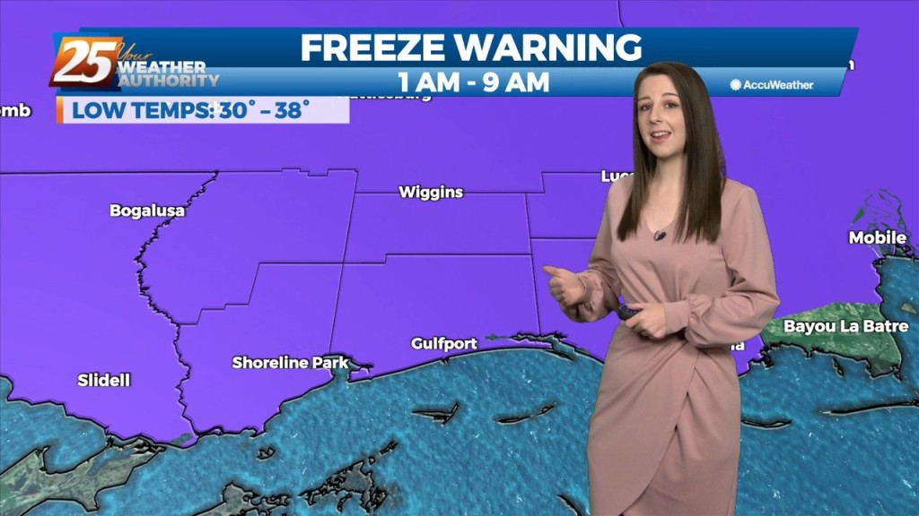
Freeze Warning for Stone, George, and Pearl River counties also, portions of Hancock, Harrison, and Jackson counties. Sub-freezing temperatures as low as 30 expected for inland…

Breezy & cold conditions are here for the beginning of the week. A Freeze Warning is in effect until 9 AM Tuesday morning due to the potential for…
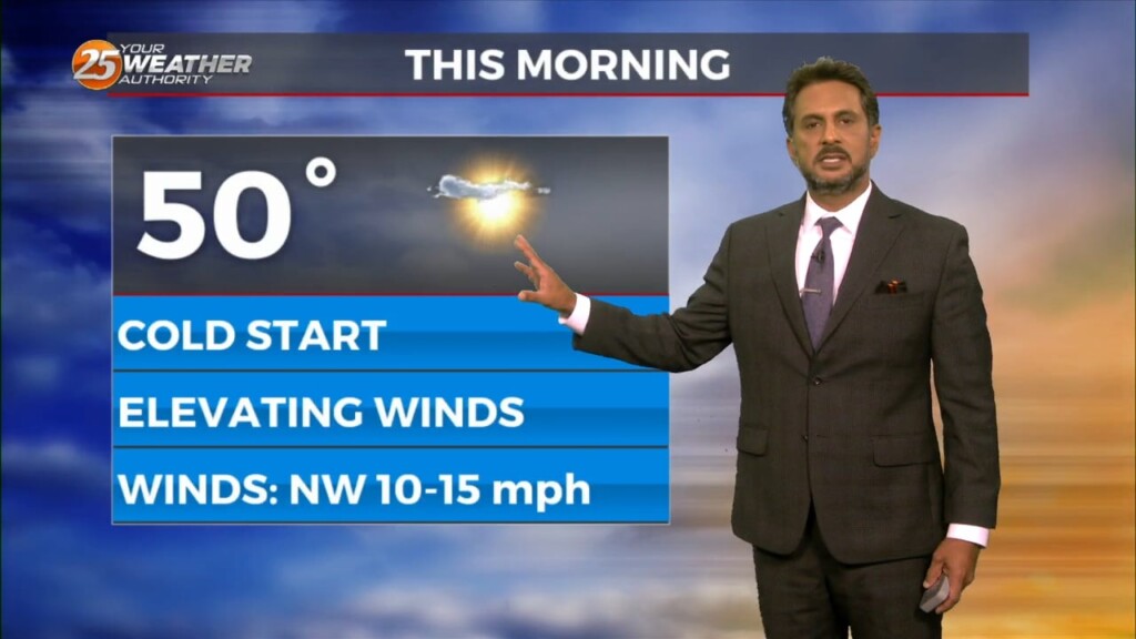
Skies have cleared out and elevated northerly winds have taken shape behind a cold front. Breezy conditions remain for some of the evening. This will be a…
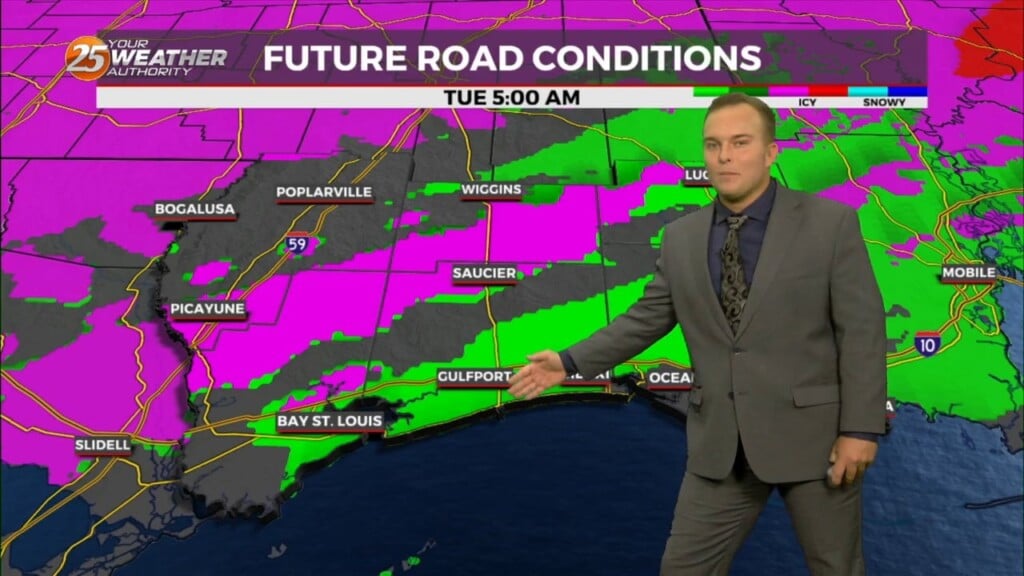
A Winter Weather Advisory is in effect for our area until 9 AM. There will be the possibility of light freezing rain leading to some icing concerns,…
A Winter Weather Advisory is in effect for our area tonight until 9 AM Tuesday. There will be the possibility of light freezing rain leading…
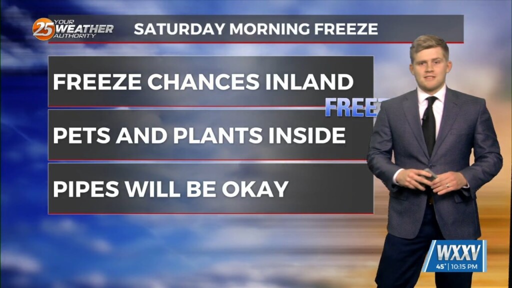
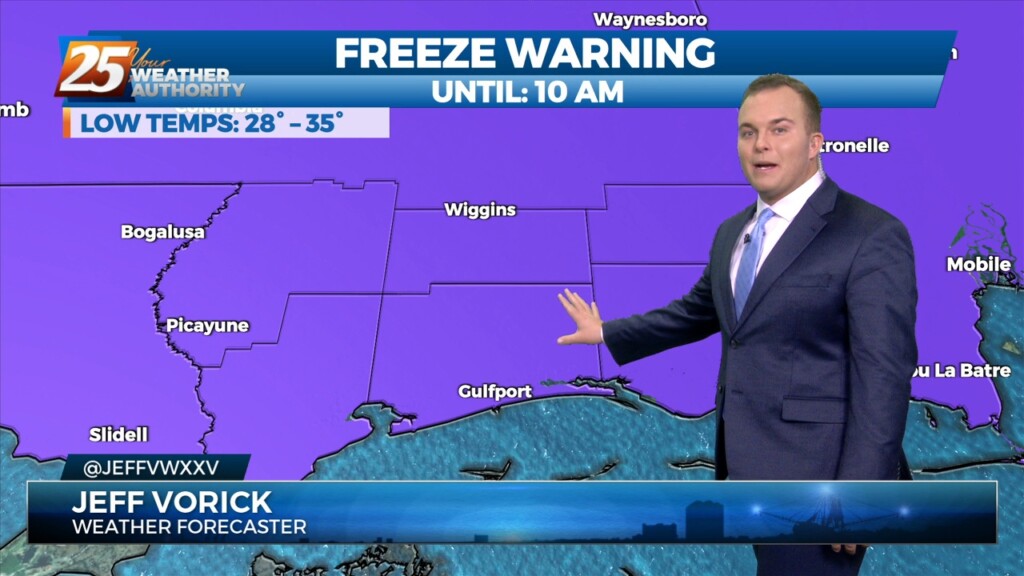
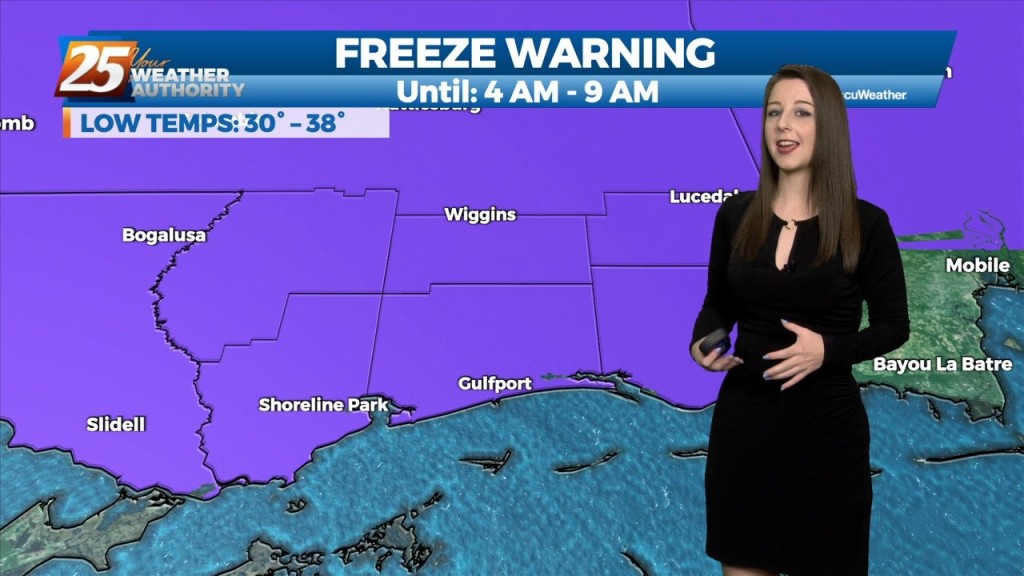
A Freeze Warning is in effect overnight until 10 AM Friday. Temperatures for the interior 3 counties will plunge to below 30 degrees, the 3 immediate coastal counties…
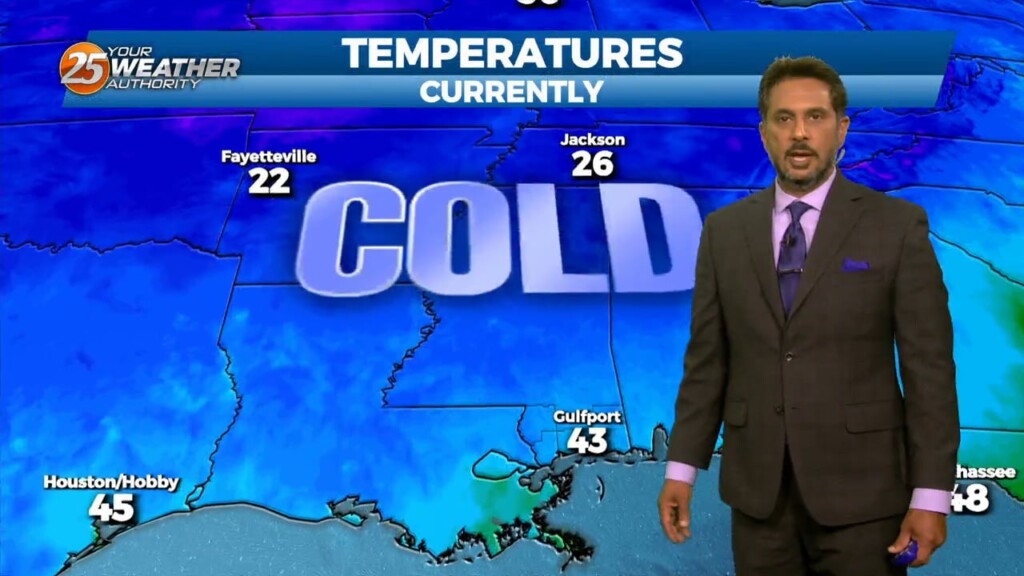
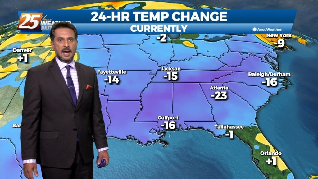
A cold pattern has arrived for the Mississippi Coast with below-average temperatures in the area for the next few days. Expect temperatures to tumble…
The biggest forecast challenge in the short term is the temperature forecast and the threat of a light freeze for many areas that may have not seen…
A Freeze Warning remains in effect until 8 AM for our entire area. A frigid start under clear skies will yield to a quick warm-up with lots of…
Today looks a little warmer than yesterday, but only by a few degrees. Aloft, the upper levels will begin to shift to a more…
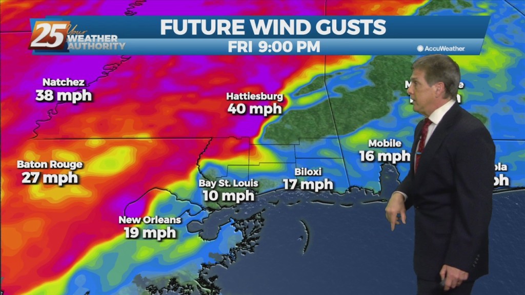
Strong winds will begin to ease today and the wind advisory will be allowed to drop as the gale warning drops this morning. Winds may not be…
A TRUE winter morning on this final day of the season, as a FREEZE WARNING is in effect through 10 am. Temperatures will rebound quickly after…
The late season chill will stick around for a little longer across South Mississippi. A Freeze Warning is in effect for all of the Southern Six…
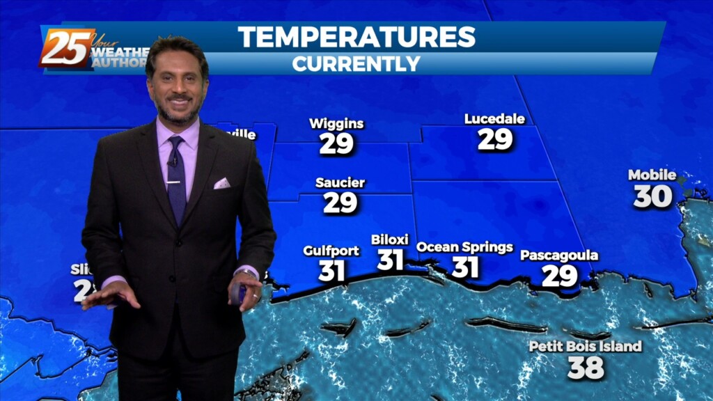
TONIGHT: Harrison & Jackson counties will be under a FREEZE WARNING beginning at 10pm, lasting through 8am. Temperatures could drop as low as 28 degrees. Pearl River &…
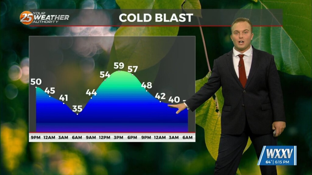
Temperatures will once again drop off very quickly after sunset, with the mercury dropping into the mid-40s around midnight, upper 30s to low 40s for overnight lows. Expect areas…
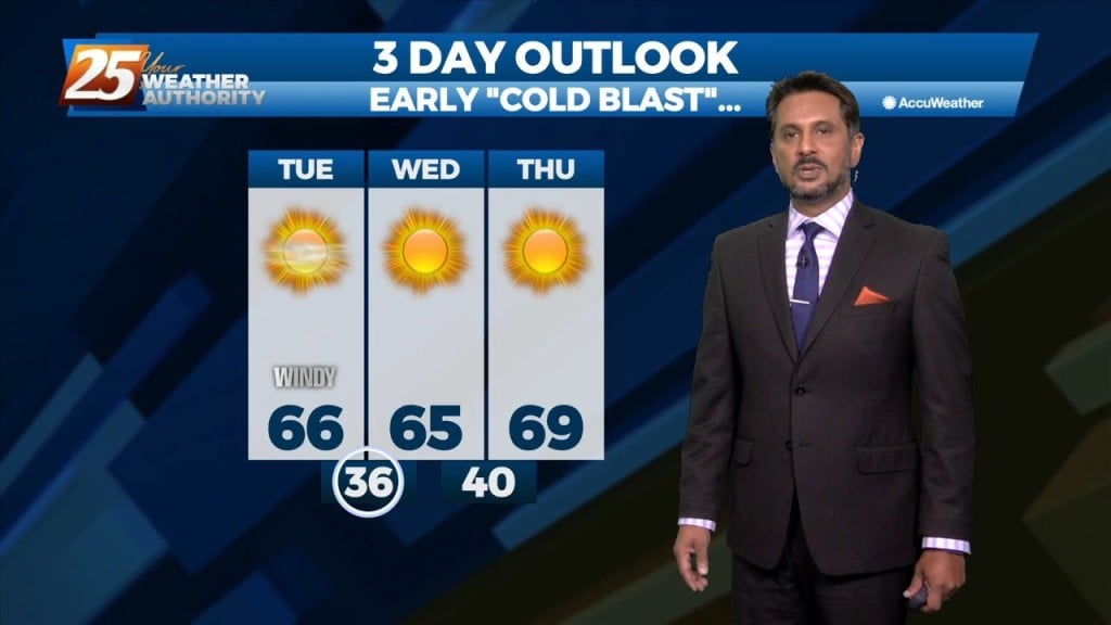
A FREEZE WARNING CONTINUES THROUGH 9 AM. A cold airmass continues to shape our forecast over the next couple of days. Temperatures will warm into the mid-60s…
This evening will be cold, breezy, and dry as a colder, drier airmass dominates the region. Temperatures will plummet after sunset and fall below 40 degrees shortly after…
Red Flag Warning continues until 7 PM. – FREEZE WARNING IN EFFECT TONIGHT – Breezy conditions will continue this evening as a colder, drier airmass dominates the…
Cooler, drier air along with gusty winds will be in place this afternoon. Winds will be out of the North at 10-20 MPH with higher gusts…
It is a much cooler start this morning with temperatures in the 40s inland, and in the 50s along the beach. Behind the cold front,…
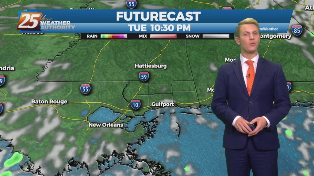
Thunderstorms to increase in number and intensity tonight. Strong to possibly severe storms will be possible along the MS coastal areas and east. The more favorable parameters for strong storms will be in place along the MS coast as the system moves…
Tonight into tomorrow morning, north winds will help to push cold and dry air into the region. Clear skies and dry conditions will prevail through the evening. Very…