04/13 Ryan's "Slowly Drying" Monday Night Forecast
Still on the warm side today, but cooler, drier air will slowly filter in over the next few days.
Still on the warm side today, but cooler, drier air will slowly filter in over the next few days.
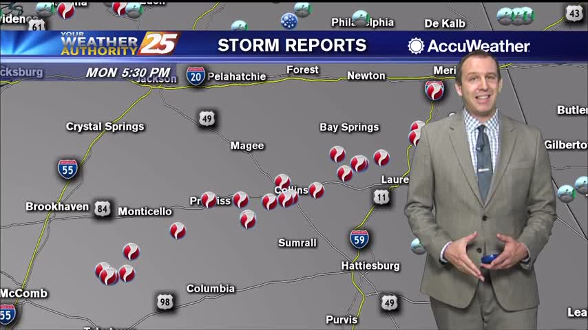
Strong storms moved through late last night, but not much happened in South MS other than a surge of drier air.
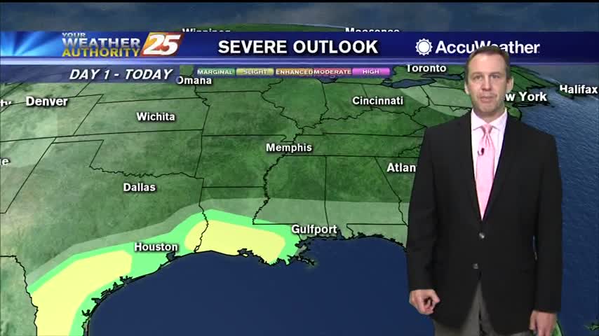
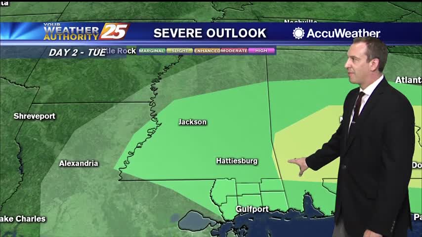
Pleasantly dry and cool weather will remain through tonight and the first part of tomorrow, but an approaching potentially severe storm will bring warm, humid conditions rushing back.
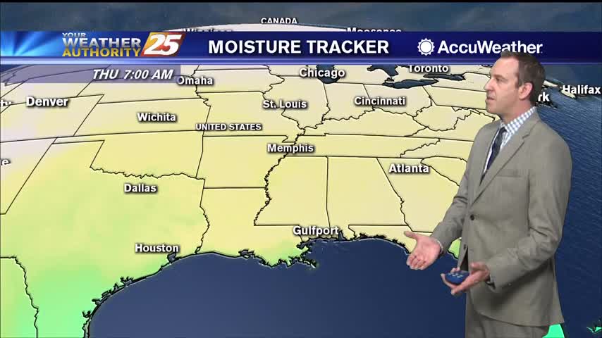
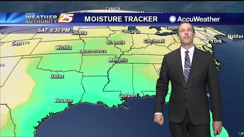
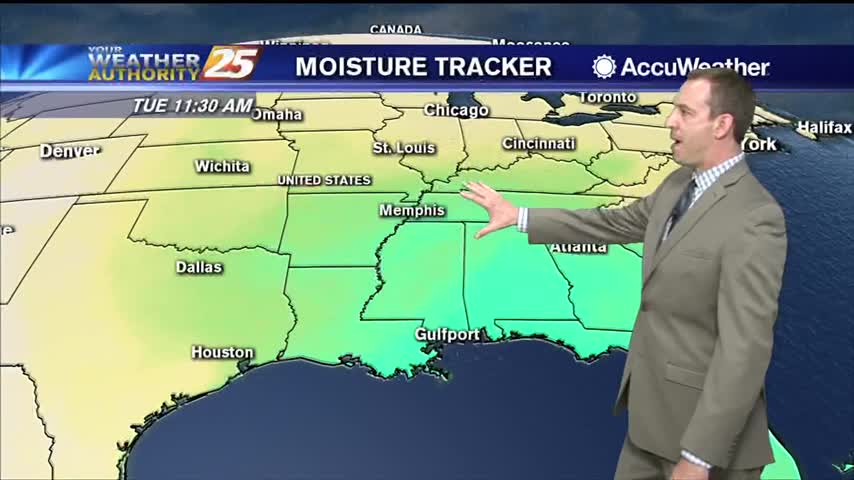
Dewpoints have fallen 30 degrees since yesterday after the cold front pushed through, but more warm, moist air and even storms are on the way.
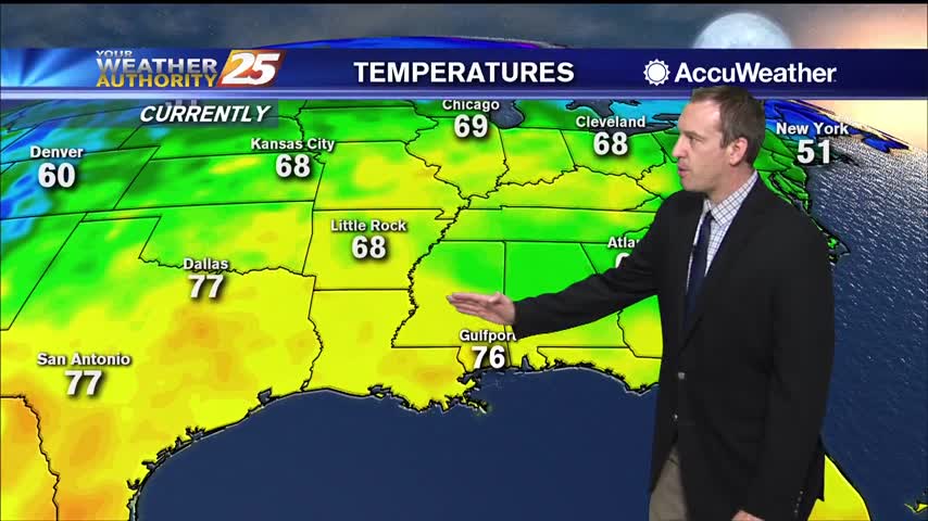
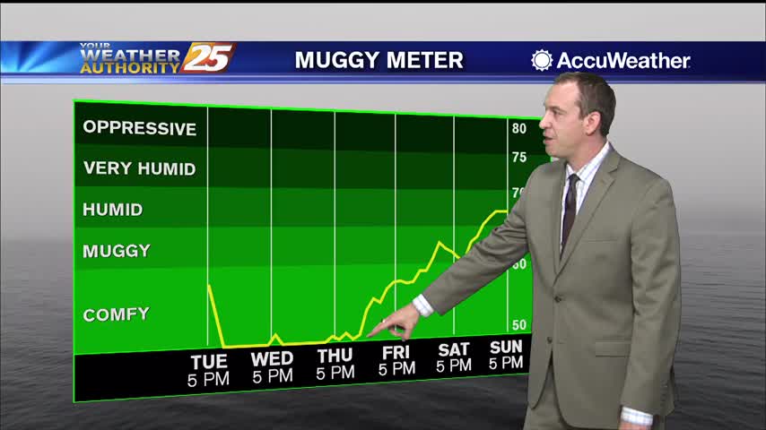
It's been downright muggy almost every night this week, but cooler air is finally moving in.
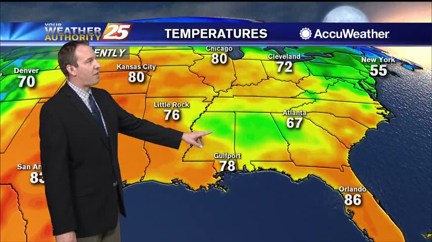
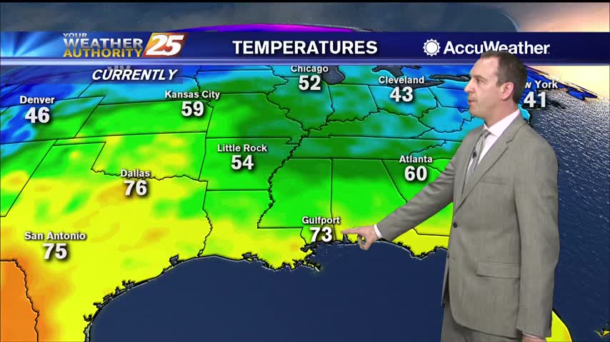
Hot and humid weather led to some mid 90 heat indices today, but cooler weather is on the way!
One of the hottest days of the year so far and a very warm night ahead, but cooler...relatively drier air is on the way.
Our highest high in quite some time coupled with today's humidity lead to some scary looking heat indices today, but cooler weather is on the way...just looks like it'll be stormy too.
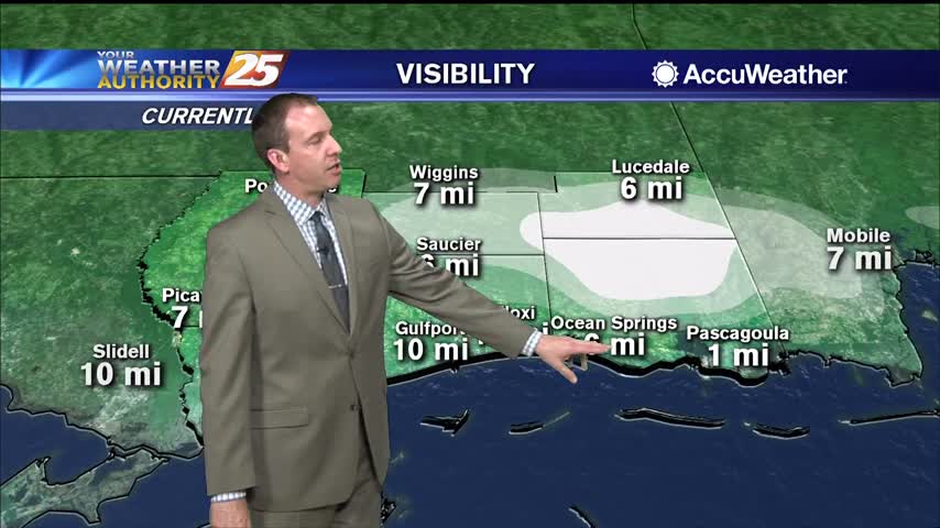
More warm, low visibility conditions moving in tonight with very little change in the days ahead.
More warm and humid conditions tonight, so expect more clouds and another round of patchy fog.
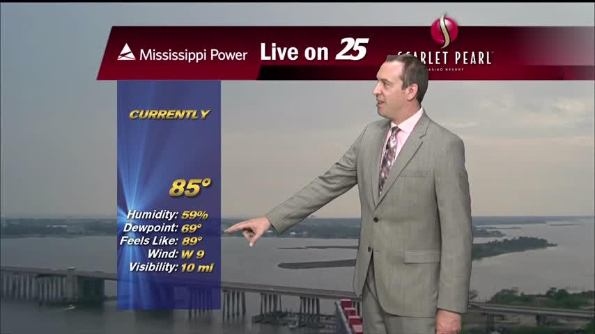
Light southerly winds throughout the weekend have increased the humidity, so get ready for a mild and muggy evening.
Much more humid than how we finished off last week, so expect warmer, foggy nights in the short term.
It's still feeling nice and dry out there, but much warmer and more humid moving forward.
Another chilly night and still much drier than we've seen in recent weeks, but warmer, more humid air will continue to move in.
A practically perfect spring day in South MS, and not much will change in the days ahead...but cloud cover and rain isn't too far away.
Coldest and driest air we've seen in quite some time is moving in, so get ready for some sunny weather and clear skies.
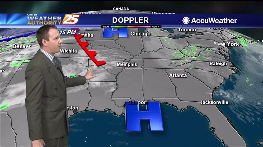
A cold front brought active, even severe weather to the South MS area, but now cooler and drier air is rushing in.
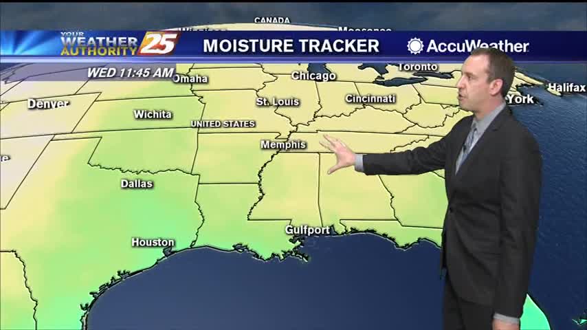
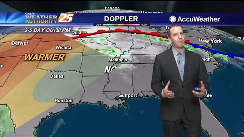
Still playing the waiting game as a front slowly creeps toward us, and we'll see some significantly drier air after it passes.
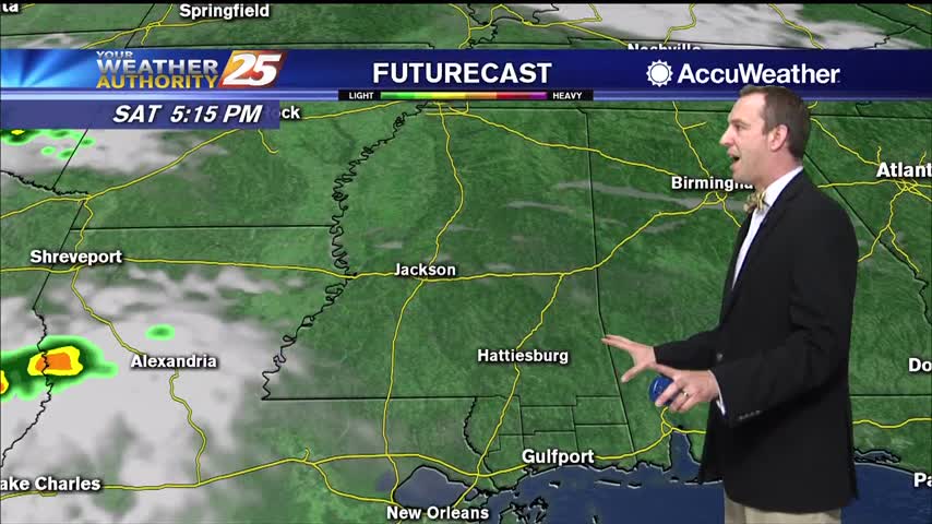
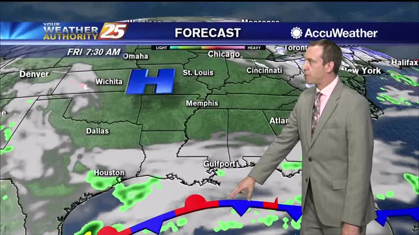
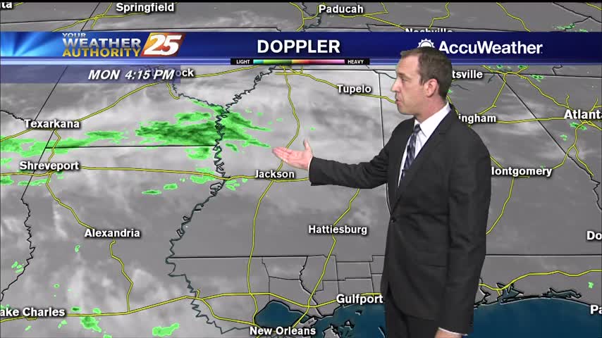
Clouds will continue to build through the night, but we won't see much in the way of rain until around sunrise tomorrow.
Record breaking heat this afternoon with more expected tomorrow, and a warm, humid night with more patchy fog in between.
Today's high temperature barely broke the record set in 2012, but it'll be even warmer tomorrow.
Continued warming will bring us close to or beyond record high temperatures over the next few afternoons, but in between we still have some relatively cooler, foggy nights.
It looks like we just missed today's high temperature record, but even warmer days lie ahead.
Expect some subtle changes in the short term, but much drier, cooler weather moves in after for the weekend along with some rain.