
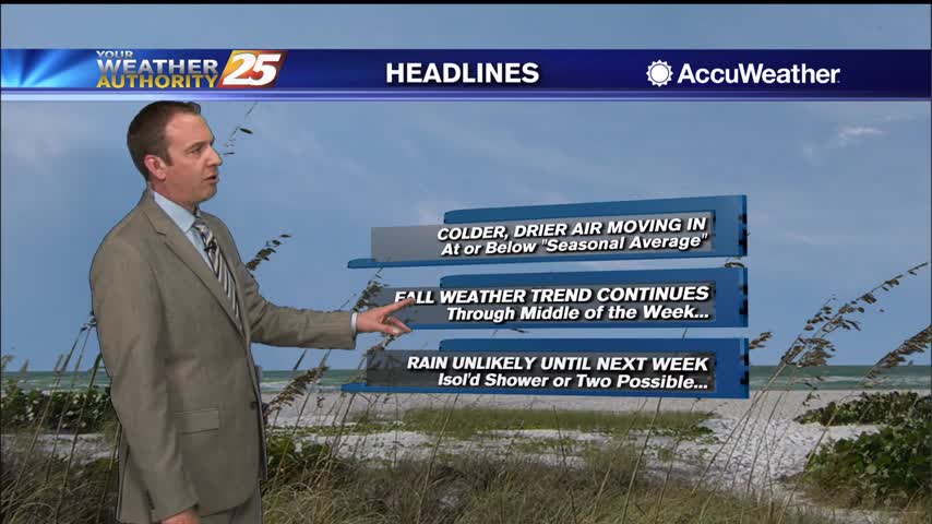
10/20 Ryan's "Fall Weather" Monday Morning Forecast
We were off to quite a cool start this morning thanks to this fall weather moving in on the backside of this weekend's front. Colder, drier air is…
We were off to quite a cool start this morning thanks to this fall weather moving in on the backside of this weekend's front. Colder, drier air is…
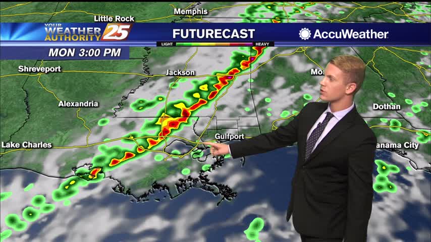
A cold front is on the way. Isolated light rain showers could also develop late this afternoon. A band of rain showers will begin to move into the northwest portion of our forecast area this evening ahead of the cold…
Yesterday’s cold front has taken hold in South Mississippi and it is feeling good outside. In fact, it’s finally feeling as good as it looks with drier…
Yesterday's cold front has taken hold in South Mississippi and it is feeling good outside. In fact, it's finally feeling as good as it looks with drier air…
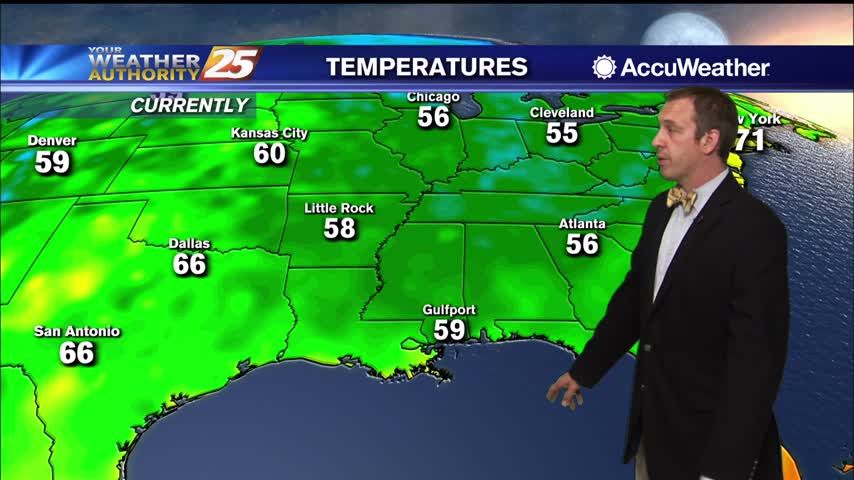
Cooler and drier fall weather has finally arrived along the Gulf Coast! High pressure will build across the Mississippi Valley region and north central Gulf Coast regions through the end of the week. A very dry airmass will remain in…
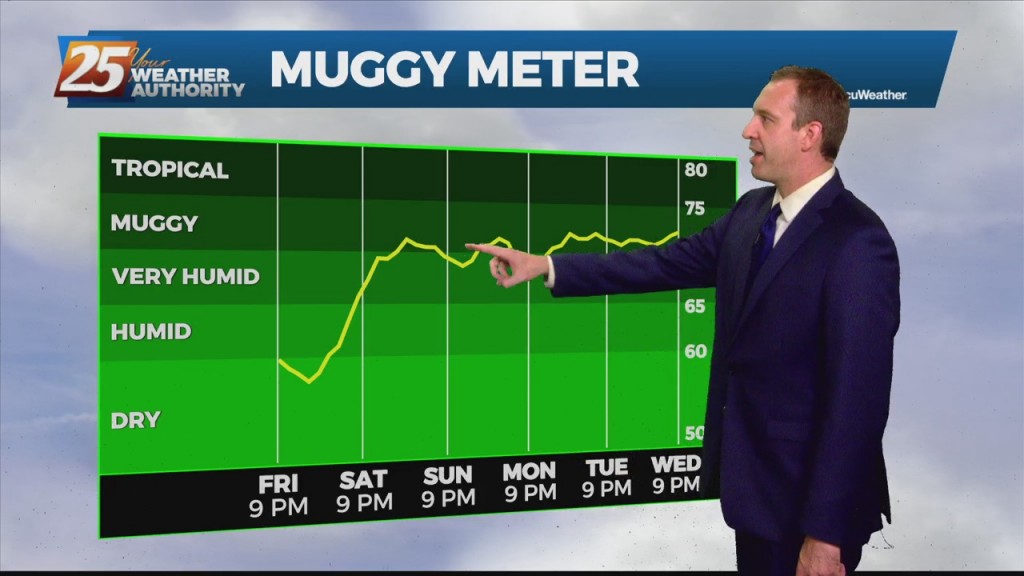
Last night and today have been a nice teaser of fall weather, but sadly it won’t last too much longer. We still have one nice fall-like night left…
We're off to a nice start after a weak weekend front, and change will be slow to move in....
Not too different yet, but cooler and drier air is on the way in after today's cold front.
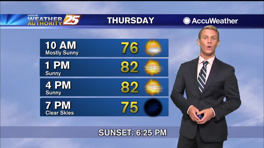
Cooling has stopped, so now warming can begin as we head into the rest of the week and the weekend.
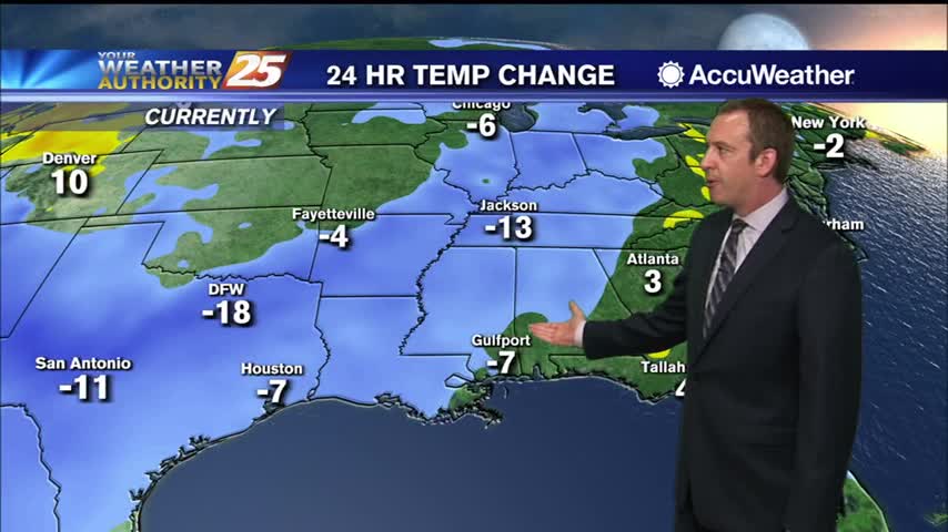
Much colder after Sunday's cold front, but it steadily warms throughout the week.
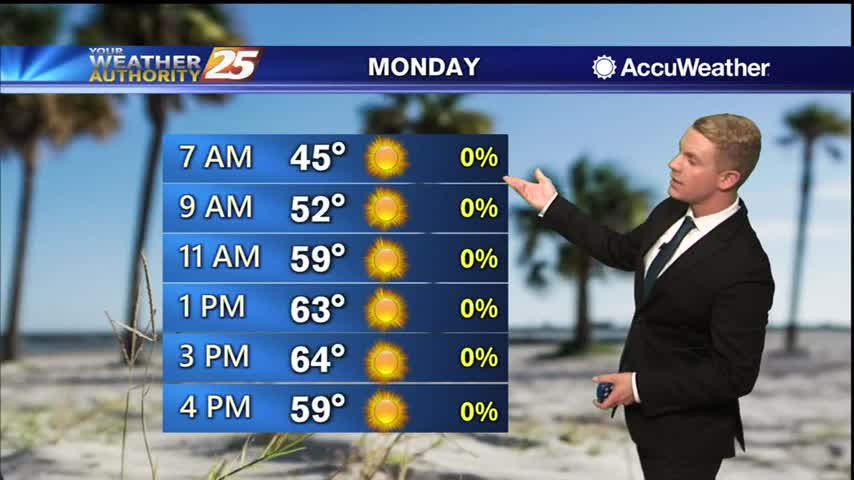
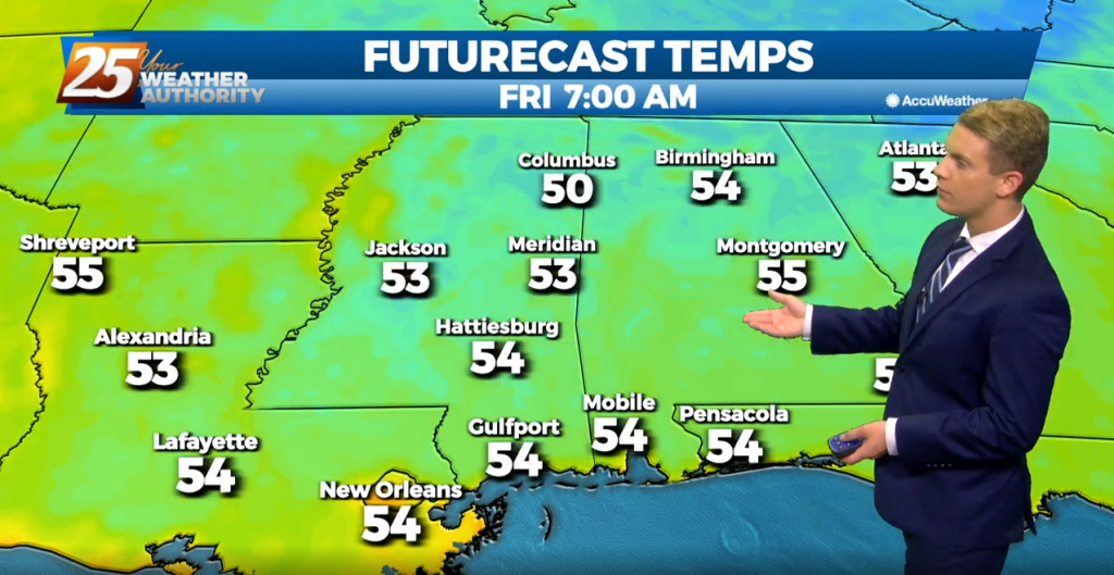
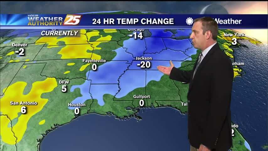
Coldest overnight lows of the week are expected Monday night into Tuesday morning as skies remain clear and winds turn very light to calm across inland areas. Temperatures will plummet into mid to upper 30s across most inland communities Monday…
Starting off early this morning, we are starting to see a steady increase in flow off the Gulf thanks to a weakening area of high pressure pulling to the east. Another pleasant day is on tap for the Gulf Coast.…
We are starting off the day on the chilly side area wide thanks to a recent cold front passage. Strong radiative cooling processes in place from a weak surface high nearby, calm winds and clear skies pushed early morning lows…
We continue to track a relatively weak cold front swinging through the area today. Behind the front, dew points are already beginning to fall pretty steadily. Most cloud activity ahead of the front along and south of I-10 is near…
Nice start to the week after a practically perfect weekend, but tropical developments will likely bring that trend to a cloudy, stormy end.
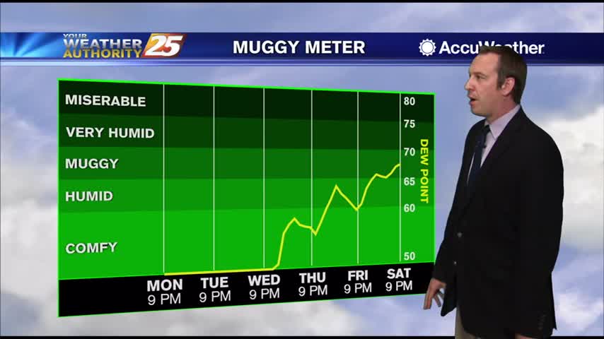
The fall weather continues, and even cooler, drier air is moving in again soon!
Fall weather has arrived a little late, but will stick around for over a week this time.
Significant fall-like weather arrives about a week late, but will linger for quite some time.

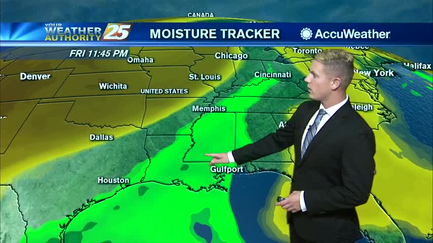
Cold front moving through will finally bring some significantly drier air, so fall-like weather is moving in soon!
The first big cold front since last spring looks like it will be moving through the area Monday evening into Monday night. Weather models have been fairly consistent with timing of the cold front moving through by early Tuesday morning…
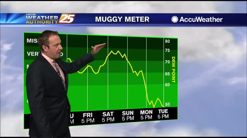
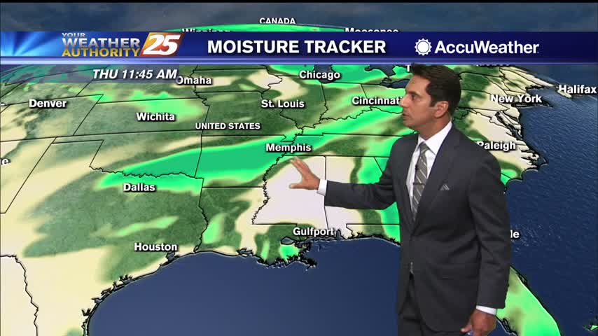
We've seen many cloudy skies this week, but drier, less humid weather is finally on the way!
The cold front that has been discussed for the last several days has finally moved through the viewing area. Rain and cloudy conditions associated with the front has mostly cleared the Gulf Coast, but a pop-up shower this afternoon cannot…
We've seen a long string of clear and sunny days, so it doesn't feel too bad we're seeing clouds and rain moving in tonight....
The clouds have thickened through the night and rain will begin soon, but after we'll see even more Fall weather.....