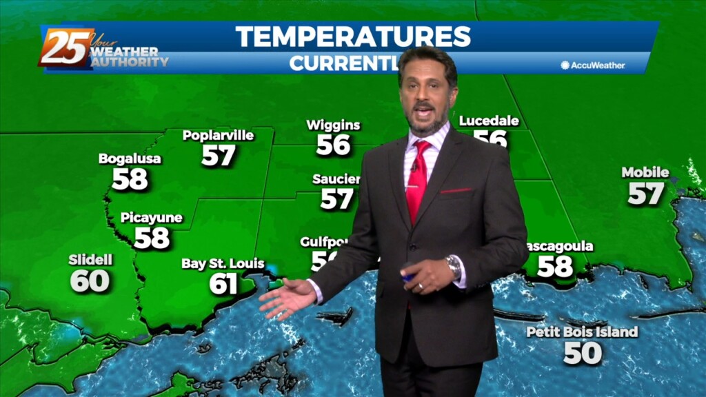
12/29 - The Chief's "Threat For Heavy Rain Ahead" Thursday Afternoon Forecast
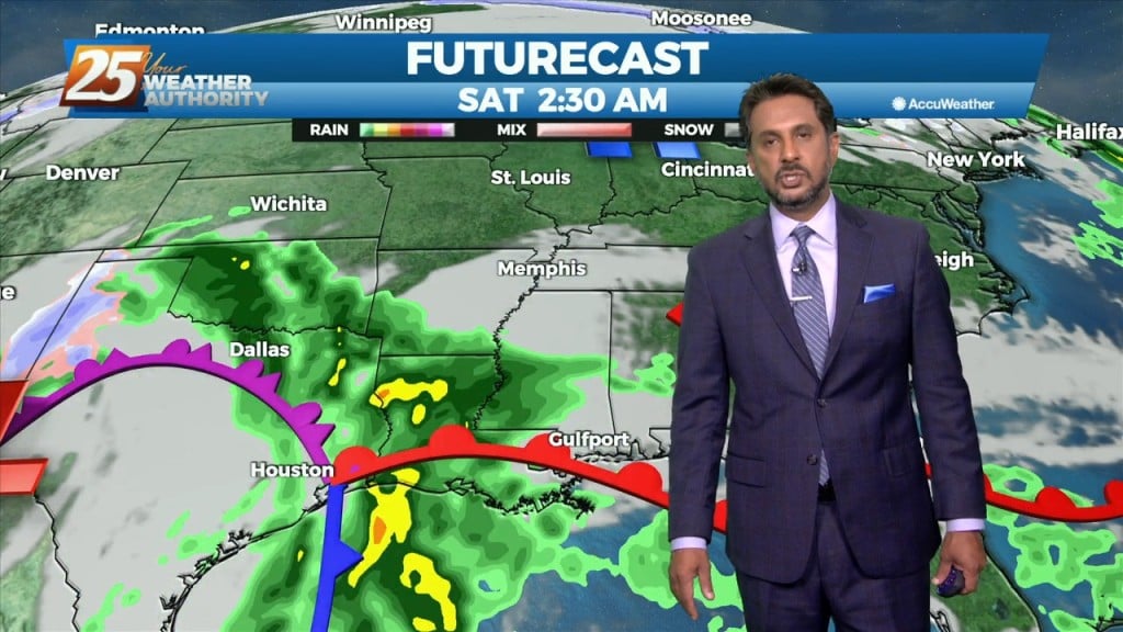
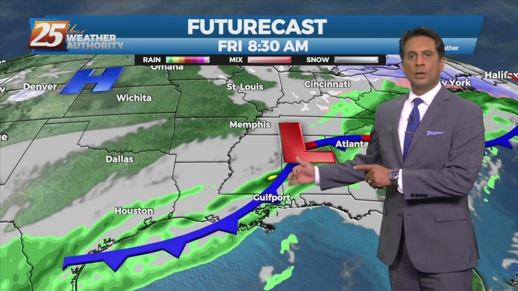
After today we will be heading into a much more active pattern. A Major disturbance will be digging down through the Central and Southern Plains…
After today we will be heading into a much more active pattern. A Major disturbance will be digging down through the Central and Southern Plains…
Surface high pressure will build into the region behind this front today bringing mostly sunny skies and calm winds. Heading into the late evening and…
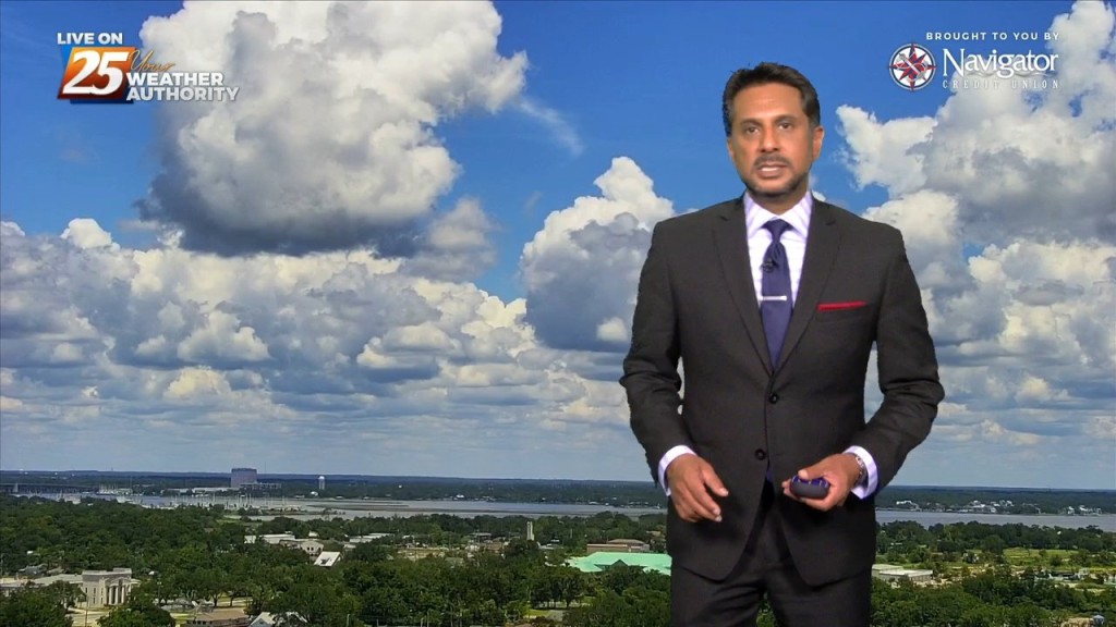
After a couple days of light precipitation in some areas with mostly cloudy skies, clouds will break up today revealing partly cloudy to eventually mostly sunny skies. These…
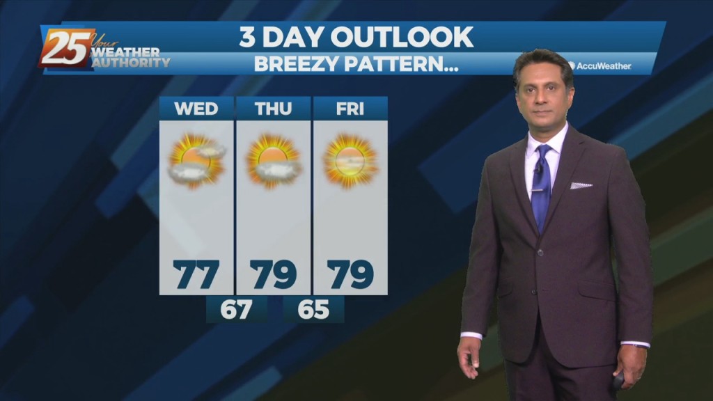
WINTER-LIKE conditions to continue through the weekend... High pressure will continue to build into the region and usher in quite cold air for this time of year.…
High pressure continues to dominate our weather pattern across the area. A weak disturbance will move across the area this morning into this afternoon. With…
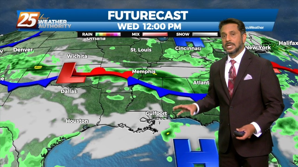
A trough of low pressure along the NW'tern Gulf of Mexico will slowly push SE as an upper low pressure system and training cold front moves through…
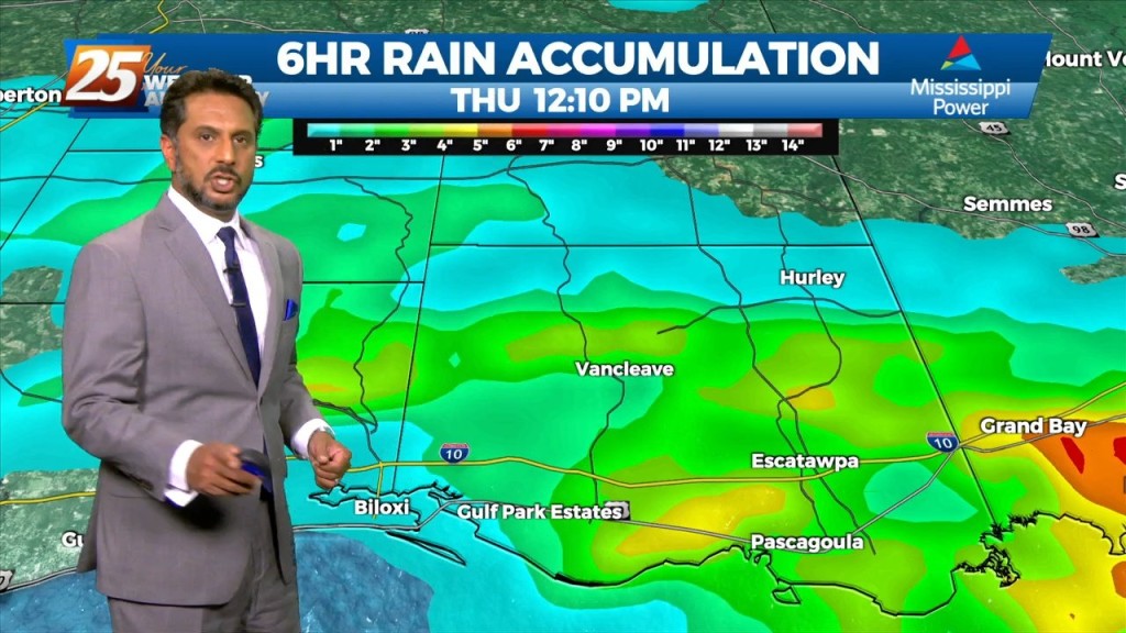
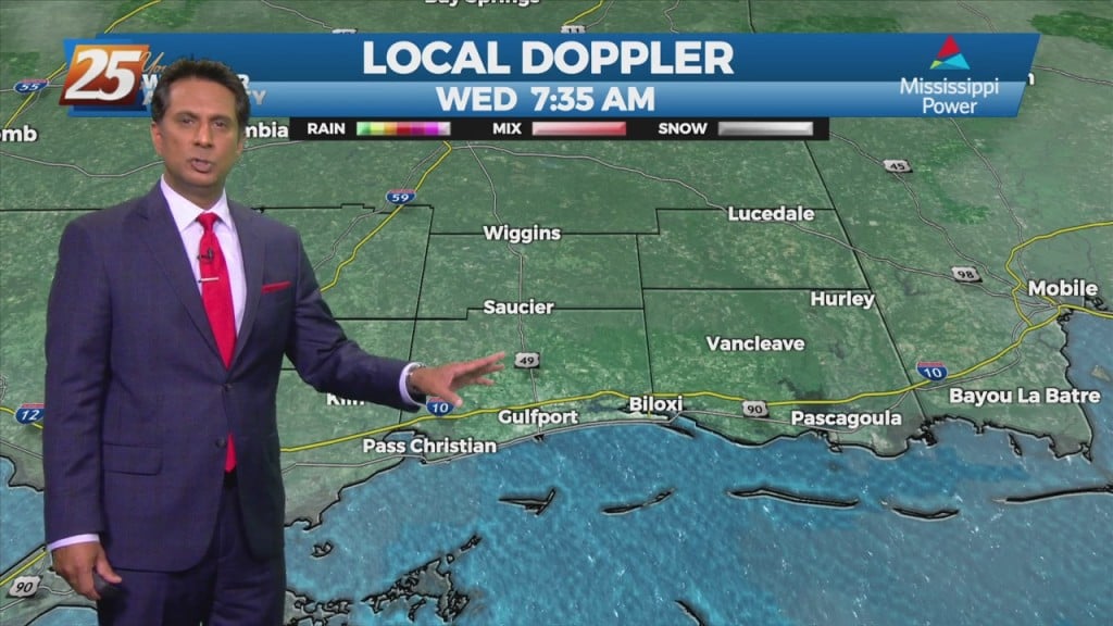
FLASH FLOOD WATCH IN EFFECT - 7 PM... The threat for pockets of HEAVY RAIN will continue this afternoon. This will not be…
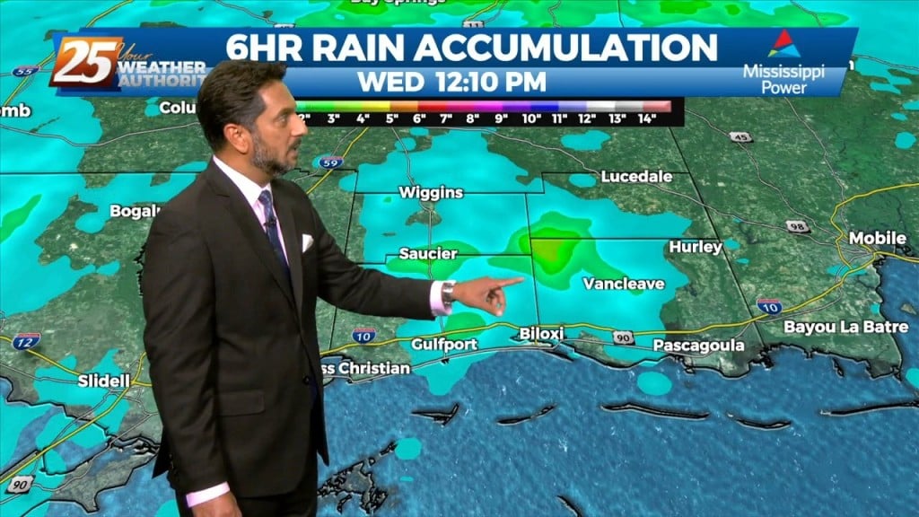
Today through Friday, high precip chances along with high rainfall rates will remain the topic along with an environment conducive for waterspouts. The surface…
The focus late this afternoon and evening will be on convective development to our north and east, with short-range guidance identifying a zone of low-level convergence oriented…
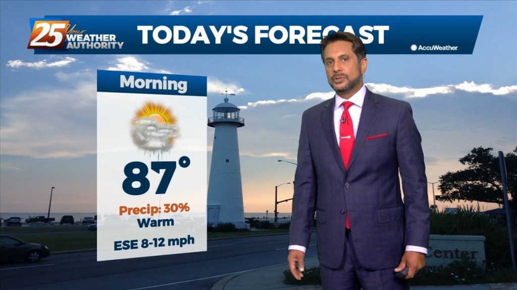
Today will bring a continuation of the past few days and a gradual warming trend as high pressure moves closer to the area. This will also…
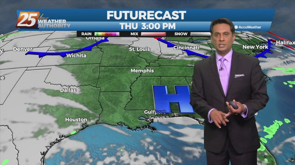
High pressure will continue to shape the forecast into the weekend. As an upper level disturbance digs through the Great Lakes and Ohio River Valley, it will…
A northern stream has become somewhat more progressive with high-pressure moving east of the Rockies and disturbances along the west coast and moving across the…
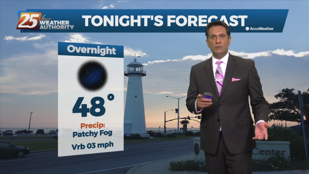
Fog this morning in a few locations and may get dense in those locations around sunrise. But most areas are seeing temps high enough to keep fog…
Onshore flow develops this afternoon as elevated winds will bring in the moisture very quickly. Those 2 changes will jump start the upcoming moderating period. We should…
The cold front is now well east of the area as skies have cleared. A less humid flow and sunshine will dominate the forecast ahead, but this will not…
The cold front has moved east of the area but will continue to be a factor in the forecast through the Easter weekend. As the upper…
The threat for severe weather and flash flooding has diminish by isolated showers and even a few late afternoon t-storms. Tonight will bring a lull in activity until…
A pleasant afternoon with a few clouds and plenty of sunshine. Fog will be a factor the next few morning but not in every location and may be…
Quiet conditions through St. Patrick's day with linger cloud coverage and mild temperatures In the 70s. The forecast gets active again Thursday night and early Friday. Our next…
A stationary front to the east will continue to be the focal point for showers and t-storms again today. The development over land will be elevated…

The frontal boundary will stall just off the northern Gulf Coast thanks to high-pressure to the SE. Isolated rain with a few t-storms possible this morning with…
High-pressure currently over the Rockies will move eastward across the Gulf of Mexico Friday and Saturday. This will gradually allow our surface flow to turn onshore and allow moisture…
The next few days will be mainly a temp and dew-point forecast. No rain anywhere in sight during the workweek with the greatest impacts likely to the fire…
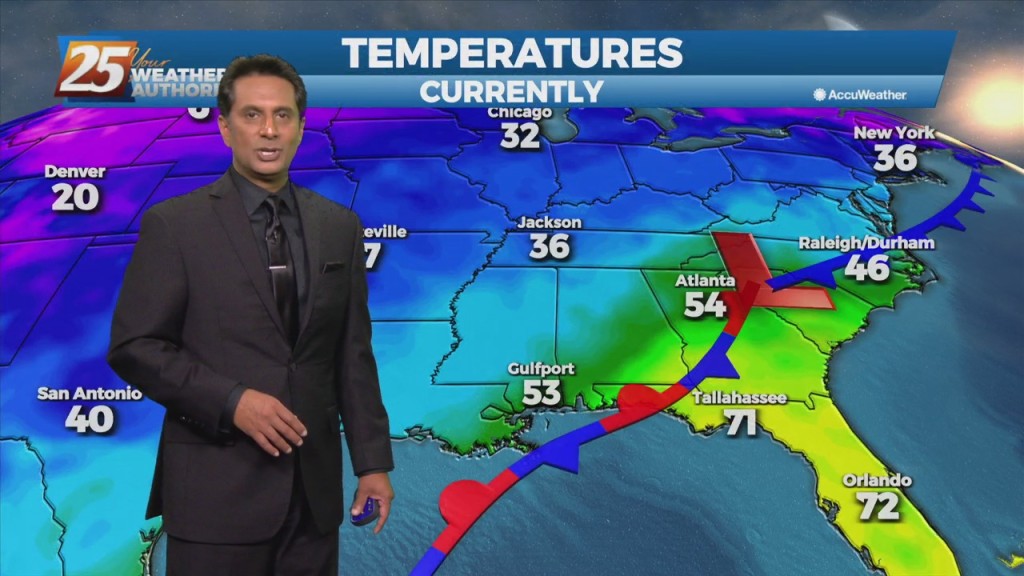
Above seasonal average temperatures will continue until a cold front makes its way through our area early tomorrow morning. Ahead of the front, isolated showers…