11/30 - Rob's "Disruptive Weather...Then Rain" Thursday Forecast
With a VERY warm/humid air mass in place in advance of a cold front, DENSE FOG has developed with an advisory in effect through mid-morning...
With a VERY warm/humid air mass in place in advance of a cold front, DENSE FOG has developed with an advisory in effect through mid-morning...
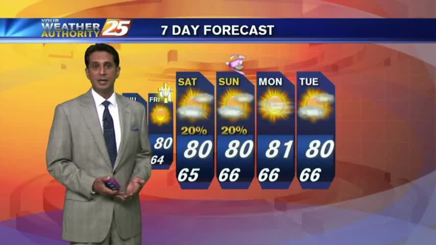
The forecast continues to unfold as expected, with slight temperature and moisture increases each day into the weekend. Expect more evening/morning fog though, details within.
Clear skies last night led to cooling, coupled radiational with a more humid air mass, areas of PATCHY DENSE FOG has developed...
Disruptive weather (Fog) continues as a cold front is now overhead...providing for isolated rain through the region.
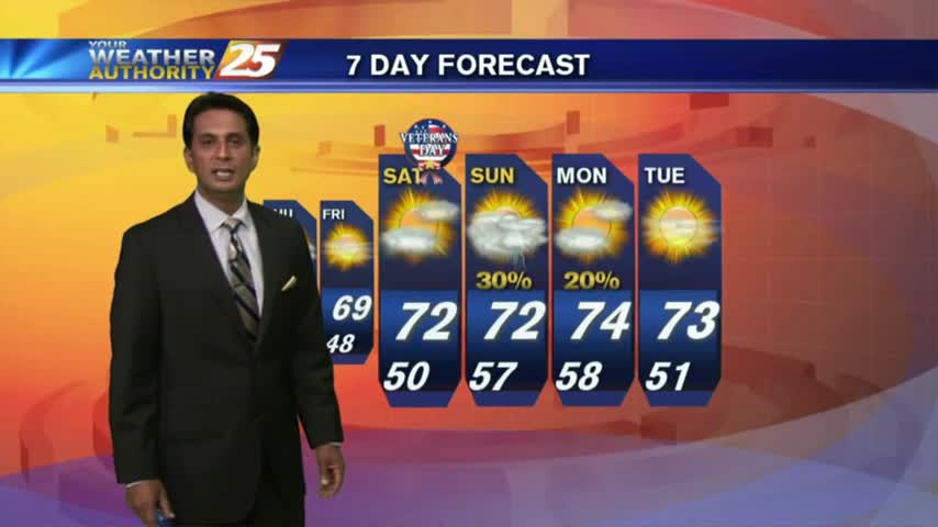
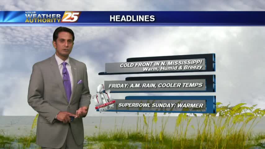
A cold front has moved into the Northern parts of the State, and will bring some cooler/drier conditions for the weekend. Click the link for the forecast details.
Disruptive weather to start off the work week...DENSE FOG has developed with an ADVISORY in effect through mi-morning...
The clouds cleared out a bit, but the temperature and humidity continued to rise as expected. Click the forecast link for the full forecast.
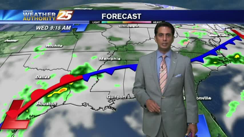
We expected a few showers today and the weather delivered, but drier conditions are expected ahead. Watch the forecast for details.
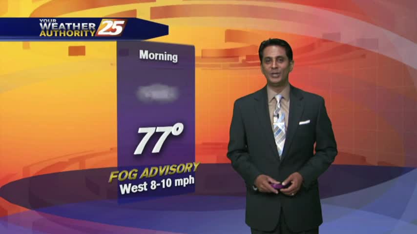
Another WARM/HUMID morning with areas of VERY DENSE fog along the coastal counties...
Very light sprinkles associated with a dissipating cold front is moving though the interior counties...along with DENSE FOG along the coast.
Another warm/humid start with DENSE FOG along southern Mississippi. The fog will lift later this morning leading to mostly cloudy skies...
The first day of Spring brought coastal temperatures into the 80s today, and tonight will be even foggier than last night. These conditions continue for much of the week, so watch the forecast for details.
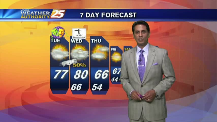
Fat Tuesday is starting off with VERY WARM conditions for this time of the year, along with areas of DENSE FOG...
As the warm/humid air mass continues to dominate the area, DENSE FOG has developed this morning with an ADVISORY in effect...
Clear skies will aid in overnight dense fog development, but clouds will move in during the early morning hours and thicken into Friday night. Great weekend ahead though, click the forecast link for details.
After HEAVY RAINFALL yesterday afternoon...very humid air in the area has DENSE FOG affect the southern 6.
After a cooler weekend with lower humidity, warmer air has returned with areas of DENSE FOG this morning...
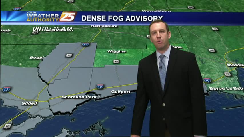
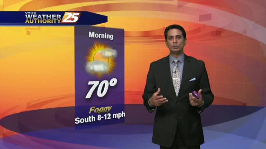
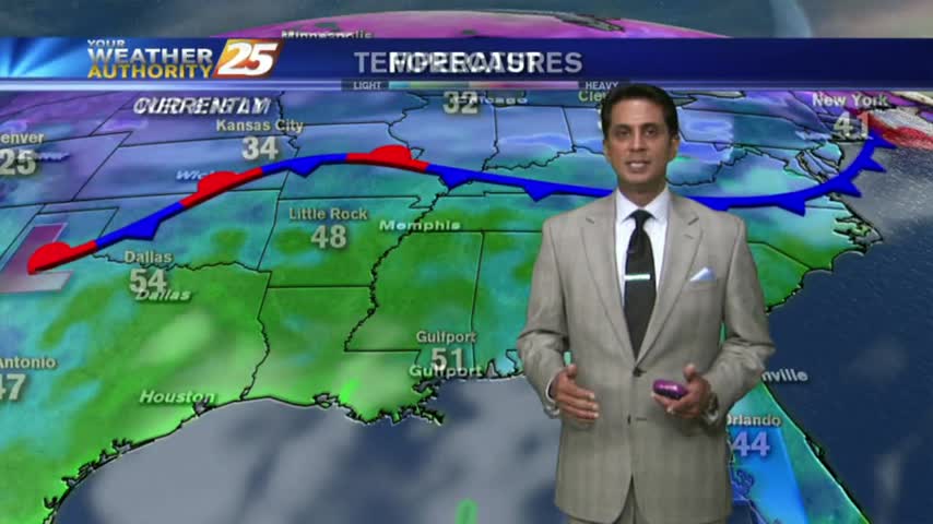
As a weak cold front moves into northern Mississippi, areas of DENSE FOG has developed along the southern 6...
As the warm/humid air from the GOM continues to move in...high pressure is suppressing the atmosphere with patchy morning fog...
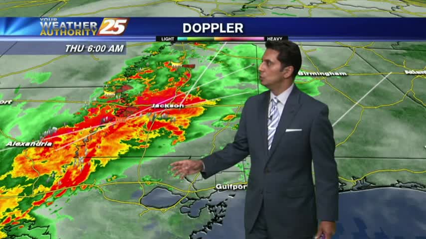
Dense fog is in the area with isolated showers and t-storms which continue from last night...
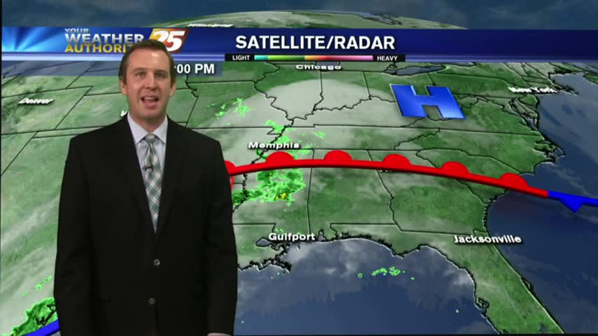
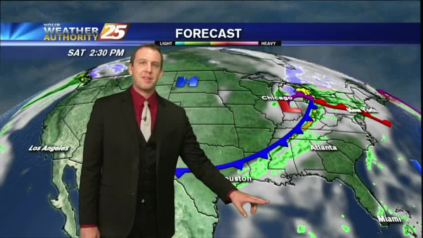
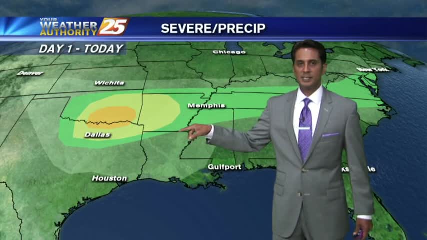
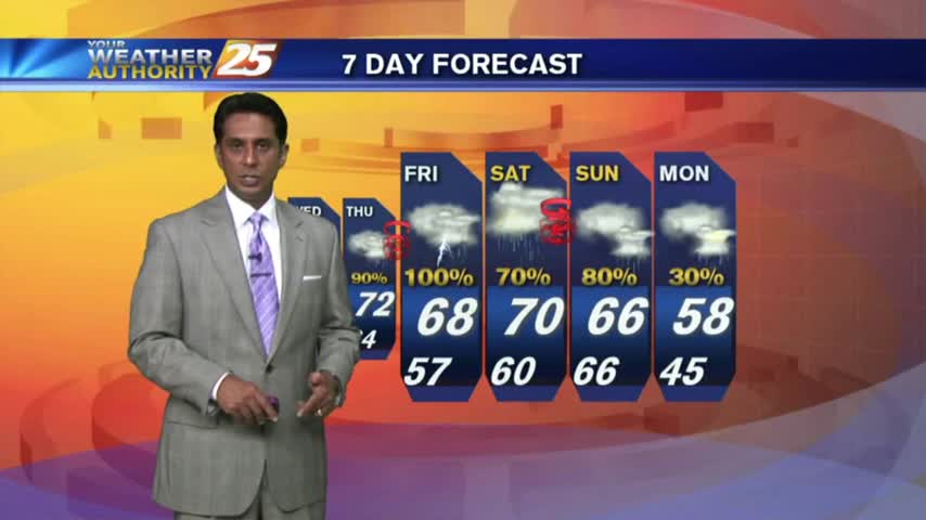
More fog ahead tonight, but we'll finally see a pattern change tomorrow. Unfortunately, it's because some strong and potentially severe storms are moving through. Details within.
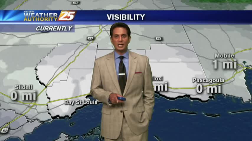
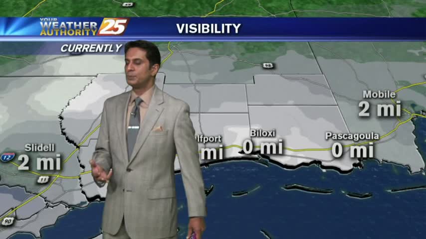
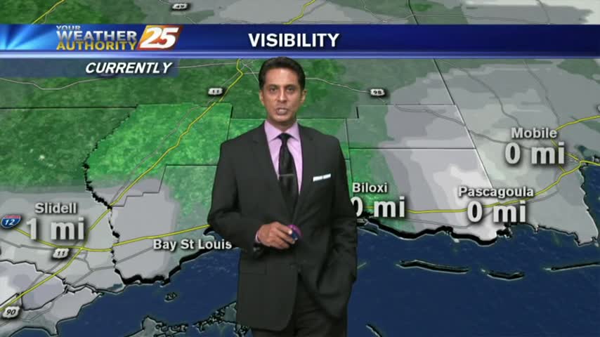
A warm/humid start with DENSE FOG and HORRIBLE VISIBILITY. Please USE CARE WITH YOUR MORNING COMMUTE.
With Spring-Like conditions of very warm/humid air along the SE, DENSE FOG has developed along the Southern 6...
Another morning with warm/humid conditions along with areas of DENSE FOG...an advisory is in effect through mid-morning...