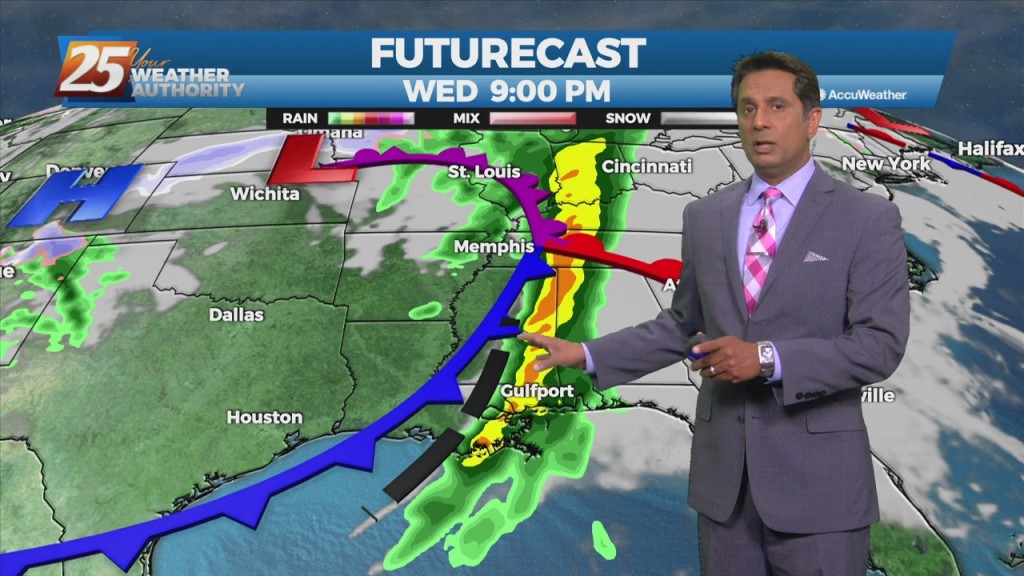
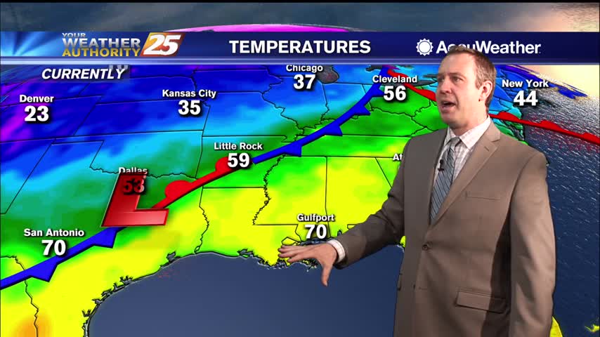
3/29 - Rob Knight's "SEVERE POTENTIAL THREAT AHEAD" Tuesday Morning Forecast
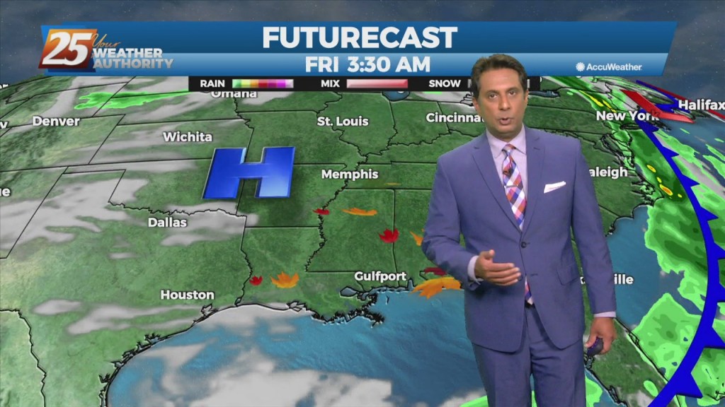
Very strong wind event and severe weather potential is expected Wednesday and Wednesday night... A quiet day with the exception of fog this morning but…
Very strong wind event and severe weather potential is expected Wednesday and Wednesday night... A quiet day with the exception of fog this morning but…
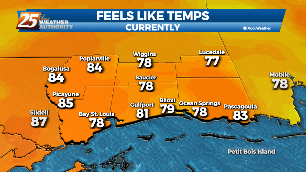
Above seasonal average temperatures will continue until a cold front makes its way through our area early tomorrow morning. The warmer temperatures coupled with high relative humidity…
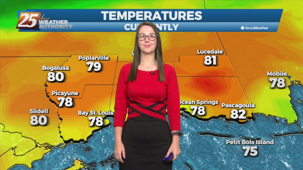
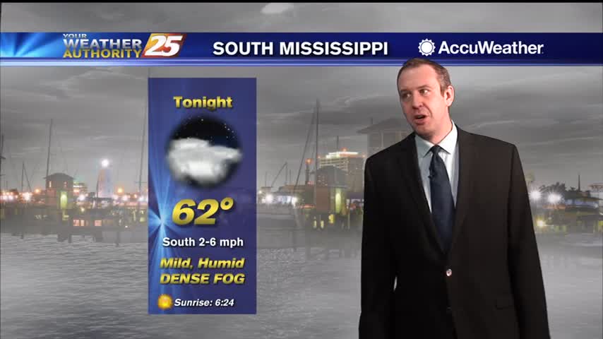
Warm and humid flow will continue from the Gulf of Mexico. The way above seasonal temperatures will continue as well as overnight DENSE FOG. A cold front draped across…
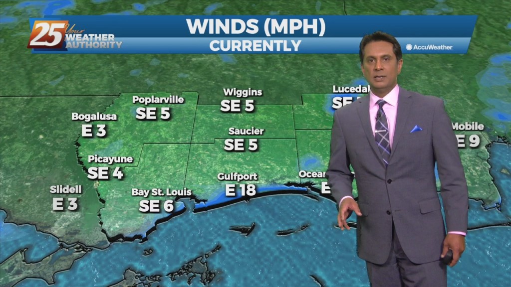
Cloud coverage and wind speeds will increase throughout the day. Winds are expected to be from the south, bringing warm, moist air from the Gulf of…
Rain showers and unseasonably warm temps continue through the next few days. As the high pressure remains seated over the Bahamas warm and moist air advection continues…
An upper level high-pressure centered near south Florida expands from east of the Bahamas to the western Gulf of Mexico. Models show a plume of moisture on the…
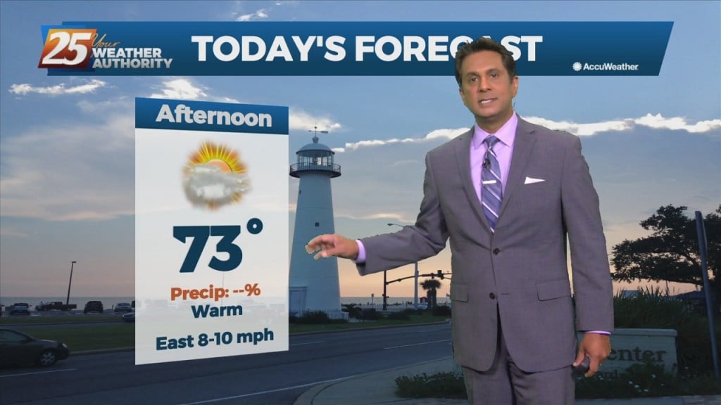
Today will be fairly quiet as high pressure remains the dominant feature of the short term forecast for the next couple days. High temperatures today warm back…
A fetch of low-level Gulf moisture riding north over a stationary frontal boundary will continue to bring cloud coverage to the area along with above seasonal…
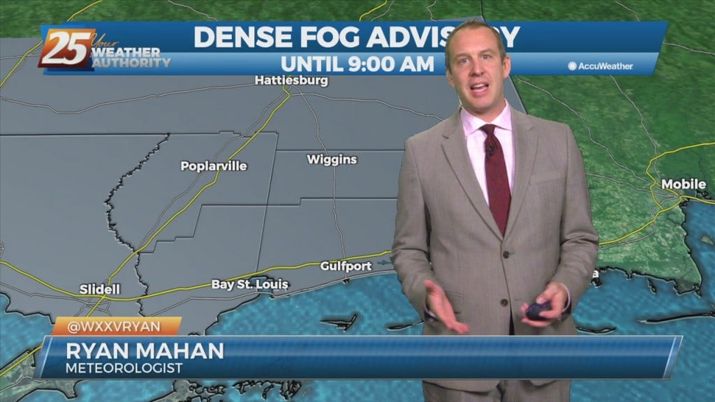
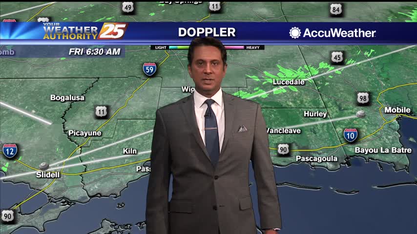
Fog continues to be the say of the day. The dense fog advisory will remain through late morning, and there is the potential that some areas could…
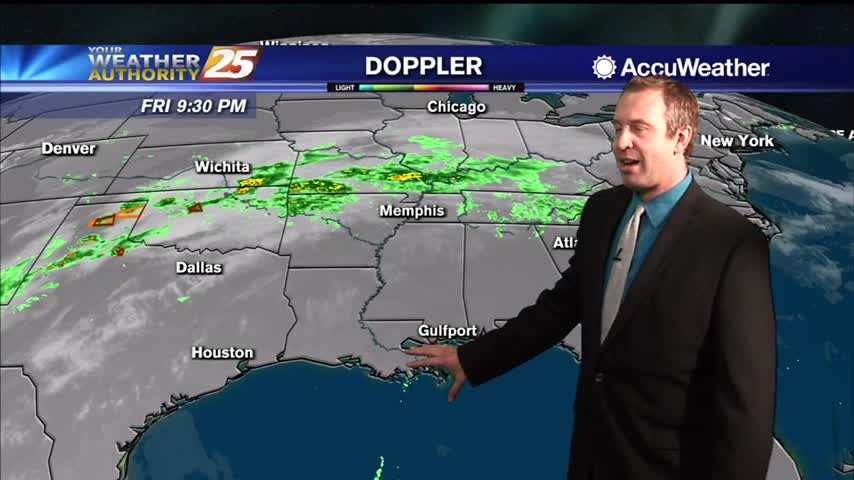
At the surface, high pressure really doesn't give way over the next 24 hours. A n upper-level disturbance will move from Texas across the area Saturday…
Surface high pressure that has been dominating the area will begin to shift off to the east today as an upper level disturbance extends down into our…
A weak cold front overhead will linger along the coast until later afternoon before getting an additional push to the SE. Areas of patchy dense fog this…
I’m sure most are sick of it, but more “late summer” weather is on the way and we're in for another foggy night. That means hot afternoons and warm,…
I'm sure most are sick of it, but more "late summer" weather is on the way as we finish off the week. That means hot afternoons and warm,…
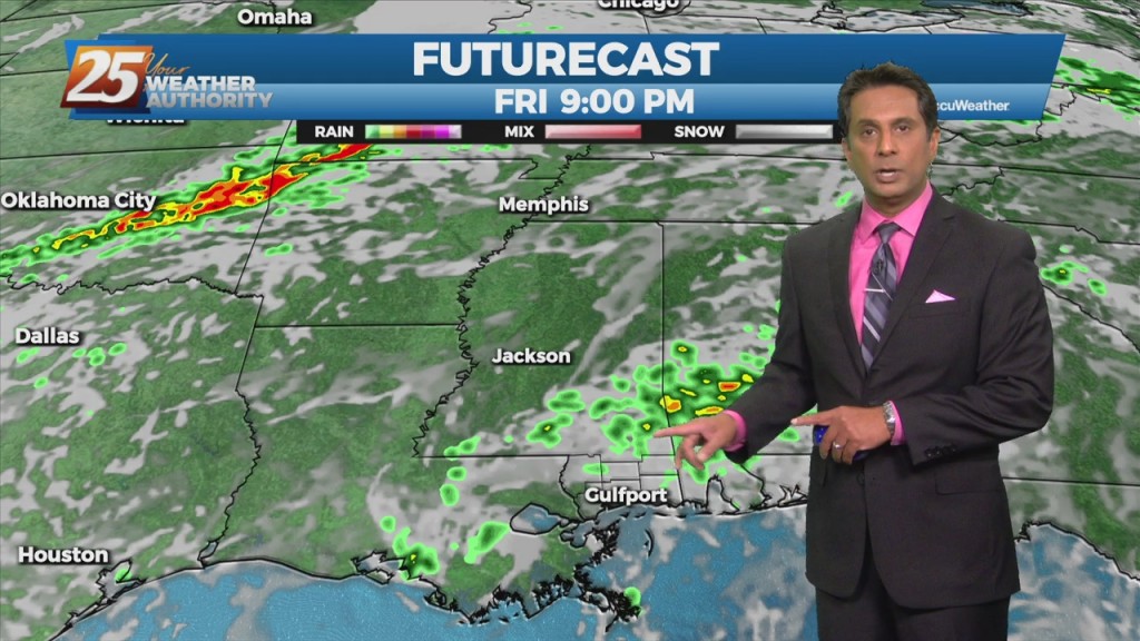
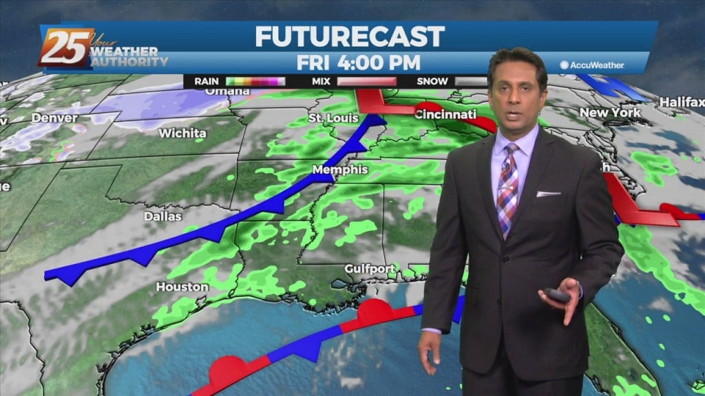
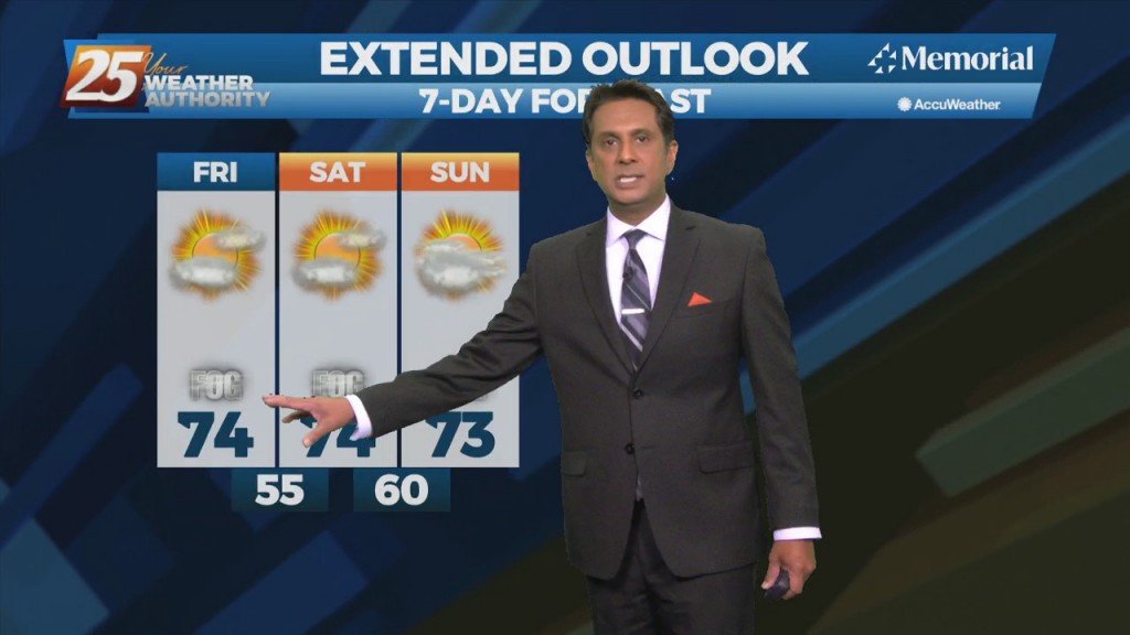
There is one last day of uncomfortable weather before a welcome changes. The disturbance moving through the Great Plains this morning will be over the Ohio River Valley by midday tomorrow. The cold front associated with this disturbance is expected…
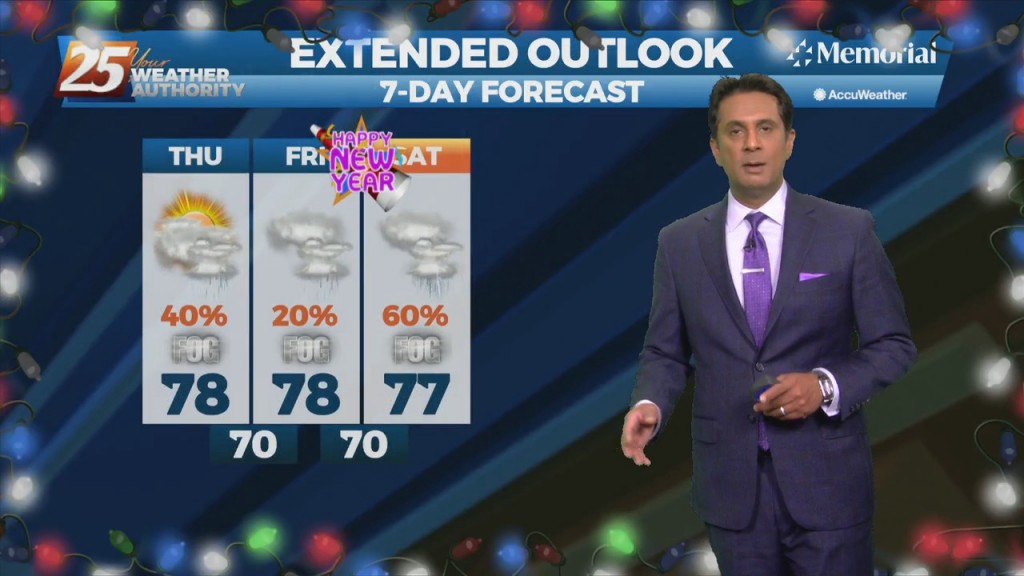
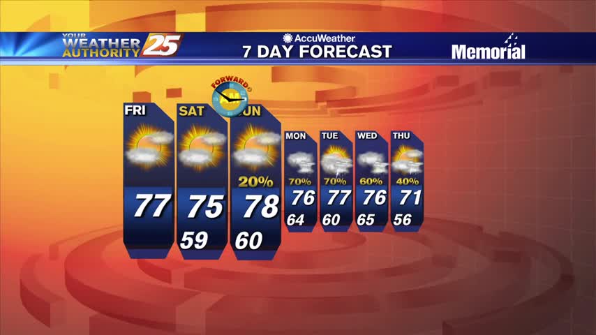
Slightly cooler and drier over the weekend, but we're right back where we started with lows in the mid 70s and patchy morning fog....
Another foggy night ahead as a slow moving front piles up moisture in the South MS area, with little change until the weekend.
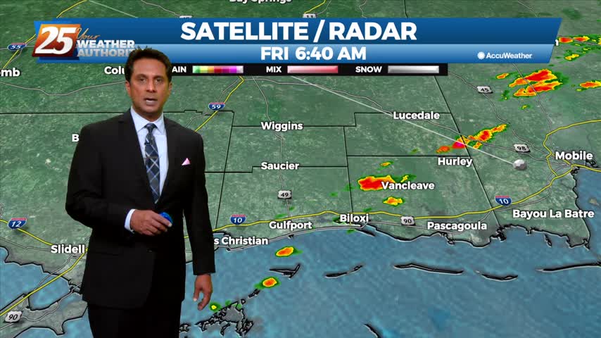
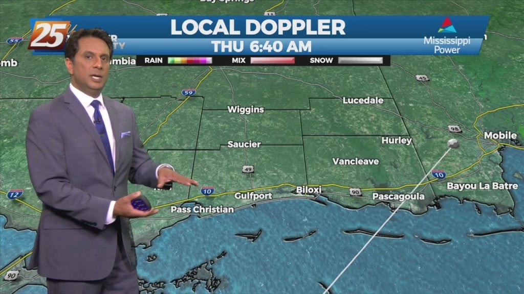
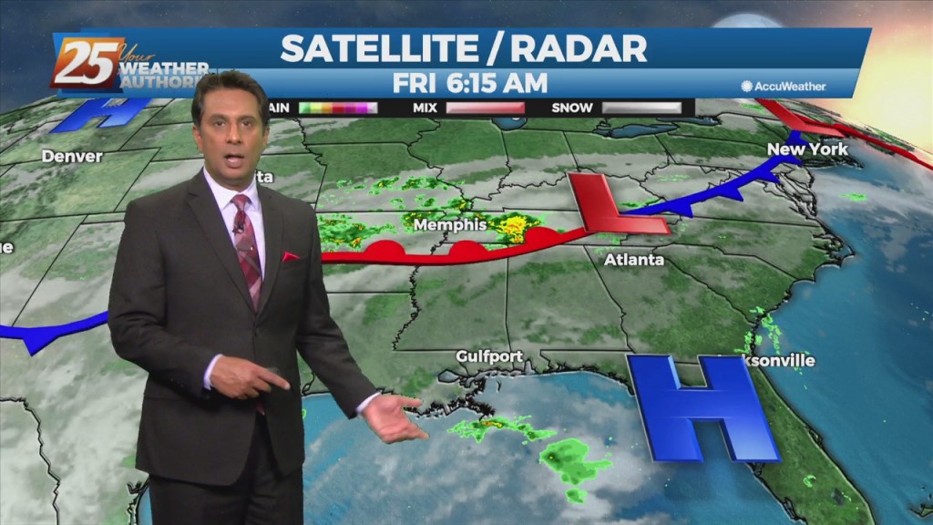
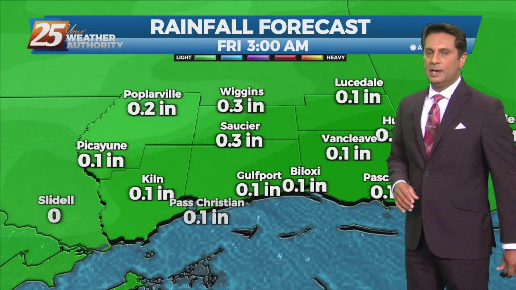
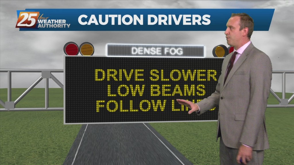
Areas of DENSE FOG affecting south Mississippi with spotty light rain...
Areas of DENSE fog this morning, then the possibility for SEVERE WEATHER this afternoon/evening...
Another amazingly foggy night ahead, with little change expected until next week.
A mild and humid start to the day with widespread fog affecting your morning commute...
Not much has changed since the end of last week as warm, humid conditions remain, but change is moving in later this week....
We'll see several warm, foggy nights in a row before anything changes noticeably, taking us well into next week....
Another very HUMID start to the day with widespread fog affecting south Mississippi...