04/04 Ryan's "Cooler/Drier" Wednesday Night Forecast
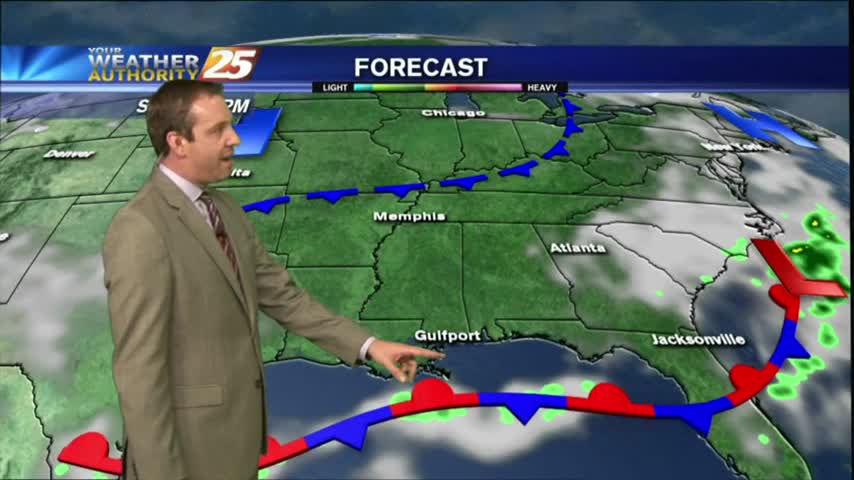
It was a stormy start to the day, a sunny and drier afternoon, and now a chilly and clear evening lies ahead. We'll see more rain and thunderstorms before next week though....
It was a stormy start to the day, a sunny and drier afternoon, and now a chilly and clear evening lies ahead. We'll see more rain and thunderstorms before next week though....
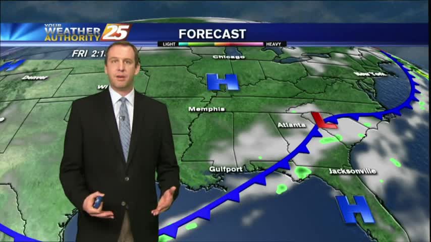
Skies remain clear and the air remains dry as high pressure continues to dominate most of the country, but rain isn't far away....
Today was as beautiful as expected, and high pressure continues to dominate. Expect a few more gorgeous days before a rainy weekend.

Happy Groundhog Day everyone! Today's weather was nice, but we'll see drastic changes as we head into tomorrow evening. Click the forecast link for more.
A cold front moved through last night and brought very little rain, but cleared our skies and cooled things down a bit. These changes don't last long, so be sure to watch the full forecast for details.
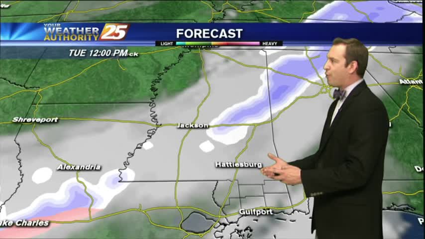
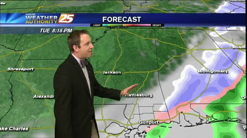
Rain is expected late tonight, but we'll be sunny and clear by tomorrow afternoon. Don't expect those changes to last though as rain moves right back in! Watch the full forecast for the details.
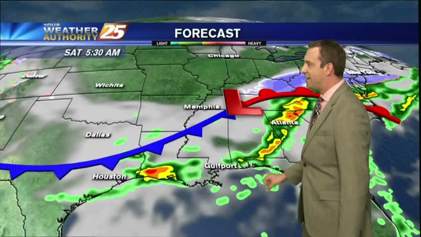
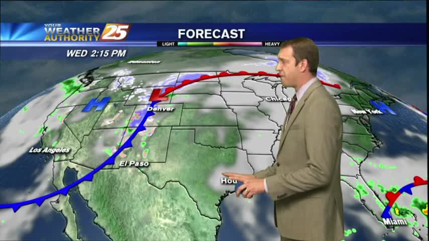
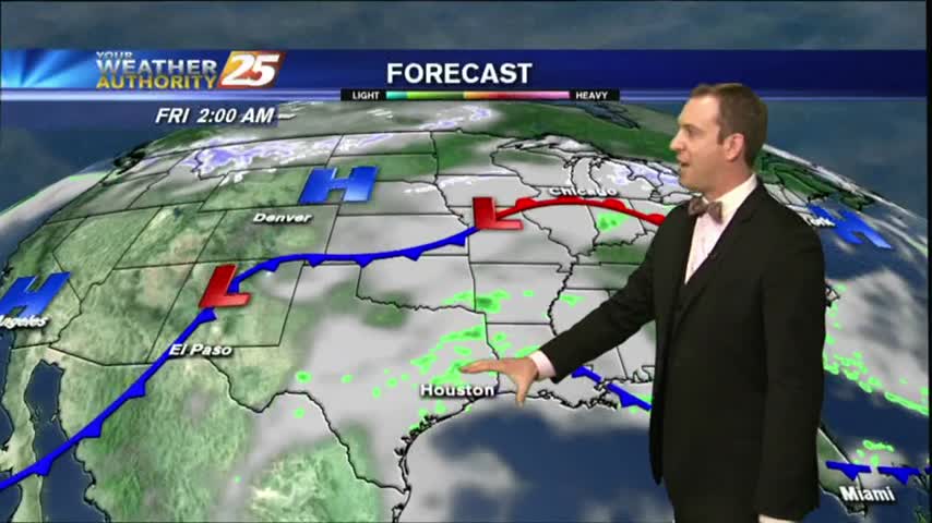
Lots of changes on the way over the next week as at least three fronts move through bringing increasing humidity & temperatures, then rain, and finally clearing & drying. Click this link for the full forecast.
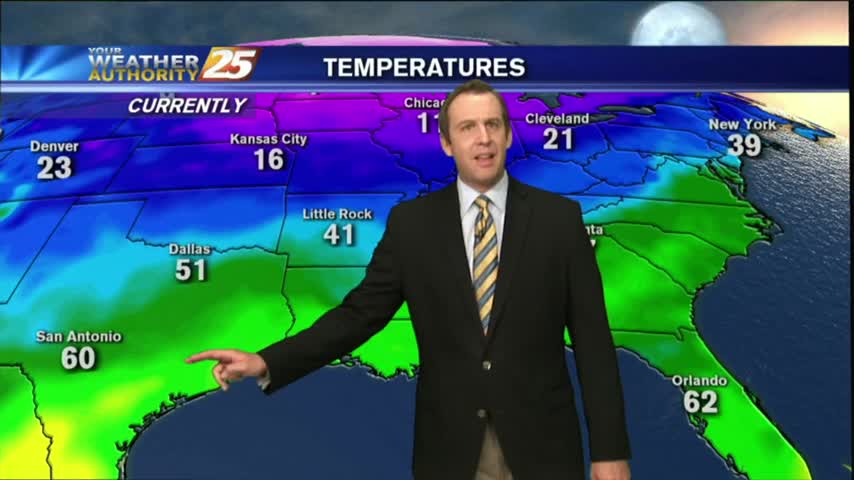
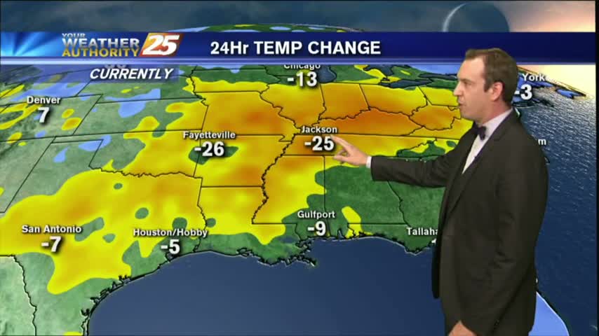
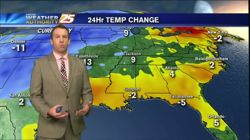
It's been a brutal week of cold, dry, and often dangerous weather; but we're finally seeing a warming trend that will carry us all the way through the weekend. Click here for the full forecast.
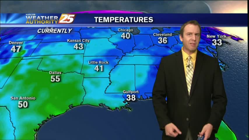
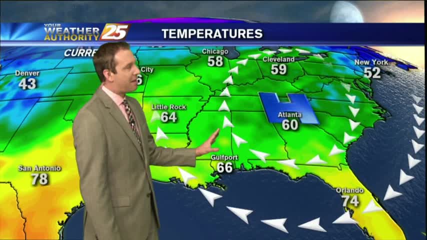
The warming trend that began yesterday continues through today, tomorrow, and into next week. We'll see another cold front by Monday though, click the link for details.
Mostly clear and cold tonight, but an Arctic front is moving in that will bring even colder air and even some possible winter weather! Click the forecast link for the latest information.
After a warm and humid start to the week we'll see some drastic changes as another Arctic front pushes into South MS, bringing the slight chance of wintry weather. Click the link for the details.
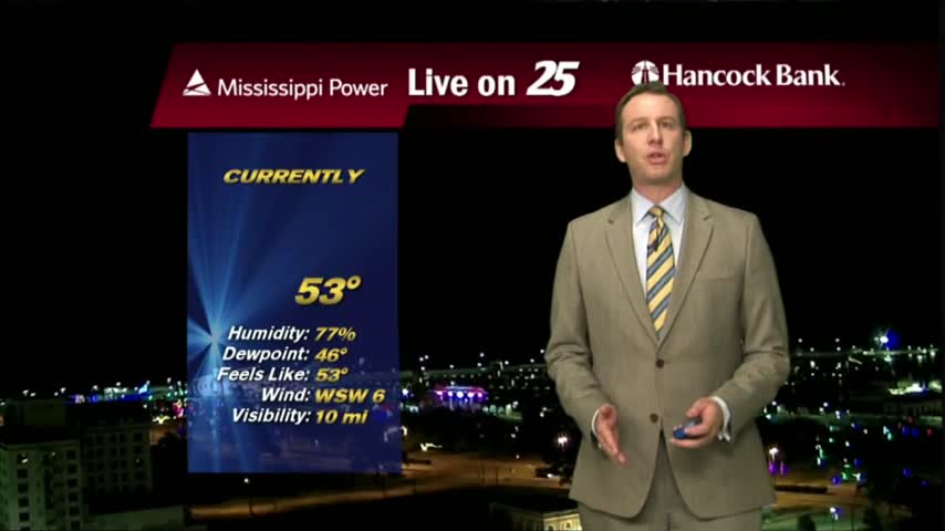
It was a gloomy day in South MS as our high humidity lead to a misty light fog and low pressure lead to cloudy skies. Expect little change in the short term, but you'll have to click the forecast link fore the details.
Patchy fog has been developing over the last few hours, and will continue to do so throughout the night and into Tuesday morning. Click this link to watch the full forecast for the details.
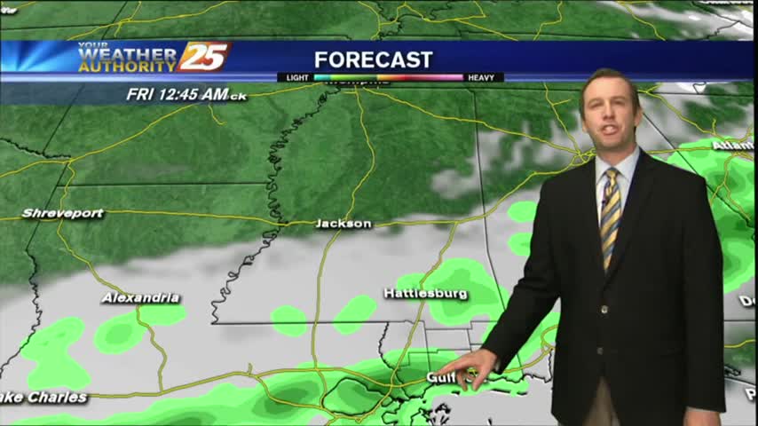
The showers and storms moved in as expected last night, and while the rain may have moved on, the moisture will remain for most of the week. Click this forecast link for more details.
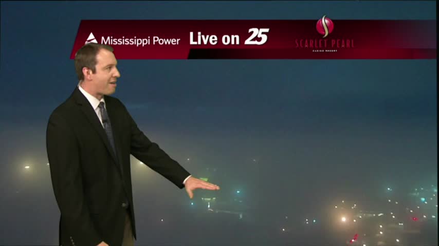
The fog cleared this afternoon and ushered in a sunny & warm afternoon, but as we cool tonight more fog will develop...just not as bad as the last few nights have been. Watch the forecast for details.
Cooling trend ended this afternoon, and now we're beginning a 24 hour warming trend before our next quick cool-down. Click here for the full forecast.
It's been slowly warming ever since our winter weather moved through and tonight will be the warmest we've seen in several days. A weak cold front is moving through tonight though bringing changes, details inside.
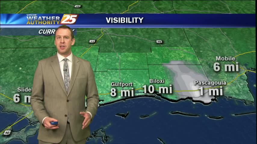
As expected, dense fog advisories have now been issued for all coastal counties and surrounding waters so get ready for another night of low visibility. Click the forecast link for more information.
Gloomy conditions galore with dense morning fog this morning and grey, rainy skies in the afternoon, but a front will bring nice weather for the weekend. Click the forecast link for details.
It's again warmer and more humid as we expected, which means patchy fog will be more of an issue over the next few evenings. Watch the full forecast for more.
It will be considerably warmer tonight that it was last night as moisture continues to pour in, meaning fog will become more of an issue in the coming nights. Watch the forecast for details.
The last week has brought us very similar weather, but tonight will be the last of those and significant changes will begin soon as a front moves in. Click the forecast link for the full forecast.
We're almost to the weekend that will bring a cold front and considerable cooler/drier air to the area. Watch the forecast for the details.
The forecast continues to unfold as expected, with slight temperature and moisture increases each day into the weekend. Expect more evening/morning fog though, details within.