3/7 - The Chief's "Sunny & Warm" Friday-Eve Morning Forecast
A beautiful day is ahead with mostly clear skies becoming partly cloudy this afternoon. The next frontal system will be getting together by tonight as the…
A beautiful day is ahead with mostly clear skies becoming partly cloudy this afternoon. The next frontal system will be getting together by tonight as the…
A broad region of enhanced upper level forcing will develop over the Gulf South today and continue into Saturday. This forcing will be driven by the…
The cold front moved out over the gulf yesterday and cool air has been slowly filtering in behind it. This will continue today keeping high…

As high pressure will shape the forecast, the next few days is primarily a temps and cloud cover forecast. As the deep closed low continue to…
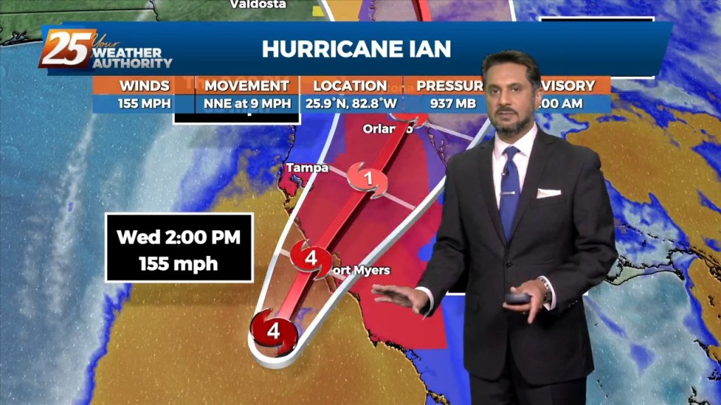
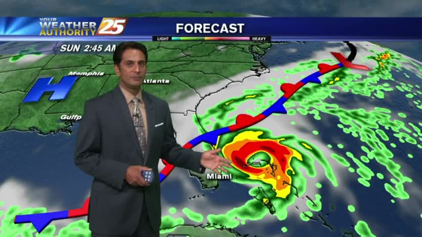
Drier and cooler temperatures are here, and Fall-like feeling is in the air! No rainfall is expected for the next few days. And while the Hurricane Ian is…
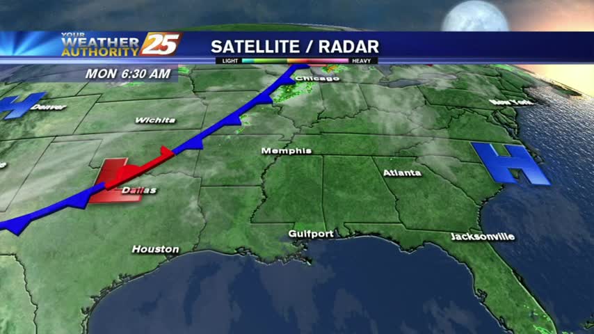
High pressure at the surface covers roughly the eastern half of the country, with low pressure and an associated front from the Dakotas into Colorado. The…

Surface high pressure continues to build in from the north, ushering in post-frontal cool and dry airmass. Observations across the local area show…
At the surface, high pressure extended from the Great Lakes southward to Florida with a weak extension southwest into the western Gulf of Mexico. This will…

Surface high-pressure building in from the north and keeping yesterday mild is quickly sliding east. Onshore flow develops today as elevated winds will bring in…
A large upper level low-pressure will continue to spin over the western Great Lakes through Saturday. Another upper-level disturbance to the NW will move through tonight…
A pleasant start with cool temperatures and upper-level clouds moving in from the south...
Another cool start to the day with upper clouds beginning to move in from the west...
A cold start this morning with a weak cold front to affect the area tonight...
It's another lovely start to the day with subtle changes as high-pressure has moved NE of the area...
A cool start to the day with very shallow ground fog, the fog will be much worse tonight...

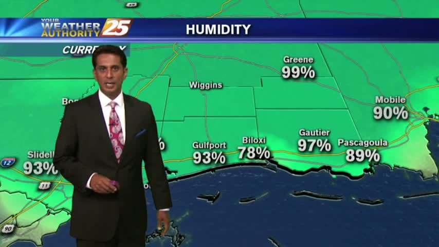
A mild and humid start to Valentine's day with areas of PATCHY FOG through the Southern 6...
A cool but warmer start to the day as the pattern has begun to shift...bringing warmer more humid conditions to the region...
As the south wind from yesterday afternoon continues in advance of the approaching cold front, it's a WARMER more humid start to the day...
Another cool start to the day but the humidity has already begun to increase heading into the weekend...
Another cool start to he day under clear skies, but the pleasant air mass will begin to modify heading towards the weekend...
A BEAUTIFUL start to the day as high-pressure to he NW is ushering in a cooler/drier air mass which will shape our forecast through the weekend...
A clear and cool start this morning will lead to a warm and breezy afternoon. Cloud cover and rain chances on the increase as the weekend arrives.
Another cool start to the day as high-pressure continue to bring clear skies and cool overnight temps...
After an ABSOLUTELY BEAUTIFUL weekend, only minor changes are on-tap for the workweek...