9/26 - Payton's Tuesday Afternoon Forecast
Showers and thunderstorms that moved off the waters this morning continue to slowly dissipate, but we could see more this afternoon.
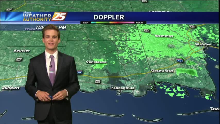
Showers and thunderstorms that moved off the waters this morning continue to slowly dissipate, but we could see more this afternoon.
Seeing a few showers in the area this morning ,but drier weather is on the way.
Showers and thunderstorms are starting to develop across the area this afternoon.
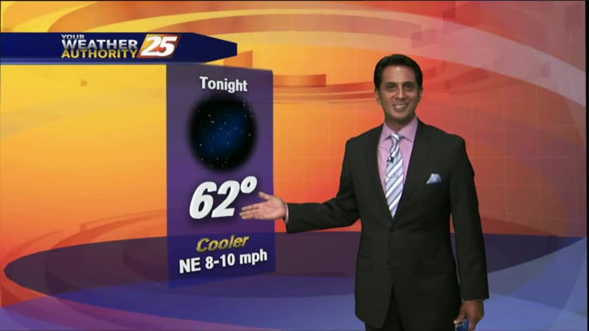
The cold front has moved south of the area with overcast skies continuing. Major changes area ahead as a COOLER/DRIER air mass moves in...
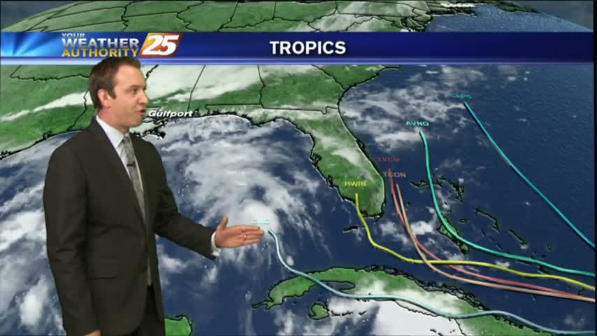
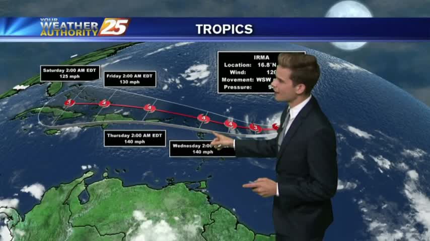
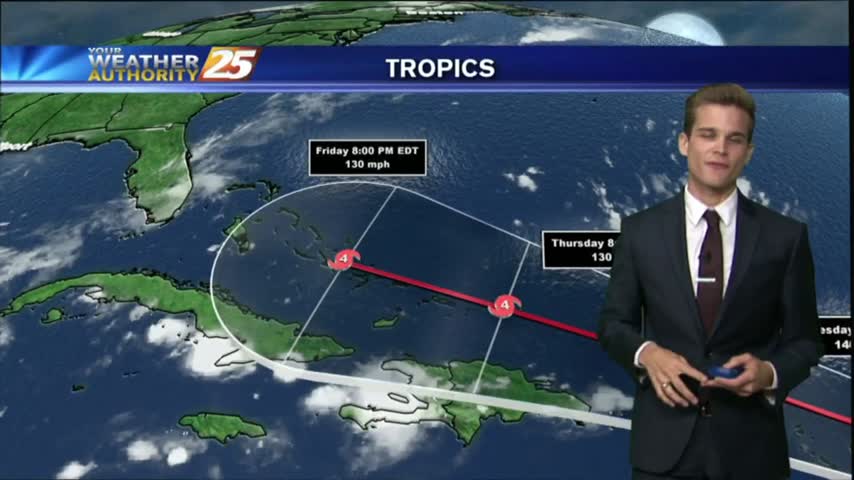
There is still a decent amount of uncertainty when it comes to Hurricane Irma's final path towards landfall in the U.S, and we discuss all the options in tonight's forecast. Details within.
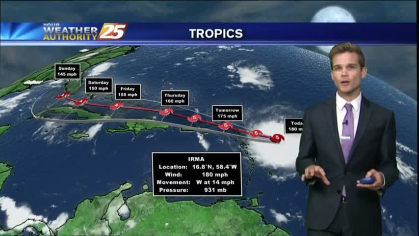
Irma continues to strengthen this morning and afternoon into the strongest Hurricane ever recorded in the Atlantic Basin with winds up to 180 mph.
We expected a gorgeous day today and weren't disappointed. We have many more amazing days ahead, but a cold front to move through first. Watch the full forecast for more.
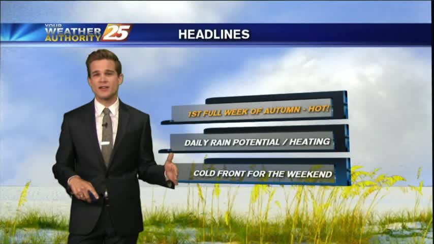
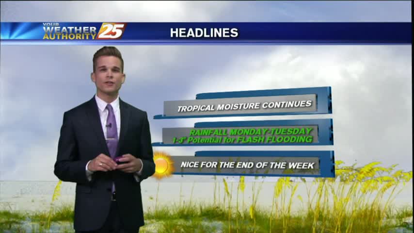
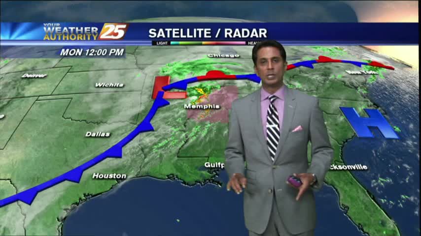
An early-week cold front will move through the area quickly, bringing cooler/drier air and sunny skies. There are a few tropical systems to worry about though, details inside.

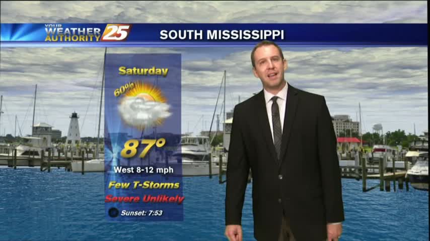
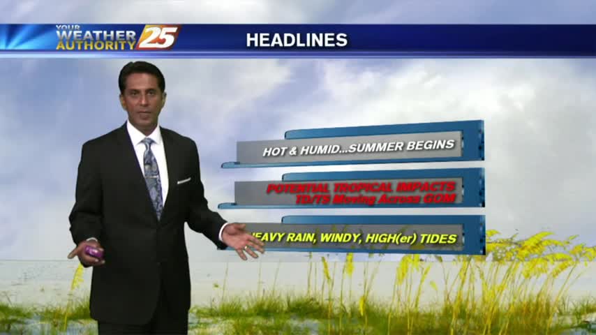
It will continue to be humid with temperatures around 90 degrees so take it easy and drink plenty of water if you’re outside for the holiday.
Good morning South Mississippi! I hope you had a great weekend and enjoyed the somewhat drier conditions.
I hope you had a great weekend and enjoyed the somewhat drier conditions. That will continue into Labor with the area being hot and dry.
While Thursday may have been the hottest, today was the most sunny! That's already starting to end though as cloud cover increases through the night. Full forecast inside.
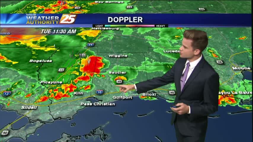
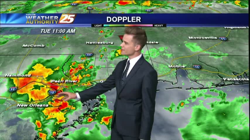
Today will bring the same scenario with the activity in the area. An additional 2-4 inches of rain is not out of the question with the strongest storms.
Another warm & humid start to the day as ALL EYES continue to focus on a DEVELOPING TROPICAL system in the W'tern Caribbean...
Rain chances continue this afternoon and evening as low pressure moves overhead, but a cold front pushes through late tonight drying out the area for the end of the work week.
Showers and thunderstorms this afternoon lead to a quiet evening with most of the activity being very light and off to the west. An upper level disturbance along with a surface trough off to the west will continue to increase…
We ended up with two waves of strong storms, but still stayed away from any "severe" weather. Watch the forecast for your weekend details.

A warm/humid and BREEZY start to the day, along with areas of patchy fog along the coastal counties...
Our afternoon cloud cover cleared a bit for the early evening but will return overnight as the cold front continues to slide Southeastward. Full forecast details inside.
We're finally going to see our "boring" weather streak coming to an end, but not until after one more sunny and humid afternoon. Showers and thunderstorms begin moving in by sundown, so be sure to check out the forecast for details.
Very light sprinkles associated with a dissipating cold front is moving though the interior counties...along with DENSE FOG along the coast.
Storms pushed through this morning and now we're seeing continuous breezy winds bringing in cool and dry air. Expect a gorgeous next few days, but you'll have to watch the forecast for the details.
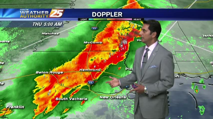
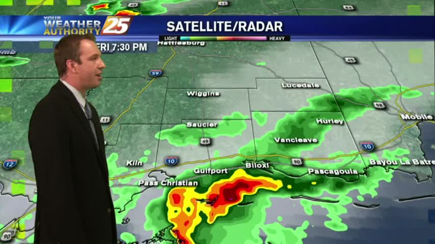
Showers/T-Storms moving in from the west with an associated cold front...SLIGHT THREAT for SEVERE STORMS...
After a cloudy, warm/humid start to the day...showers & t-storms continue to develop and move into the area...