11/11 - Sam Parker's "Nitty-Gritty" Monday Midday Forecast
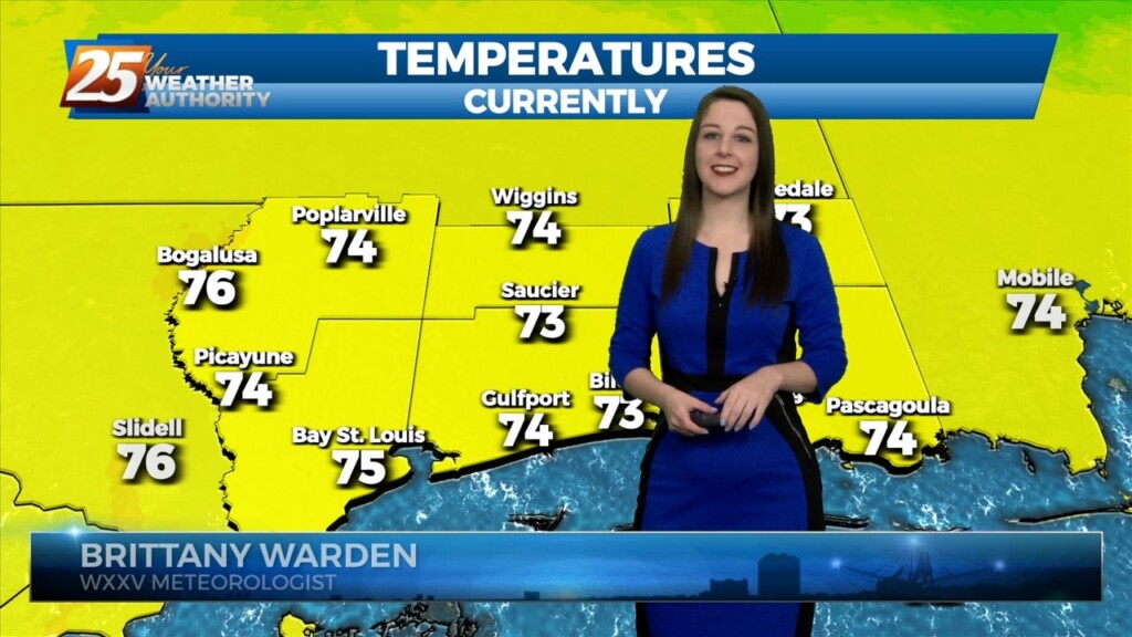
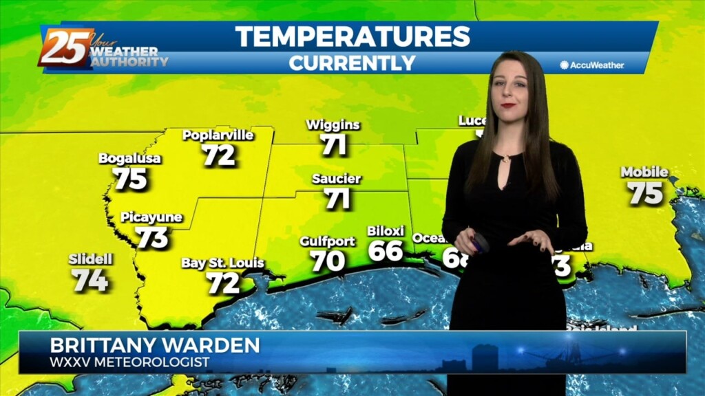
The thicker cloud cover and rain did cool things down yesterday and for this morning, dropping lows to the upper 60s and low 70s, cooler than…
The thicker cloud cover and rain did cool things down yesterday and for this morning, dropping lows to the upper 60s and low 70s, cooler than…
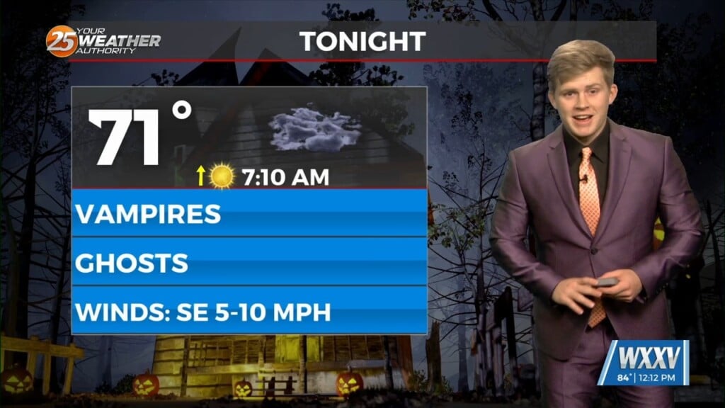
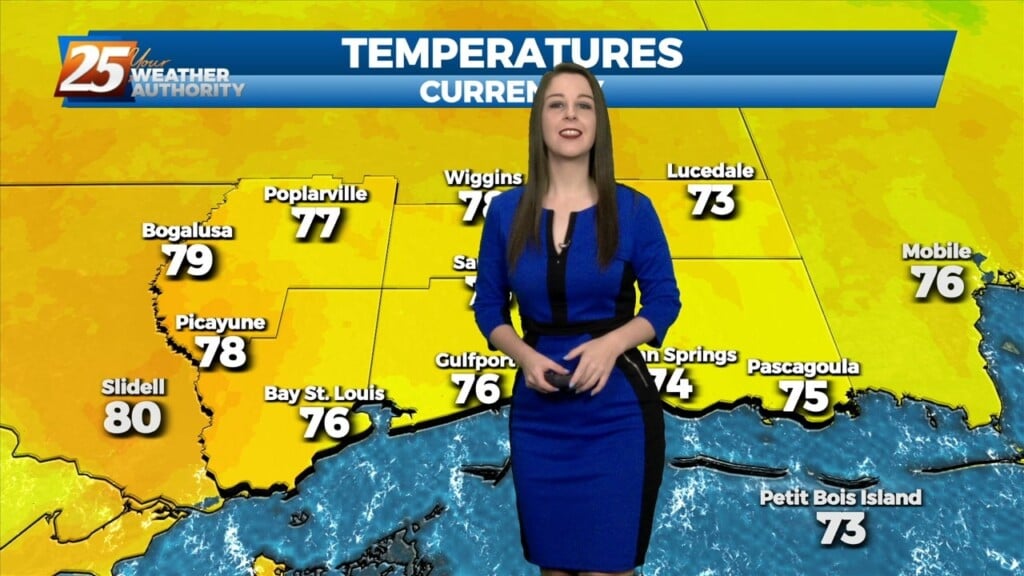
Happy Halloween all you ghouls, ghosts, and witches and even though it is Oct 31st it is still going to be a warm one across the south…
An area of low-pressure remains over Arizona, with a cold front to the SE of the area. A few sprinkles early this morning, but that’s about…
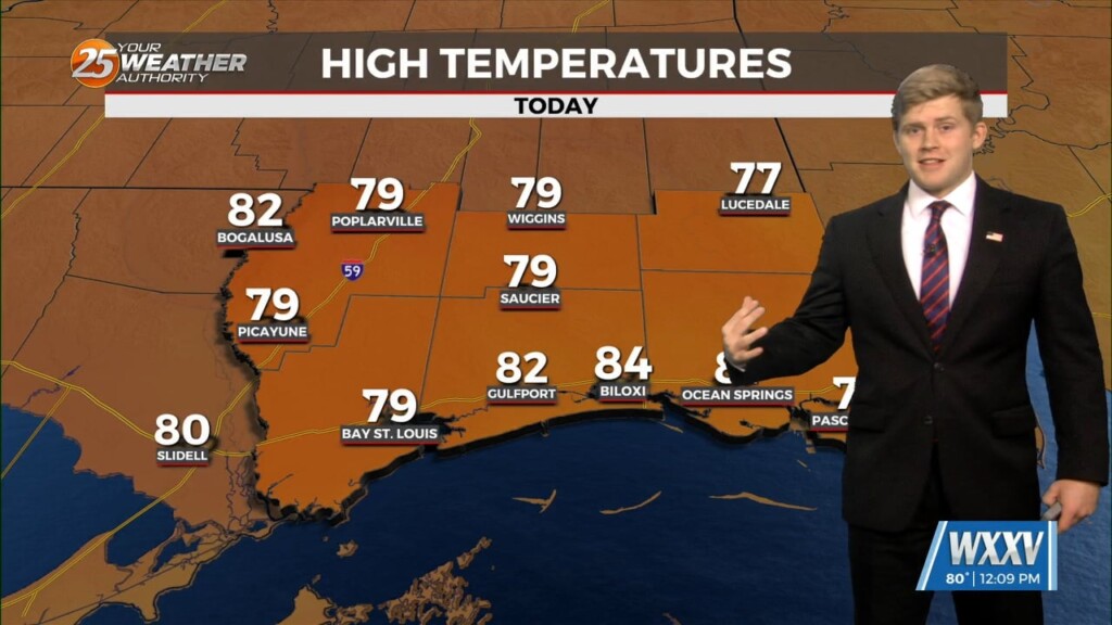
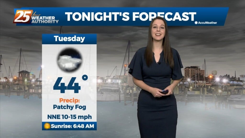
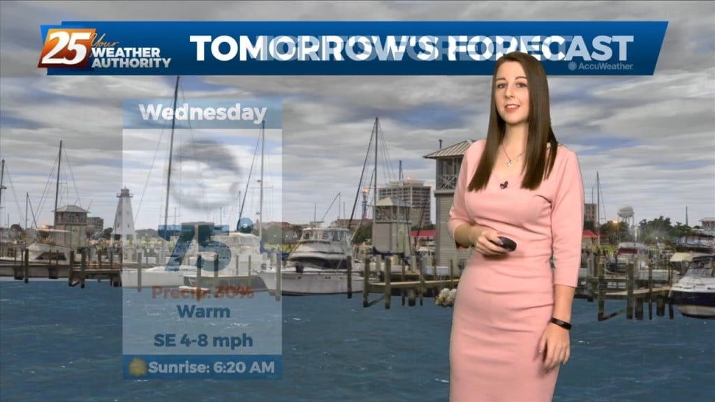
Some sunshine returns this afternoon, particularly along the beachfront. Temperatures will be slightly warmer and right at the average high temperature this afternoon. Winds will also back…
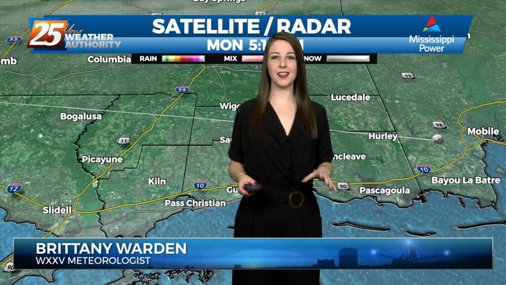
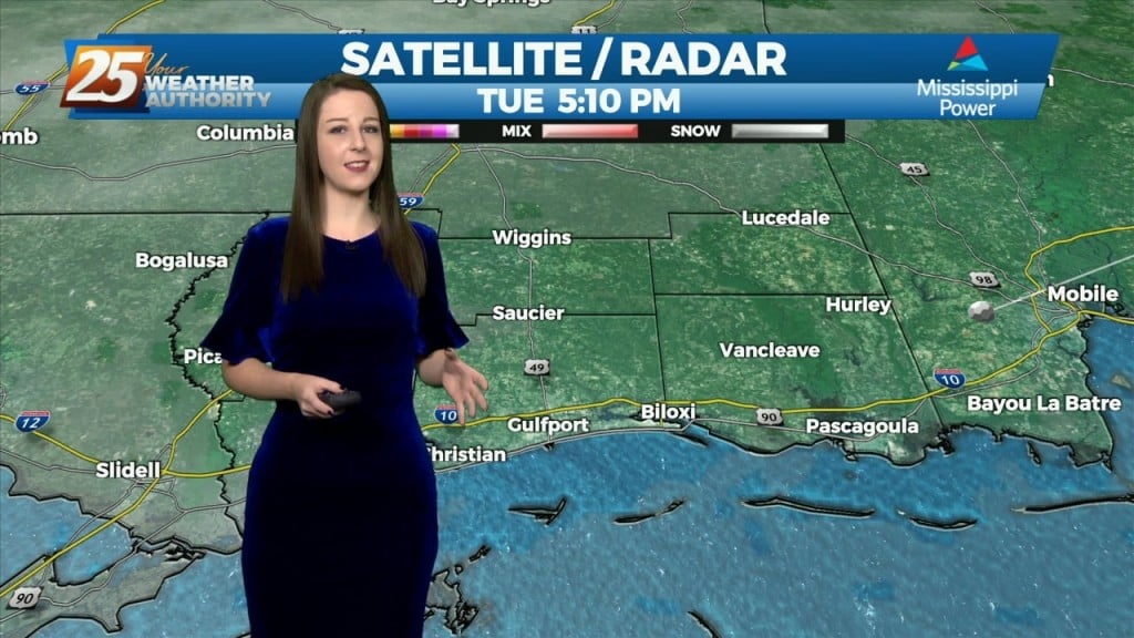
Some weak convection has developed over the MS Sound and near the Pearl River this afternoon. This is likely in response to steel low level lapse rates/enhanced…
Some weak convection has developed over the MS Sound and near the Pearl River this afternoon. This is likely in response to steel low level lapse rates/enhanced…
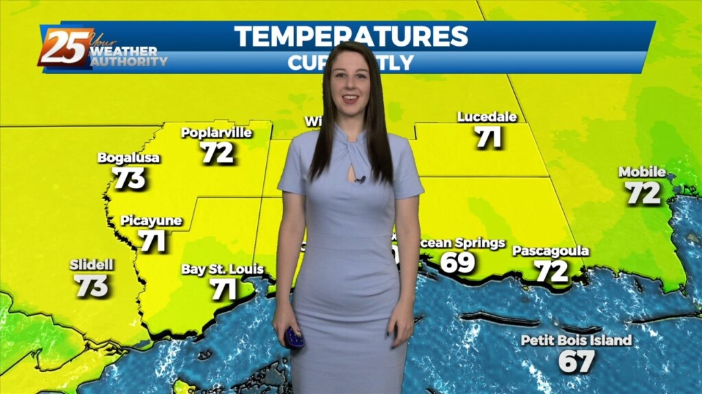
Morning lows will still be quite warm but they should be back in the upper 60s at least. This is still on the warm side but given…
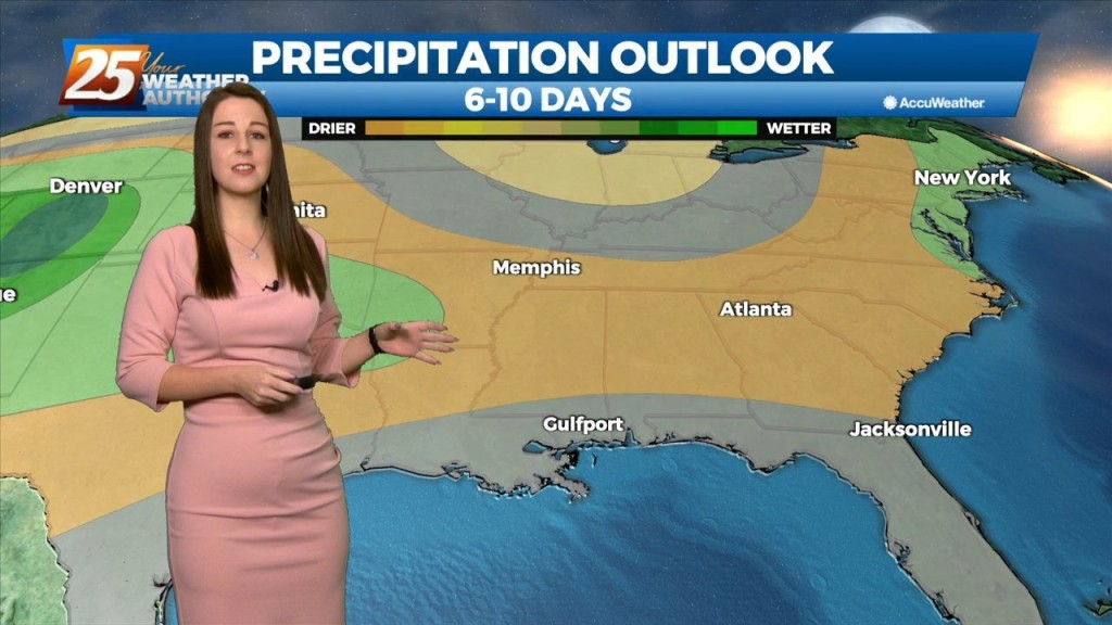
Warm and moist air advection continues as we stay ahead of the trough over southern Colorado. The advection as well as isentropic lift has created some showers across the…
Warm and moist air will stick around until Thursday after the main cold front moves through. This will keep us warmer than average tomorrow and Thursday ahead…
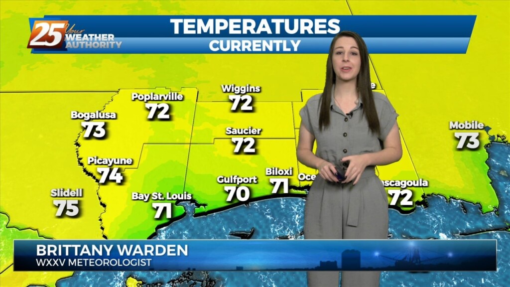
Quite the dreary start to the day but once fog burned off temps torched out with mid to upper 70s. Along and north of the stalled stalled front which…
As the cold front exits stage right, we will see temps begin to fall this morning into the 40s and 50s by mid-morning. With strong…
An upper low currently is deepening as it crosses the southern portion of the Rocky Mountains. As this upper low moves across the Central Plains today and…
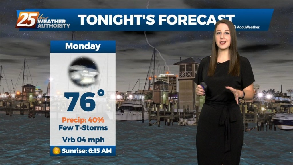
It'll be a warm and wet night in advance of an approaching cold front that will make its way overhead by early tomorrow morning. By tomorrow afternoon, conditions will…
Tonight will be another cold night here in south MS but it'll be one of the warmest nights we have left of this workweek because…
Low clouds and even some haze/light fog has been impacting the region outside of the light rain. The warm front retreated quickly and even by this morning…
Cloudy skies will continue this afternoon with breezy conditions from the North at 10-20 mph. Tomorrow, a stronger system will move across the Southern Plains, finally…
Strong high pressure will build into the region and usher in quite cold air for this time of year. Highs and lows will be 15+…
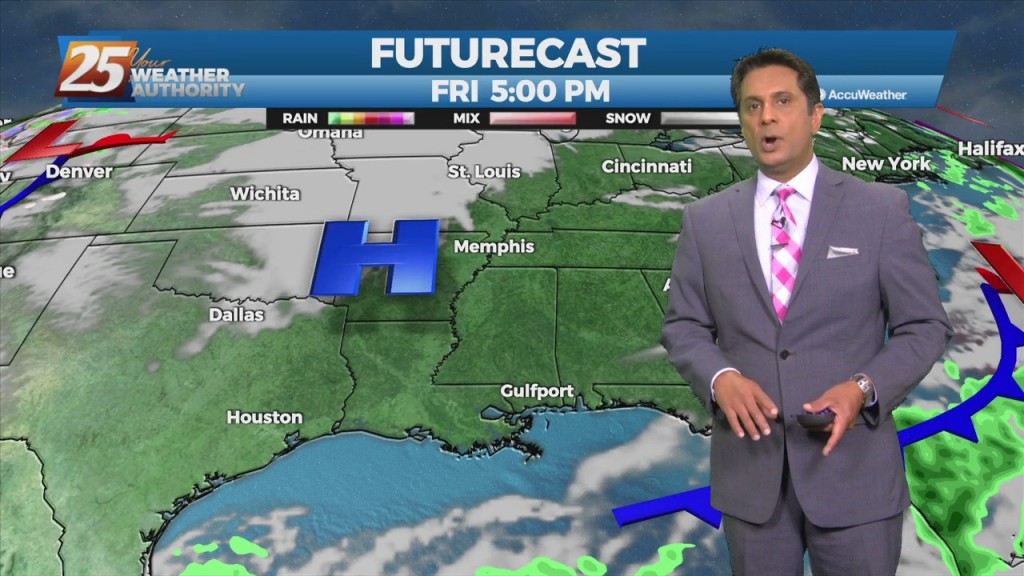
The upper low to our west will move eastward across Texas this afternoon and evening, and be located near Shreveport by early Saturday morning. Beyond that point, the…
Tonight through Wednesday Night, little change in the ongoing pattern is expected through Wednesday night as a broadly diffluent westerly upper level pattern, a weak shortwave trough,…
A shortwave trough will move through the area over the next few days. Southerly surface winds will continue to enhance warm air and moisture advection, which will…
Going into tonight, a few scattered showers should continue to cycle downward over the land-based zones as the diurnal cycle shifts offshore. On Thursday the flow shifts…
Convection is ongoing across the region this afternoon. Going into tonight, a few scattered showers should continue to cycle downward over the land-based zones as the diurnal cycle…
Thunderstorm activity will taper off after sunset, then lingering debris clouds and VFR conditions expected overnight. Winds will be variable in and around storms, then light southerly winds will…
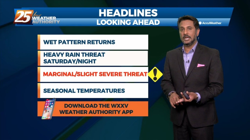
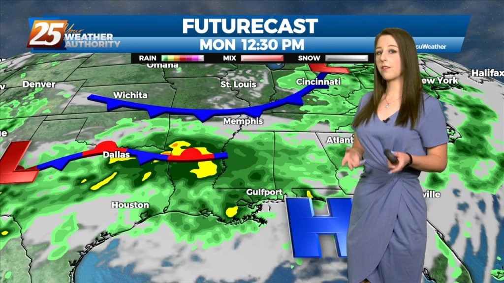
The main focus of the short term will be the cold front that is still looking on track to slide down into our area later today. This…