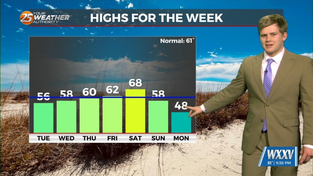
1/13 - Sam Parker's "Warmer Week" Monday Night Forecast
Warming up gradually for the week until showers come at the end and another Arctic blast in 2025. A really beautiful day to start the week…
Warming up gradually for the week until showers come at the end and another Arctic blast in 2025. A really beautiful day to start the week…
Conditions will remain relatively similar for the next few days with cloud coverage and breezy conditions from the south. The main feature on the map…
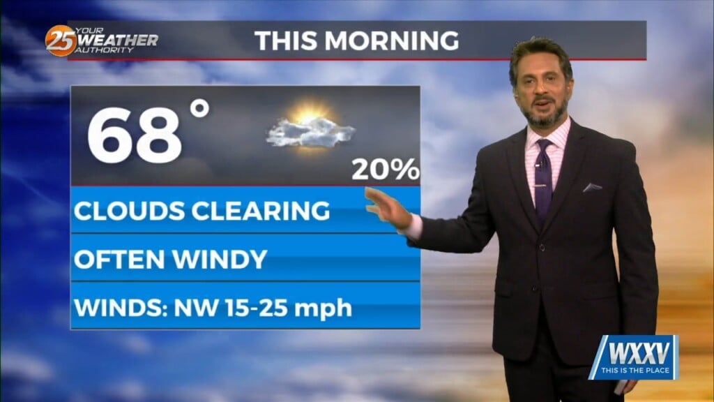
All precipitation has cleared the coast at this point as cloud coverage will continue through mid/late morning. High pressure to the NW will move in…
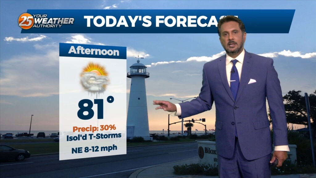
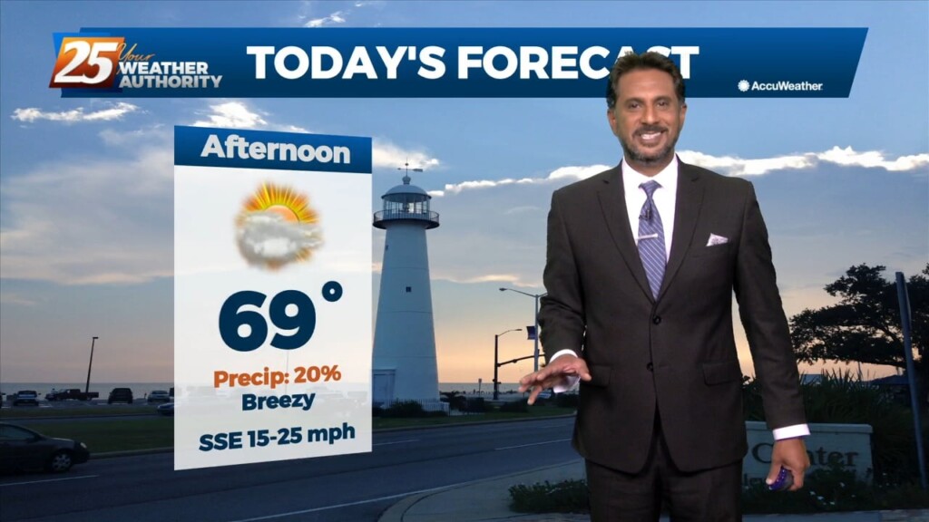
This afternoon will continue to bring breezy conditions from the south...increasing the moisture. Tuesday is still the main forecast issue but honestly it…
No real issues to discuss today. High pressure over the Gulf will continue to dominate the region while low level temps keep slowly stepping up.…
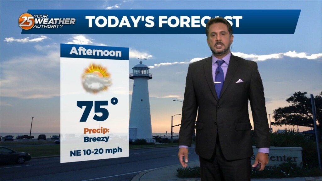
Some clouds move for this afternoon but the biggest change will be the wind direction. Gradually, our area will experience a moderating pattern with temperatures not as…
A disturbance over northern Mexico is promoting its development as it ejects over the southern plains. High pressure over the GOM will keep the disturbance too…
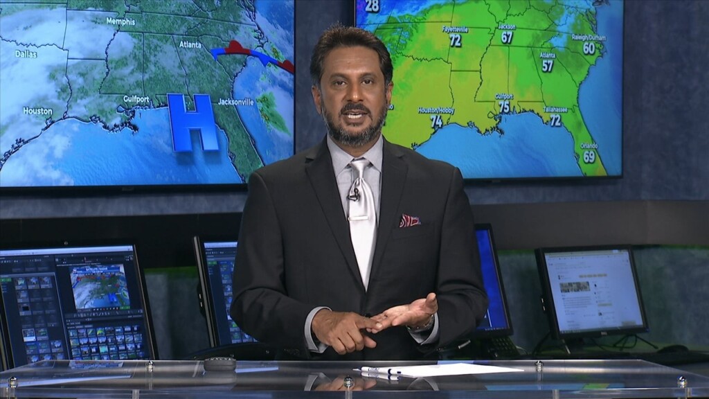
Models signal very similar activity during peak afternoon heating compared to yesterday. Temperatures today look to vary a good bit, as highs will max out in the lower…
Under a further amplifying disturbance, the region will remain on the dry side of this feature. The best lift and instability will be through the Gulf South.…
With a disturbance over the Great Lakes, and another disturbance over the northwest, we look to stay in zonal flow for the next couple of days, keeping…
High pressure over the northern Rockies is setting up a quasi-zonal flow across the southern third of the country. At the surface, a reinforcement of drier…
An area of low pressure remains over the Great Lakes this morning, with a disturbance moving into the Pacific Northwest. High pressure was noted over the…
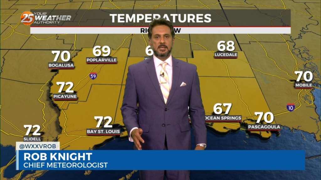
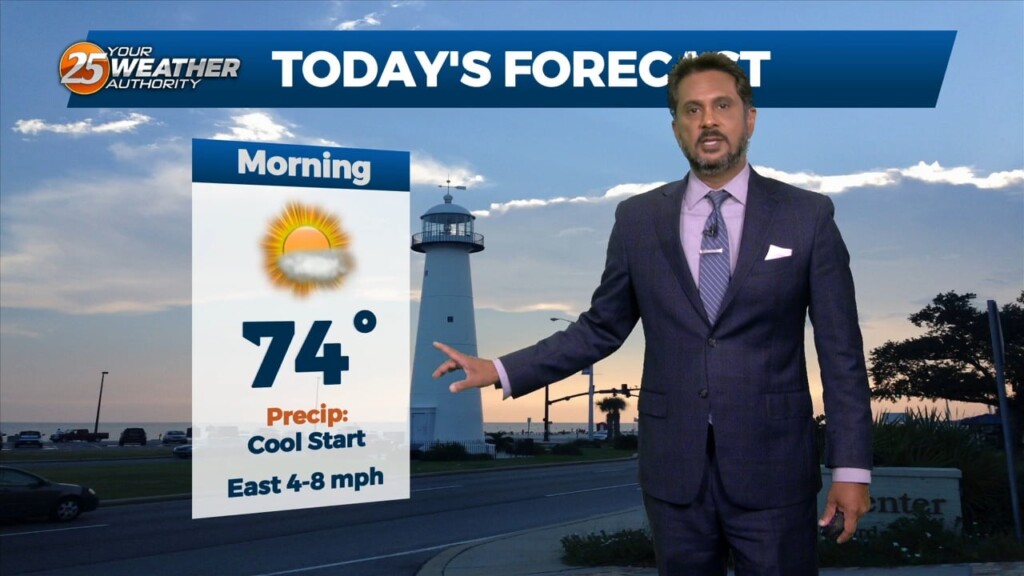
Starting out with early this morning, geez it's a bit muggy! Moist, onshore return flow continues to pump low to mid 70 dew-points well north…
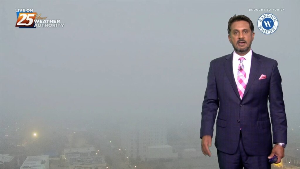
Another warm day across the region and no sign of a change at least in the short term. Fog was an issue this morning and could be…
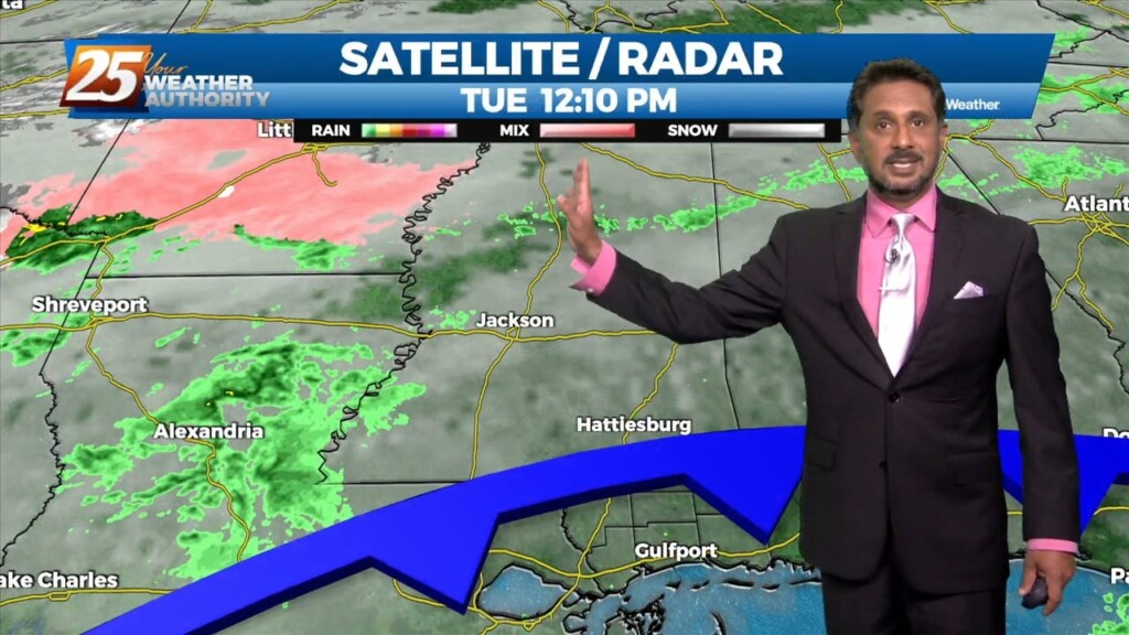
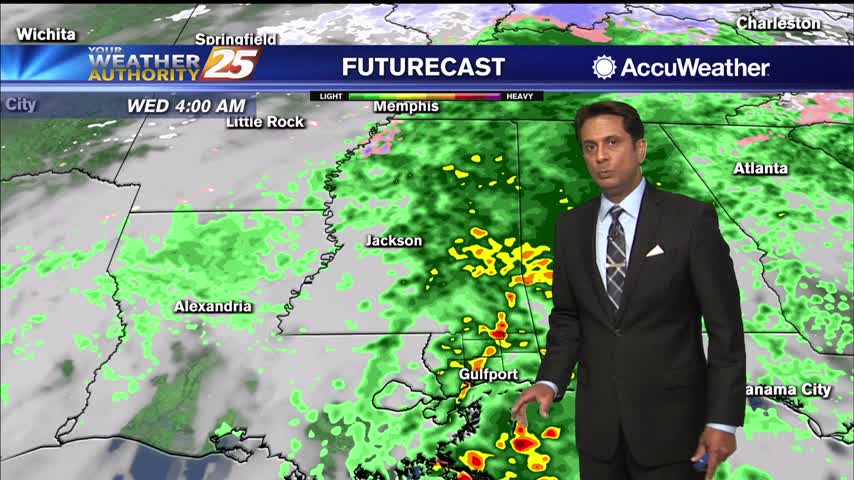
Finally seeing the models come into solid agreement on every variable and this has caused some sudden moderate changes in severe wx and rainfall risk levels…
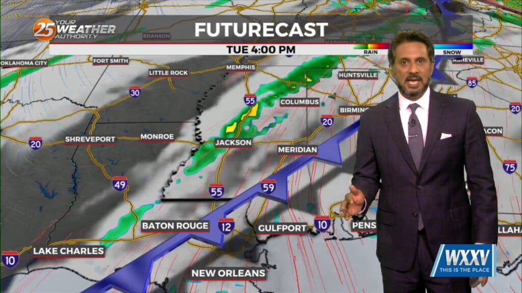
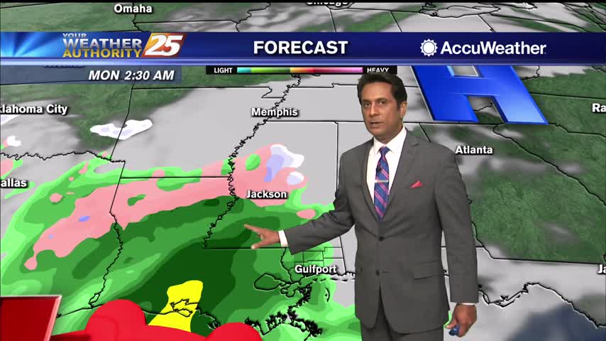
A weak cold front overhead will slowly move to the south as fast as molasses in winter. It will take from now until just before…
We start to enter a more active weather pattern starting today as an upper level disturbance moves eastward with an associated front forming at the…
Upper level moisture/clouds continue to stream through the area in advance of a weak upper level disturbance moving NE. The disturbance will move northeastward and deamplify,…
As the cold front is now to the east, post frontal clouds will slowly dissipate this afternoon as drier air moving in from the NW. High pressure will…
A minor disturbance to the west will exit the area this afternoon with weak high-pressure building in. This will keep our weather dry through the weekend. Tomorrow morning…
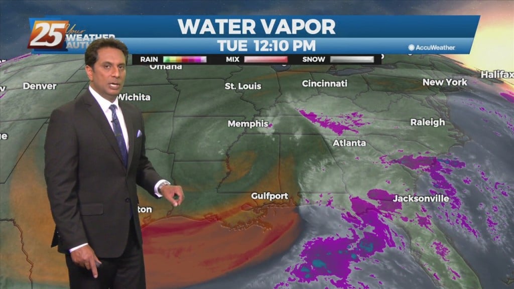
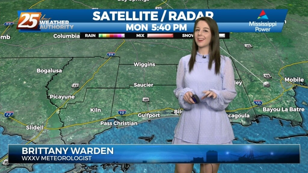
There is a marginal risk for excessive rainfall for the best chances of getting rainfall this afternoon over coastal Mississippi. This is all being brought about from an upper disturbance that extends from northern LA up into the northeast. The…
A cold start as cloud coverage continues trough much of the region...
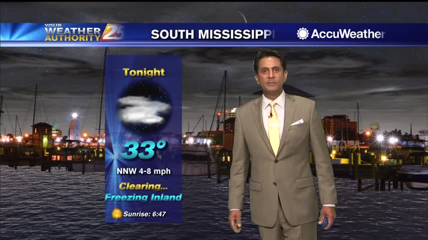
A slow clearing will occur this afternoon through tonight as COLD air moves in...
Some sunshine will peek through the clouds this afternoon in advance of overnight rainfall...