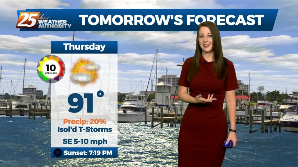
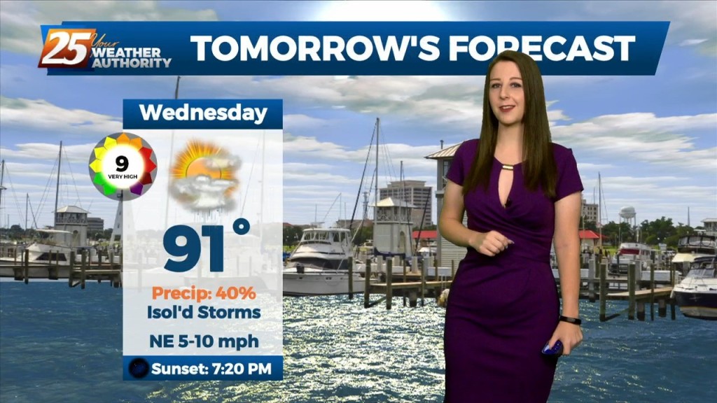
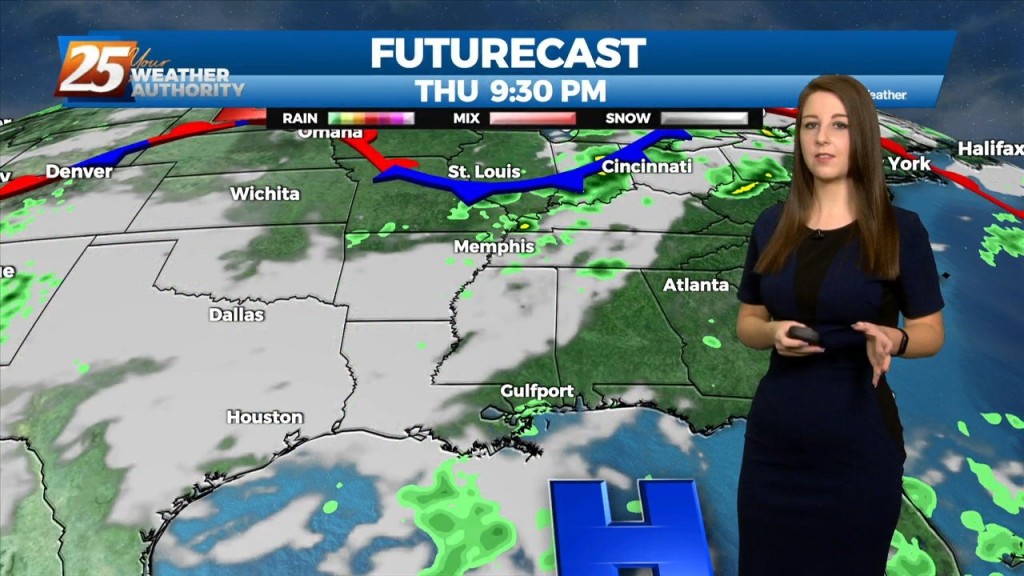
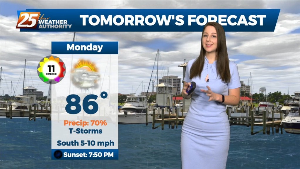
10/6 - Brittany's "Changes Ahead" Thursday Night Forecast
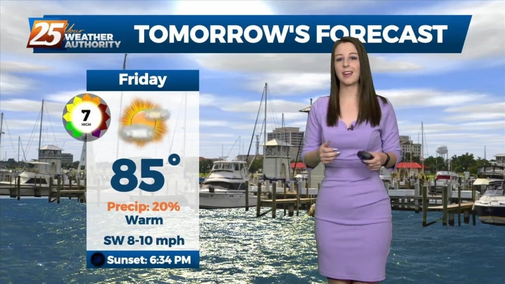
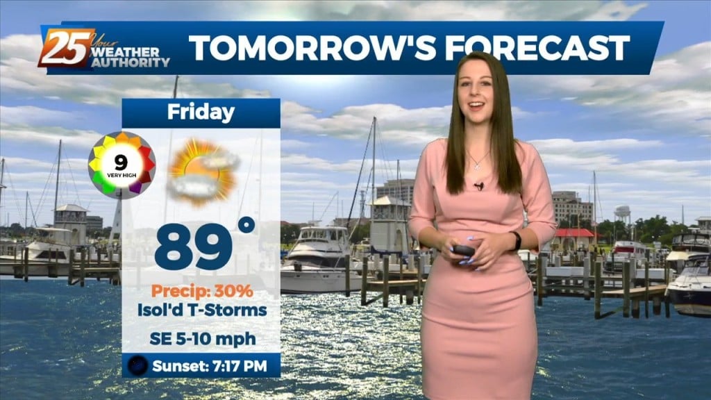
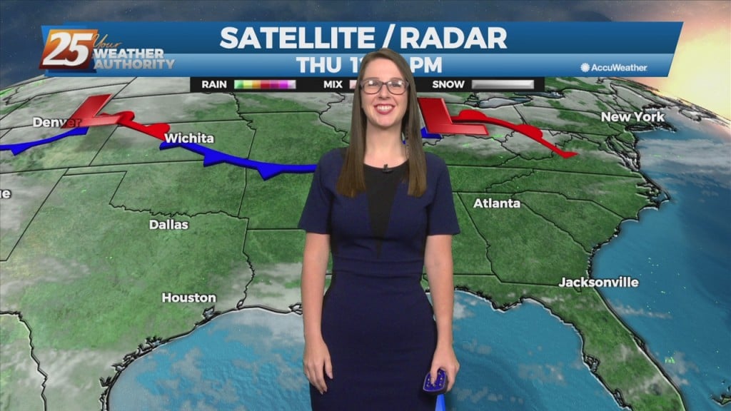
Friday temperatures will be above average thanks to some brief southerly winds ahead of a dry boundary this weekend. General model consensus shows high temperatures approaching 90 degrees.…
Friday temperatures will be above average thanks to some brief southerly winds ahead of a dry boundary this weekend. General model consensus shows high temperatures approaching 90 degrees.…
A mild weather pattern has been across the area today and for the remainder of the workweek. The area of high pressure is in place to…
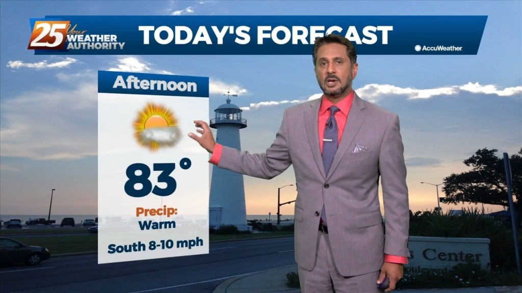
This afternoon will bring sunny skies with a few upper-level clouds as high pressure to the northeast continues to shape the forecast. Clear and mild conditions overnight…

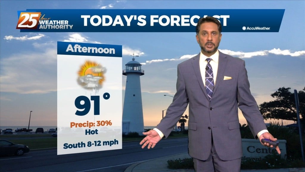
VERY HOT temperatures ahead this afternoon as a few locations will either tie or break a record high temp. High pressure will hold on one more…
Tomorrow is looking nice to start yet again with some low-level clouds around. Main focus will be the continued return of low-level moisture drifting north adding to that…
Going into Friday, the surface high steadily builds east into New England, as we begin to see less in the way of influence over the region. We in turn…
We can expect the quiet and calm conditions to continue, courtesy of high pressure to our north. Tonight and tomorrow night`s low temperatures will be below normal for most…
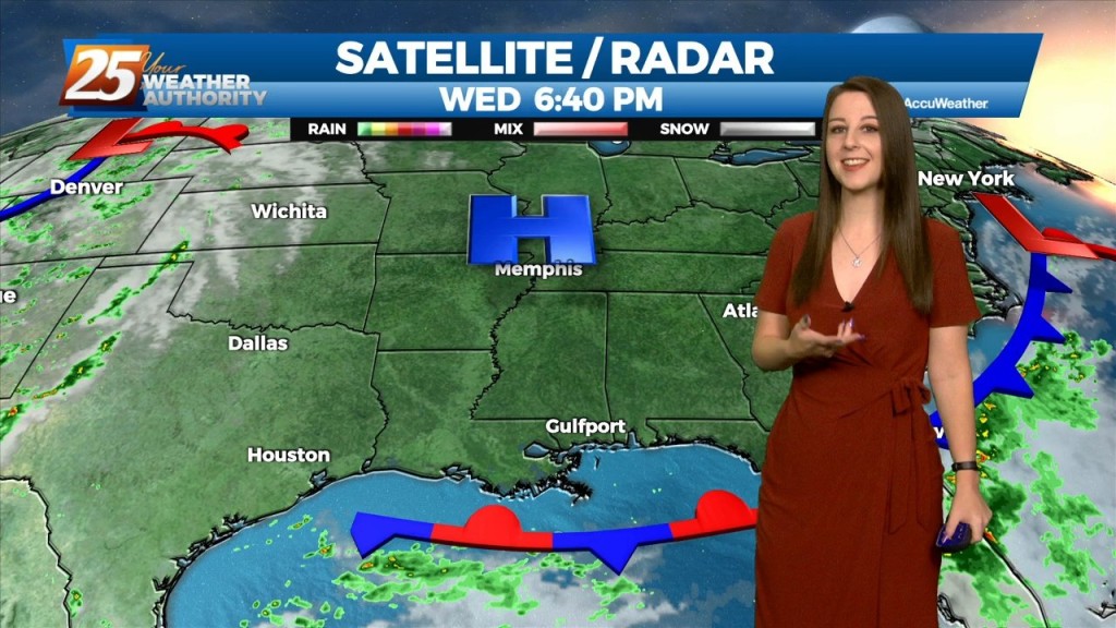
Winds will shift to a more light to moderate southerly direction by later today. This flow will help spread abundant gulf moisture back into the region and should allow…
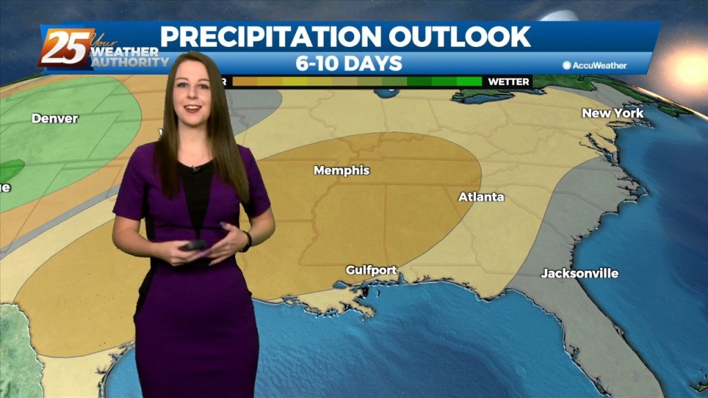
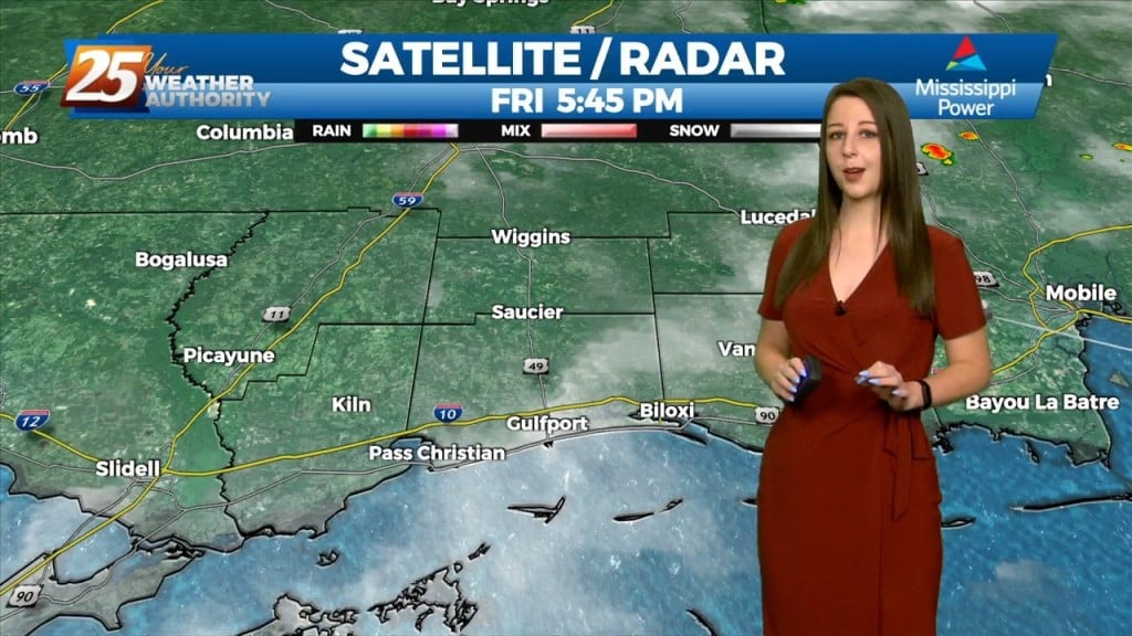
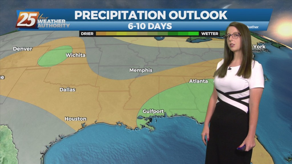
The dry conditions have been nice for a short time, but the rain will return over the weekend as the pattern changes. Southerly surface winds will act to…
Mid level dry air will remain in place today. This will help cap the environment, making it harder for thunderstorms to get started. There will be some…
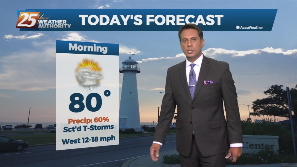
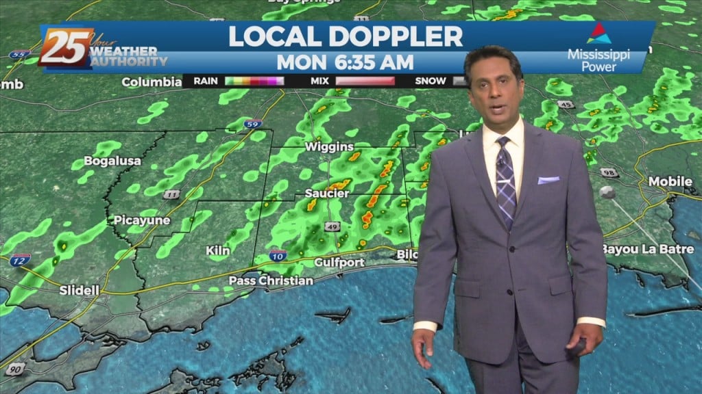
A frontal boundary is expected to move into the area late tonight and stall over the area by tomorrow afternoon. This front will bring stout mid-level dry air into…
The convection will decay in the late evening as the sun goes down and it will give way to warm and muggy overnight conditions. More of the…
Tonight through Wednesday Night, on the synoptic level, an elongated ridge axis extending from Texas eastward across the Gulf South and then across Florida will weaken…
Today through Friday, the current pattern continues with the upper level high pressure and daily showers and thunderstorms in the afternoon. Very moist air along with erratic…

Scattered showers and t-storms earlier have moved inland and begun to dissipate. The daily diurnally driven convection will continue each day primarily driven by sea-breezes or outflow boundaries…
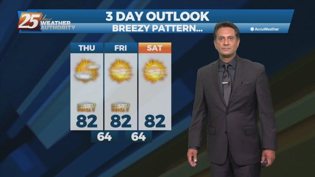
Not a lot is going to change between now and Saturday other than subtle changes. The heat will remain into the weekend but some changes are on the…
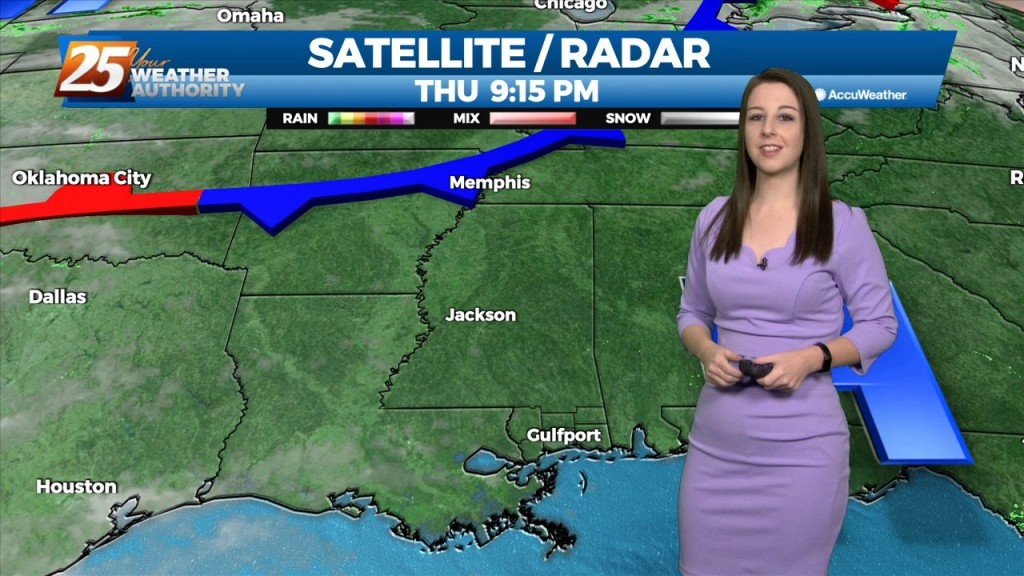
An upper low-pressure system this morning is moving into Missouri, with the associated cold front appears to extend from Jackson to Lafayette, probably just moving into the Baton…
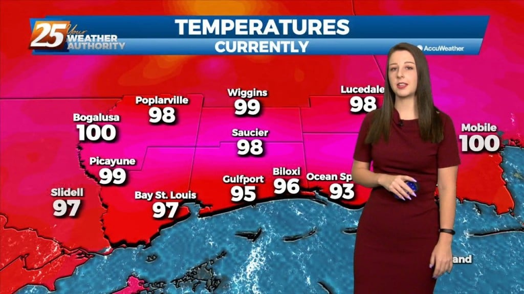
Today will be quiet, humid, and warm with HI readings mostly in the mid to upper 90s and a few 100s. Saturday the chance for rain will increase.…
A Texas disturbance will move across the area this afternoon and evening. It appears to be weakening at this time, with no significant convective development today. Beyond tonight, high-pressure…
An upper level high-pressure will begin building in and across the southeastern CONUS today through Saturday. As a result, onshore flow continues to become well established. Those 2 changes will enhance moderating period that started yesterday. We will see about…

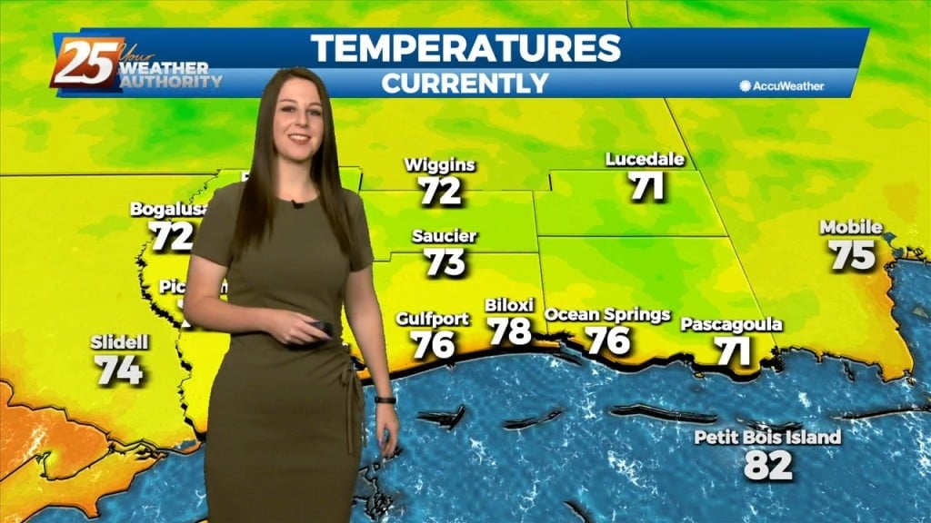
Surface high-pressure building in from the north and keeping yesterday mild is quickly sliding east. Onshore flow develops today as elevated winds will bring in…
High pressure continues to shape the forecast. Clear skies are area-wide with comfortable spring conditions. As we head into the new workweek though, changes are ahead. We will…
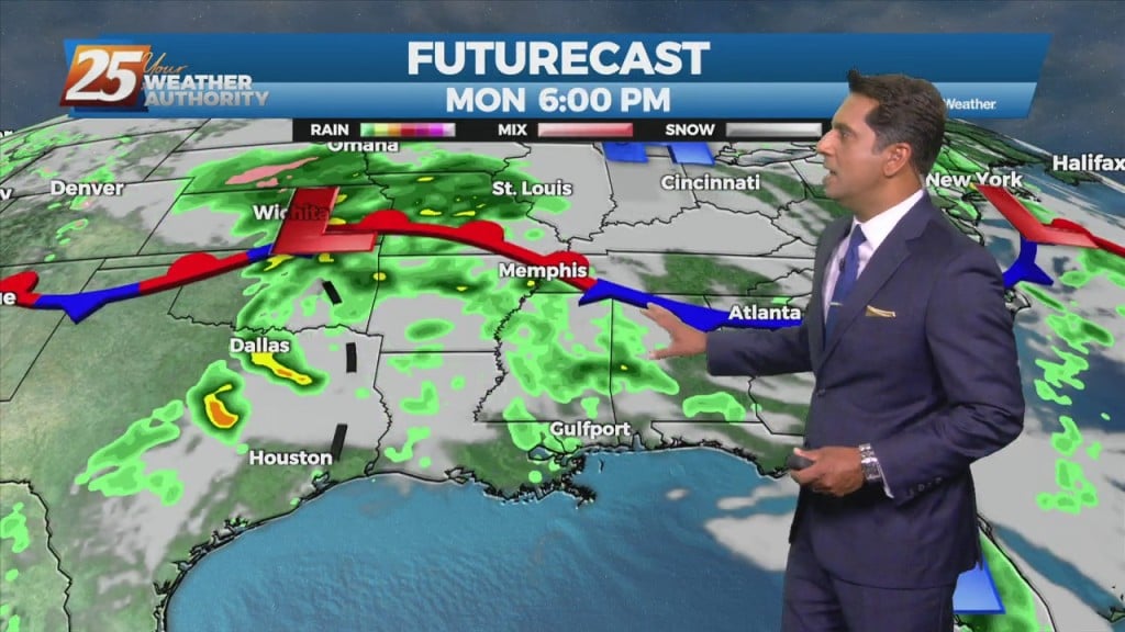
Low pressure is currently over southern Indiana with a cold front southwestward to near Memphis and Shreveport. As the surface low continue to lift northeastward, the cold…
High-pressure currently over the Rockies will move eastward across the Gulf of Mexico Friday and Saturday. This will gradually allow our surface flow to turn onshore and…