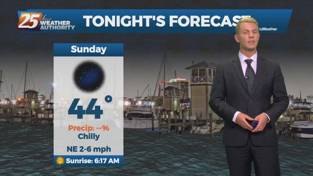
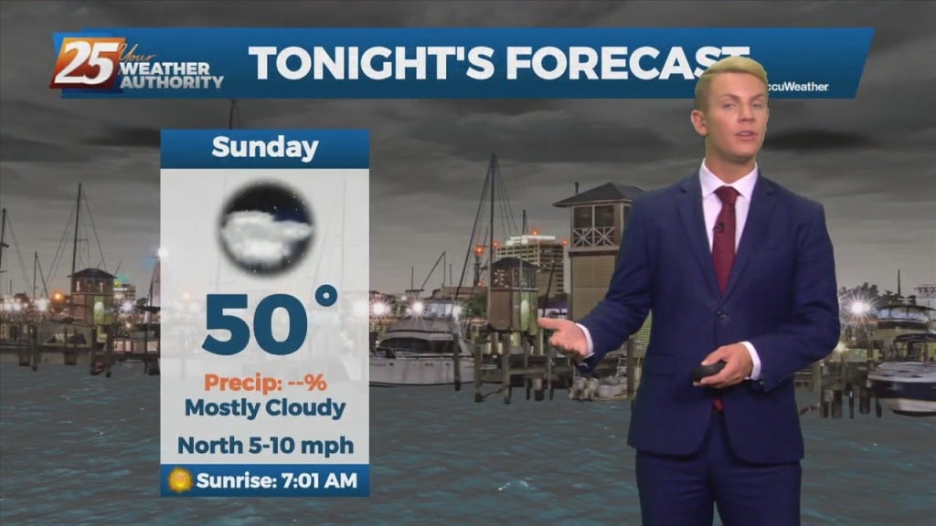
11/07 – Brantly's "Chilly" Sunday Night Forecast
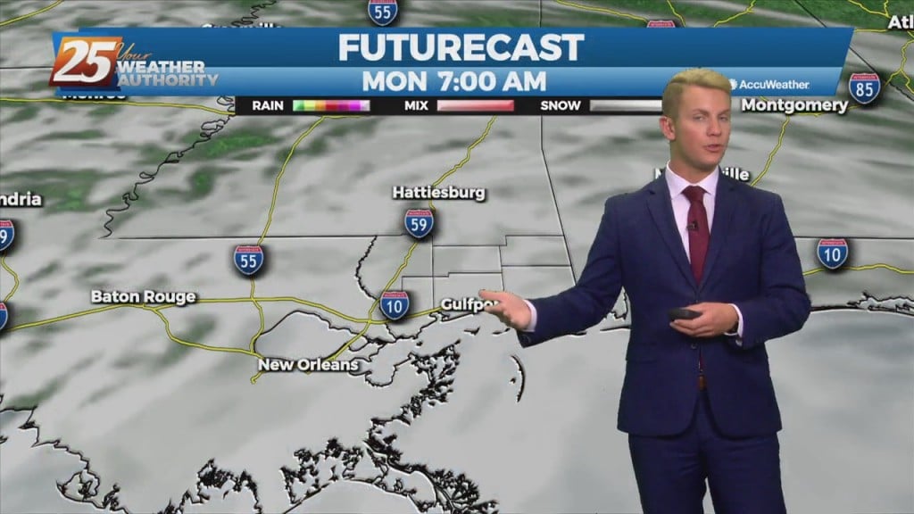
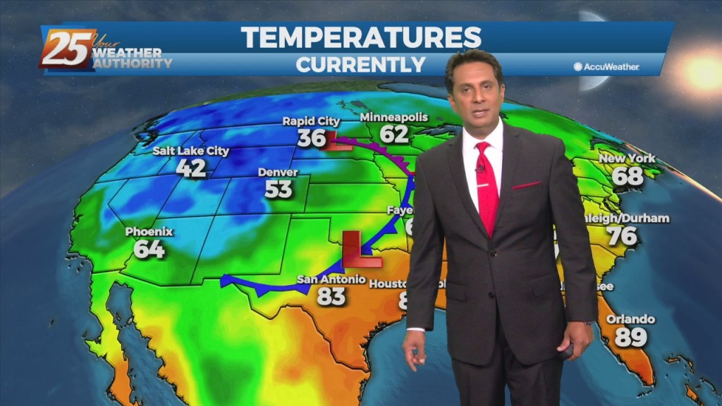
An area of high pressure ridge will continue to move slowly east across the central U.S. states and Gulf Coast region into Monday. Expect generally clear and sunny skies…
An area of high pressure ridge will continue to move slowly east across the central U.S. states and Gulf Coast region into Monday. Expect generally clear and sunny skies…
Mostly cloudy skies are expected today, although a few glimpses of sun not are out of the question. We can’t rule out a few sprinkles either, especially…
Mostly cloudy skies are expected today, although a few glimpses of sun not are out of the question. We can’t rule out a few sprinkles either, especially over lower…
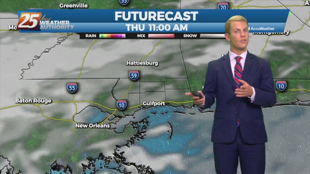
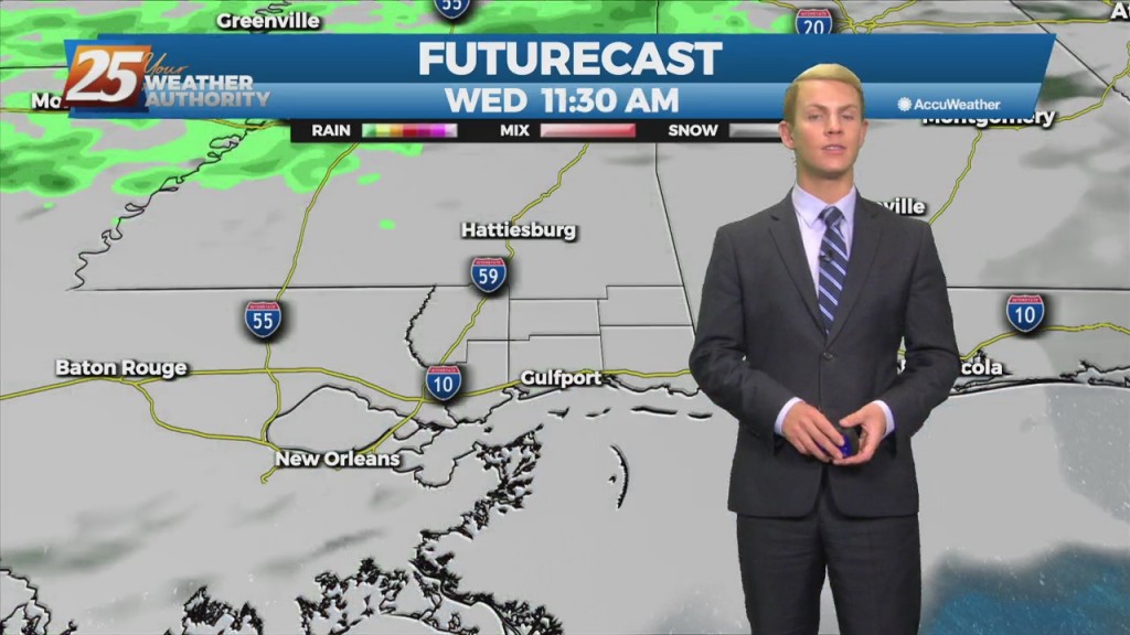
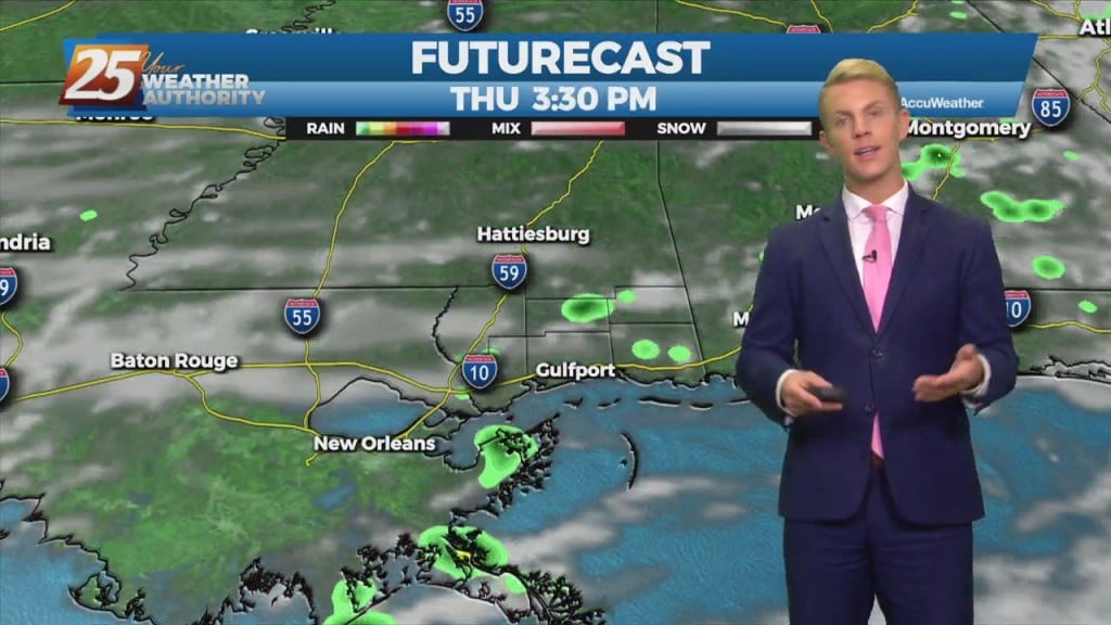
Quiet, dry weather persists through the day Wednesday before giving way to a slightly more complicated forecast scenario Thursday. A slow but steady increase in cloud cover will…
Very nice conditions will remain for the next several days. Another cold front will move through the area Wednesday night into Thursday morning bringing a continuation of…
Surface high pressure is maintained over the Lower Mississippi River Valley through Monday. Cool, dry northerly flow over the forecast area and nearby limited temperatures to around…
Surface high pressure is maintained over the Lower Mississippi River Valley through Monday. Cool, dry northerly flow over the forecast area and nearby limited temperatures to around…
Dry conditions are in store for Thursday now that a strong cold front has passed through and allowed for high pressure to begin building in. Breezy conditions…
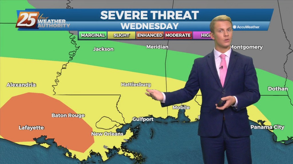
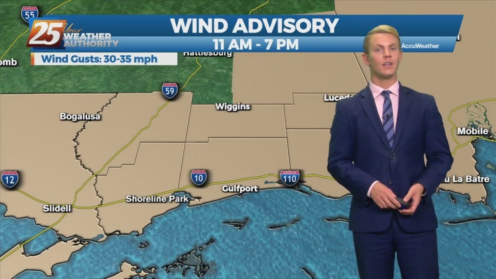
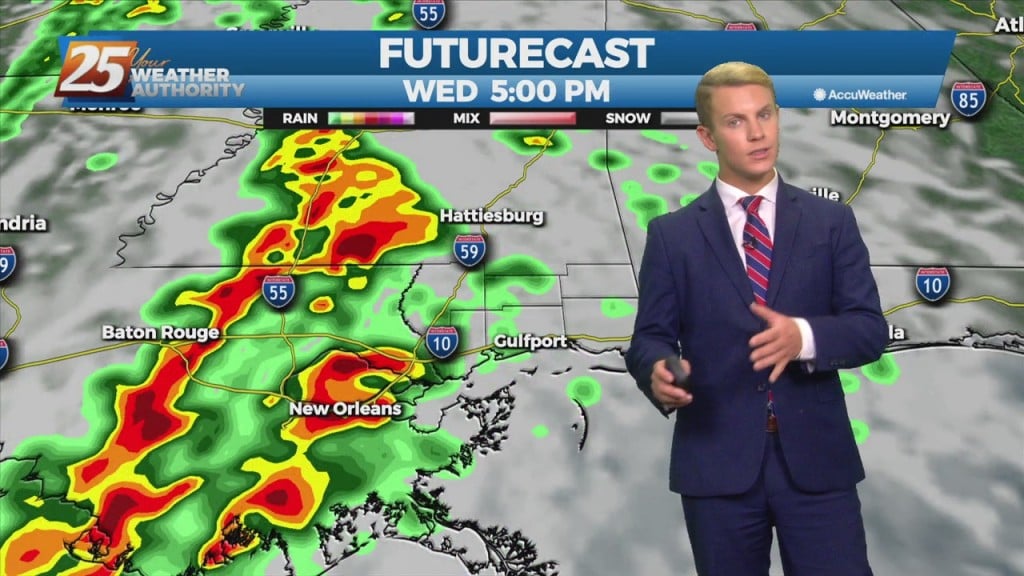
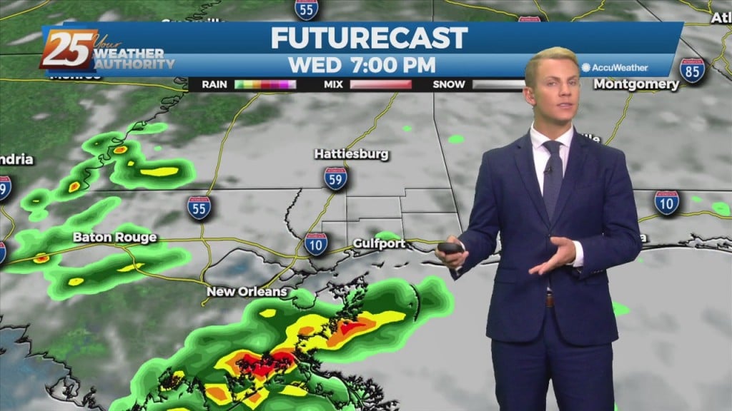
Rapidly changing weather conditions will be the rule over the next 18 to 24 hours, with the threat of severe weather and heavy rainfall continuing to be…
A backdoor cold front was sinking southwestward passed southwest of Baton Rouge and New Orleans since midnight. Backdoor front will gradually slip off the coast today,…
Some big changes to our weather pattern will take place this week. Dry weather prevails at least for the beginning of the week heading into Tuesday with high…
Some big changes to our weather pattern will take place this week. Dry weather prevails at least for the beginning of the week heading into Tuesday with high pressure…
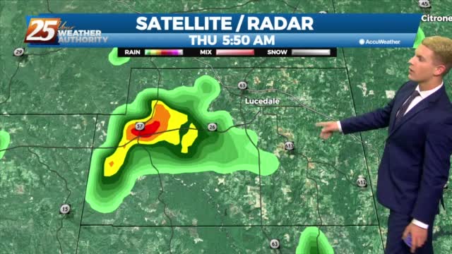
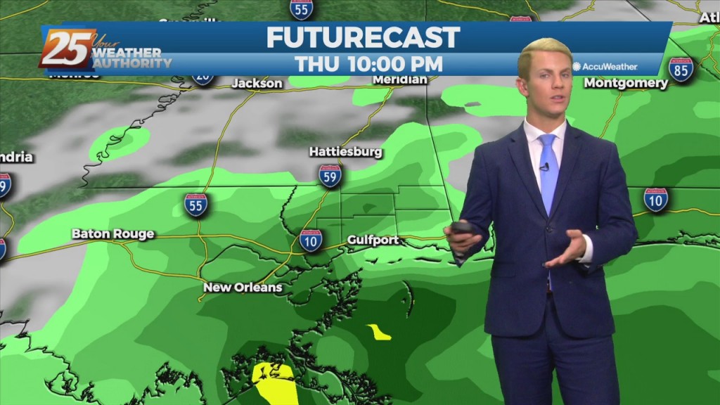
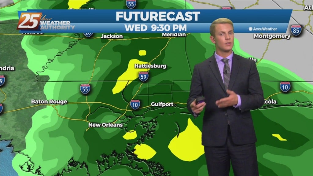
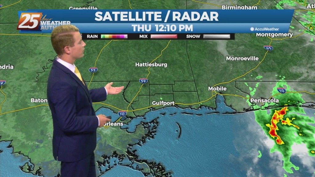
Showers and a few embedded thunderstorms are expected to increase in coverage through Thursday morning then diminish during the afternoon leaving isolated showers and storms for Thursday…
Today, wet weather returns to the forecast. We are expecting quite a bit of shower activity along with a few thunderstorms. Although there may not be more than…
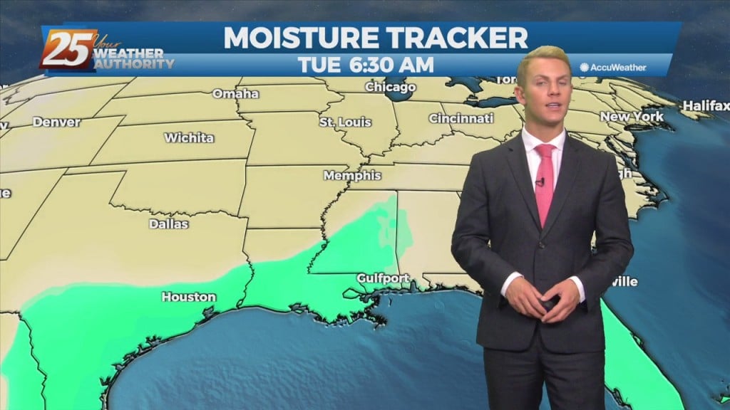
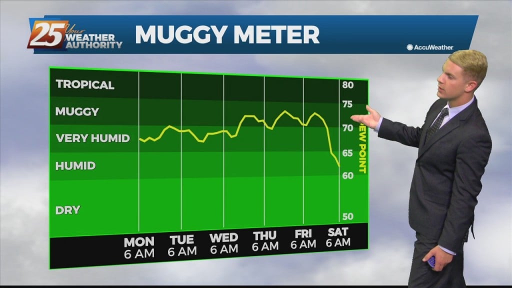
Our cool and dry pattern is starting to fade away. For Tuesday, we remain dry, however, rain chances, albeit slight, will begin to increase over the Gulf waters Tuesday afternoon as moisture increases. Going into Wednesday, as moisture spreads inland,…
Dry weather continues through the period as a weak area of high pressure builds into the region through Tuesday. A disturbance looks to pass over the area through Monday helping to bring some increased high clouds to the area during…
Dry weather continues through the period as a weak area of high pressure builds into the region through Tuesday. A disturbance looks to pass over the area through Monday helping to bring some increased high clouds to the area during…
A cold front is on the way. Isolated light rain showers could also develop late this afternoon. A band of rain showers will begin to move into the northwest portion of our forecast area this evening ahead of the cold…
Southerly return flow around high-pressure to the east will keep us in the same weather pattern we have been in for the past week with mainly dry conditions and slightly above normal temperatures. The high-pressure will start to retreat to…
A dry airmass remains in place across our area which will continue to allow for mostly rain-free weather conditions. A moist east to southeast low level flow pattern will result in the development of cumulus clouds each day across the…
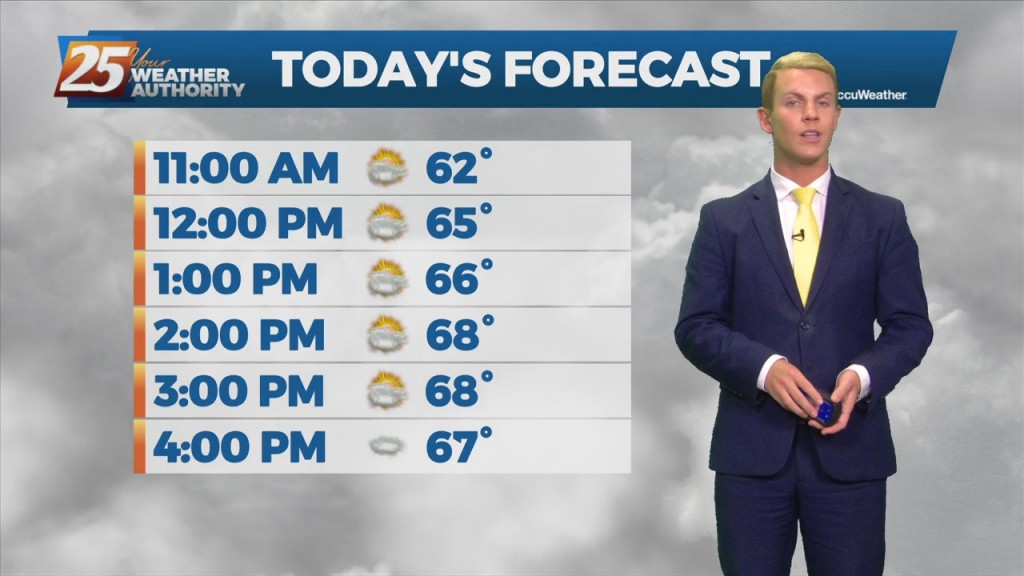
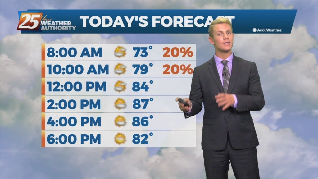
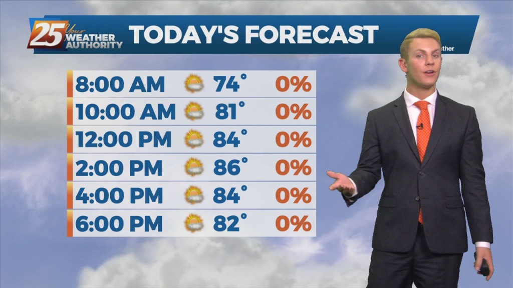
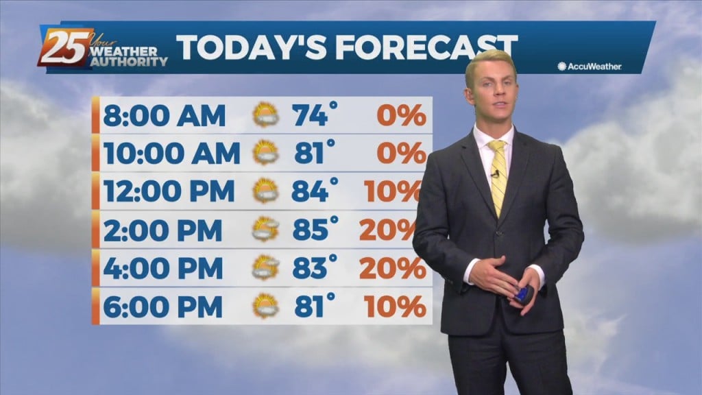
After starting off in the mid to upper 60s across most of the region on Tuesday morning with some lower 70s at the coast, expect temperatures to jump into the mid to upper 80s in the afternoon. Expect little change…
Highs Monday afternoon will then be similar to today, in the mid to upper 80s. Overall, enjoy the mostly clear skies and dry weather. A dry airmass underneath high pressure will allow for a continued dry forecast Tuesday and Wednesday…
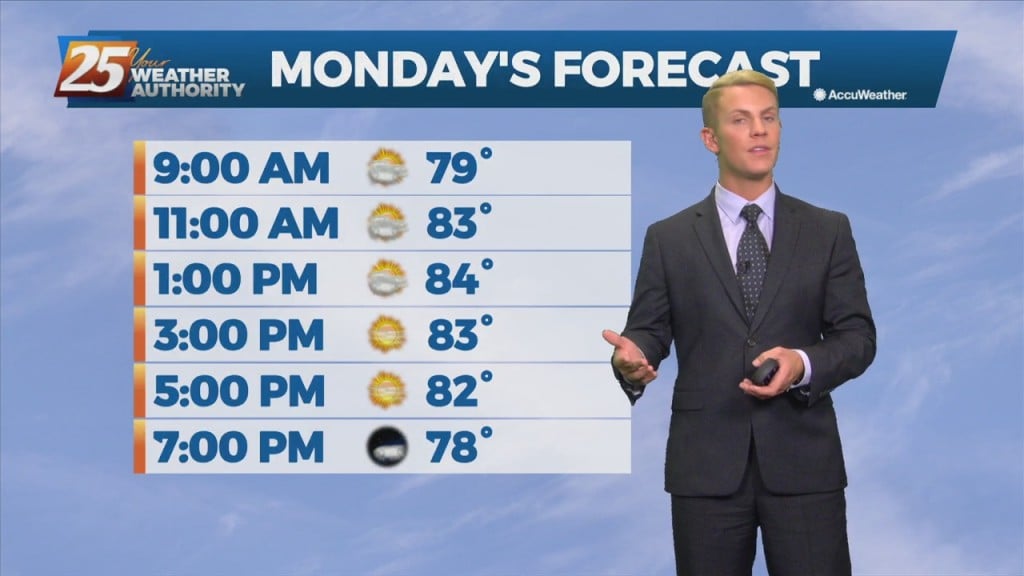
Highs Monday afternoon will then be similar to today, in the mid to upper 80s. Overall, enjoy the mostly clear skies and dry weather. A dry airmass underneath high pressure will allow for a continued dry forecast Tuesday and Wednesday…
Dry, sunny weather has finally arrived! High pressure will quickly replace the loitering low that has plagued us for the better part of this week. Dry northwesterly flow will filter in much drier air into the area allowing for rain…