10/26 - Steve's Midday Forecast
Slight rain chances are around today and tomorrow. We've got your weekend and Halloween forecast with Meteorologist Steve Taylor.
Slight rain chances are around today and tomorrow. We've got your weekend and Halloween forecast with Meteorologist Steve Taylor.
As temps have been slowly warming over the past few days...areas of light fog have developed this morning.
Another slightly warmer night, but some changes are ahead...just not drastic ones.
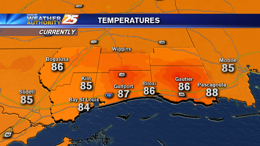
As expected, today was very similar to yesterday, but our evening warming trend continues. Full details inside.
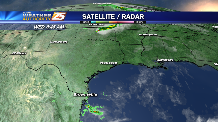
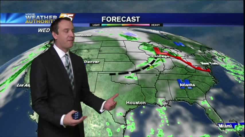
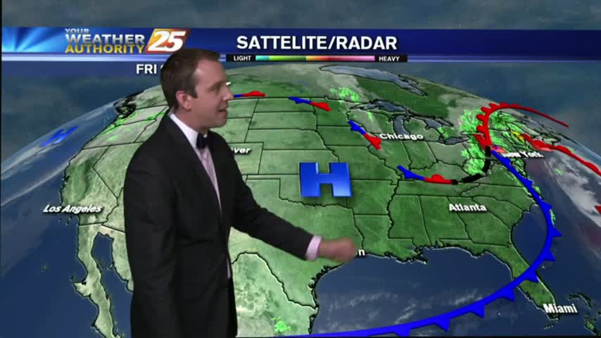
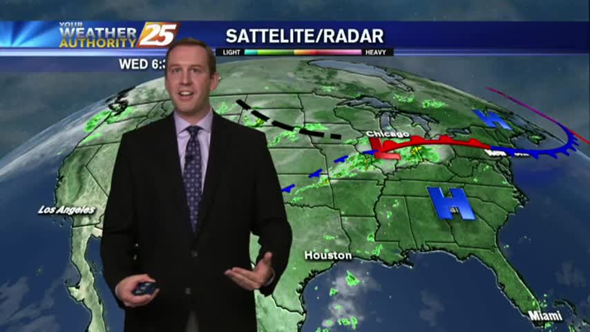
Rain enters the forecast on Wednesday. Steve's also got your weekend forecast!
Slight warming trend continues, but we can expect rain and another cold front before the weekend. Check inside for details
A little rain relief may be on the way midweek prior to excellent weekend weather on the way!
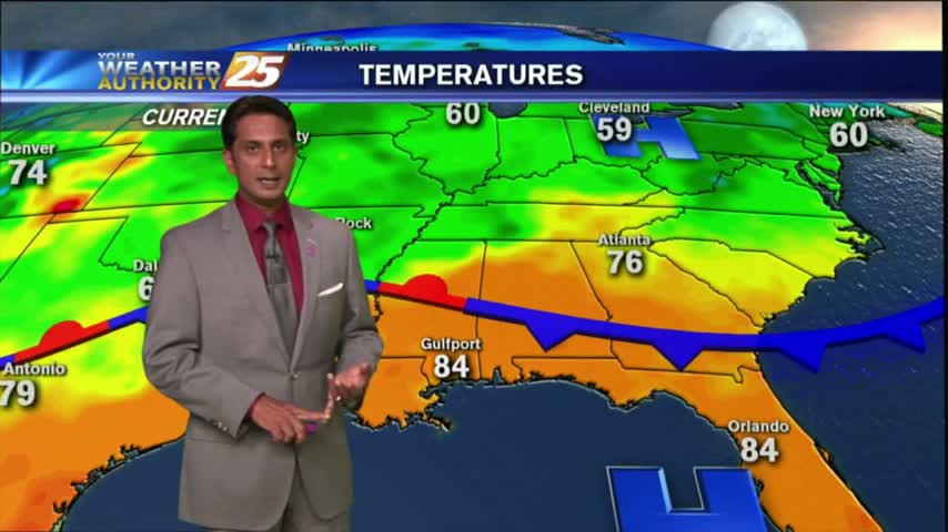
As promised, today was absolutely gorgeous, but tomorrow will be even better. Check out the forecast for more.
In the wake of a cold front, this morning brings lower humidity, falling temps and breezy conditions...
The cold front has already entered South MS and will slowly move through the area overnight. Click the link for forecast details.
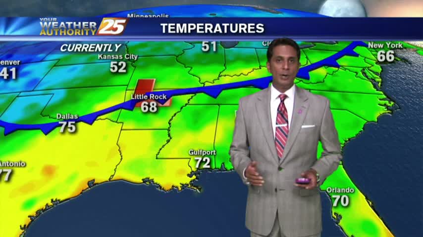
This afternoon was the last time we'll see temperatures in the 80s for several days, but we're still waiting on the arrival of the cold front. Click the link for this afternoon's forecast and check back for the update at 11 pm.
With an approaching cold front...this morning brings the final day of warm/humid with low clouds and areas of patchy fog...
One warm & humid day left before a 10 or more degree cool down. Check out the forecast for details.
Another morning of patchy fog as a humid wind continue from the south, in advance of an approaching cold front...
Slightly more clear skies this afternoon than we had yesterday, and I expect the warming trend to continue for one more day as well. Significantly cooler temps ahead though, details within.
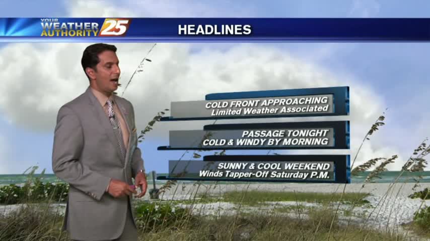
A frontal boundary will affect the area later this week and a significant cool-down is on the way!
With a warm/humid wind during the afternoons, areas of patchy fog has developed overnight once again...
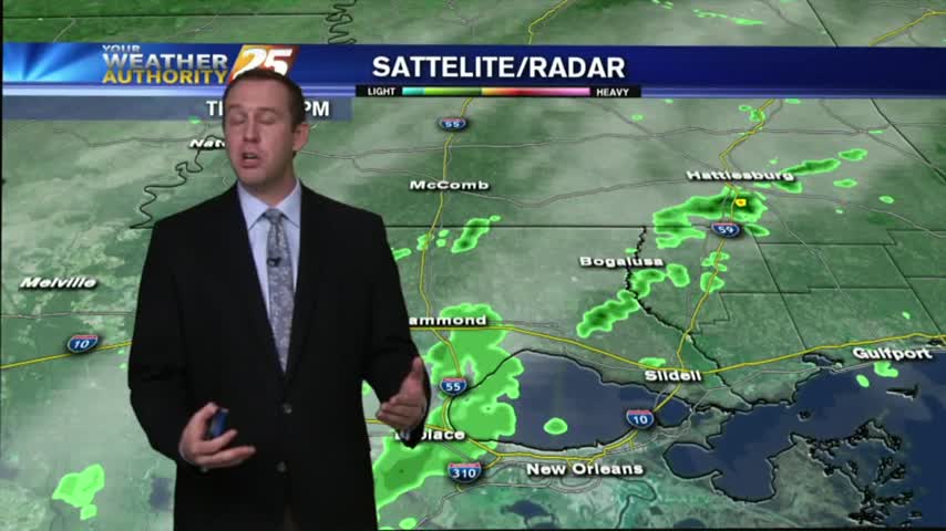
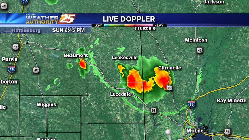
Some light showers today, and while even less is expected tomorrow, we'll see a bit more before the week is through. Full forecast inside.
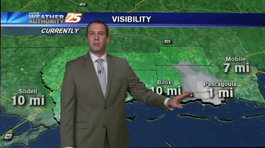
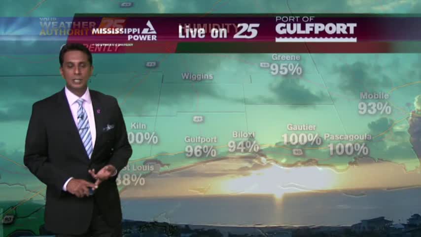
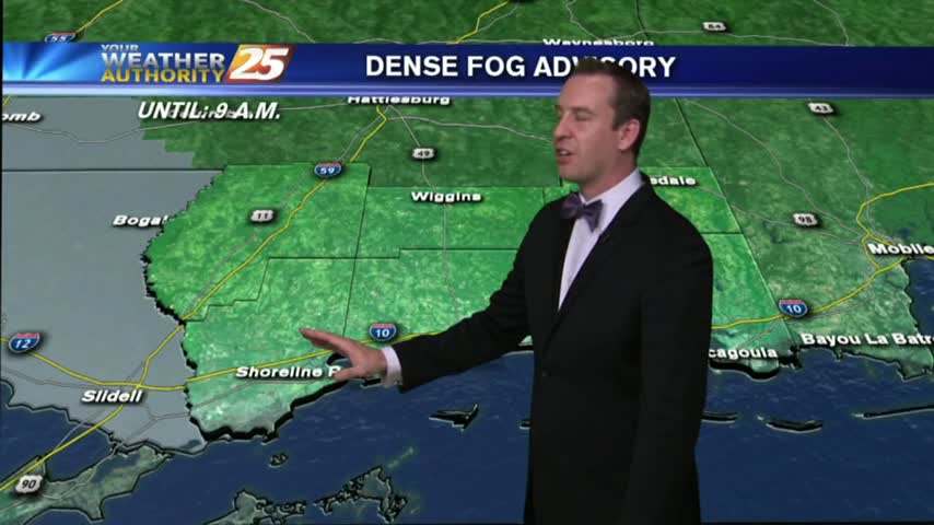
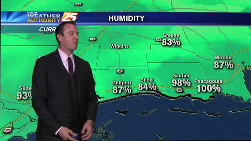
As low-level humidity has been on the increase...areas of PATCHY FOG has developed. A DENSE FOG ADVISORY is in effect through 9 a.m...
Change is on the way in this forecast package from Meteorologist Steve Taylor!
After a slightly warmer evening, we'll see our first rain chances for quite a while over the weekend. Details inside.
After another gorgeous day, we'll finally see a chance of rain over the weekend, but only a small one. Details inside.
After patchy fog earlier this morning, we have BEAUTIFUL mid-October conditions to close-out the workweek...
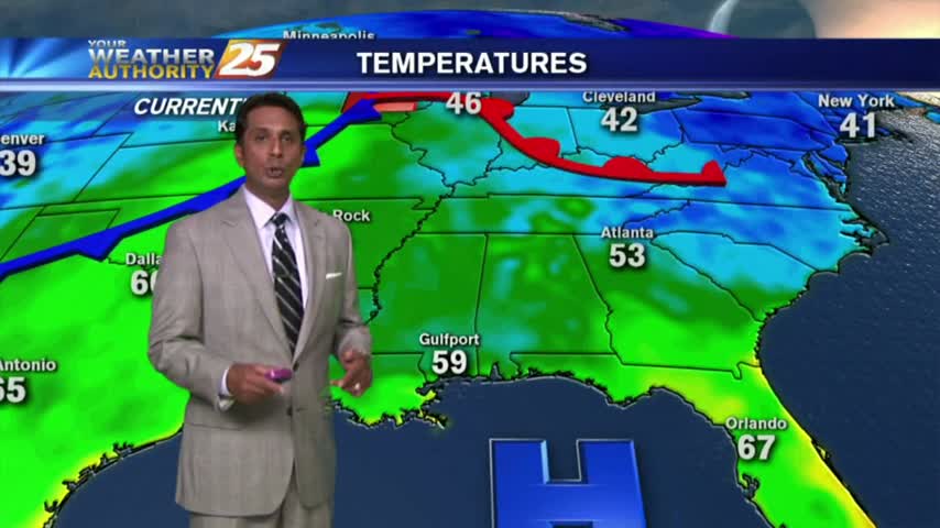
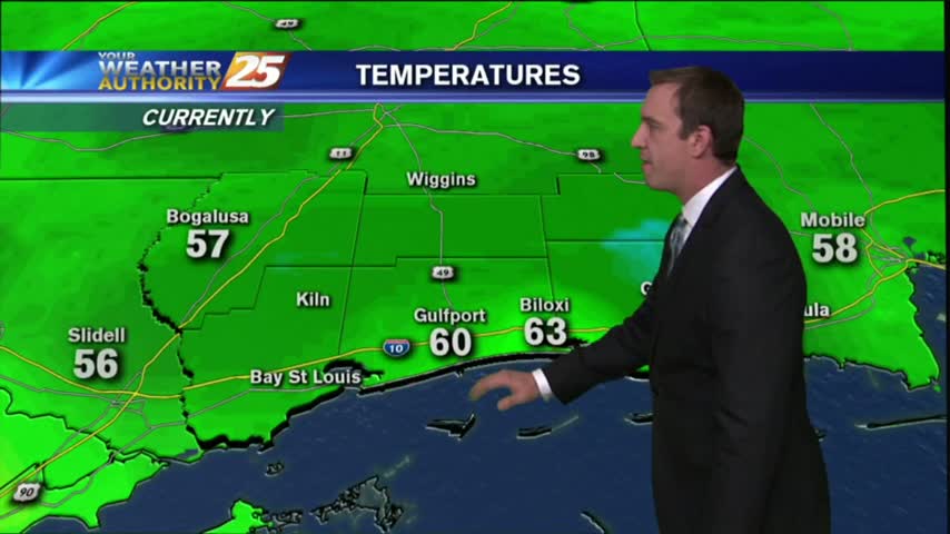
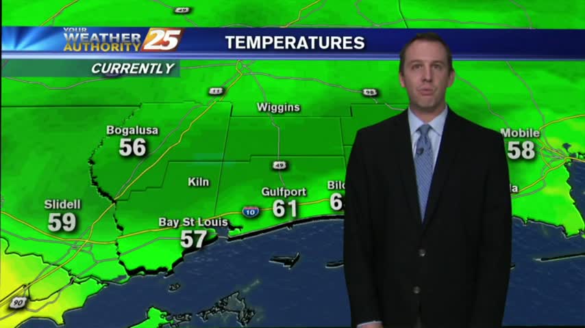
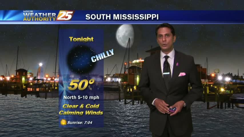
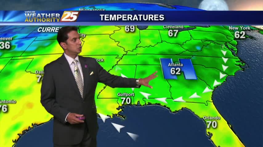
It's another cool start on this Friday morning with temps averaging 60 degrees, and areas of patchy fog...