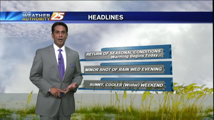
1/27 - Rob Knight's "Final Weekend of January" Forecast
After a CHILLY start to the day, sunny skies mixed with upper-level clouds have temperatures warming into the 50s...
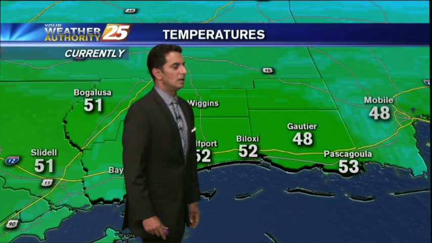
After a CHILLY start to the day, sunny skies mixed with upper-level clouds have temperatures warming into the 50s...

It's a COLD start to the weekend as a cold/dry air mass continues to move into the Gulf coast...
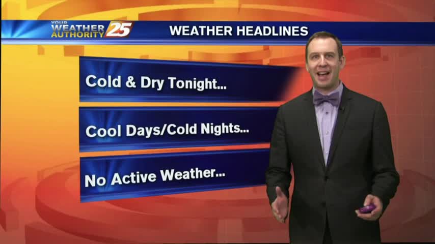
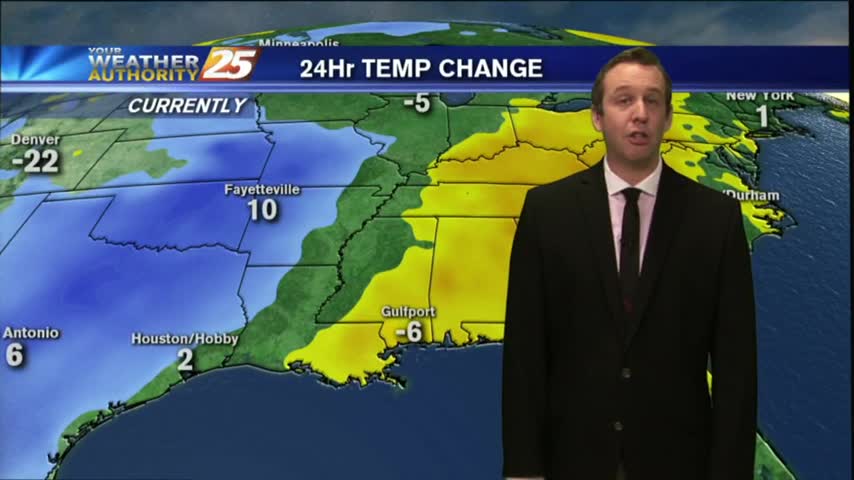
Much colder tonight, but still above freezing in South MS. Some light frost possible in some of the more inland areas tonight and tomorrow night though. Details inside.
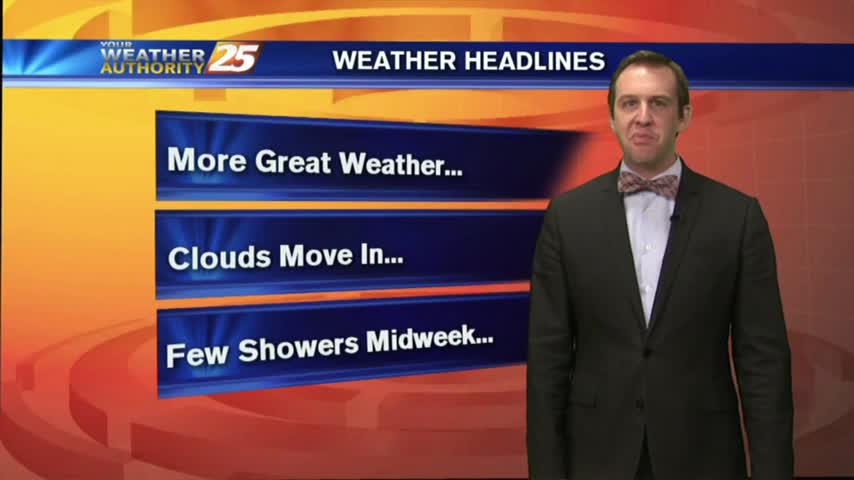
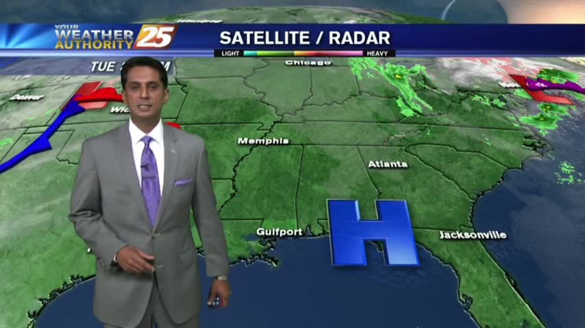
Rain has ended across most of the Southern States and more seasonable weather lies in its wake.
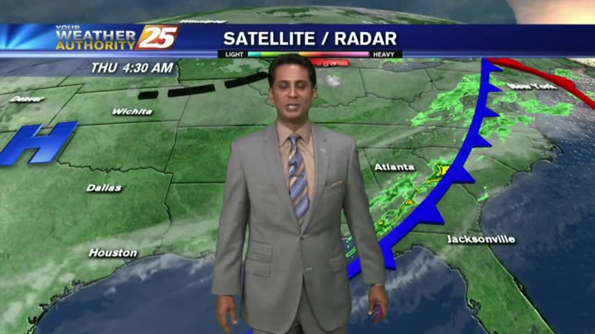
In the wake of cold frontal passage last night, rain is out of the area but the clouds will continue to linger...
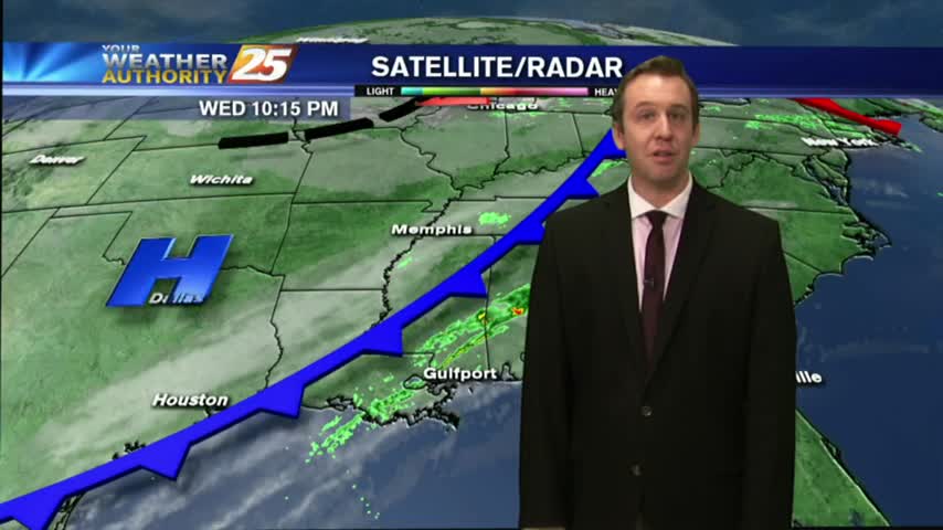
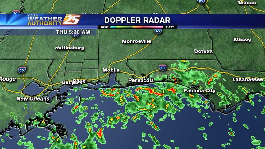
A cold front is slowly marching through the area, expect a few showers over the next few hours, but clear, cool, and dry weather afterwards. Full forecast details inside.
A few showers and storms will be moving through the area between now and midnight, bringing dry & sunny weather to the Gulf Coast. Watch for details.
A few showers will be possible through this afternoon and evening here in southern Mississippi.
As the warmer air moves into the area in advance of an approaching cold front, areas of patchy fog has developed this morning...
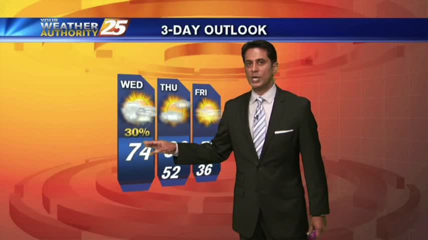
Still warmer than "average," but cooler temperatures are on the way...just not until after tomorrow's low 70s. Details inside.
After a CLEAR & COLD start to the day, warming temperatures will continue in advance of an approaching cold front...
After WINDY conditions yesterday, the winds tapered-off last night with cool and dry conditions to start off the day...
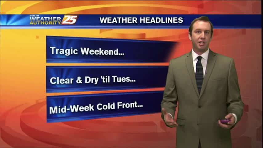
A tragic severe weather weekend may have soured weather for many, but this week's conditions will be markedly more clear and dry. Click for forecast details.
Still breezy this afternoon, but winds will begin calming overnight. Expect "above-average" temps to continue for the short term, details inside.
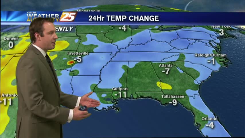
Rain is over for the area and more seasonable temperatures are expected this week.
After violent weather through the weekend, it's a cooler/windy start heading into the workweek...

Rain and storms are gone, replaced by (actually) seasonably-normal weather on the Coast.
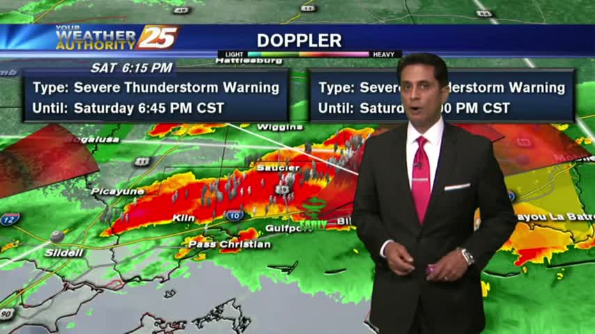
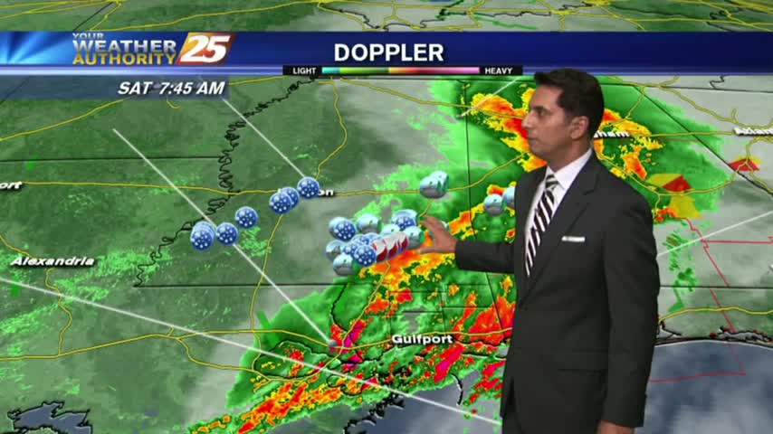
Doppler indication of early rotation of t-storms along the beach...
After sunshine this afternoon, t-storms are beginning to pop to our SW...moving NE into the area...
After BUMPY weather early this morning, a lull in the activity will occur through this evening before flaring back up...
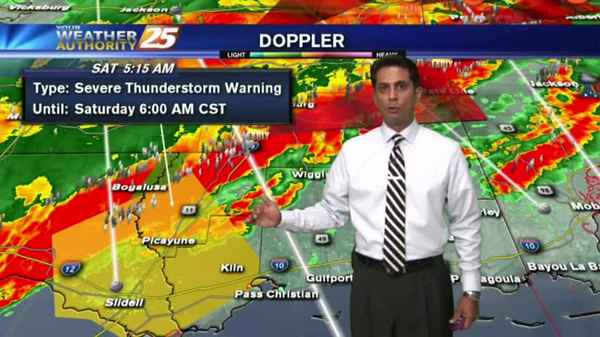
A SEVERE T-STORMS WARNING is now in effect for Hancock and Pearl River Counties until 6 a.m.
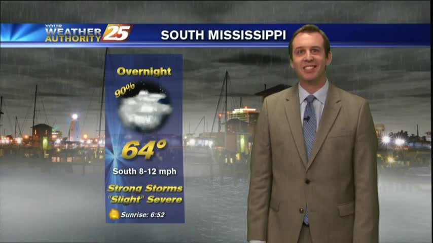
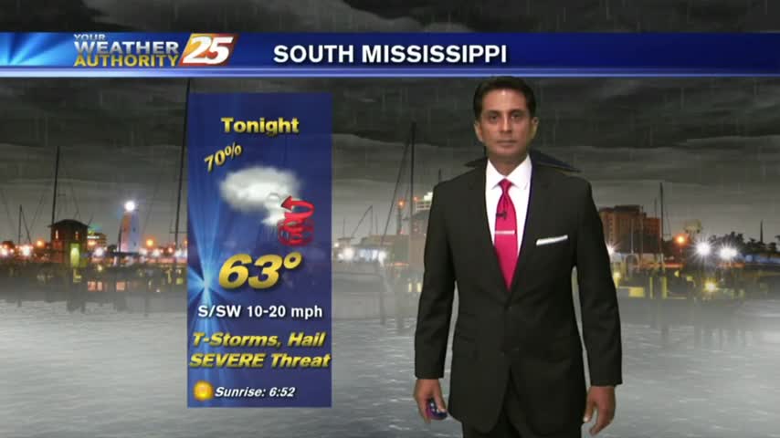
After a pleasant day, we'll see a strong round of storms tonight. Details within, updates to come.
After rain yesterday afternoon...very light fog is in the area with warm & humid conditions to head into the weekend...
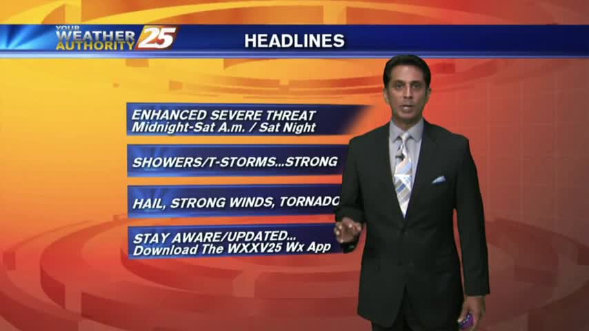
Today's afternoon weather passed through as expected, but more severe weather is ahead for the weekend. Forecast details inside.