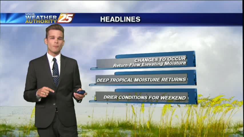
7/5 - Rob's "Hump Day" Hot Forecast
The fireworks went off without any issues from mother nature last night, but the pattern will begin to change...
The fireworks went off without any issues from mother nature last night, but the pattern will begin to change...
Today has been hot and humid. There have been very light isolated showers, but most of the area was dry and will remain that way tonight.
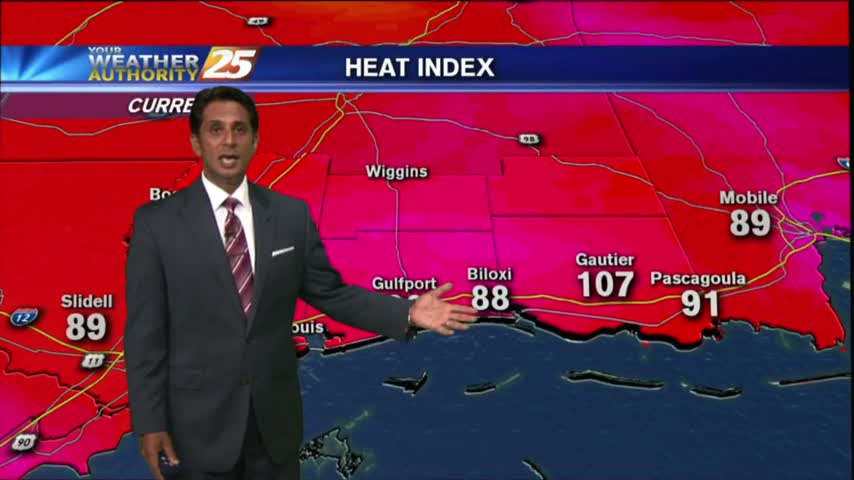
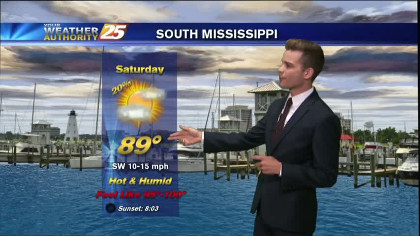
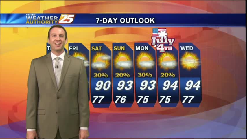
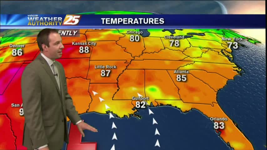
VERY HOT and humid as the HEAT INDICES are pushing the 100 degree mark this Independence Day afternoon...
Another warm/humid start to the day (Independence Day) with VERY HOT conditions on-tap through the region...

Independence Day will be another day of hot and humid conditions with heat index values running around 100 degrees.
The forecast is stuck on repeat, at least for the next few days.
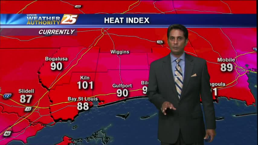
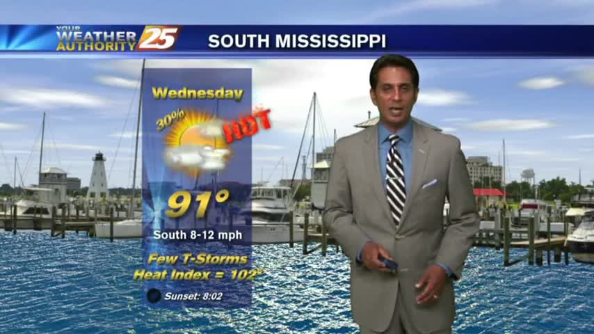
Temperatures continue to warm with the HEAT INDEX poised to be between 100-105 degrees this afternoon...and through much of the workweek.
A warm/humid start to the day/workweek with DANGEROUS HEAT INDICES to affect the Mississippi Gulf coast...
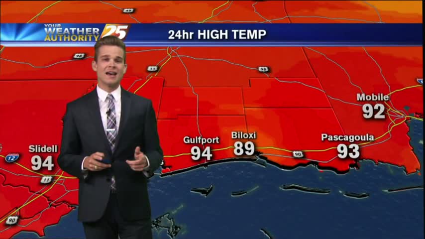
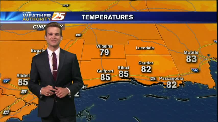
With an area of high pressure directly overhead today was hot, hazy and humid.
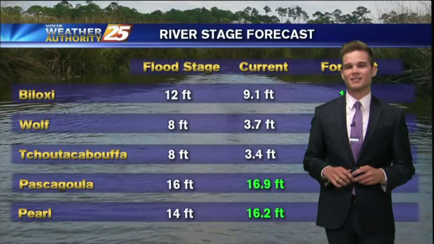
We are ending the month as the wettest June on record.
We are ending the month as the wettest June on record.

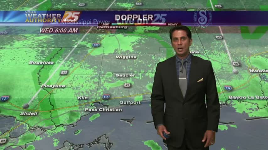
After a rain-free start to the day, minimal activity has been popping up along the Southern 6/northern Gulf of Mexico...
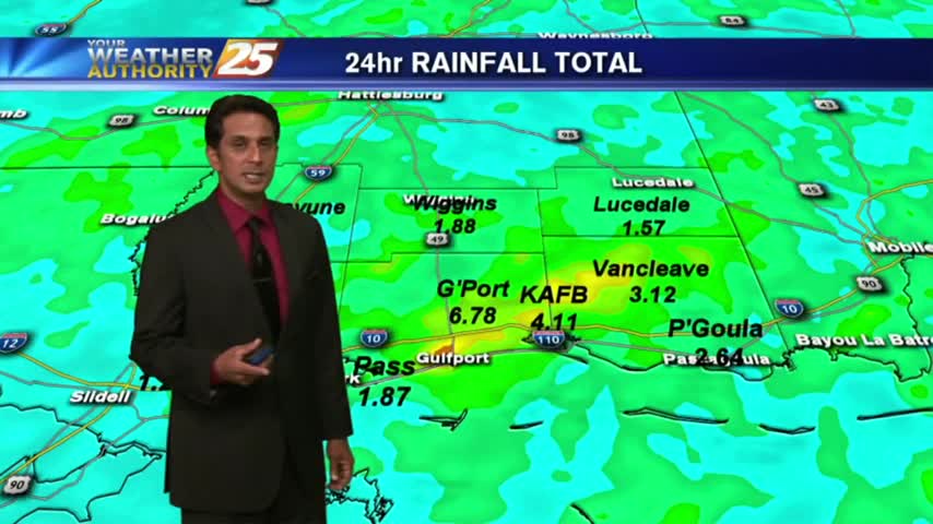
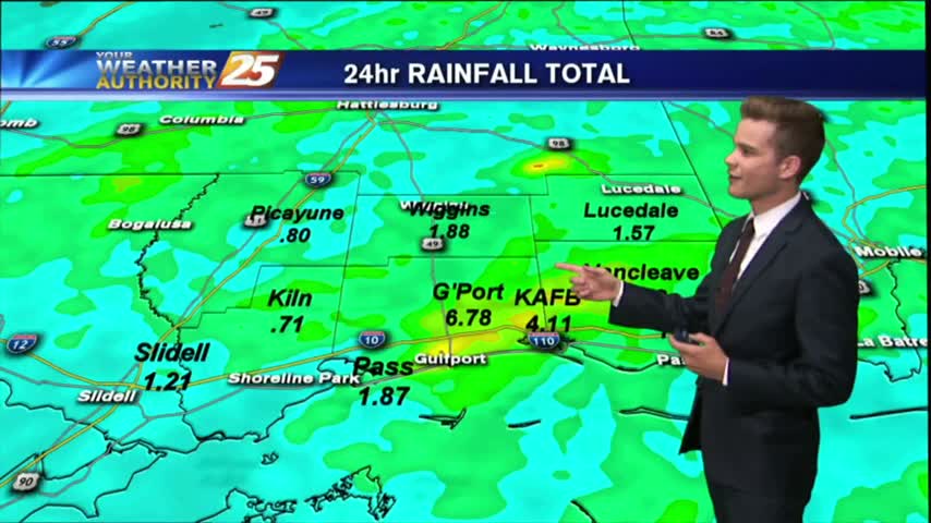
After torrential rainfall yesterday with as much as 6" of accumulation, it's a drier (rain-free) start to the final day of June. ..
A very active day across South Mississippi as an area of low pressure sits overhead.
A very active day across South Mississippi as an area of low pressure sits overhead.
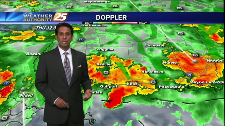
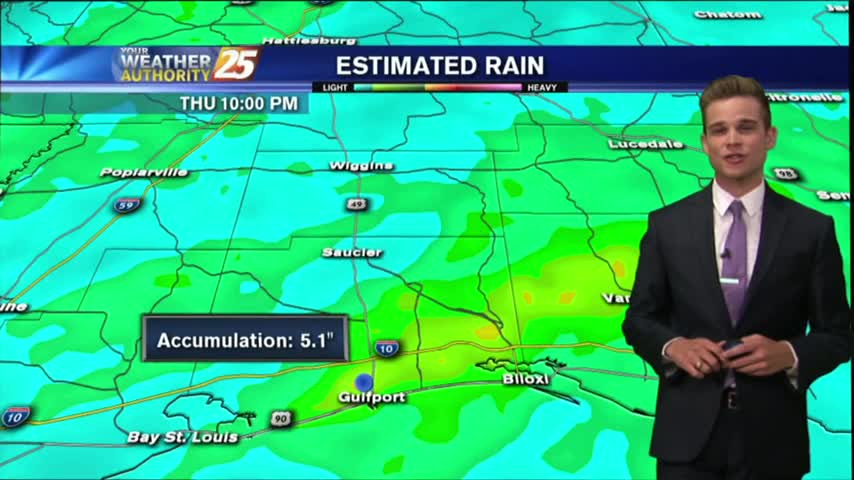
HEAVY RAINFALL has been in the area since last night...and will continue though tonight as a FLASH FLOOD watch continues...
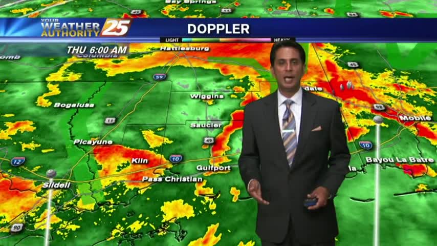
A gray/gloomy start to the day as an area of low-pressure west of Lake Pontchartrain is bringing HEAVY RAIN into the area...
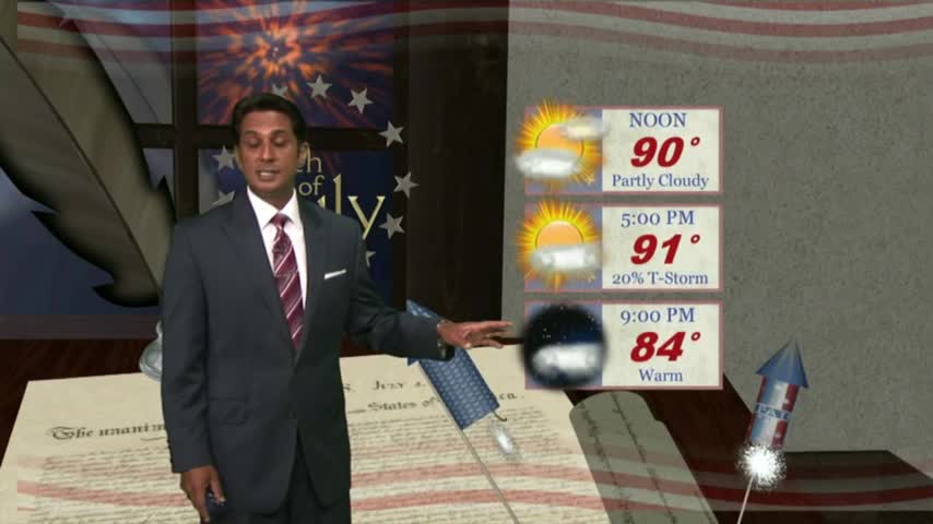
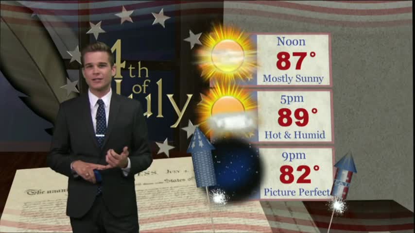
Storms moved in earlier today, but will wait until the early morning overnight hours before bringing in round 2. Best to get it out of the way now, leading to a sunny holiday! Details inside.
Today brought the first significant rain since Cindy left, and even a few Tornado Warnings this morning! Expect it to continue for a few days, but dry & hot weather is ahead. Click for details.
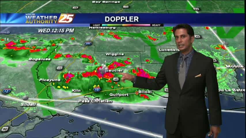
Isolated activity has been moving into the area from the south since prior to sunrise...with the activity on the increase this afternoon.
After a couple of dry days with very low humidity, the moisture flow has begun with rain moving in from the south...
I hope you enjoyed our last few dry days because the rain is set to move in as early as tomorrow. Please watch the full forecast for more details.
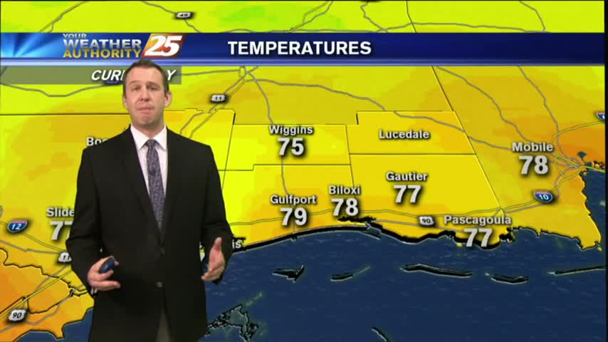
Another day of lower humidity and primarily dry conditions across the area.
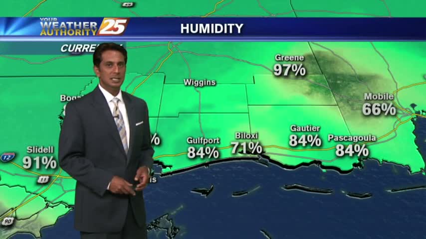
Skies are mostly cloudy with a mild start to the day as lower humidity continues across the region...