06/26 Ryan's "Drier & Mild" Monday Night Forecast
It's still considerably drier tonight than it was all of last week, but we will see more humid days & showers later this week. Click the forecast link for details.

It's still considerably drier tonight than it was all of last week, but we will see more humid days & showers later this week. Click the forecast link for details.
Last weekend's forecasts called for the Sun returning on Monday, and so far everything is moving along as we expected. The dry & sunny days won't last forever though, details within.
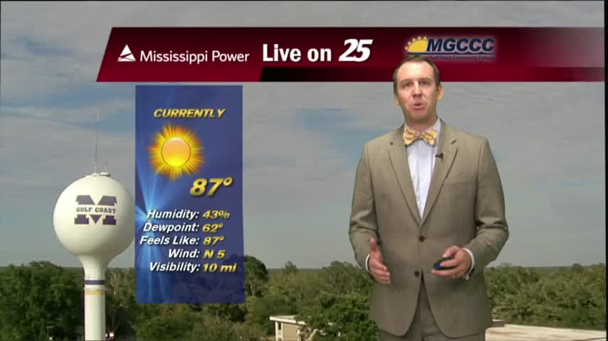
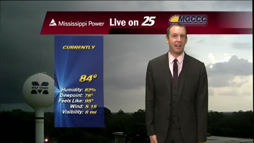
A beautiful day in store as drier air continues to filter into the area. With a weak cold front to the south, and high pressure to the north this will continue into Tuesday

It's a much DRIER start to the day as a weak cold front moved through the area overnight...now stalled over the sound/N'tern Gulf of Mexico.
After a extremely soggy week last week, the forecast is looking better...at least for the next few days.
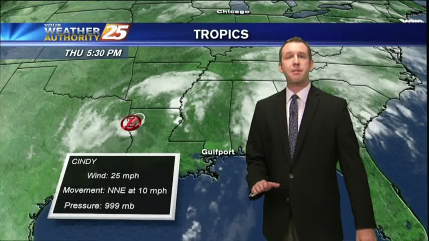
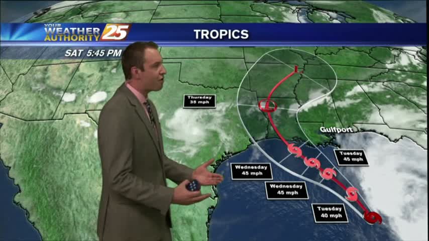
Cindy has all but moved on, though we'll continue to see a few showers in the forecast through the weekend due to an approaching frontal system. Watch the full forecast for more.
Cindy has almost moved on, but has one more wave of associated showers and storms before she leaves. Watch the full forecast for details.
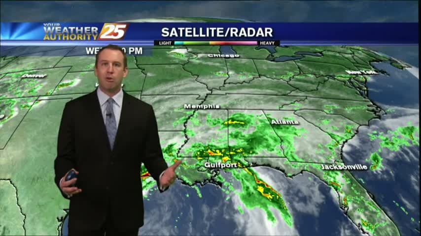
After a rain-free start to the day...isolated activity to the west is moving east and into the viewing area...
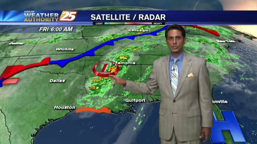
As the remains of CINDY moves through Arkansas, the moisture flow continues to bring bands of showers to the area...

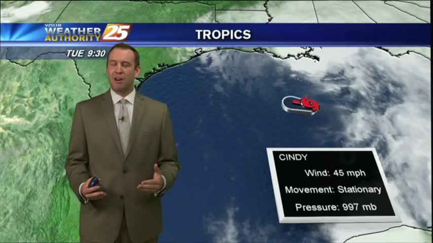
Most of the weather watches and warnings have expired as Tropical Depression Cindy continues to weaken, but more rain still expected through the weekend. Watch the forecast for more.
Cindy is starting to wind down, but that doesn't mean the flooding or rain is done just yet. Be sure to click the link for the full forecast.

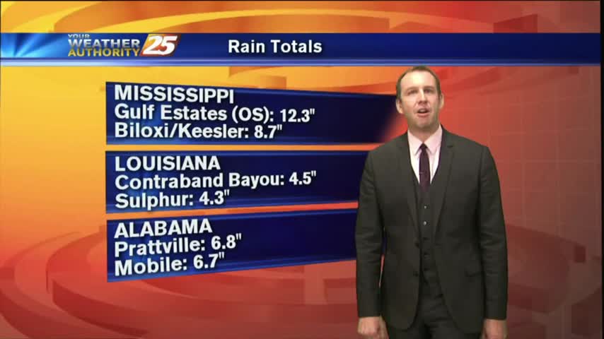
Cindy has been downgraded to a TD...but HEAVY RAINFALL continues along the viewing area with EXCESS of 6-8" east of Hwy 49 this morning alone!

Now that TS CINDY has made landfall...conditions continue to slooowwwlly improve this morning with respect to a few variables...
Dry air working its way into Tropical Storm Cindy has created a few "rain-free" areas, we're still expecting a few inches over the next day or so. Watch the full forecast for the details.
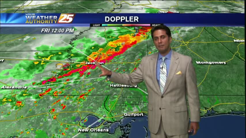
Skies quieted for a while after an "active" morning, but even then a few tornado warning were issued. The stormy weather will continue, so click the link for the forecast details.
HEAVY RAIN has tapered-off quite a bit but the activity is still in the area with several watches/warnings still in effect...

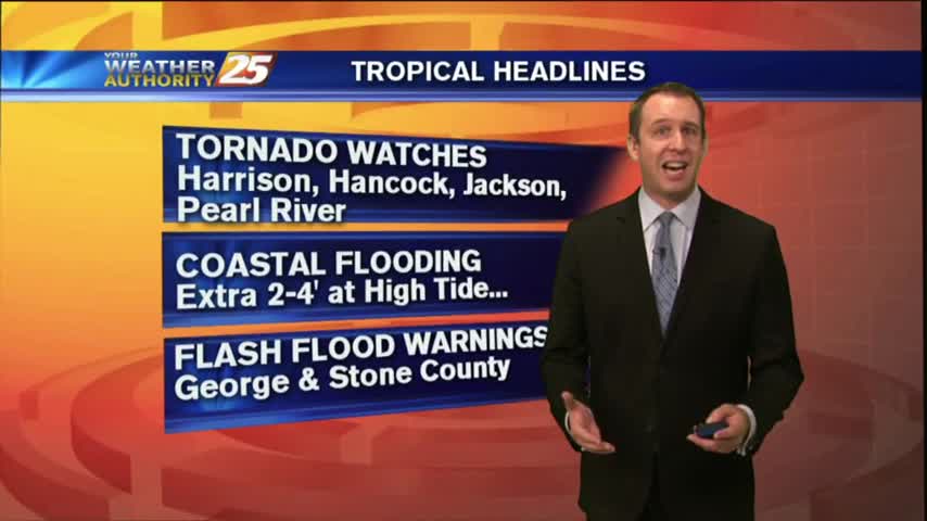
A BUMPY start to the day with HEAVY RAIN...and a TORNADO WATCH. TROPICAL STORM effect will continue...
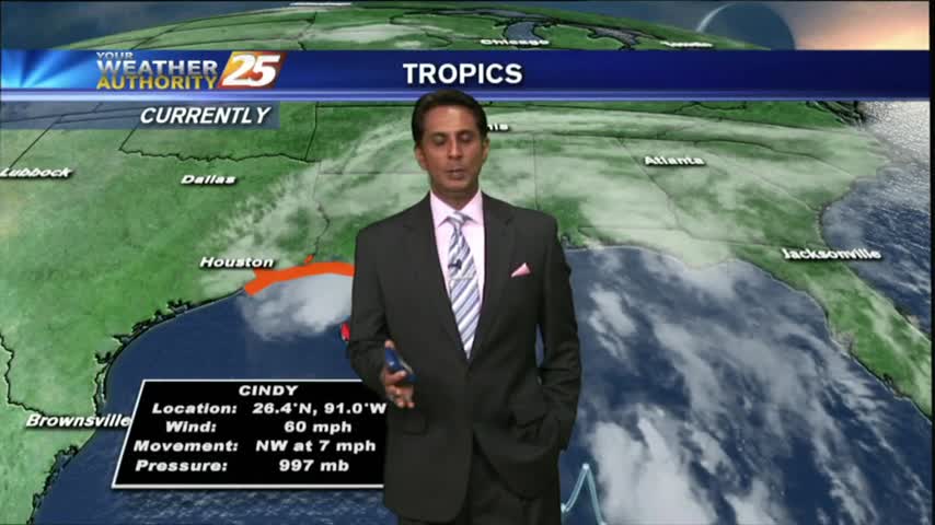
Tropical storm Cindy officially formed this afternoon and continues to pummel South MS with rain. Don't expect that to change for quite some time, meaning flooding woes will begin to arise. Watch the full forecast for more.
Light to moderate rainfall has been in the area since prior to sunrise and will continue through the duration of this event!
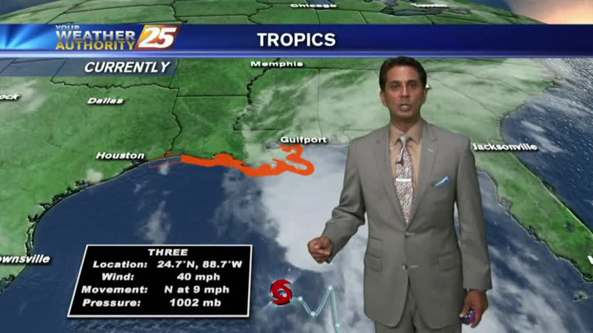
It's a warm/humid start with rain moving in from the SE, with TD #3 in the central Gulf of Mexico...

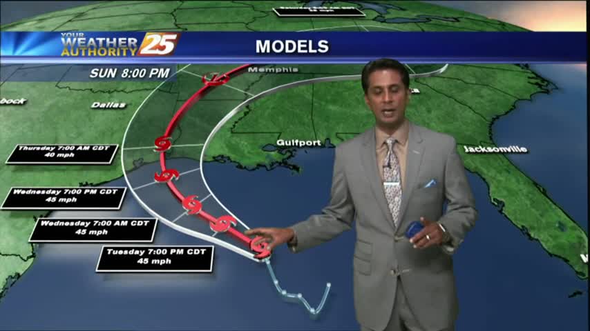
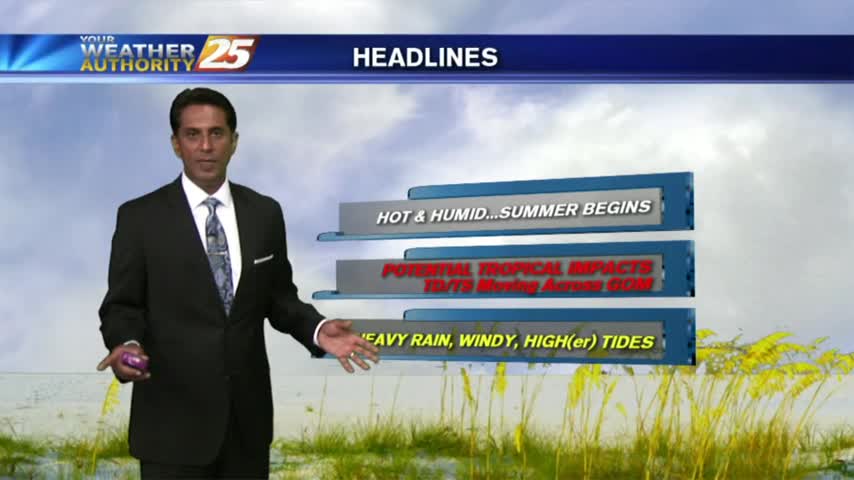
Not much rain over the last few days but we'll be making up for it as a potential tropical system funnels moisture into South MS. Watch the full forecast for details.
After a mostly dry holiday weekend we're in for a considerable amount of rain and a tropical storm effects! Watch the forecast for more.
After a warm/humid start to the day under mostly clear skies, the clouds have moved back in with t-storms/rain on-tap this afternoon....
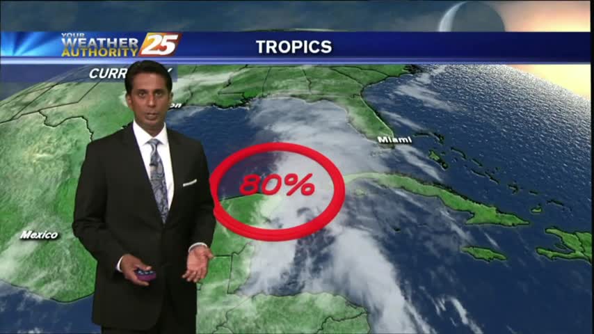
Another warm & humid start to the day as ALL EYES continue to focus on a DEVELOPING TROPICAL system in the W'tern Caribbean...