1/23 - Rob's "Back To Seasonal Conditions" Forecast
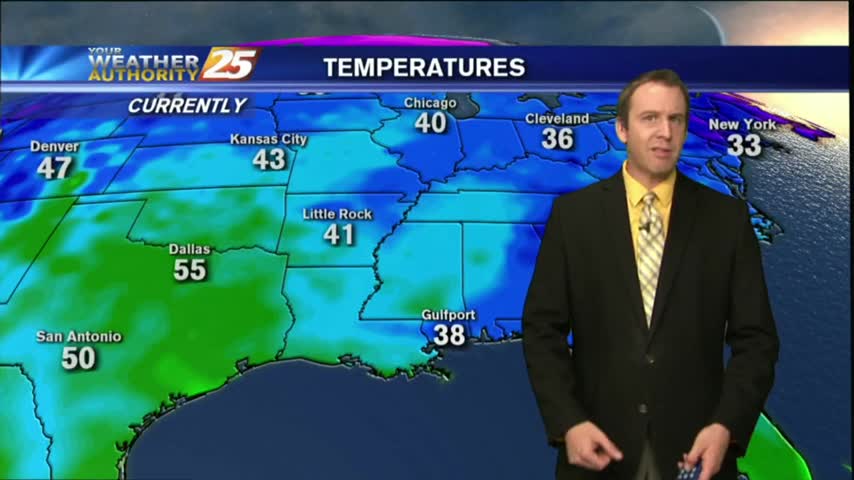
In the wake of yesterdays cold front now beginning to move off the east coast, colder air is moving into our region...

In the wake of yesterdays cold front now beginning to move off the east coast, colder air is moving into our region...
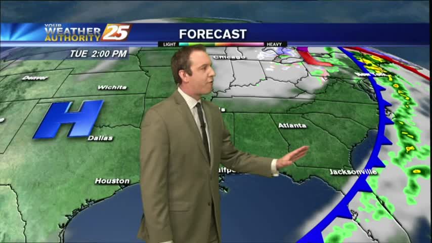
Warm and humid conditions have dominated over the last few days, but today's forecast will change all of that. Click here for the full forecast with Meteorologist Ryan Mahan.
Today may have started warm and humid, but this afternoon's cold front will bring cooler and drier conditions through the rest of the week. Click here for the full forecast.
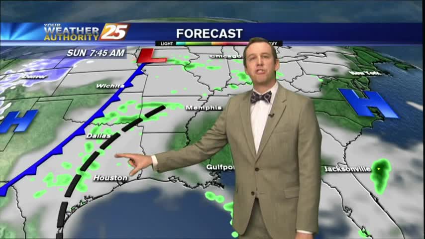
Shower activity continues to move off to the east, but sunshine is in the near future.

This morning brings MUCH WARMER TEMPS along with extensive cloud coverage and windy conditions in advance of an approaching cold front...
Beautiful weather today, but rain and colder air is on the way.
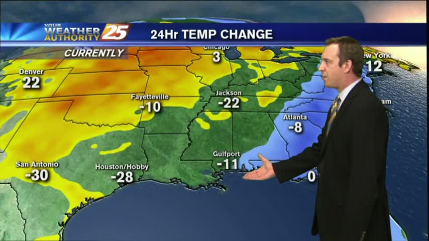
It's been a brutal week of cold, dry, and often dangerous weather; but we're finally seeing a warming trend that will carry us all the way through the weekend. Click here for the full forecast.
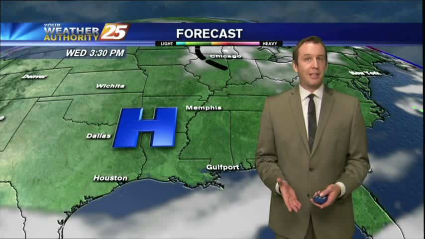
The warming trend that began yesterday continues through today, tomorrow, and into next week. We'll see another cold front by Monday though, click the link for details.
Surface high-pressure has shifted to our east and the return flow has begun to increase temperatures and humidity...
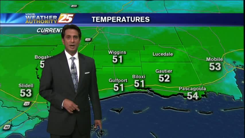
A FRIGID start to the day but warmer than what we have seen this past week. The weekend will bring seasonal conditions back to the Gulf coast...
This afternoon was significantly warmer than the last few have been, but we're in for one more night below freezing in the short term. Click this forecast link for more details.

After another FRIGID morning temperatures continue to warm nicely, a HARD FREEZE WARNING is in effect again tonight...
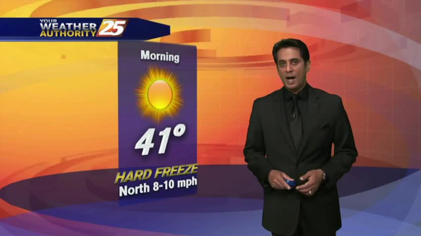
Another FRIGID start to the day with a HARD FREEZE WARNING through 11 a.m...with the warm-up beginning tomorrow...
There won't be any winter weather tonight, but icy conditions will remain on some South MS roads. Watch the full forecast for the latest.
We're in for another brutal and dangerously cold evening, but without the added drama of the winter weather which has moved East. Click this link for the full forecast.
After a ICY start to the day and multiple wrecks, temperatures are still in the mid/upper 20s poised to max out in the low/mid 30s...
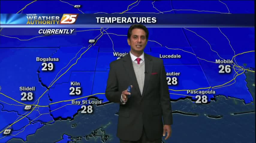
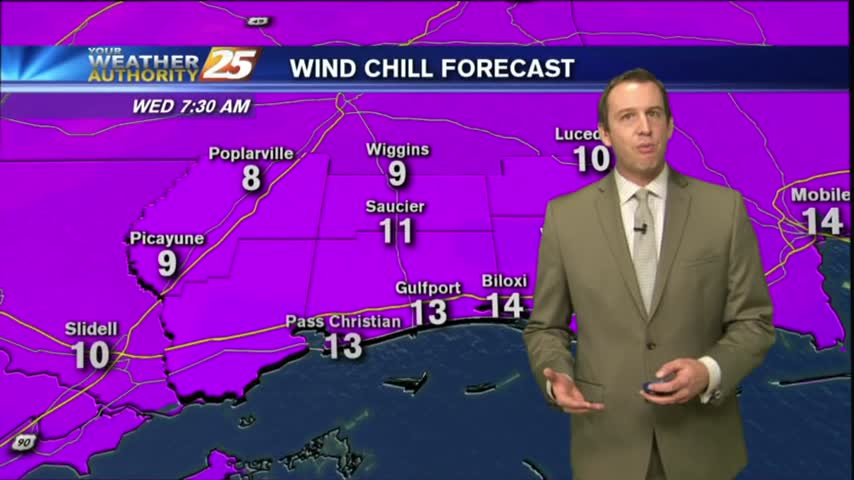
Single digit wind chills and ice on the roads. Bundle up and drive slowly this morning.
Very dangerous roads this morning, and extremely cold conditions.
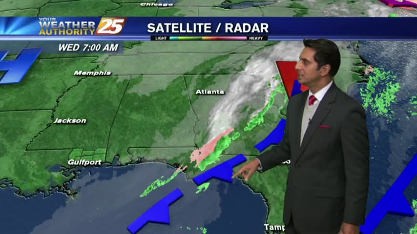
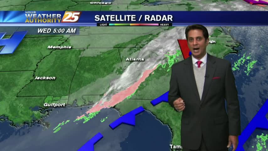
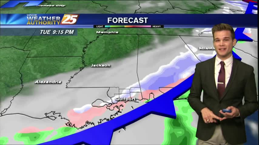
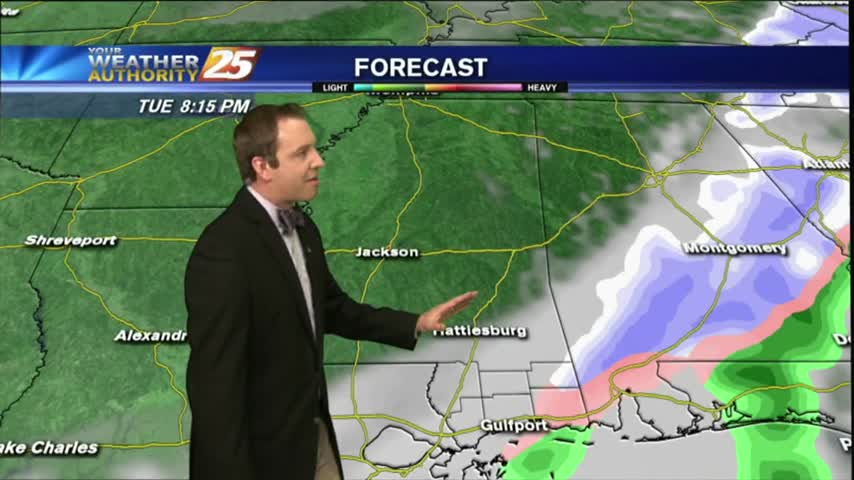
Another round of rare winter weather has moved into South MS bringing inches of snow to the Jackson and Hattiesburg areas, but so far not much more than sleet for us. Watch the full forecast for details.
Most of South MS will see some form of winter weather tonight, but even colder and more brutal temperatures are moving in over the next day and a half. Watch the full forecast for details.
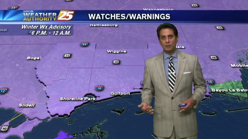
Wintry precip chances increase this afternoon, and brutal temperatures for tonight.
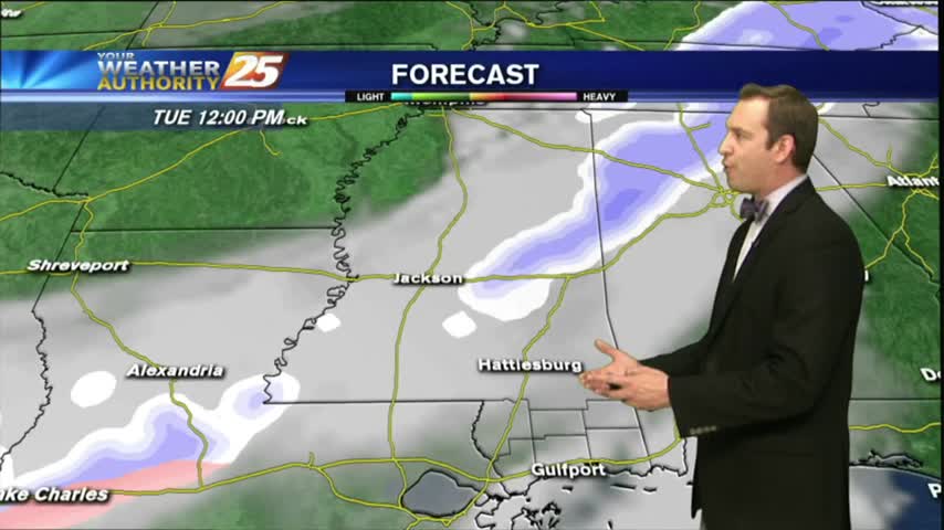
A cold start with warming temps in advance of an approaching cold front. Temps will cool this afternoon with the possibility for a few flurries late...
Mostly clear and cold tonight, but an Arctic front is moving in that will bring even colder air and even some possible winter weather! Click the forecast link for the latest information.
After a warm and humid start to the week we'll see some drastic changes as another Arctic front pushes into South MS, bringing the slight chance of wintry weather. Click the link for the details.