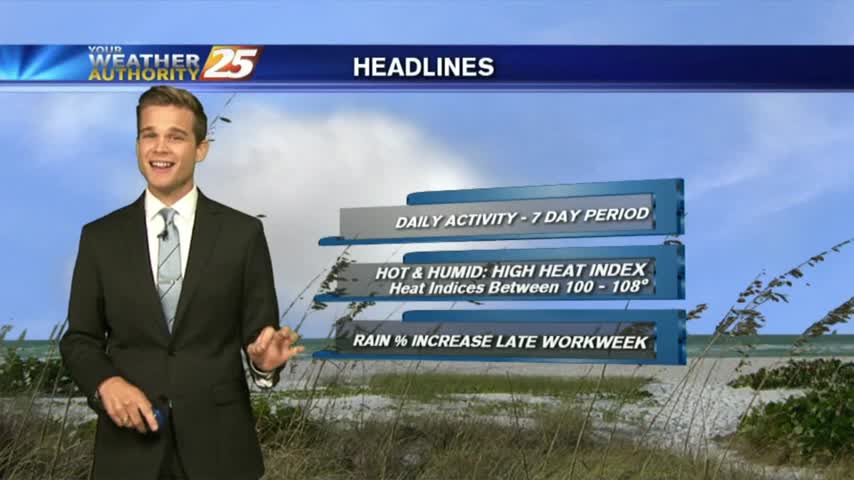
8/8 - Rob's "Hot/Humid" Midday News Forecast
The clouds have developed along the coastal counties, with showers/t-storms to follow shortly...
The clouds have developed along the coastal counties, with showers/t-storms to follow shortly...
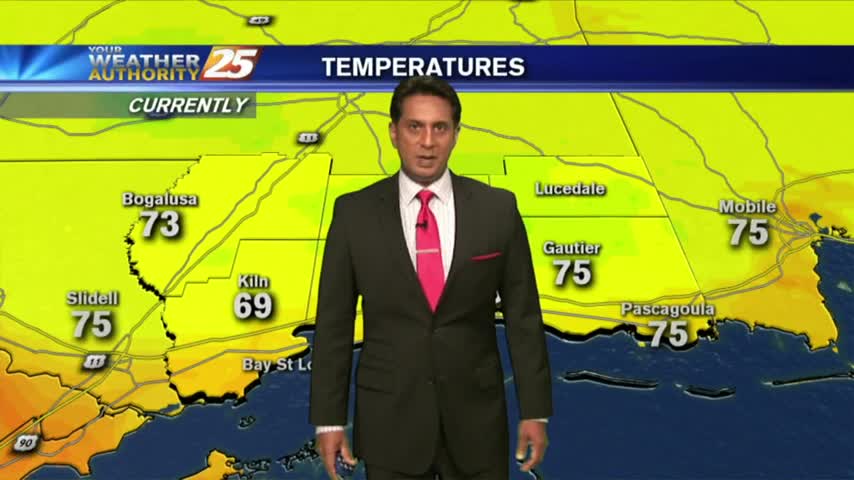
A slightly cooler morning along the gulf coast with a few showers approaching from the south...
Our afternoon sea breeze storms are dissipating, but we'll see a few more tomorrow....
It was another hot and sunny day with an active afternoon due to the sea breeze, and we'll see a few more similar days before the week is done....
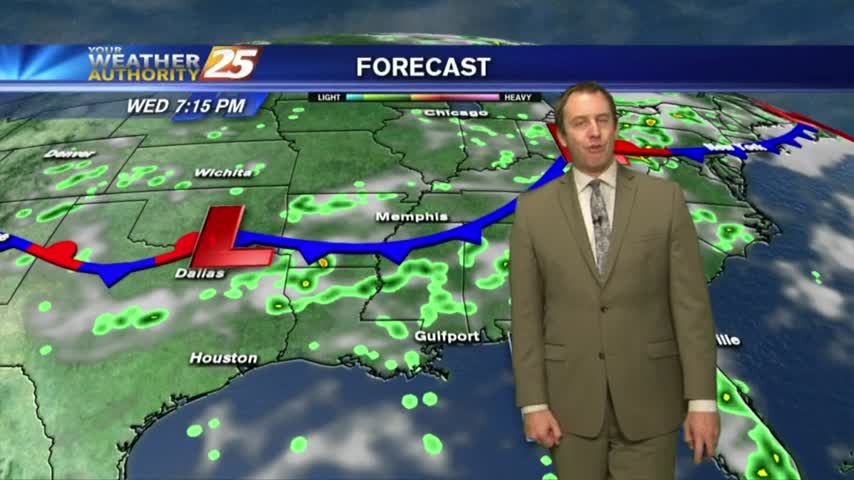
After a dry start to the week, a wetter pattern will start to setup.
Cloud coverage has been on the increase the past few hours with light showers in the vicinity...
Expect several "boring" days this week, but more active weather is right around the corner....
It's just as dry and beautiful as we expected, but it doesn't last forever....
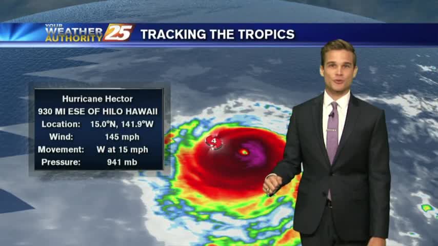
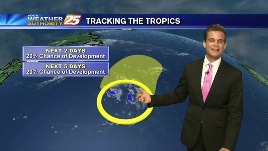
The Atlantic remains fairly quiet, while the Pacific remains active.
August weather continues...meaning heat, humidity and rain chances.
It's back to school Monday with a warm/humid start to the day/workweek...
Hot and humid today, and much of the same tomorrow.
Didn't see many today, but we'll see one more rainy afternoon before a long string of drier days....
We saw a few scattered showers today and will see a few more tomorrow, but much drier days are around the corner....
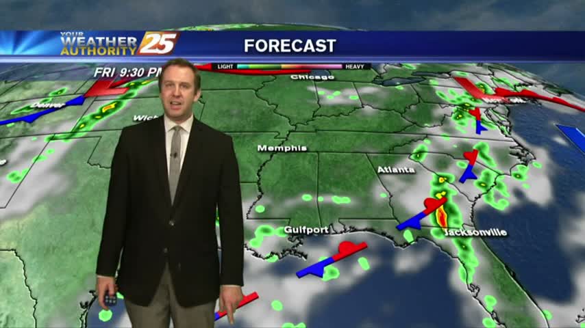
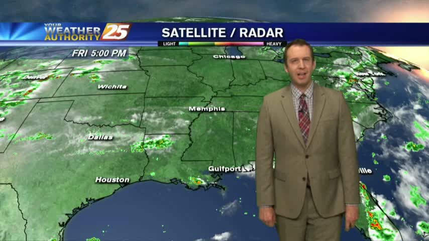
A few thunderstorms today and going into the weekend.
Some showers and thunderstorms as we head into the weekend, but not everyone sees rain.
It didn't rain as much today as expected, but we'll still see some over the next few days before it dries up....
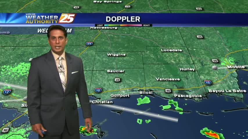
Isolated showers/t-storms south of the area overnight has been slowly moving north into the coastal counties...

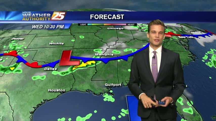
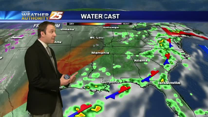
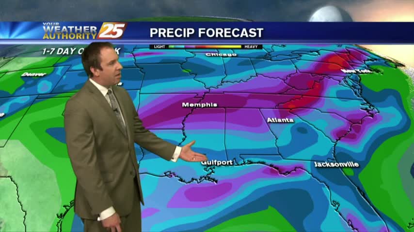
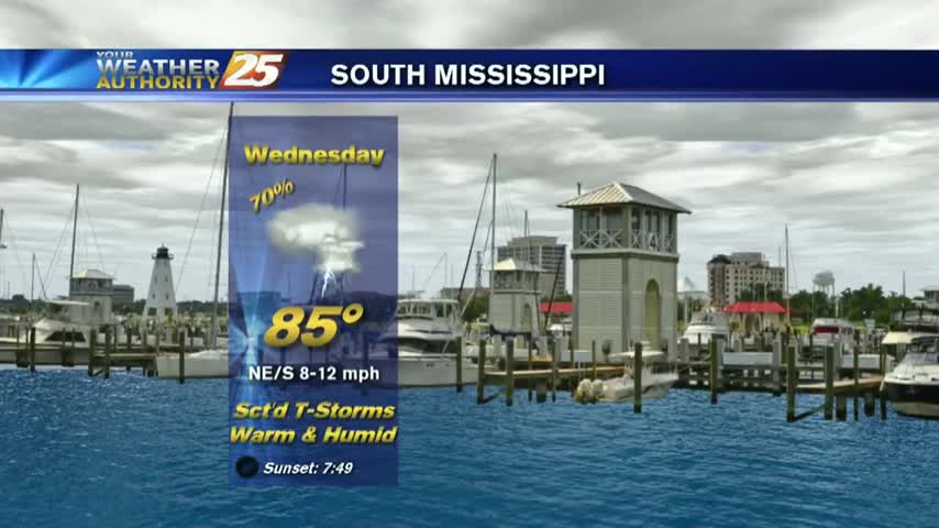
A wet day is expected, and it will continue into Wednesday.
Wetter week, which means some cooler temperatures.
Tomorrow is the last of the drier days and we'll see rain moving in soon....
We'll have one more sunny and drier day before we start seeing significant rain moving in. Tomorrow will be slightly more humid than today was, and with a little more cloud cover, but the rain will largely stay away. That…
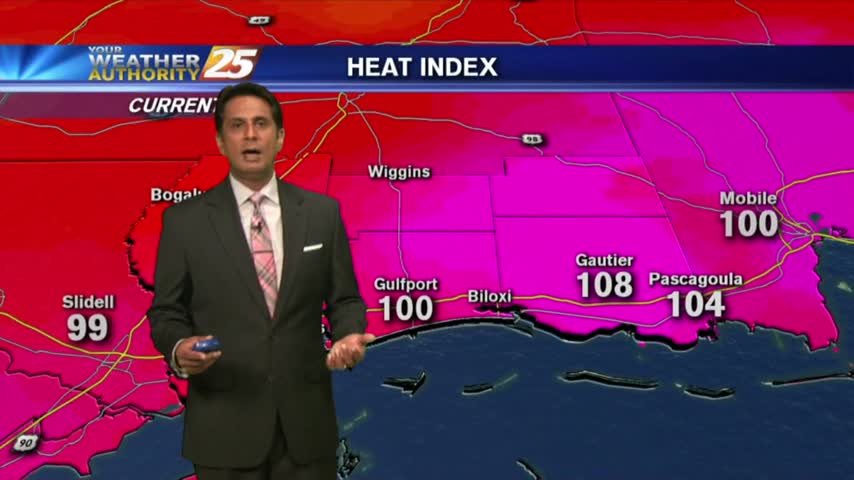
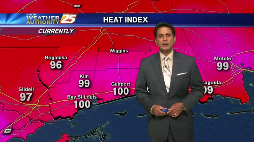
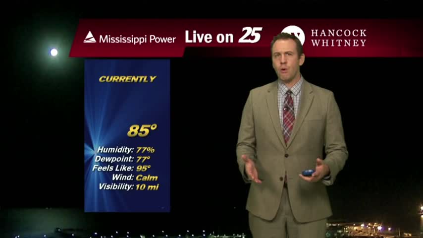
The drier air mass in departing as the humid flow from the GOM is moving in, making the HEAT INDEX a factor...

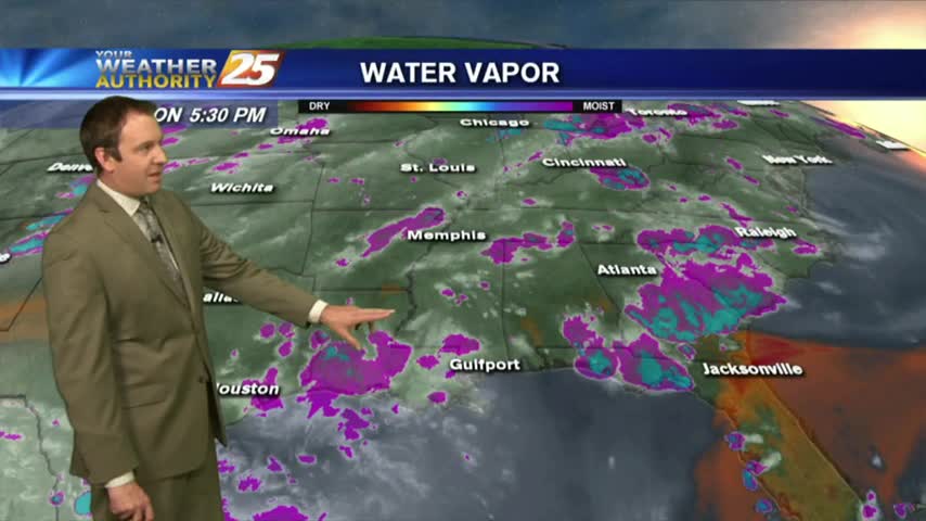
The stationary front is overhead and beginning to dissipate as minimal activity is to our south...