07/22 Ryan's "Wishy-Washy" Monday Forecast
The weather couldn't make up its mind today as we started with rain and saw it clear just to come back in the evening....
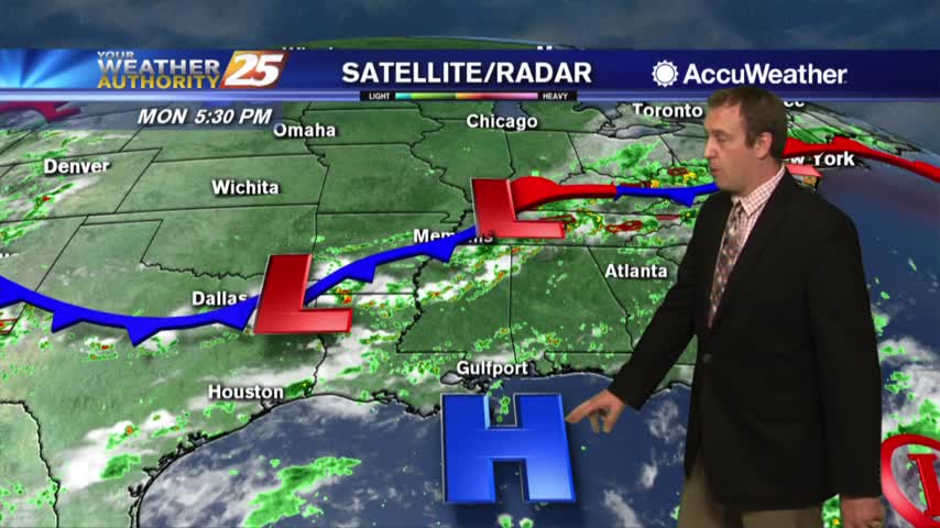
The weather couldn't make up its mind today as we started with rain and saw it clear just to come back in the evening....
Temperatures are a bit cooler this afternoon due to cloud coverage and spotty rainfall...
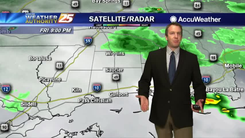
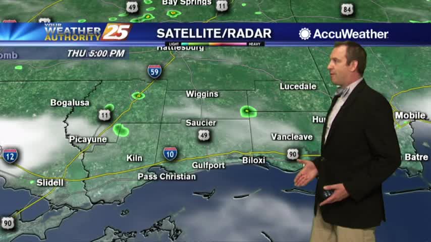
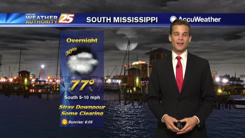
As the tropical moisture continues to flow into the area, spotty rain is moving north through south Mississippi...
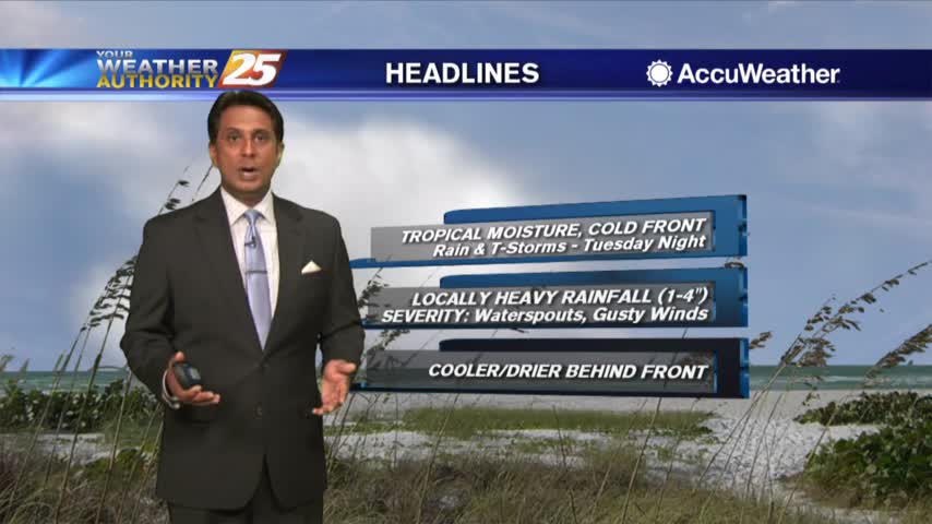
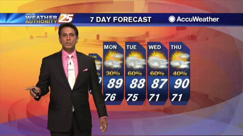
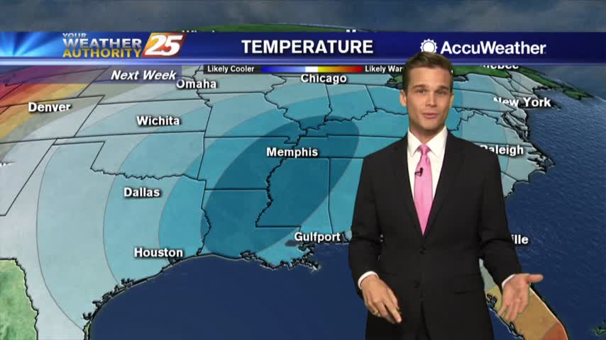
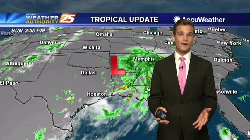
A July "cold" front will help out with the humidity later this week and an update on the tropics.
Not too much rain today, but much more is expected over the weekend....
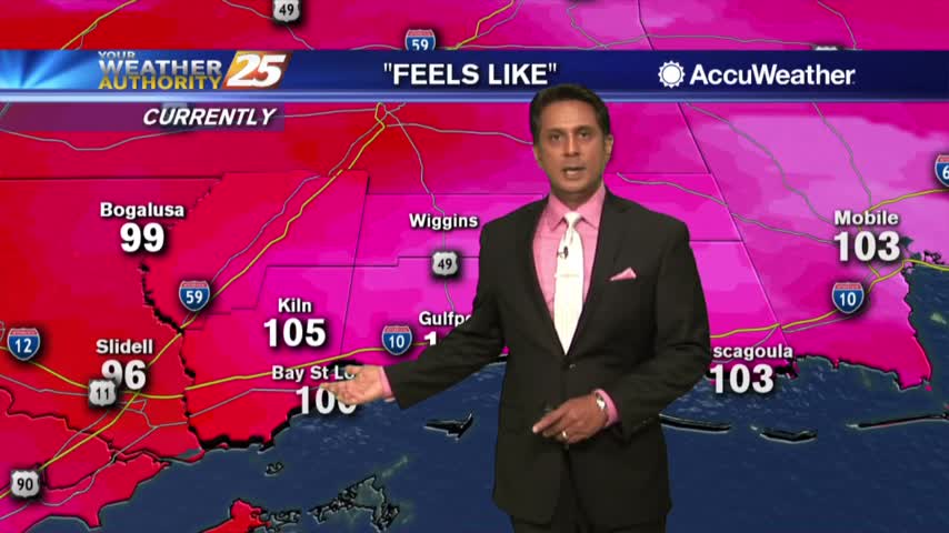
HOT temperatures this afternoon as the HEAT INDEX will average 104 degrees, please be safe...
A warm start with upper-level clouds moving across the area from east to west...
Another drier day today, but more rain is on the way....
Another drier day out there today, but more rainy days are coming....
Be careful in the heat...some relief possible next week.

Heat index values over 100 this afternoon.
More sunny weather today without rain, but it won't stay away for much longer....
More nice weather today with many more similar days ahead....
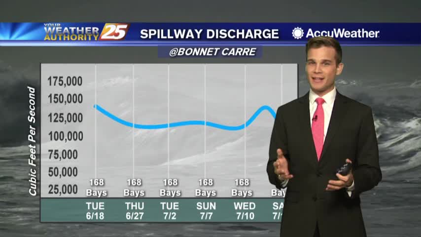
Heat index values over 100 and low rain chances...and an update on the Bonnet Carre Spillway
The heat will be with us for several days and heat index values will rise to around 105 each day.
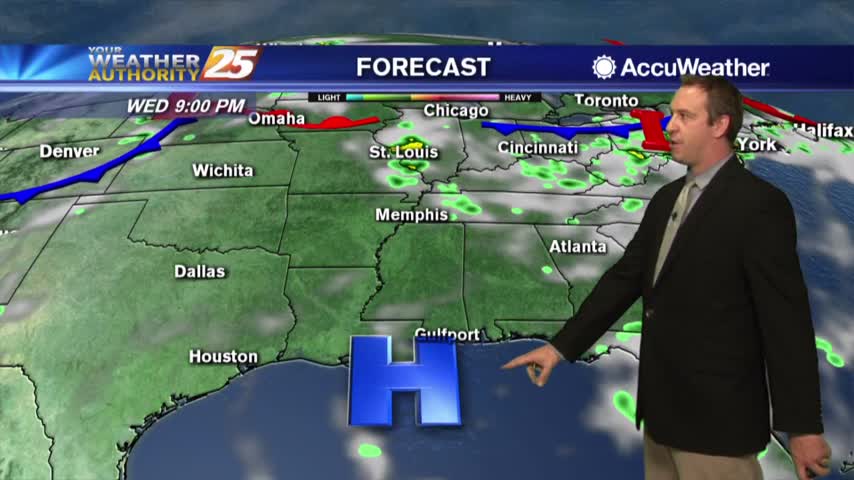
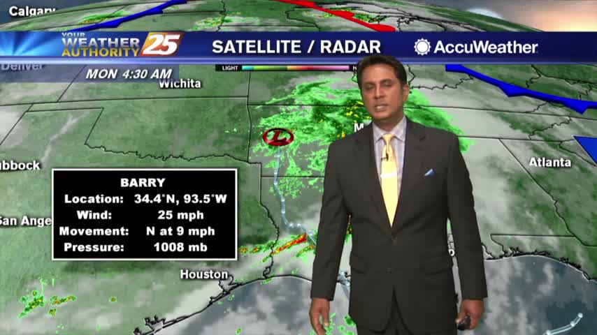
Barry is gone and so now our usual summertime pattern continues....
Hurricane Barry came and went, so now we're getting back to normal....
The sunshine is back and it's hot and humid

Starting off with some sunshine this morning!
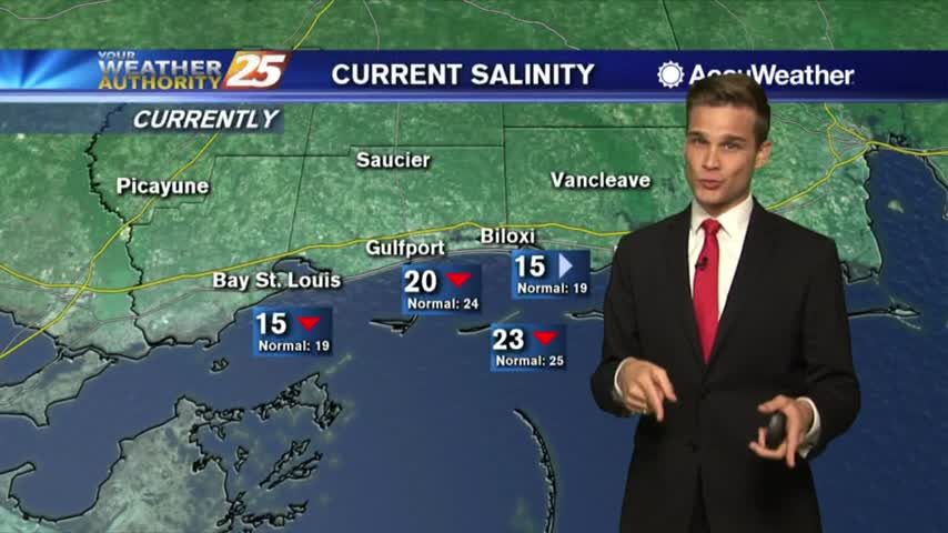
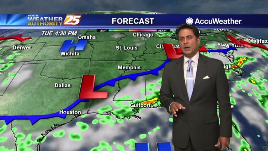
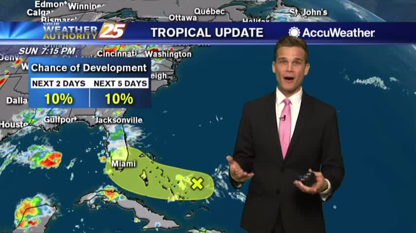
A few downpours tonight with more downpours possible on Tuesday. Update on Salinity levels.
Tuesday will feature more sunshine with a few downpours possible throughout the day.

Rain has tapered-off significantly but a few showers will continue through tonight...
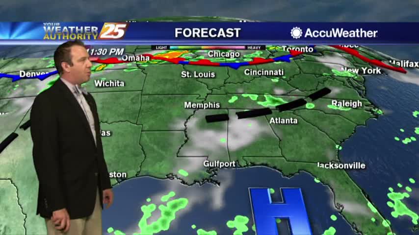
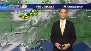
A wet start as bands of rain continues to move into the area from the Gulf of Mexico...
Barry moves out of the area, but rain chances continue