Ryan's "Much Warmer, Still Chilly" Wednesday Forecast
It's much warmer than it was last night, but still going to be quite chilly out there....
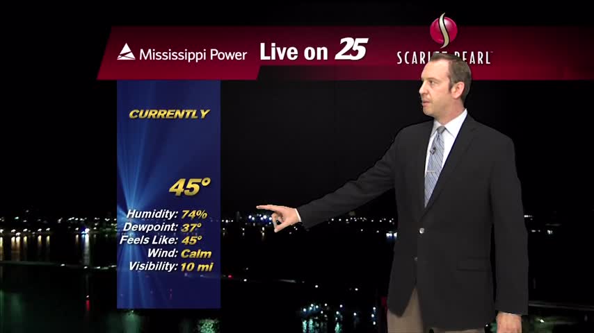
It's much warmer than it was last night, but still going to be quite chilly out there....
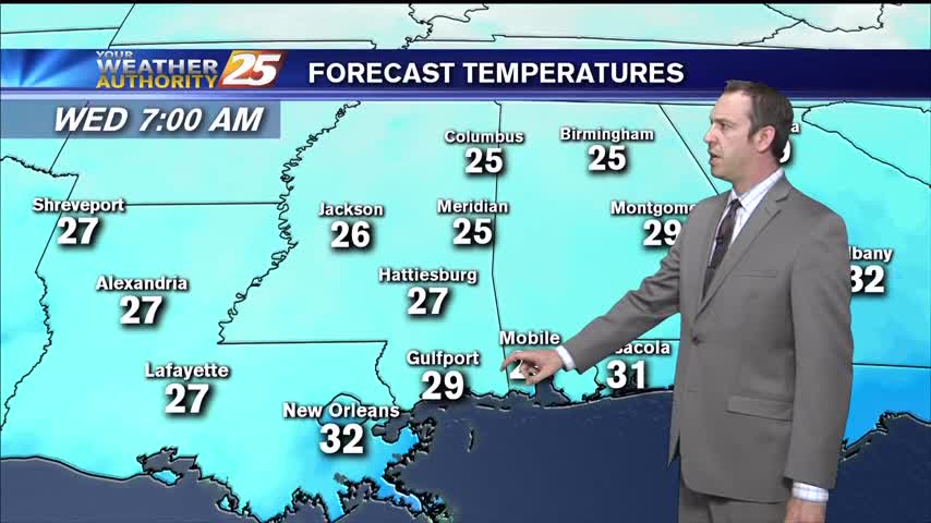
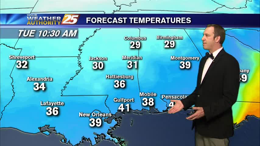
After a very cold morning, the wind has died down and temperatures are slowly bouncing back. Highs temperatures will top out in the mid 50s today. Biloxi reached a record low this morning of 25 degrees, breaking the old record…
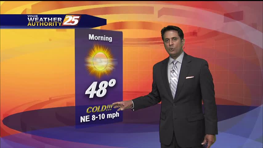
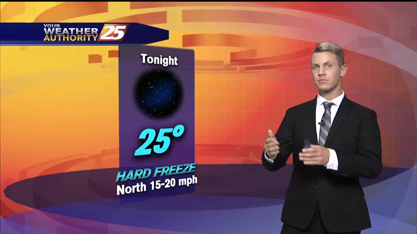
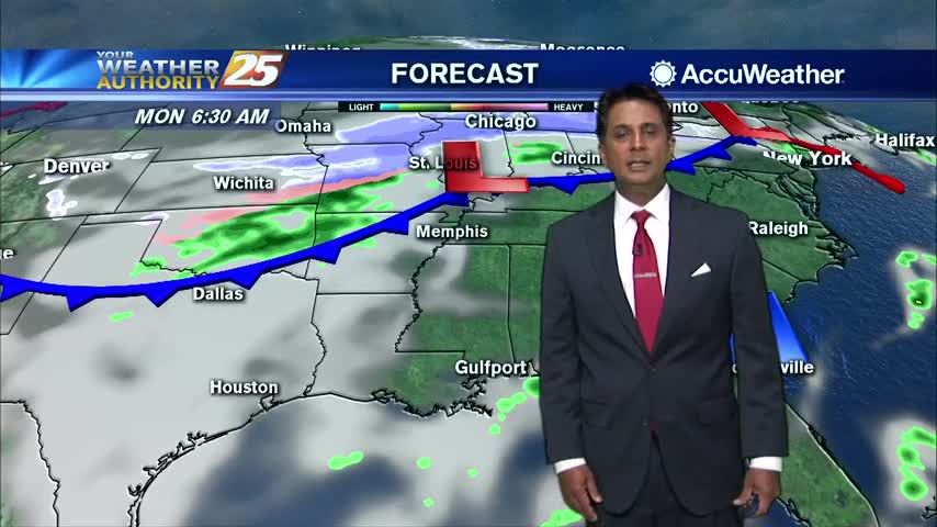
A very cold and dry morning with temperatures dropping into the lower to middle 20s along and north of I-10. The upper trough will continue to drift off to the east with high-pressure moving in over the eastern Ohio Valley…
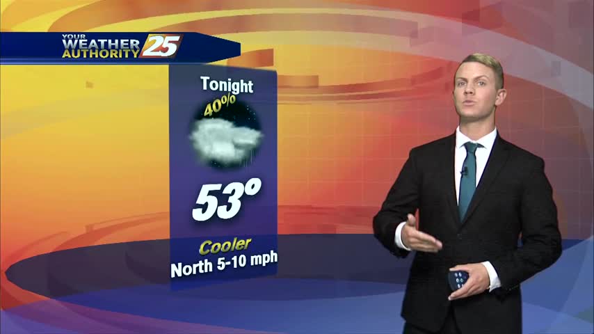
Freezing, potentially record breaking conditions are moving in tonight....
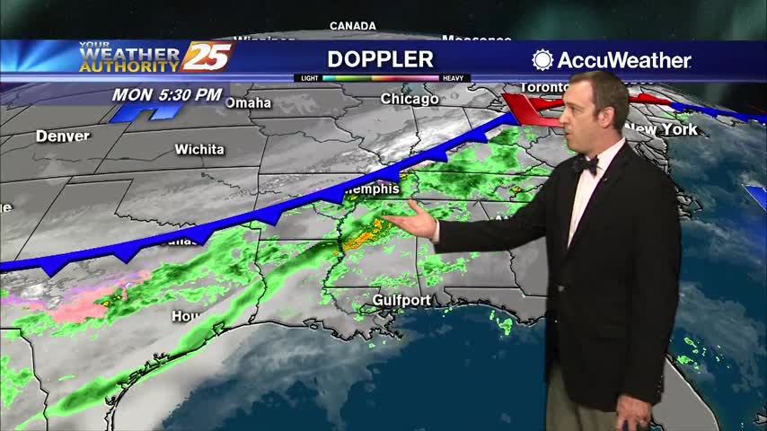
A major cold front has moved through, and an arctic air mass is now in place across the Southeast United States. Skies will clear through the afternoon, becoming clear by tonight. Winds will be blustery out of the north at…
As a major cold front pushed through the area, winds will continue to be out of the north at 20-25 miles per hour (mph) with higher gusts of 35 to 40 mph possible. A Wind Advisory has been issued for…
Today was the last time we'll see the 70s for a little while, very cold temperatures moving in.
Today was the warmest day we'll see for at least the next few weeks as colder and colder air moves in....
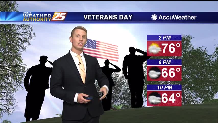
Temperatures on Veterans Day will be close to seasonal normal with highs in the mid 70s and lows in the lower 50s. Skies will start off cloudy, but by the afternoon, the sun should start to peek through. Rain chances…
Temperatures on Veterans Day will be close to seasonal normal with highs in the mid 70s and lows in the lower 50s. Skies will start off cloudy, but by the afternoon, the sun should start to peek through. Rain chances…
Temperatures on Veterans Day will be close to seasonal normal with highs in the mid 70s and lows in the lower 50s. Skies will start off cloudy, but by the afternoon, the sun should start to peek through. A major…
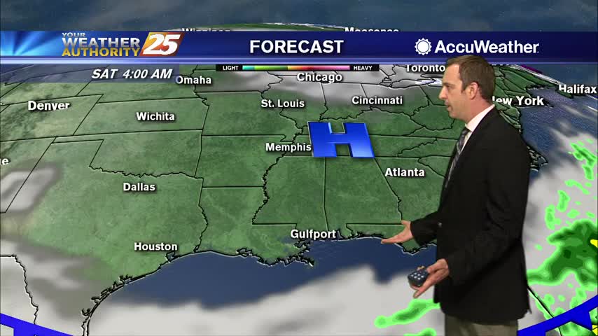
Clouds remained for most of the day, but they're clearing quickly now as dry air moves in for the weekend.
The front has moved on, but the cloud cover will remain through most of the night before clearing into a beautiful fall weekend.
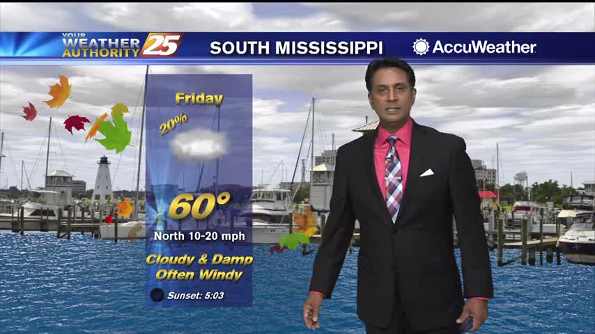
Clouds continue to linger with gusting winds from the north at 15-25 mph...
A cool, cloudy and windy start to the day in the wake of last nights cold front...
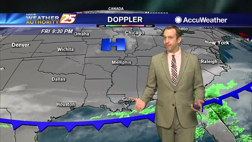
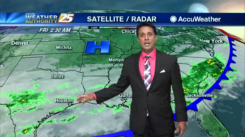
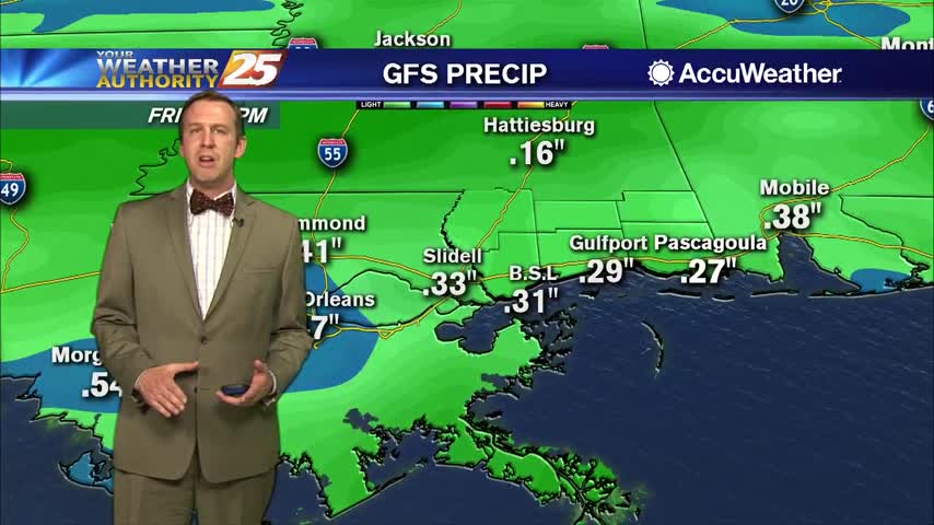
Rain finally moved in, just not much of it. Expect drier days ahead.
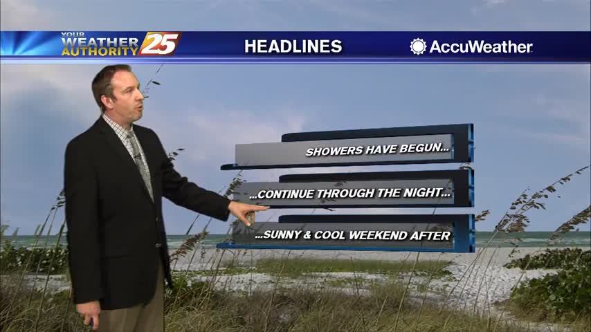
The front has finally arrived and showers will continue through the night, but much drier weather moves in quickly.
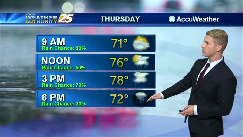
With temperatures topping out near 80 degrees this afternoon, this will likely be the last "warm" day along the Gulf Coast for a while. Showers and a few thunderstorms will roll through South Mississippi this afternoon and evening ahead of…
With a humid air flowing back into the area, light patchy fog has developed this morning in advance of an approaching cold front. Showers and thunderstorms will move in late this afternoon into tonight with windy conditions after the cold…
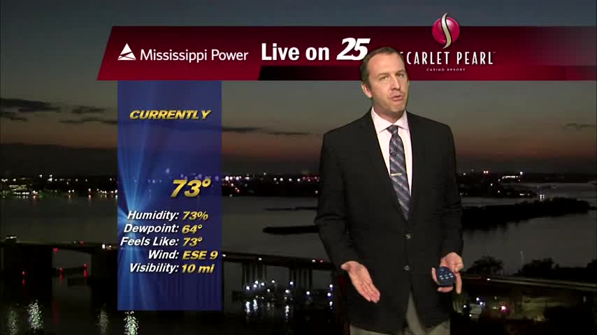
Much warmer and more humid than it's been over the last few nights, but a front brings changes tomorrow night.
Doesn't really feel much like fall right now, but colder days are coming.
Another warm day is on tap for South Mississippi. High temperatures will warm up to the upper 70s this afternoon with some areas hitting 80 degrees. Skies will remain mostly clear aside from a few upper-level clouds rolling through. Cloud…
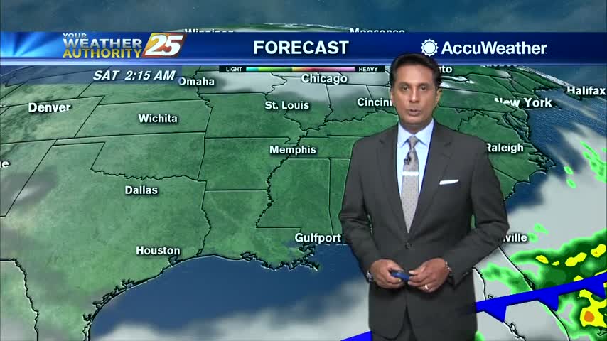
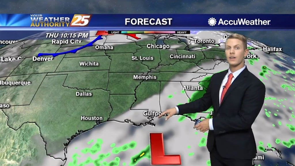
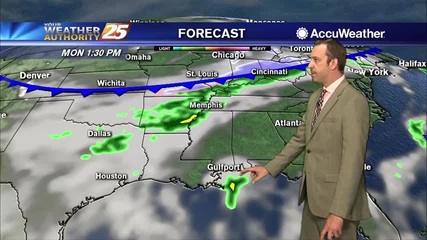
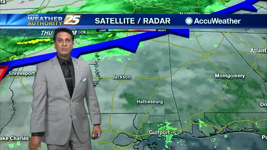
Moisture flow off the Gulf will get started once again tonight into Thursday ahead of the next cold front. With the approaching front, precipitation will be split into two areas, one over SW LA and another over Mississippi/Alabama. The rain…
The weather was pleasant for Election Day, but rain is on the way!