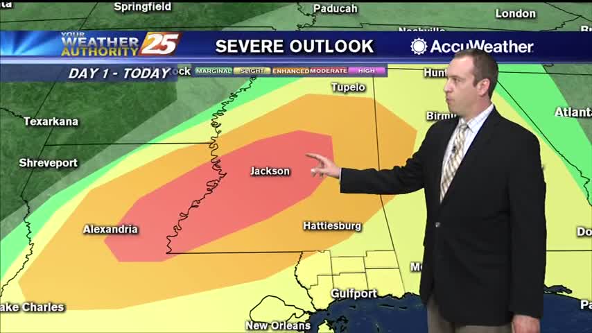
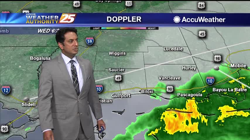
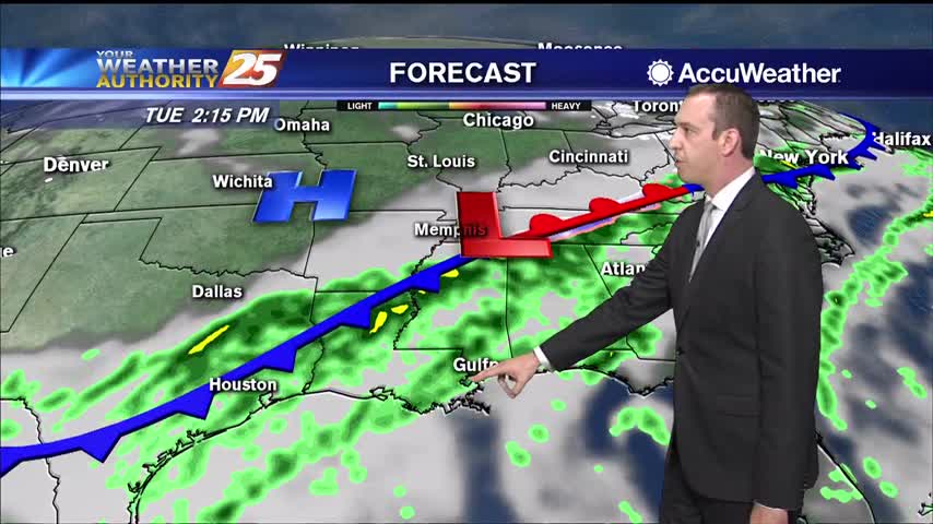
12/16 Ryan's "Severe Storms" Monday Forecast
A cold front is moving in and strong thunderstorms are likely overnight before nicer weather moves in.
A cold front is moving in and strong thunderstorms are likely overnight before nicer weather moves in.
Very warm conditions today with temperatures expected to reach the upper 70s. This is way above our normal high temperature for this time of the year which is about 61 degrees. We could even reach a record high temperature. The…
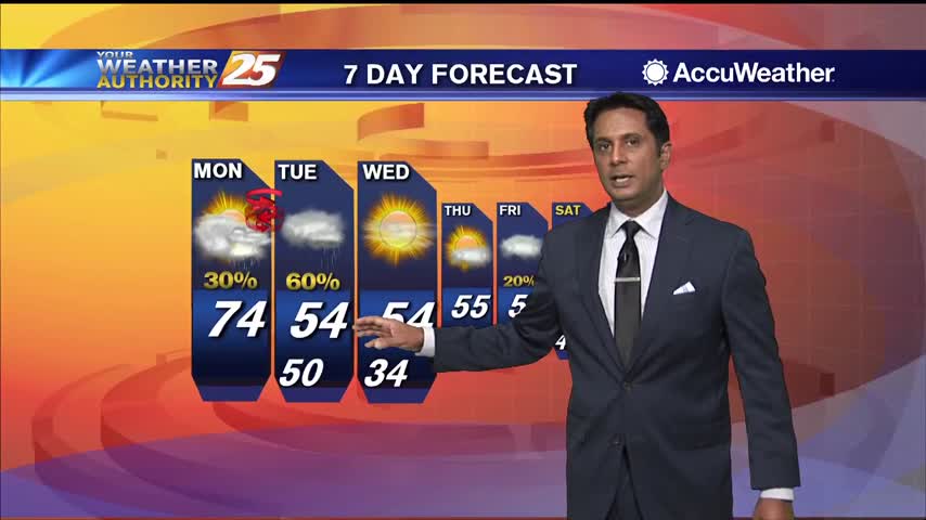
A mild and very humid start to the workweek with areas of patchy fog...
Dense fog is already developing across the region this evening. It will remain warm tonight with temperatures staying in the 60s. Tomorrow will be very warm, above normal for this time of the year, with highs reaching the mid to…
The last week has been cloudy, rainy, and quite humid, but sunny weather is on the way after one last foggy night!
The rain has finally moved on but cloud cover and dense fog will remain through the night.

Areas of patchy fog and light rain continues to affect south Mississippi...

A damp start to the day with light rain and areas of patchy DENSE fog...
We won't see much of the last full moon of the decade due to active weather moving in, but it doesn't look like anything serious.
We saw a few hours of sun yesterday evening, but rain chances and cloud cover are increasing through the night.
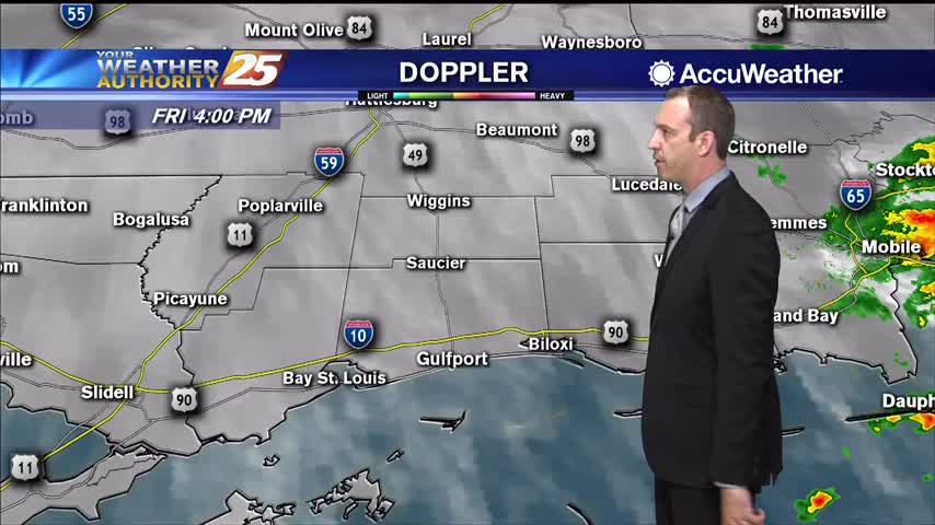
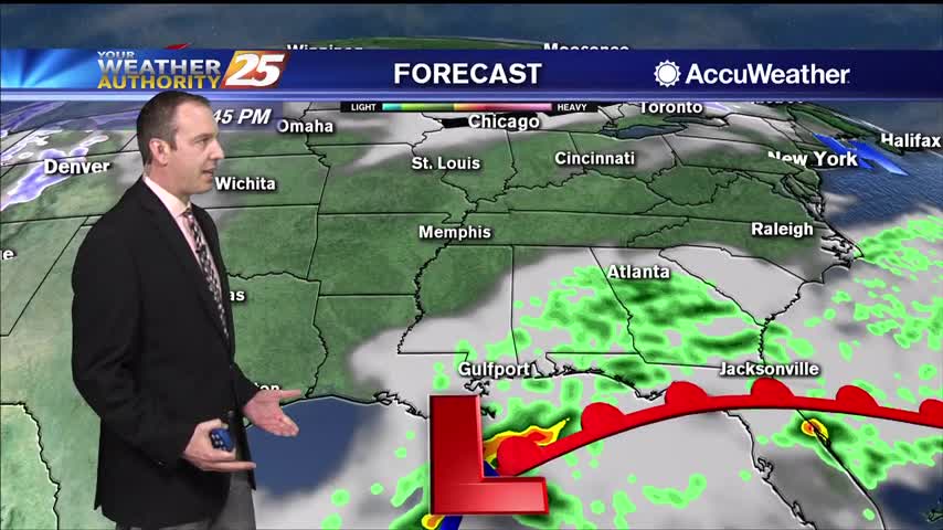
Cloudy and cool conditions will continue through the afternoon. Low pressure over the Gulf of Mexico will move toward the coast late tonight, bringing showers and a few thunderstorms. Rain may be heavy at times. Some light showers may linger…

Models are in pretty good agreement in depicting low-pressure development along the stationary front situated across the central Gulf. This feature remains relatively weak but does cause pressure winds in the outer-coastal to increase later today along with rainfall into…
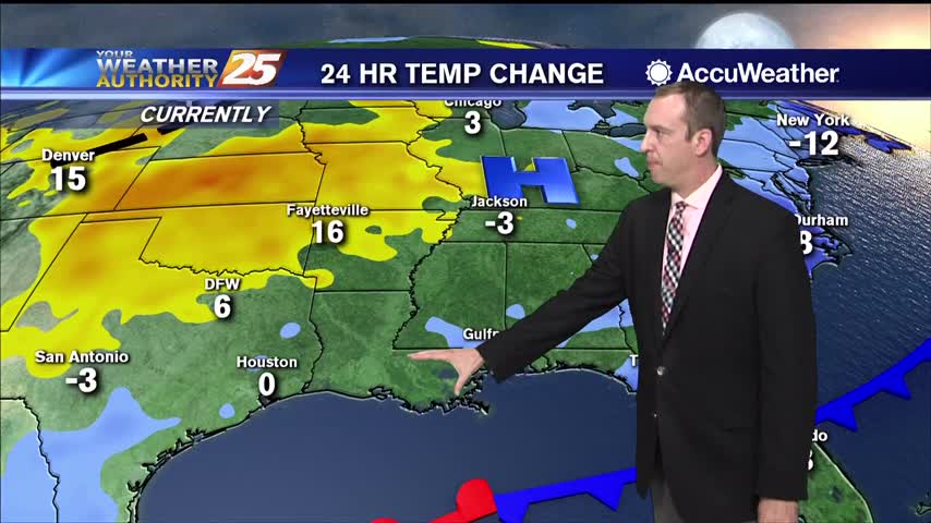
Front moved through yesterday bringing cold air and strong winds, but the really cold conditions won't show up until later tonight.
Yesterday's cold front is gone, but the cold and dry air remains...for now.
Cold and windy today conditions will continue through the afternoon and evening across the Gulf Coast. High temperatures will only reach the mid 50s under mostly cloudy skies with north winds at 15 to 20 miles per hour. Winds may…
The cold front is well south and east of our coastal waters this morning as high-pressure extends from western Kentucky to northeast Texas. An upper level low pressure system is driving the large patch of rain away from our area…
A front has been in the area for a full day now, but the cold weather and the rain are just getting started.

The cold front has arrived and temperatures are falling, but rain has so far been hard to come by.
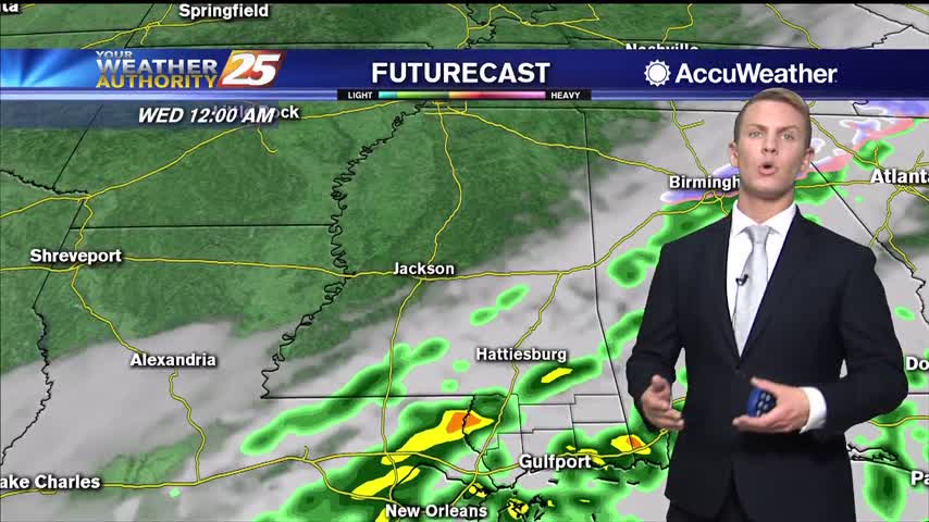
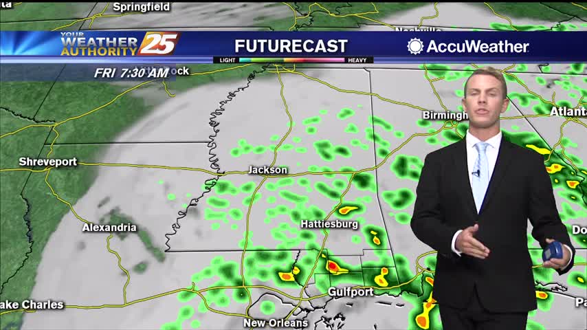
Showers will continue on and off through the afternoon and evening across South Mississippi. Rain chances will remain elevated at around 80 percent through the overnight hours. While the heaviest of rainfall is expected late Tuesday night, some showers may…

Another morning with areas of DENSE FOG and spotty rain moving in from the west...
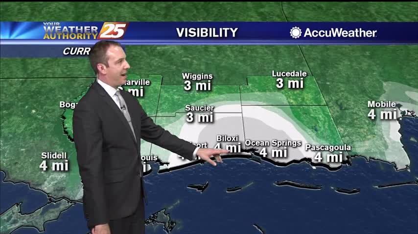
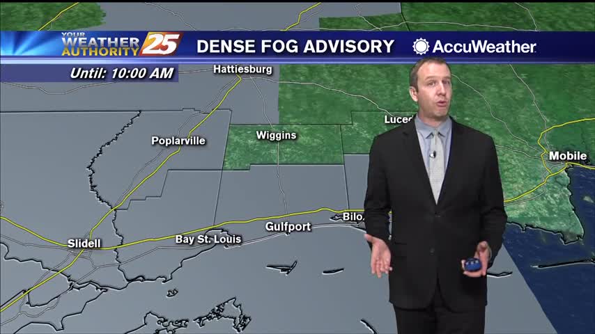
Dense fog advisories have been issued for South MS, and the approaching front isn't in any hurry so any changes will be slow.
The misty and muggy weather continued today, and will get worse through the night as a front slowly moves in.
Warm and humid conditions will continue across South Mississippi today with temperatures reaching the mid 70s area-wide. Southerly wind flow will continue to bring in warmer, moist air off the Gulf of Mexico. Dense fog development is likely again overnight…
A very warm and humid start this morning has develop DENSE FOG though south Mississippi...